Rain Changing To Snow Results In A Slick Commute For Parts Of The Northeast This Morning
Hello everyone!
Our generally quiet weather pattern will continue today, with the only area of active weather located along the Northeast coastline. A cold front has moved through this area this morning, and temps are crashing as a result. With precipitation lingering behind the front, a change from rain to snow is occurring, and the result will be a slick morning commute.
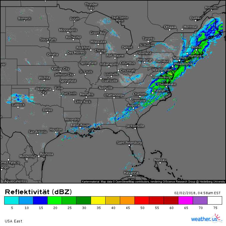
Regional radar composite imagery shows a line of precipitation associated with this front stretching from the Gulf of Mexico to Canada. The southern end of this line is just a few scattered showers with little/no impact. The middle part of this line from South Carolina to New Jersey is a moderate band of rain, again with little/no impact beyond wet roads. It’s the northern part of the line that will really cause some problems this morning, as temps from Connecticut up through Maine are cold enough for the rain to end as a period of snow.
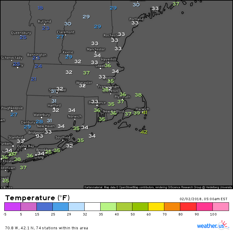
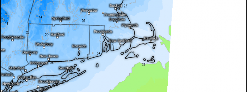
Here’s a snapshot of current temps in the Southern New England area as of 5 AM this morning. There are a few holdouts of above freezing air near the coast, but much colder air is lurking in the Berkshires where temps are already in the low 20’s. Temps in the Boston area are already falling near or below freezing, and as a result rain is changing to snow. However, HD radar imagery for the area shows drier air moving in, shutting off precipitation not too far behind the leading edge of the cold air. This will act to cap snow accumulation potential at around an inch, or maybe two atop some of the hills that are changing over before the lower elevation areas.
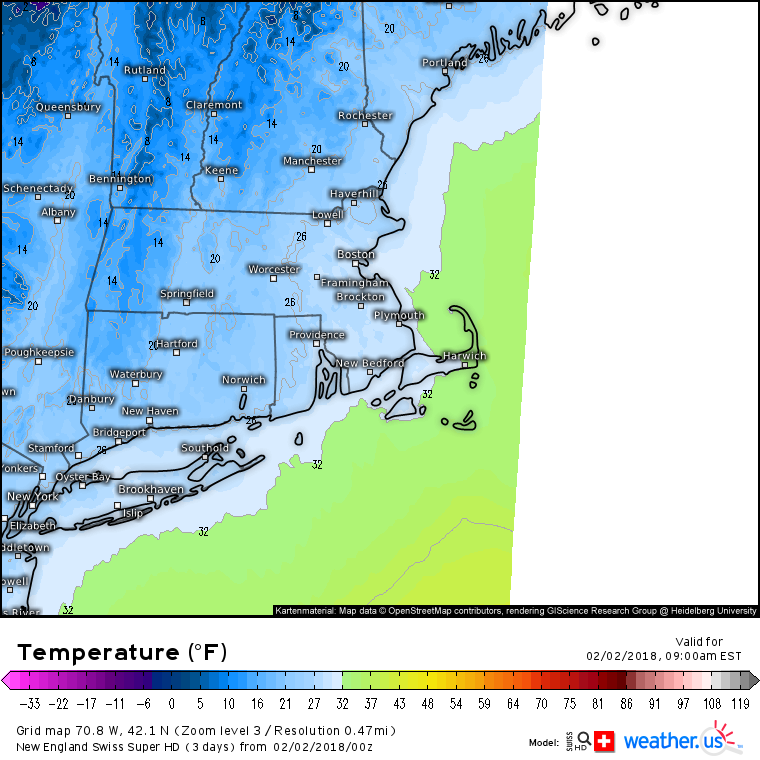
Even if you don’t end up with more than a dusting of snow, that doesn’t mean you’re out of the woods for slick travel conditions today. Swiss Super HD model forecasts show temps below freezing for all but the outermost part of Cape Cod by 9 AM, meaning the morning commute will feature wet roads and puddles rapidly freezing up. Allow plenty of extra time to get where you’re going, even if the sun is beginning to come out by then.
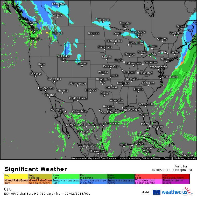
As the system discussed above races into the Canadian Maritimes this afternoon, quiet weather will continue across the vast majority of the country. The only other areas expecting precipitation of note today will be Washington State and adjacent parts of Northern Idaho and NW Montana, as well as a small part of Wyoming. Expect valley rain and mountain snow in these areas, with little in the way of impacts except to travel over the high passes.
For more information on your local forecast: https://weather.us/
For more information on the local forecast for ME/NH: https://forecasterjack.com/2018/02/02/morning-snow-gives-way-to-a-cool-and-breezy-afternoon/
-Jack
