Clipper Brings Quick Burst Of Accumulating Snow To A Swath Of The Midwest Today
Hello everyone!
An energetic clipper system will be racing southeast today through the Plains and into the Midwest. It won’t have a lot of moisture associated with it, but the very cold Arctic air in place means that it won’t take much moisture to produce a band of accumulating snow.
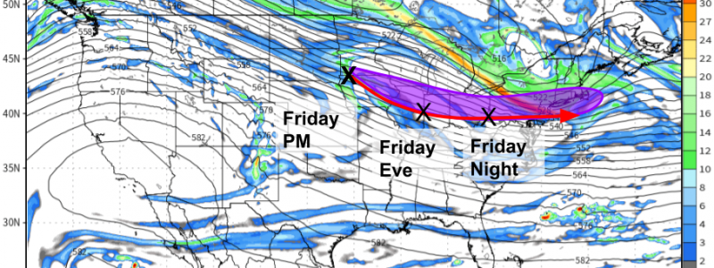
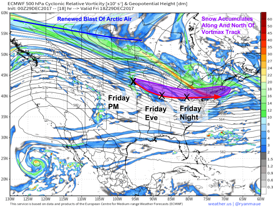
The ECMWF 500mb heights and vorticity map from weathermodels.com is a great tool to spot our disturbance and where it’s headed. You’ll notice the area of higher vorticity (green/yellow) near the first black “X” I drew marking the disturbances forecast position this afternoon. This enhanced vorticity (energy) will help to drive a band of accumulating snow along and just north of the track of the vortmax (vorticity maximum).
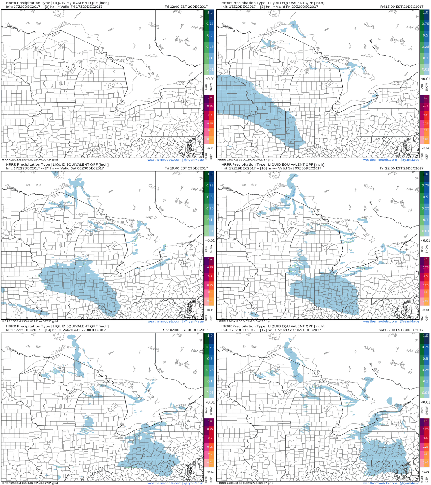
Here’s a look at the ECMWF’s QPF (quantitative precipitation forecast) forecast for all the precip forecast to fall as snow. For more on how this works and why it’s helpful, check out this video. The jackpot for snow accumulations will be the area just north of the vortmax’s track from Sioux falls down to Ceder Rapids and ending north of Indianapolis. As the disturbance approaches the Appalachian mountains in Eastern Kentucky, it will weaken a bit, resulting in lesser accumulations for parts of Ohio.
Here’s an animation of who’s likely to see snow over the next 18 hours as the system tracks SE towards the coastline. You can see as the system moves over the Appalachians, the area of snow shrinks and weakens. It will restrengthen a bit tomorrow as it hits the Atlantic Ocean, but redevelopment will be too late for a major storm system even in New England. You can find these maps and make them into animated GIFs on weathermodels.com.
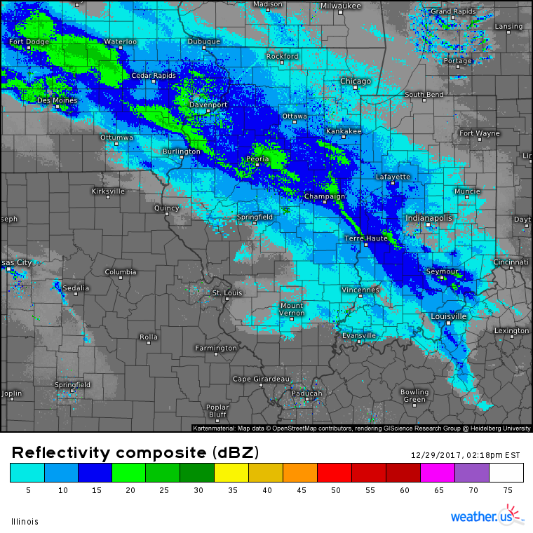
Here’s a look at the composite radar for Illinois this afternoon. It shows a band of light to moderate snow in just the area we highlighted above. You can use the radar selection tools at weather.us to access HD radar data and you can zoom into individual counties for even more detailed information by clicking the map. If you put the radar into motion using the play button, you’ll see that it’s moving ESE fairly quickly. This fast motion will help keep accumulations fairly low.
As the disturbance hits the Atlantic Ocean tomorrow morning, modest coastal redevelopment will occur. This will lead to some bands of moderate snow across Long Island and parts of far SE New England that could drop a brief 2-4″ of snow before the whole system shoots east tomorrow evening. Much lighter snow showers/flurries will be found across upstate New York and parts of interior Southern New England. Cold high pressure will likely keep Northern New England mostly dry.
-Jack


