Christmas Eve Snow Falls Across Parts Of The Pacific Northwest And Ohio Valley
Hello everyone!
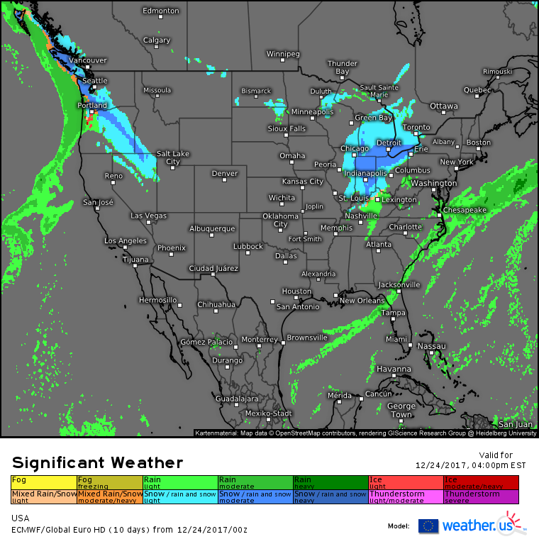
Today will feature some pre-Christmas snowflakes for parts of the Pacific Northwest as well as the Ohio Valley as two disturbances track eastward. Generally quiet weather is expected outside of these areas as cold high pressure builds into the Plains, and a stalled frontal boundary sits offshore in the Gulf of Mexico.
The ECMWF’s overview map does a good job highlighting who’s expecting snow, rain, and dry conditions today. A stalled frontal boundary will bring some showers to parts of Northern Florida as well as coastal parts of the Carolinas, though it will be too weak to cause any major issues. Snow is expected farther north as an Arctic disturbance races through the Ohio Valley, and as the disturbance begins to interact, expect precipitation to fill in across parts of the Mid Atlantic this evening. This is the system that will go on to produce heavy snow in New England tomorrow morning. For a full rundown of that system, check out last night’s update.
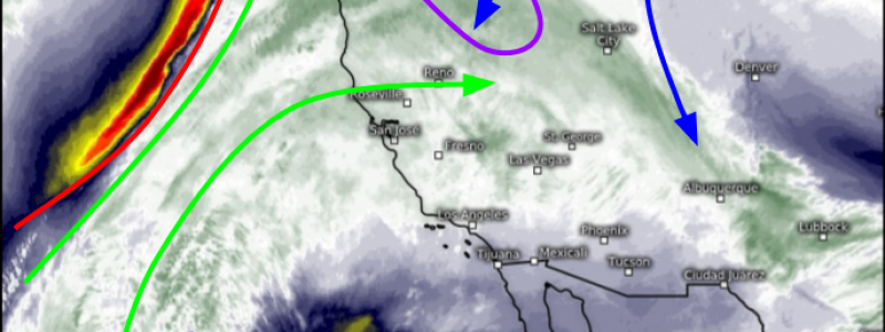
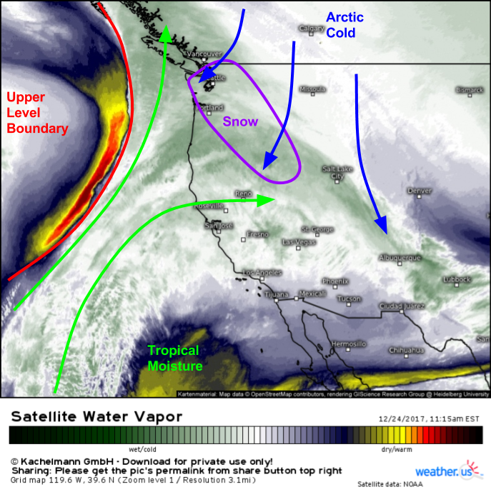
Along the West Coast, a storm system moving into Alaska will drag an upper level boundary east towards the Pacific Northwest as seen on Water Vapor satellite imagery (what’s that?). Ahead of this, tropical moisture will be streaming north, resulting in precipitation. What will make this system a bit unusual is that a cold Arctic airmass will be moving SW behind the disturbance that passed through yesterday. As a result, the atmosphere will be favorable for snow even in low elevation areas such as Seattle.
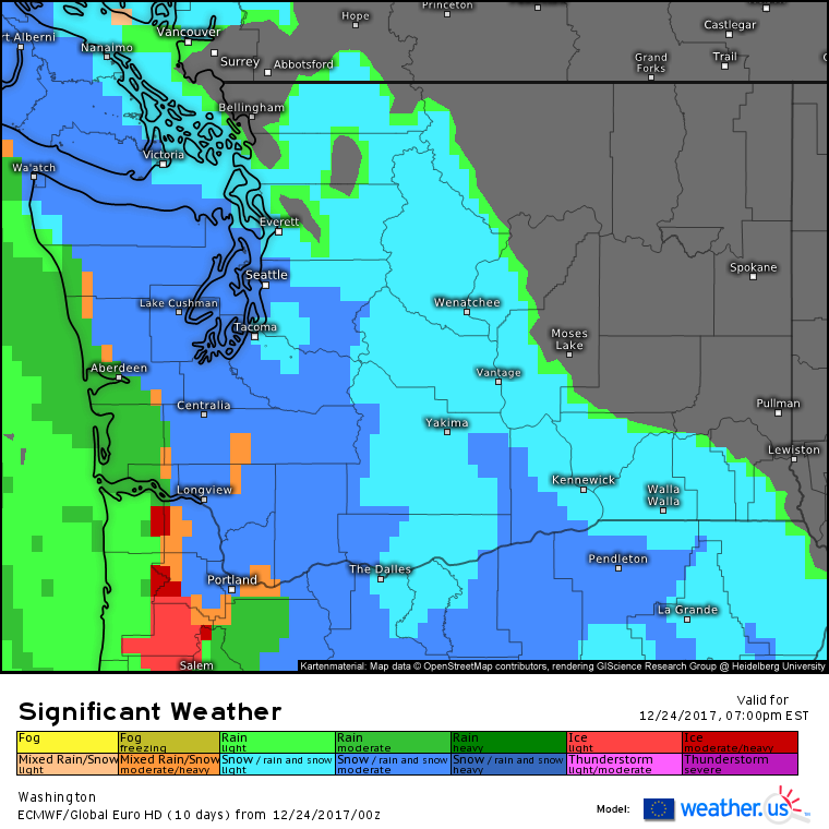
Here’s the ECMWF”s forecast for this afternoon (4 PM PST) shows steady snow impacting Seattle and much of the rest of Western Washington as well as the north side of the Portland Oregon metro area. Precipitation will move into eastern parts of Washington later in the evening as moisture continues to advance NE. Even though snow will be falling in the lower elevations, it will have a hard time accumulating outside of the typically favored higher terrain. Look for a slushy coating-1″ in the Seattle and Portland areas, with a solid 3-6″ up in the mountains. Precip will wrap up tomorrow morning.
For more information about your local forecast: https://weather.us/
For more information about the local forecast for ME/NH: https://forecasterjack.com/2017/12/24/the-calm-before-a-christmas-noreaster-today/
-Jack


