Appalachian Storm Brings Ice To New England, Snow To The Ohio Valley, And Storms To The Southeast
Hello everyone!
A weak but energetic storm system will move up the Appalachians today before reforming off the New England coast this evening. This storm will bring a variety of impacts to much of the eastern third of the country today. In New England, expect a prolonged period of icing as warm air floods in aloft, but fails to dislodge near-surface cold air. In the Ohio Valley, expect rain to change to snow as cold air rushes in behind the system. In the Southeast, watch for strong to severe storms and heavy rain as tropical moisture surges north ahead of the storm.
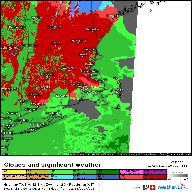
Here’s the Swiss Super HD model’s forecast for rain and freezing rain in New England today. Icing will cause slick travel from Connecticut all the way up through Maine. As warm air continues to stream in aloft, any leftover snow in the mountains of New Hampshire and Maine will change to sleet and freezing rain, though that process could take much of the rest of this morning to be completed. I discussed this freezing rain setup in detail yesterday morning, and all the information in that blog post remains relevant this morning. Check it out for some of the science behind freezing rain as well as my forecast for how much ice accretion to expect!
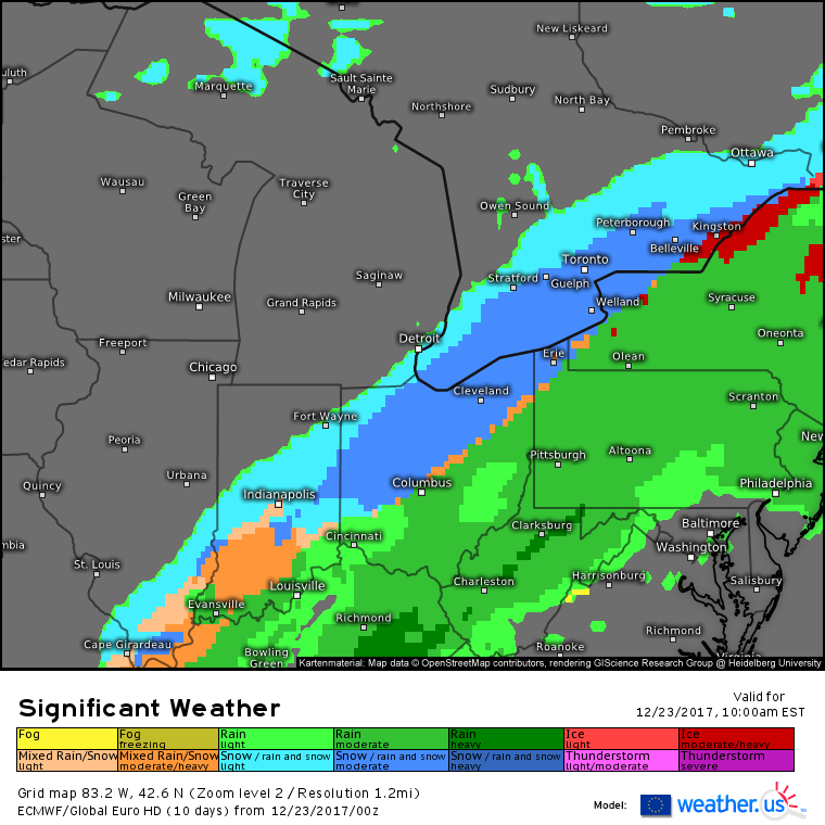
While freezing rain causes problems on the front side of the storm, rain will be changing to snow on the back side of the storm in parts of the Ohio Valley. The ECMWF’s significant weather forecast shows snow falling from Southern Illinois up through Indiana and into parts of Northern Ohio and Western New York. As cold air continues to flow into the storm, the rain/snow line will shift southeast. However, the back edge of precipitation will be moving in the same direction meaning that significant accumulations are not expected. Slushy coating-1″ amounts are likely for most of the area that sees snow today, with a few inches possible in parts of Western New York where snow will fall for longer.
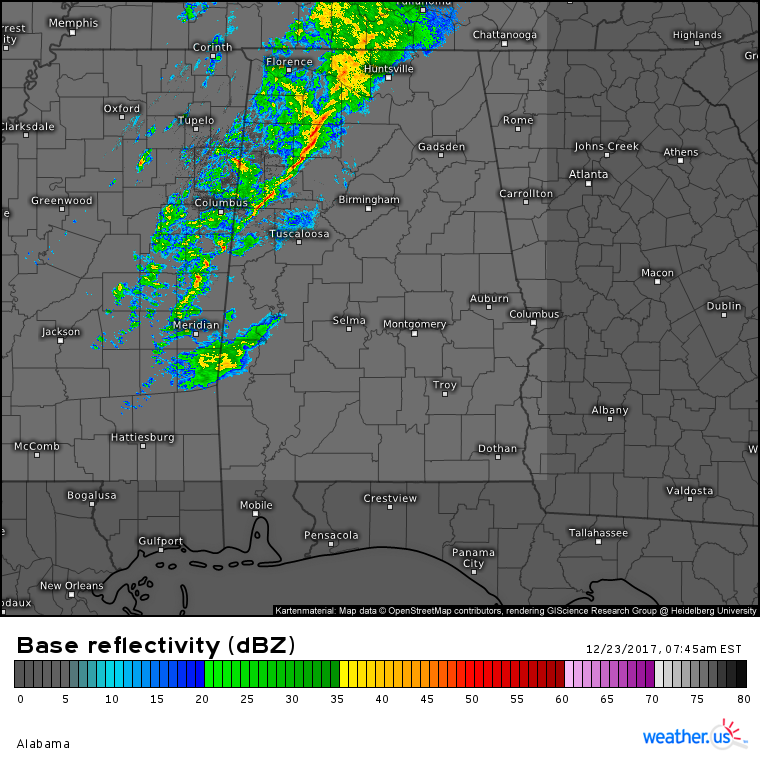
To the south, HD radar imagery shows a line of storms moving through NW Alabama this morning. Some of those linear storm segments will feature winds gusting briefly to 40 or 50 mph. A few severe wind gusts (>58mph) are possible as these storms continue to move east this morning. Heavy rain will also accompany these storms, but due to their fairly fast forward movement, no widespread flooding issues are expected.
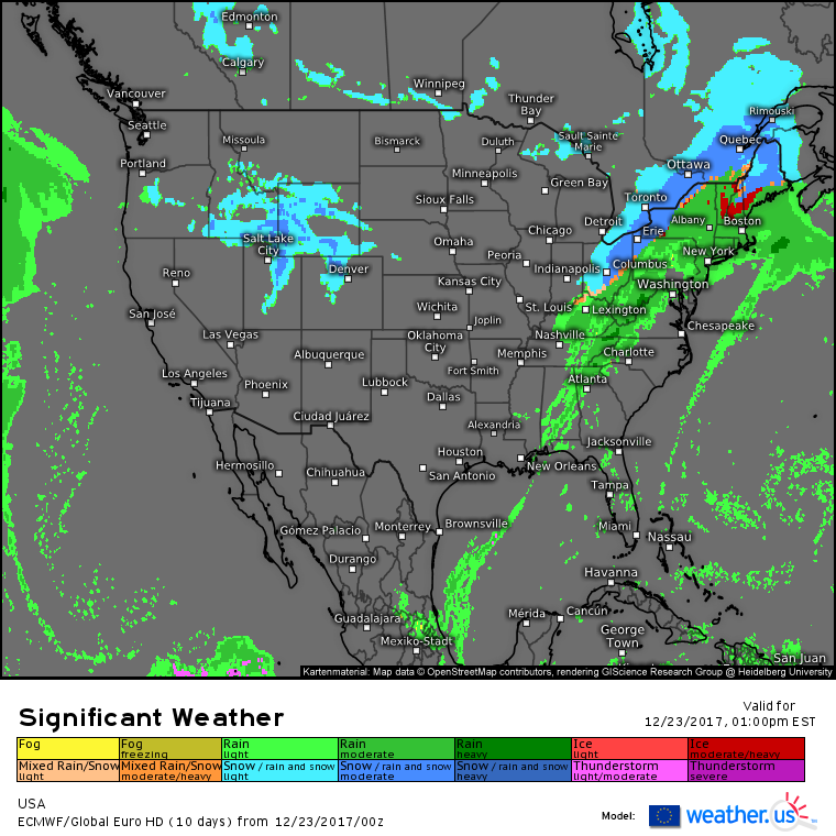
Elsewhere across the country, the ECMWF’s overview map shows the Southwest, Northern Plains, and West Coast all enjoying quiet weather today as two high pressure centers establish control of those areas. The active weather in the East we’ve discussed, so the only other feature to note is the storm moving through parts of the Central Rockies.
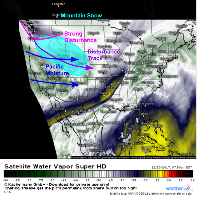
Water Vapor satellite imagery (what’s that?) shows a strong disturbance diving southeast into the Rockies this morning with Pacific moisture streaming east ahead of it. The combination of upper level energy and Pacific moisture will result in snow breaking out in the mountains of Southern Idaho, Northern Utah, Western Wyoming, and NW Colorado today. Locally heavy snowfall amounts up to a foot are possible in the high peaks of Colorado, where this storm’s dynamics will be maximized.
This disturbance will continue to zoom east in the next few days, bringing a stripe of snow from Wyoming to Maine. As the disturbance hits the coast near New England, it will rapidly intensify into a snowstorm on Christmas morning. I’ll have a full analysis of that system this afternoon!
For more information about your local forecast: https://weather.us/
For more information about the local forecast for ME/NH: https://forecasterjack.com/2017/12/23/mixed-precipitation-arrives-today-with-significant-ice-accretion-expected/
-Jack
