A Series Of Weak Disturbances Brings Light Rain/Snow To The Northern Tier Of The Country Today
Hello everyone!
Today will feature a chain of weak disturbances drifting across the top tier of the country and bringing light rain/snow with them. None of these disturbances will be very strong, and thus none of them are expected to be high-impact events. However, it doesn’t take much snow to cause slick roads, and that’s what you can expect in places like Northern New England, Northern Minnesota, Northern Montana, and the mountains of Washington State.
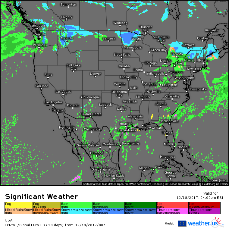
Here’s the ECMWF’s overview map for today showing the string of disturbances in the north. I’ll briefly discuss each one individually below. In addition to the northern systems, notice some shower and thunderstorm activity along the Gulf Coast from Texas over into the Panhandle of Florida. Another upper level low is beginning to eject east today from the Southwestern US, and lifting ahead of it will help to fuel showers and thunderstorms. No severe weather is expected, but locally heavy rain and lightning will be threats in this area. This system will have more impacts tomorrow, which is when I’ll discuss it in more detail.
In Northern New England, a weak disturbance will cause light snow to break out as warm air is forced up and over low level cold air. In the absence of any strong lifting dynamics, this system will rely on terrain influences to produce accumulating snow. That means that the highest amounts will be found over the Adirondack mountains of NY, the Green mountains of VT, and the White mountains of NH. Along the Maine coast, a weak low pressure system will provide just enough lifting to squeeze out an inch or two, but that’s about it. Snow tapers off tonight outside of the mountains.
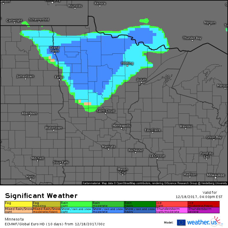
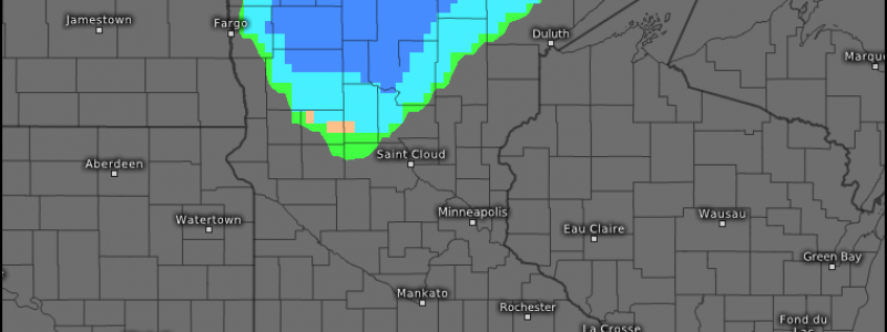
In Minnesota, a cold front will be pushing south as low pressure tracks towards Hudson Bay. This will help to spark an area of light-moderate snow primarily in the northern part of the state. While lifting is a little more consolidated with this system compared to the New England wave, the lack of moisture in the middle of the continent will limit this storm’s potential. Like in New England, 2-3″ will be the ceiling for accumulations.
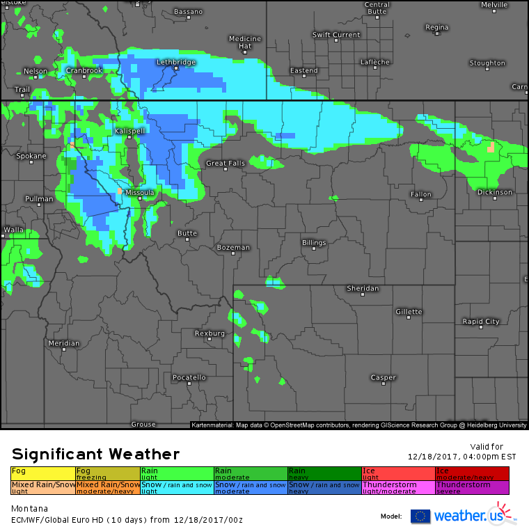
In Montana, Pacific moisture will be drifting over the Rocky Mountains, causing snow in the NW part of the state. Farther east, that Pacific moisture will interact with the tail end of the cold front bringing snow to Minnesota. This will result in light snow across the NE part of the state as well. Any accumulations of significance will be limited to the higher terrain, making this another low impact system for folks not heading up through the passes.
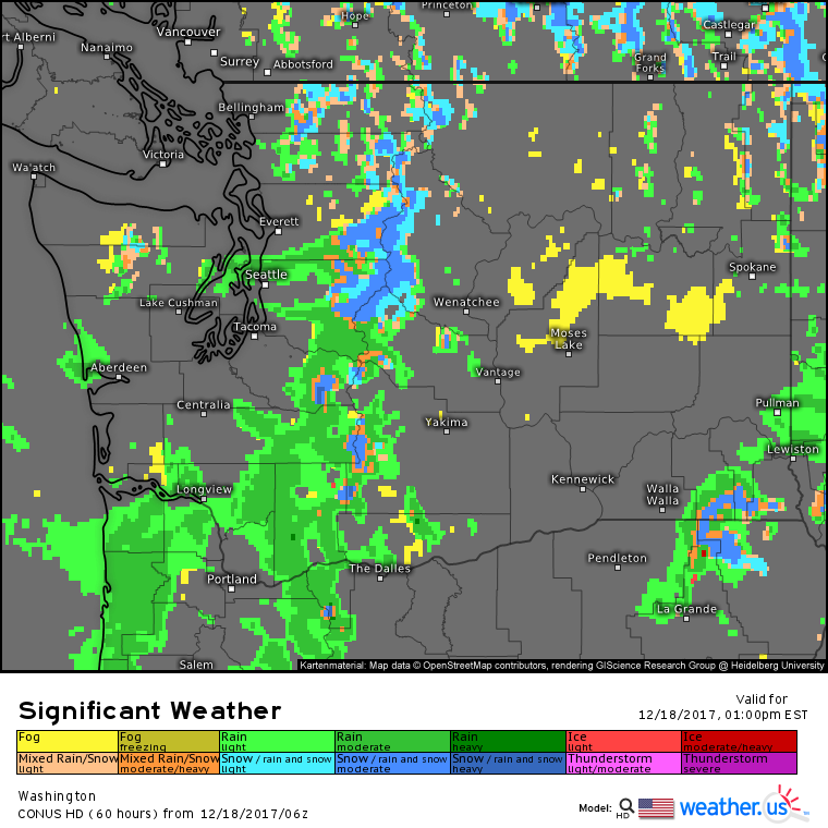
At the Western end of our chain of disturbances, we have continuing rain and mountain snow for parts of Washington State as Pacific moisture continues to stream onshore. There’s no real cold air in place for today, so snow will be limited to the higher elevations. This means that we’re looking at a similar setup for impacts. If you’re heading up through the passes, watch for slick travel. Otherwise, this system is unlikely to impact you much.
The middle of the country will see mainly quiet weather today in between the northern stream disturbances discussed above and the southern stream system that will bring showers and thunderstorms to the Gulf Coast.
For more information about your local forecast: https://weather.us/
For more information about the local forecast for ME/NH: https://forecasterjack.com/2017/12/18/light-snow-today-3/
-Jack
