Strong Storm System To Bring Blizzard Conditions And Severe Storms To Parts Of The Plains Today
Hello everyone!
Our quiet pattern is finally ending! A strengthening storm system currently located over South Dakota will move northeast today, bringing a variety of active weather to the central third of the country. The two main threats will be blizzard conditions in the Dakotas and severe storms in Missouri, Arkansas, and Oklahoma.
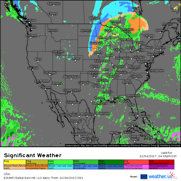
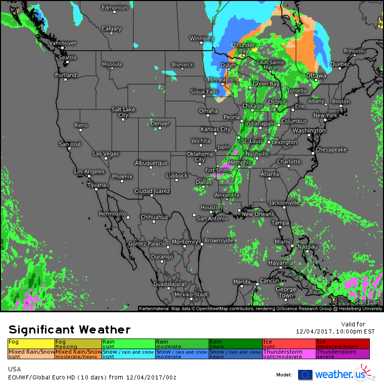
The ECMWF’s national overview map shows our system in the midwest dominating the weather today. Quiet conditions will be found across both coasts as high pressure builds into the West Coast and is slow to depart in the east. 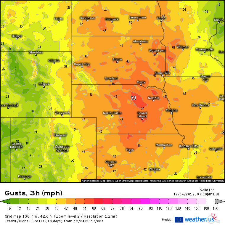
The gradient between the high pressure building into the West Coast and the developing storm over the Great Lakes will fuel strong winds across the northern Plains today. Wind gusts behind the storm will exceed 40 mph for a majority of the area as the ECMWF forecast above highlights. These winds are the first ingredient in one of our major threats for today, which is blizzard conditions.
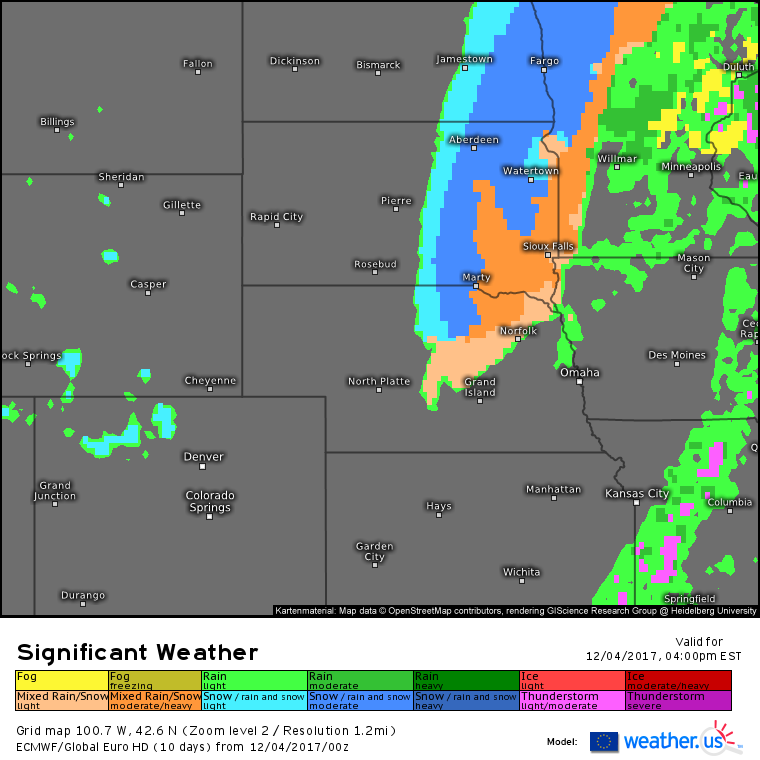
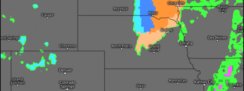
While winds will be gusting over 40 mph, snow will be falling in NE South Dakota, Eastern North Dakota, and NW Minnesota. The combination of falling snow, and blowing snow due to the winds will result in dangerously low visibilities in these areas, along with dangerous travel conditions.
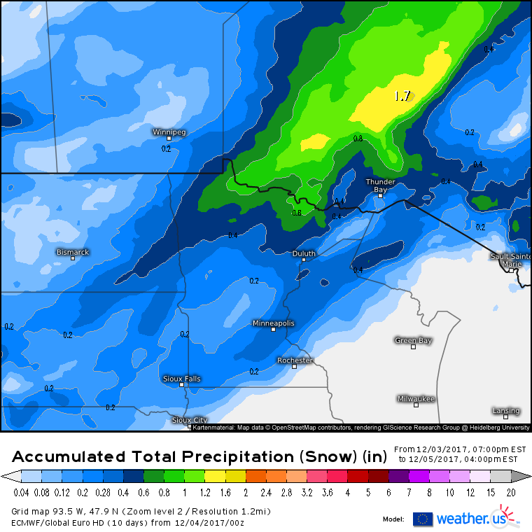
Total snowfall accumulation won’t be overly impressive with this system, it’s the combination of snow and wind that will produce the greatest impacts. The .2″ liquid equivalent line is a good demarcation for who will see over 2″ of snow from today’s system. Snow ratios will be higher the farther NW you go, so NW Minnesota has a good chance of stretching its .4-.6″ of liquid equivalent to 6-10″ of snowfall. The opposite will be true in places like Minneapolis where a transition from rain to snow will limit accumulations, and .2″ of liquid equivalent may only result in 1″ of actual accumulation. For more on forecasting snowfall from liquid equivalent, check out this video.
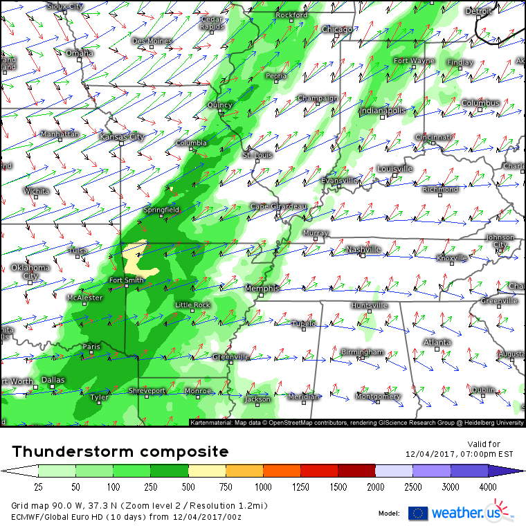
This storm’s impacts won’t be all winter-related. On the southeastern side of the system, moisture will pool ahead of a cold front, and this moisture will fuel thunderstorm development. The ECMWF’s thunderstorm composite (what’s that?) shows a limited amount of instability, but the strong nature of the front, and its upper level support, will allow for storm development this afternoon and evening. Some of the storms will become severe, with damaging winds being the main threat.
Simulated radar forecasts from the HRRR model show a line of storms stretching from SE Oklahoma through NW Arkansas and into SE Missouri. It’s these areas that have the greatest risk for severe weather, storms will be weaker in the colder airmass located over Illinois.
As the evening progresses, snow will come to an end across the Dakotas, though hazardous travel is still possible in any areas of blowing snow. Rain will be changing to snow across eastern parts of Minnesota, and while winds will be gusty there too, the heavier/wetter nature of the snow will prohibit visibilities low enough to qualify as a blizzard.
The system will continue to move NE into Canada tomorrow, with showers along the cold front becoming the primary impact after snow on the west side of the system moves north of the border.
For more information about your local forecast: https://weather.us/
For more information about the local forecast for ME/NH: https://forecasterjack.com/2017/12/04/cool-and-calm-pattern-continues/
-Jack
