Northeast And Northwest Once Again See Rain And Mountain Snow While The Rest Of The Country Remains Quiet
Hello everyone!
Today will feature a continuation of a familiar weather pattern. Active weather will be focused across the Northeast and Northwest corners of the country, while the rest of the nation sees quiet conditions.
The ECMWF weather overview map for this afternoon shows this pattern well. A developing coastal storm will brush New England with rain and mountain snow, while a different storm will bring rain and high mountain snow to the Pacific Northwest. Neither system is expected to be overly impactful, as any wintry precipitation will be confined to sparsely populated areas.
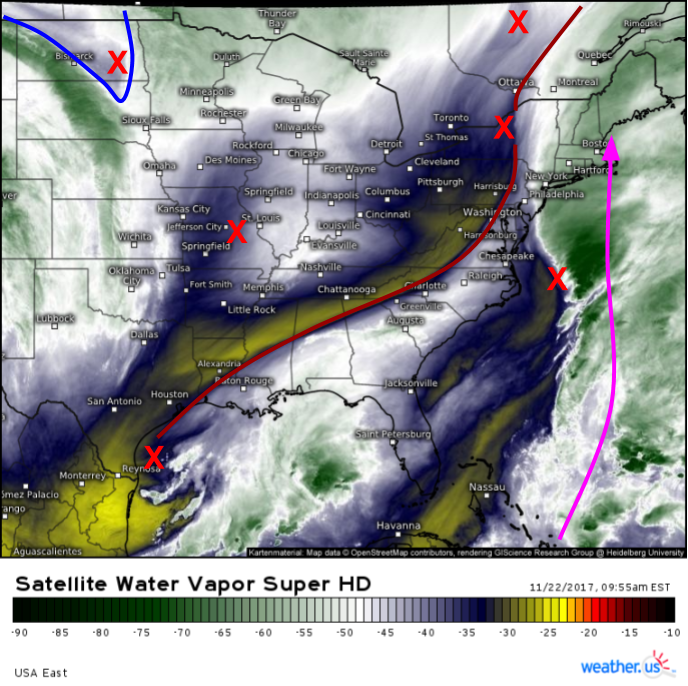
GOES-16 water vapor imagery (what’s that?) shows why the coastal storm in the Northeast won’t bring major impacts. Each red “X” represents an upper level disturbance. Notice how the important disturbances are spread out across the entire eastern half of the country, rather than concentrated in one area. The disturbance that is carrying with it a blast of Arctic air is all the way back in North Dakota, over a thousand miles from the disturbance with the moisture, located off the Carolina coast. This disconnect will prevent the I-95 corridor from seeing snow. Additionally, the disturbances responsible for steering the developing storm are strung out from northeast to southwest (dark red line). This so-called “positive tilt” will steer the storm more quickly east than north, meaning that Atlantic Canada will see the brunt of the heavy precipitation instead of New England. That being said, a decent feed of tropical moisture highlighted by the pink arrow will help fuel steady rains across New England through this evening before the storm moves east.
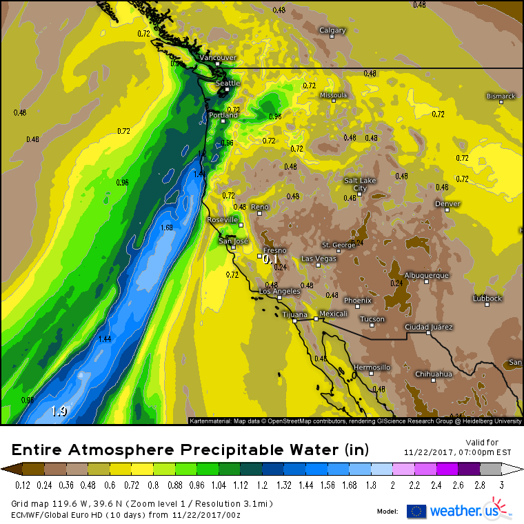
Across the Northwest, the Precipitable Water forecast from the ECMWF tells today’s story well. A plume of moisture will move onshore north of Eureka California. Within this moisture plume, rain is expected, with snow limited to the highest of summits, due to the warm nature of the airmass that is being sourced straight from the tropical Pacific. There’s no powerful storm to the west of this moisture plume to force it ashore with great force, so no unusually heavy precipitation is expected. Instead, it’ll just ensure another grey and rainy day for the Pacific Northwest.
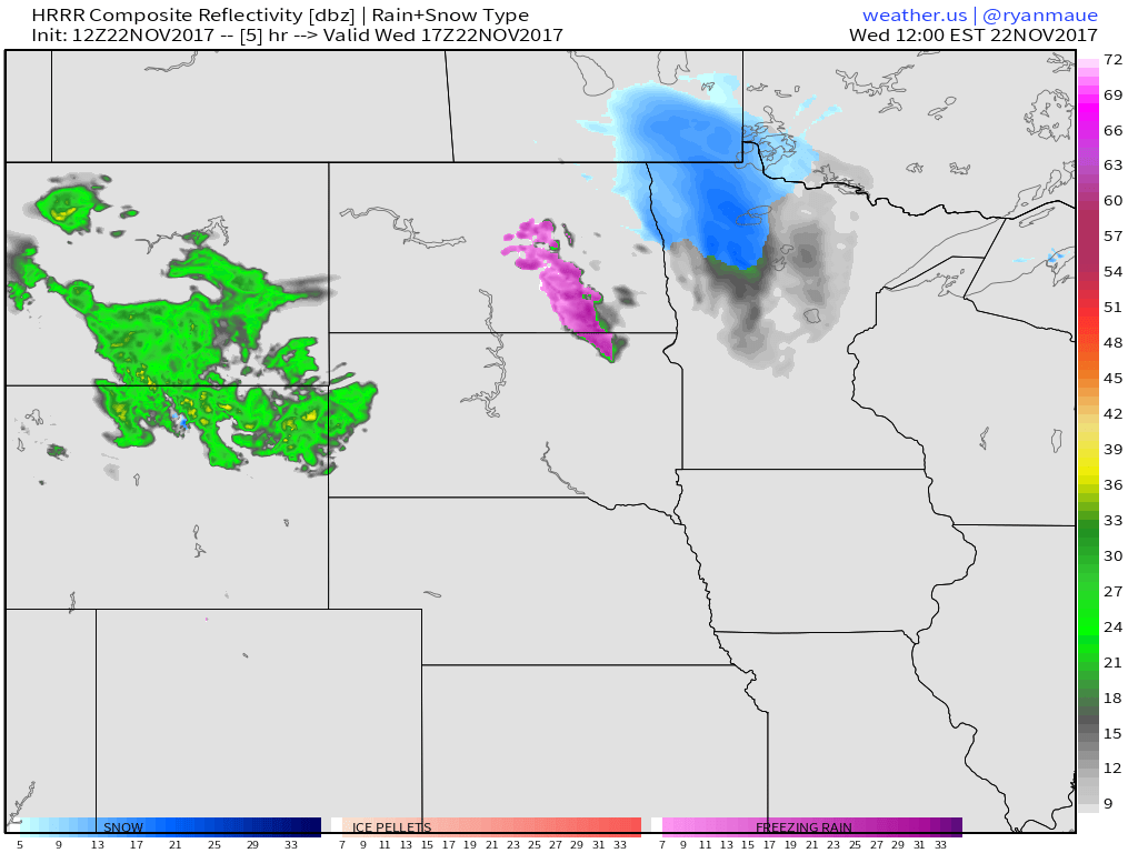
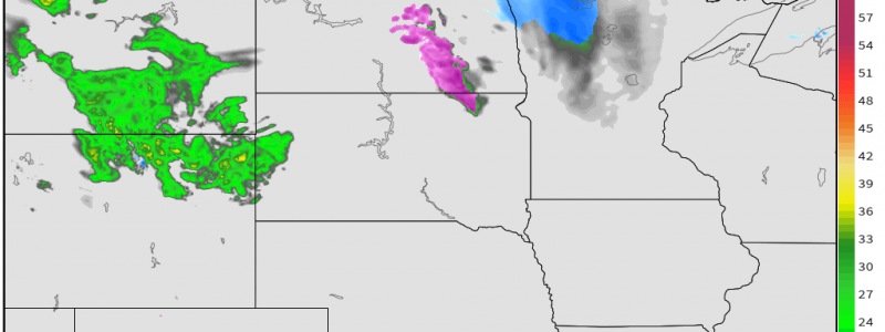
Elsewhere across the country, the only other weather of note is across the Northern Plains where a weak system will bring light snow and mixed precipitation to parts of North Dakota and Minnesota.
The HRRR’s simulated radar product shows this system and its impacts well. While the system is weak and moisture starved, it won’t take too much snow and/or freezing rain to cause problems on the roads in this area.
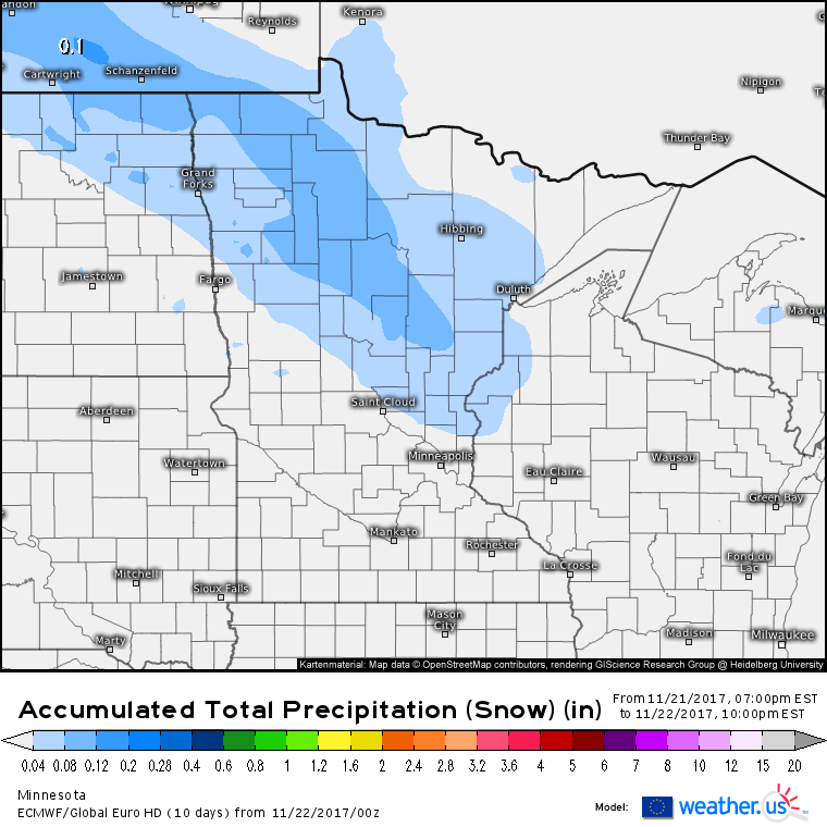
The ECMWF’s liquid equivalent snowfall forecast (what’s that and how do I use it?) shows between .4 and .1″ of liquid equivalent snowfall through today. This suggests actual accumulations of a coating to two inches at most. Farther southeast, a quick trace of ice is possible with that band of freezing rain in North Dakota. Once again, these amounts aren’t large enough to cause significant, widespread issues, but they will warrant slower and more cautious travel.
For more information about your local forecast: https://weather.us/
For more information about the local forecast for ME/NH: https://forecasterjack.com/2017/11/22/warm-with-rain-and-mountain-snow-today/
-Jack

