Early Season Snow Storm Heads For Denver
Hello everyone!
This evening’s update will shift gears away from Nate and towards an early season snow storm forecast to develop tonight across Colorado.
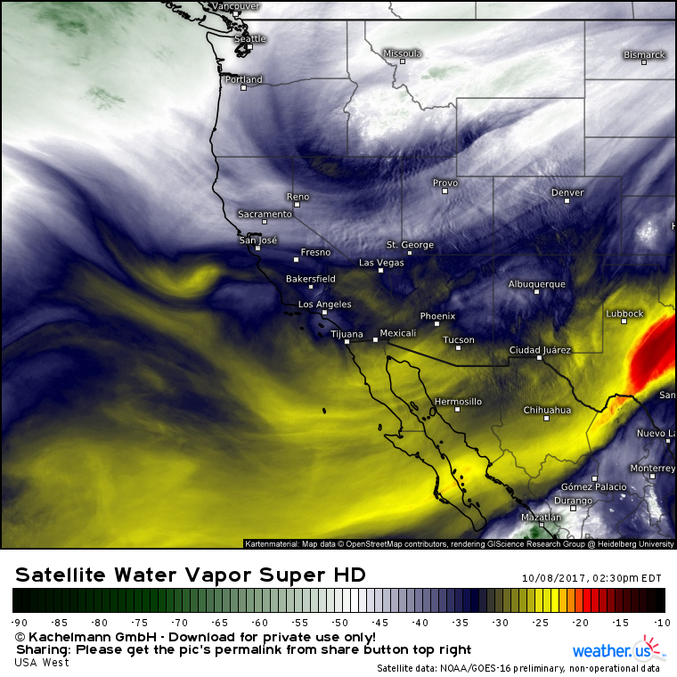
GOES-16 water vapor imagery (what’s that?) shows an upper level trough over Idaho this afternoon. This trough is moving SE, and will arrive in Colorado tonight. Notice the stream of Pacific moisture moving around the base of the trough. This moisture, combined with lift from the trough and cold air from a high pressure system in Canada will create snowfall over Colorado tonight through tomorrow.
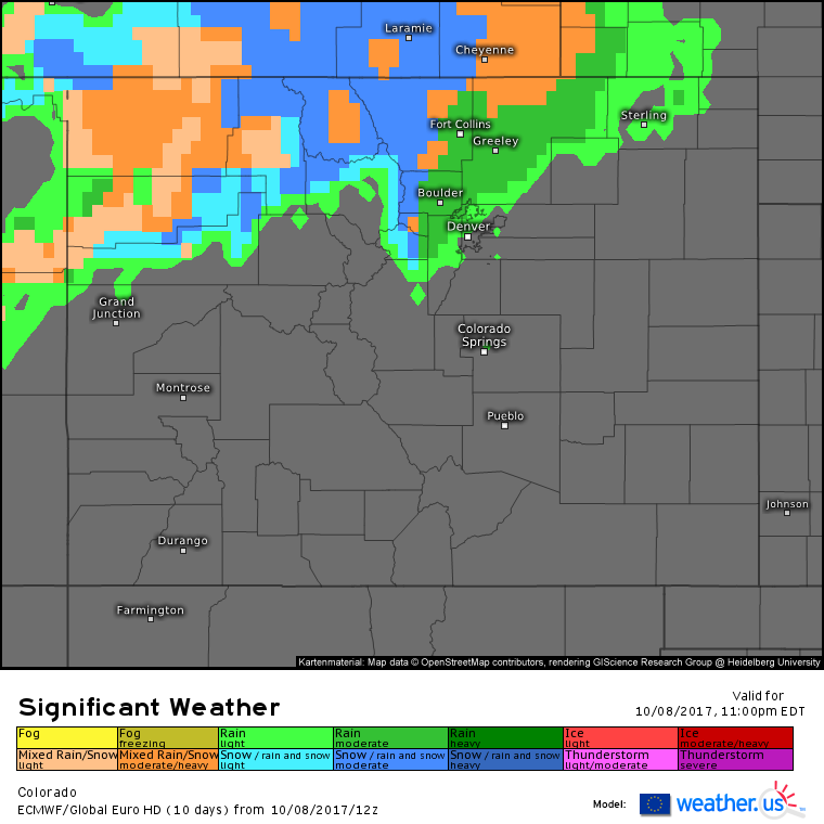
The ECMWF model shows precip rolling in from the north tonight. The mountains will see all snow while areas like Fort Collins, Boulder, and Denver will start as rain.
Nighttime cooling plus northerly winds bringing colder air in from Canada will lead to falling temperatures tonight. As a result, Fort Collins, Boulder, and eventually Denver will see a change from rain to snow. Snow will continue throughout the day tomorrow before departing tomorrow night.
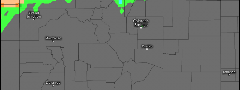
Current observations show warm temps across the state this afternoon, outside of the high mountains. These warm temperatures will put a damper on accumulations, as a good amount of snow will melt on contact with the warm ground.
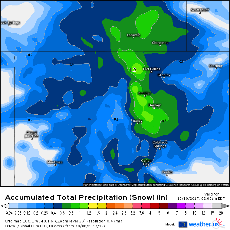
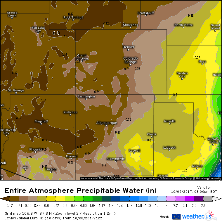
This map shows how much liquid equivalent precipitation is expected to fall as snowfall through the end of the storm. Normally, we’d multiply these values by a snow to liquid ratio of 10 or 15:1, but given the warm ground and daytime timing (most snow will fall during the day tomorrow), that ratio will be pushed way down for areas outside of the mountains. The .8″ of liquid forecast to fall in Denver will likely only amount to around 4″ of snow. I’d be surprised if areas to the east of Denver, even those forecast to see >.5″ of liquid equivalent, end up accumulating more than 1-2″ of snow. NW of Denver, it will be a much different story and the 1″ of liquid forecast to fall over the high mountains west of Fort Collins will likely amount to a foot or so of snow.
Despite the relatively low snowfall totals in the Denver area, this will still be an impactful storm.
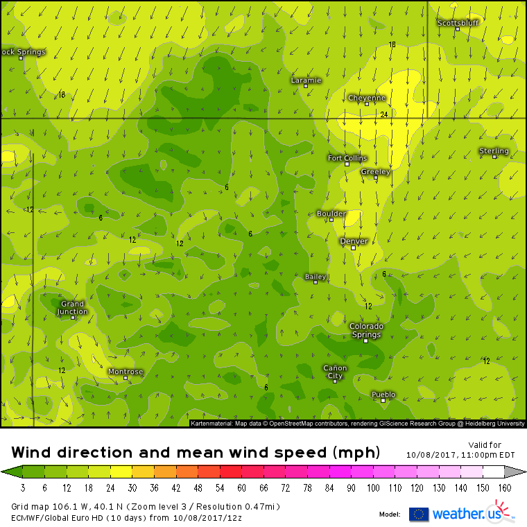
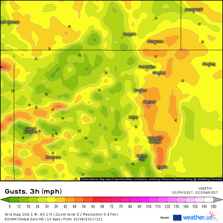
Northerly winds will gust between 40 and 50 mph early tomorrow morning as the gradient between high pressure to the north and low pressure to the south intensifies. Several inches of heavy, wet snow combined with these strong winds will lead to the threat for power outages. While most roads in the Denver area should remain wet due to the warm temperatures today and sunshine during the day tomorrow, bridges, and shady spots could be quite slick. Road conditions will deteriorate as you head up into the higher terrain west of the city.
By tomorrow evening, drier air will be moving SE as the storm system moves east. Snow will taper to flurries from NW to SE and clear skies will return for Tuesday.
As the storm moves east, away from the supply of cold mountain air, snow will turn into rain which will fall across parts of the Plains over the next few days. No significant impacts are expected once the system moves out of the Denver area.
More updates tomorrow!
-Jack
