Hurricane Nate Will Make Landfall In Louisiana Tonight, Heavy Rains Move Up The East Coast Tomorrow
Hello everyone!
Hurricane Nate continues to cruise towards landfall on the Louisiana coast this afternoon. I’ve gone over the expected impacts in quite a bit of detail over the past few days. All of the landfall impacts are locked and loaded at this point.
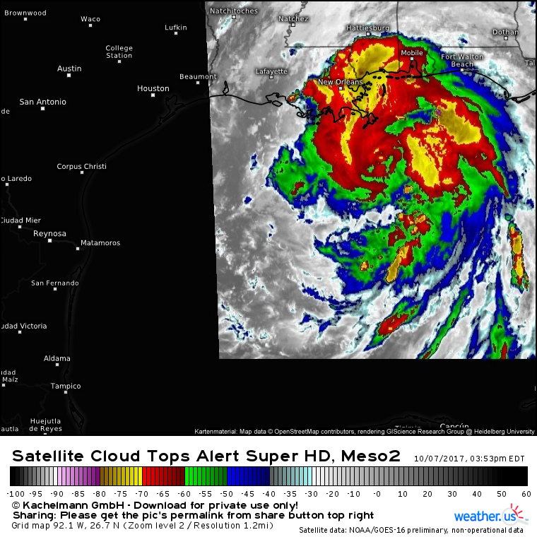
Nate’s satellite presentation has weakened a bit in the past hour or two, but there are still signs of strength such as the well defined spiral bands and the strong thunderstorm activity near the center. The center is racing north at speeds of over 20 mph, and the storm will make landfall this evening in SE LA. At that point, the storm will begin to weaken as rapidly as it intensified, while it races N and then NE.
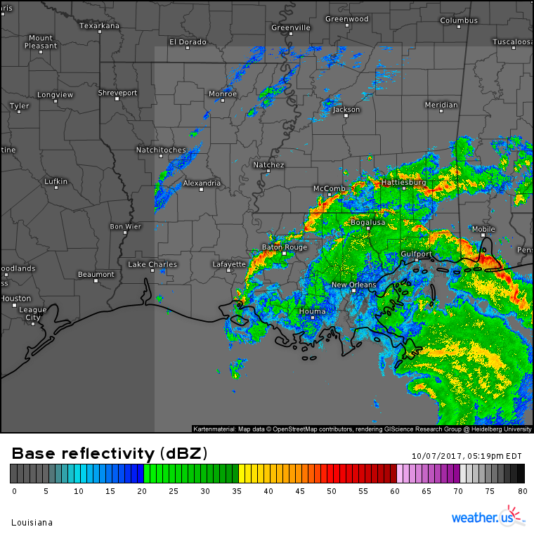
You can watch the storm move onshore with our HD radar products. If you want to zoom into county level, just click the link then click on the map for even more detail!
Because I’ve already discussed the rain/wind/surge impacts along the Gulf Coast, this update will focus more on the impacts away from the coast as Nate races NE tomorrow and into Monday.
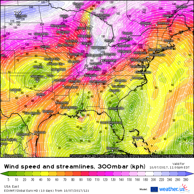
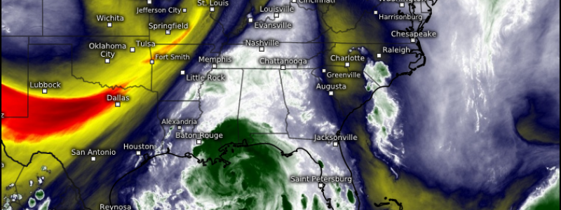
This map shows upper level winds tonight. Nate is located over Southern Mississippi and Alabama. Notice the very strong upper level winds over the Midwest. These winds will help to pull Nate’s moisture north. A cold front moving east through the Ohio Valley will help to wring out that moisture in the form of heavy rainfall, all the way up into New England.
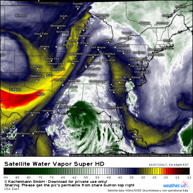
Satellite imagery shows the northward moisture transport well underway this evening as moist air is lifted north into the Ohio Valley ahead of an approaching cold front.
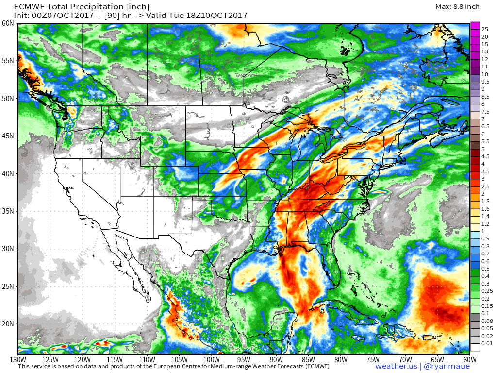
This map shows the total amount of rainfall forecast in the next couple days. Notice the swath of higher totals associated with Nate running from the Gulf of Mexico up through New England. The very fast forward motion of the storm will keep rainfall totals from getting too out of hand, however it only takes a couple inches to cause flash flooding problems for some of the more vulnerable spots.
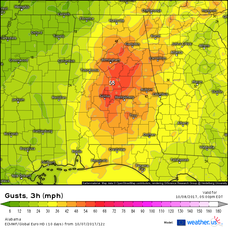
In addition to the rain, gusty winds will persist well inland due to the fast movement of the storm. This ECMWF forecast shows wind gusts near 60 mph even 100+ miles from the coast. 60 mph wind gusts are more than capable of knocking down trees and power lines! Gusty winds will continue into the Mid Atlantic, but will weaken enough to not cause major problems.
By Monday evening, Nate’s remnants will be long gone off the New England coast, and quiet weather will return to the East. The west will be a different story though, and as Nate winds down, Denver’s first snowstorm of the season will wind up. More on that tomorrow!
-Jack
