Severe Storms In The Southern Plains As Nate Moves North
Hello everyone!
We have two main weather stories to talk about today, severe weather in the Southern Plains and TS Nate moving north through the Caribbean.
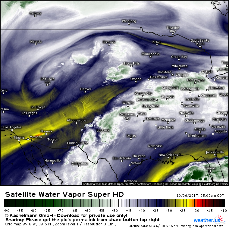
GOES-16 WV imagery (what’s that?) shows a strong setup for severe weather today. An upper level low digging SE through the Rockies will help provide lifting, moisture from the Gulf of Mexico will stream north helping to fuel the storms. In the mid levels, dry air from the East Pacific is seen moving in from the west. This dry air helps to enhance the damaging wind threat in severe thunderstorms by making air heavier than it normally would be. Heavier air sinks to the ground faster, causing higher winds. To top it all off, a cold front in the area will help to focus lifting enough to see storms develop.
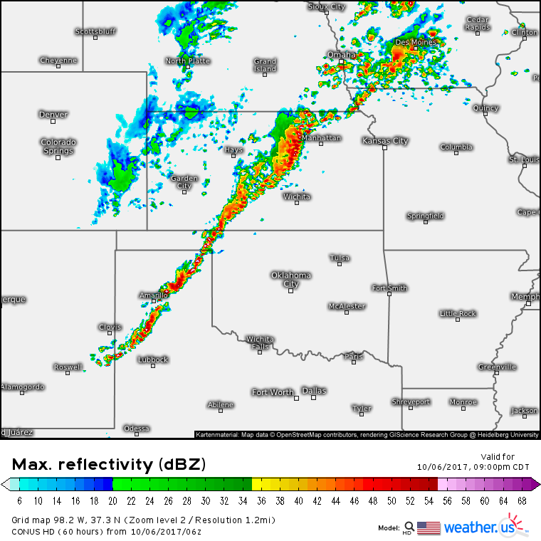
By this evening, strong to severe storms will be in progress all across the Southern Plains from E NM to IA. Damaging winds will be the biggest threat with storms oriented in linear structures ahead of a cold front. However, if any storms can form out ahead of the line, tornadoes and large hail would become larger threats. This can’t be ruled out, but it’s also not expected to be a widespread issue. I won’t discuss each element of this severe threat, but if you’re interested in exploring CAPE/Shear parameters, you can do so over at weather.us!
Elsewhere across the US, generally quiet weather is expected as all eyes continue to be on TS Nate in the Western Caribbean.
Nate has improved quite a bit overnight on satellite imagery. Strong thunderstorms have developed over/near the center of the system, and organized outflow is beginning to develop in the upper levels. Banding structures are beginning to organize around the system, a marked change from last night when thunderstorms were disorganized and weak. The storm is now over the warm waters of the Western Caribbean, and further intensification is expected.
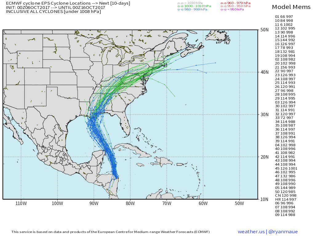
Nate’s track forecast continues to wobble around a little bit, but the general idea remains consistent. The storm will either make landfall, or barely miss the Yucatan peninsula today before tracking NNW into the GOM. A turn N and then NE is expected on Saturday before a landfall somewhere between Lake Charles Louisiana and Panama City Florida. The storm’s remnants will then race NE, bringing heavy rains to the Mid Atlantic and parts of New England.
How strong will Nate be at landfall? I covered the intensity forecast in a bit more detail yesterday, but it’s worth revisiting briefly this morning.
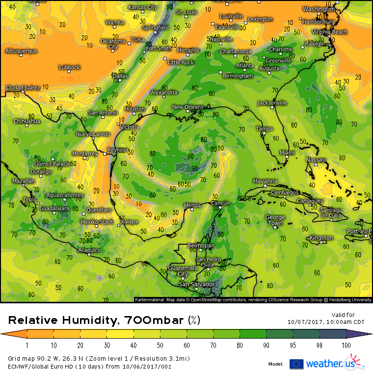
With warm waters and low wind shear, dry air will be the primary inhibiting factor in terms of Nate’s eventual intensity. ECMWF forecasts show dry air wrapping into the system from the west and south as it moves closer to New Orleans tomorrow. This dry air, if it can wrap into the inner core of the system, will keep a lid on Nate’s intensity. If an inner core can organize today before the dry air really kicks in, and if interaction with the Yucatan doesn’t disrupt the inner core, the storm may be able to continue strengthening despite the dry air.
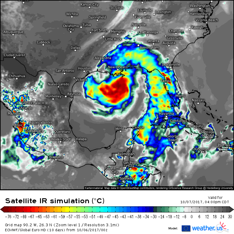
Regardless of the inner core’s organization and ferocity (or lack thereof!), impacts will extend well away from the center of Nate, especially to the east. This simulated satellite forecast from the ECMWF shows strong thunderstorm activity in Nate’s outer bands moving onshore in Florida, hundreds of miles east of the center. Gusty winds, heavy rains, and tornadoes will be concerns in these outer bands.
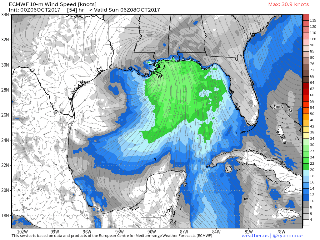
This map shows another dangerous aspect of Nate that will cause problems regardless of the storm’s exact strength. That is the storm surge. Notice the wide expanse of onshore winds from New Orleans all the way east to the Big Bend of Florida. These onshore winds, even if they’re only barely TS force, will pile water up along the coast. Due to the very flat slope of the Gulf Coast, even a small rise in water levels is enough to cause flooding concerns. The extent of the storm surge will depend on the storm’s intensity, but coastal residents vulnerable to storm surge flooding should take action now to prepare for high water.
Several inches of rain will also cause freshwater flooding concerns, but the storm’s fast forward motion will preclude any devastating flooding a la Harvey.
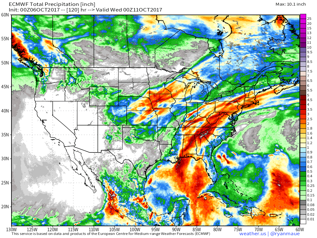
This map shows total rainfall for the next 5 days across the US. Notice the swath of higher totals along Nate’s forecast path from the Western Caribbean all the way up into New England where the storm’s remnant low will enhance rainfall associated with a cold front.
I’ll have more updates tomorrow on Nate!
-Jack
