Early Season Snow Storm Headed For The Northern Rockies
Hello everyone!
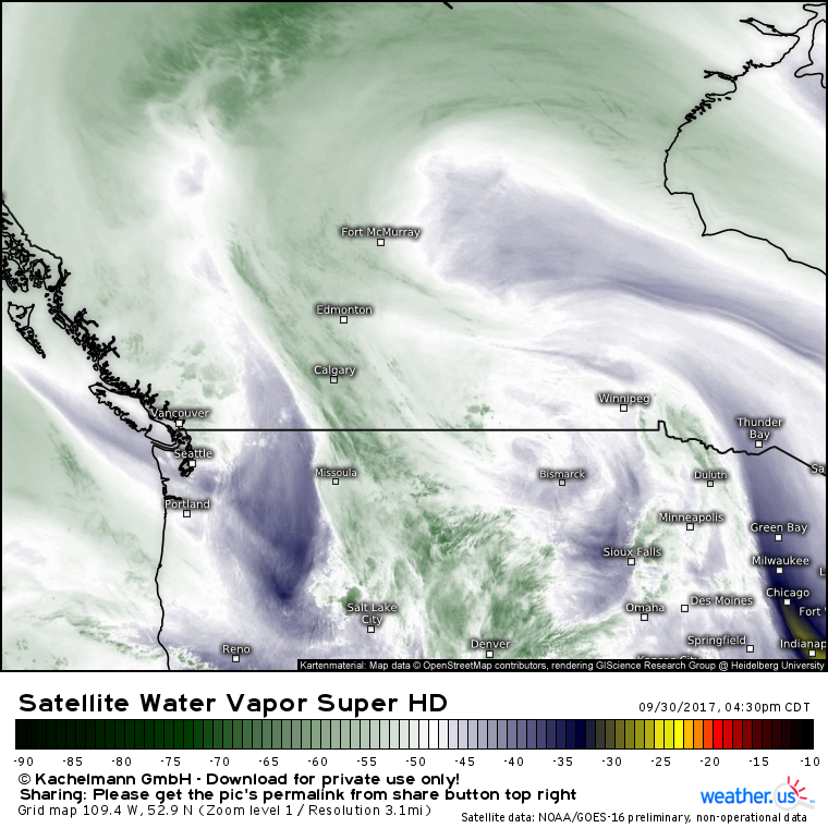
This evening’s update will discuss an early season snow storm headed for the Northern Rockies over the next couple of days. All the factors that will go into powering this storm are visible on water vapor satellite imagery this evening. What’s this?
Upper level energy scattered across the region from Vancouver to Bismark will consolidate as the jet stream forces the Vancouver system west, and an upper level high east of Fort McMurray forces energy from the Dakotas east. This process will unfold tonight and tomorrow, and the result of the converging energy will be a seasonably strong low pressure system.
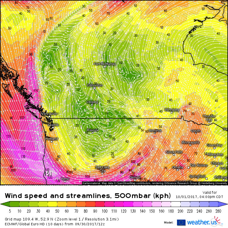
The ECMWF wind forecast shows an upper level low, with winds spinning counter-clockwise, over Montana by tomorrow afternoon. Upper level lows bring cool and unsettled weather, and that’s exactly what can be expected across Montana and the rest of the northern Rockies as we head into the beginning of the week.
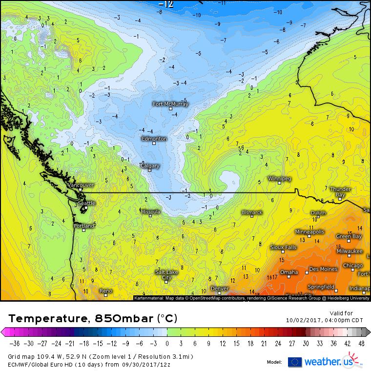
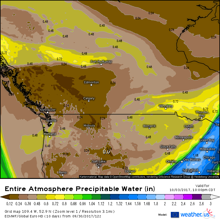
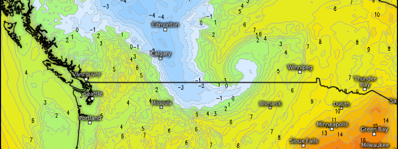
By Monday afternoon, the upper level low will have developed a lower level counterpart over the Canadian Prairies Notice the cold air draining south out of the Arctic in the mid levels of the atmosphere. As that cold air approaches Montana, it will encounter moisture and mountains, creating an environment favorable for snow.
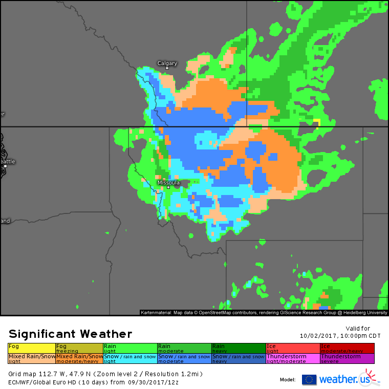
The ECMWF’s significant weather parameter shows moderate snow across much of northern Montana by Monday night. Roads will become snow covered and slippery, resulting in slow travel. Due to the cold stream of air coming in from far northern Canada, even the valleys of north-central Montana will see snow, though the heaviest accumulation will be in the mountains.
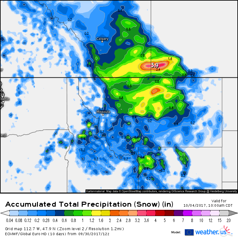
This map shows the ECMWF’s forecast for how much liquid equivalent precipitation will fall as snow through Wednesday morning. To find out how much snow will fall, take the numbers displayed on the map above and multiply by a snow-to-liquid ratio. Generally, a 10:1 ratio will give a good approximation of how much snow to expect, however actual ratios can range from 4:1 to 30:1 depending on how the atmosphere is set up. For this event, given the early season timing, the 10:1 ratio will work well. This means that areas in green can expect about 6″ of snow, while areas highlighted in yellow have a chance at a foot of snow. The ECMWF model isn’t run at a high enough resolution to pick up on each mountain and valley, so adjust these numbers up a bit for higher elevations and down a bit for the valley floors.
By Tuesday night, dry air will rush into the region as the storm system weakens and moves east. This drier air will put an end to the snowfall.
I’ll have more updates in the coming few days as this storm unfolds.
-Jack
