Maria Slowly Weakening While Moving North
Hello everyone!
Today’s update will once again focus on Maria as the weather across the country today is generally quiet.
Maria is slowly weakening due to the effects of dry air and wind shear, as well as cooler waters left in Jose’s wake. Satellite imagery shows this with a clear and open eye no longer visible. However, Maria remains a powerful storm with maximum winds of 110 mph and Tropical Storm force (40 mph+) winds that now extend up to 240 miles from the center. This expanding wind field will play a big role in delivering impacts to the Outer Banks of North Carolina even if the storm remains offshore.
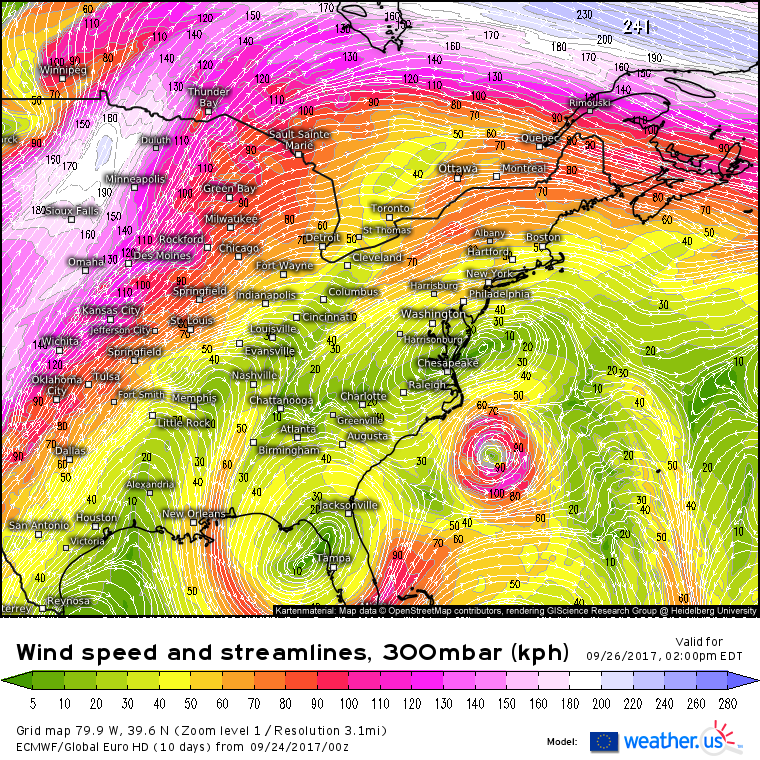
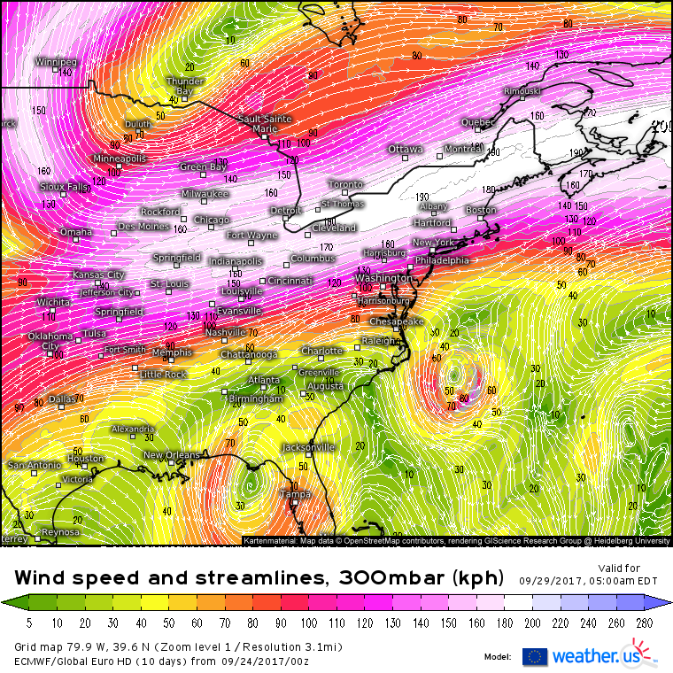
The basic steering forecast remains the same as yesterday’s forecast. A blocking ridge of high pressure over the Mid Atlantic (clockwise swirl E of DC) will work in tandem with an upper level low over Florida (counter-clockwise swirl near Tampa) to guide Maria NW to a point somewhere near the Outer Banks of NC. There’s still some uncertainty as to how far NW the system can make it, which will determine the extent of impacts in North Carolina. Maria will be caught in a bit of a steering “dead zone” as the FL ULL drifts too far south to have an influence and the blocking high weakens. As a result, the storm is likely to stall out for a couple days before changes in the jet stream finally kick it out to sea. This stall will prolong and magnify impacts for the Outer Banks which are likely to include gusty winds, heavy rains, storm surge, and pounding surf.
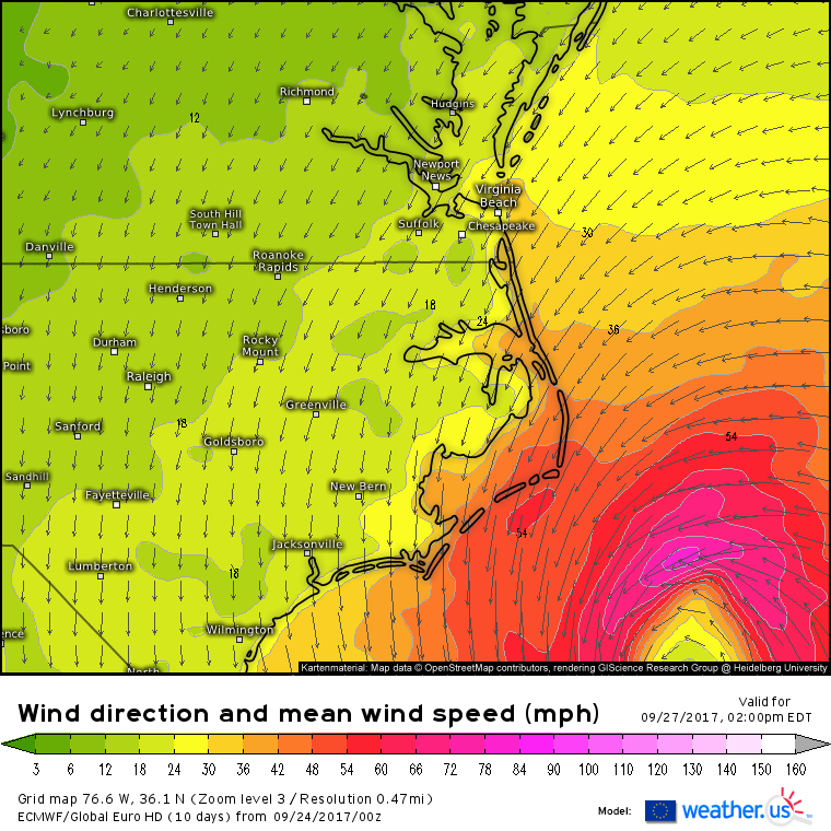
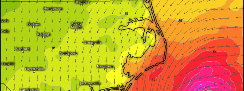
Given Maria’s forecast to closely approach the Outer Banks, and the storm’s expanding wind field, it’s safe to expect that winds on the Outer Banks will exceed Tropical Storm force (40 mph+) as we approach the middle of the week. Notice that much stronger winds to hurricane force are forecast in Maria’s core just offshore. A wobble west of that core by 30 or 40 miles would put hurricane force winds (75 mph+) onto the Outer Banks. Wobbles in weak steering flow are hard to predict, so while my forecast wouldn’t call for hurricane force winds, it would be wise for residents of the Outer Banks to prepare for them, just in case.
The strong onshore winds pictured above will pile water up on the ocean side of the northern Outer Banks and on the bay side of the Southern Outer Banks. A couple feet of storm surge in both of these areas is expected, with higher values possible if the storm wobbles a bit closer.
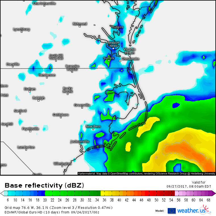
Rain will fall across Eastern North Carolina this week as Maria’s outer bands move onshore. The extent of the heaviest rain, located near the storm’s center, will depend on exactly how close to the coast the center moves. As with the wind forecast, a wobble of 30 or 40 miles will make a big difference regarding the extent of impacts. While no widespread inland flooding is expected, flash flooding of the low-lying areas that typically fill up during heavy rains is expected.
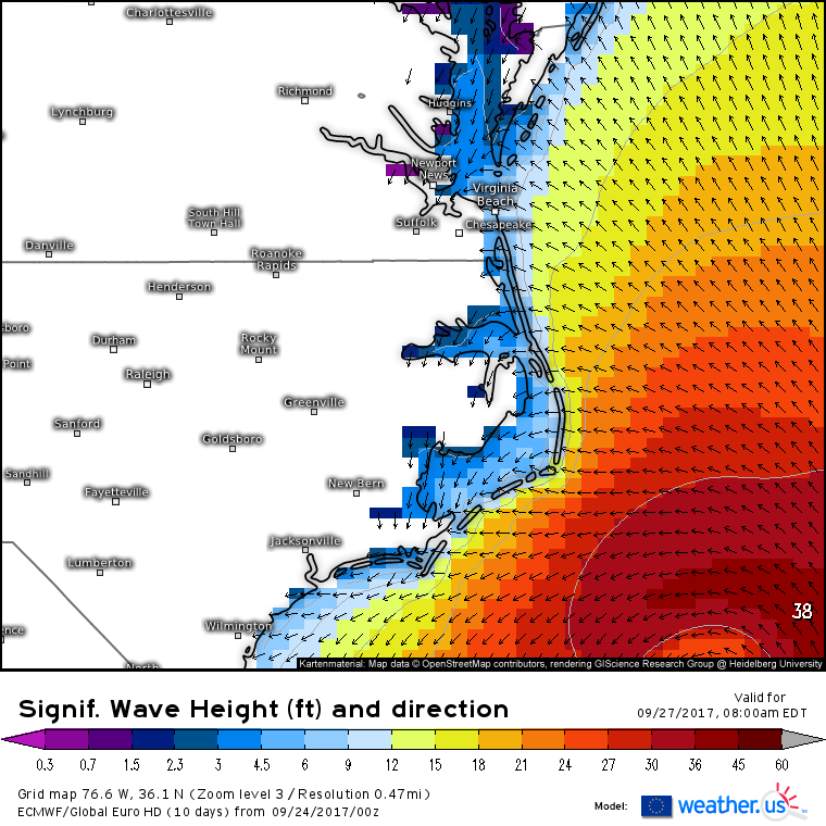
On top of the wind and rain concerns, large surf will continue to batter beaches already suffering erosion from PTC 10, Irma, and Jose. When combined with the surge, these very large breaking waves could do damage to beach houses and other structures not very far above sea level. Unlike the rain/wind/surge, large waves will be an issue regardless of the storm’s exact track.
By the time Friday rolls around, changes in the jet stream will be well underway. The strong blocking high pressure area over the Mid Atlantic will be replaced by the fast westerly winds of the jet stream as upper level low pressure digs into the Great Lakes. This will result in Maria getting caught up in the westerly jet stream winds, which will sweep the storm out to sea. This ENE movement on Friday is forecasted with very high confidence, regardless of uncertainties and wobbles earlier in the week.
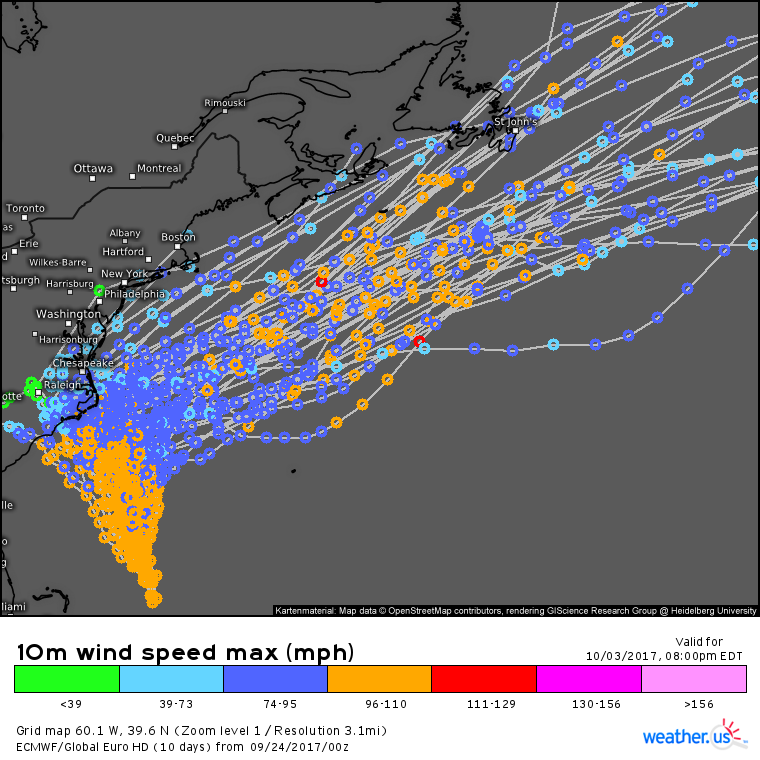
As always, the ECMWF ensembles are a great tool to visualize the range of potential outcomes with a system like Maria. Notice the high confidence in a general NNW movement towards NC early in the week. There’s considerable disagreement as to how far NW the storm gets with most members forecasting a track that keeps the center offshore. Some members, however, do forecast a landfall which, while unlikely, can’t be ruled out at this point. By the end of the week, though, all members are in agreement that the storm will turn NE and race out into the open Atlantic.
I’ll have more updates on Maria in the coming days as the forecast for Eastern North Carolina becomes clearer!
-Jack

