Maria Will Threaten The Outer Banks Of North Carolina This Week
Hello everyone!
In last night’s update, I talked about why I thought we could see a shift west in the forecast track of Maria. I talked about the blocking high over New England and an upper level low over the Gulf of Mexico that will work in tandem to pull Maria a little closer to the coast than most forecasts showed. Well, overnight model guidance is now firmly on board with this idea.
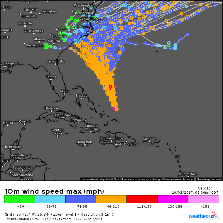
ECMWF ensembles show Maria moving NW to some point near the Outer Banks of NC before rushing out to sea. Notice how there’s still some uncertainty as to how far NW the storm will make it, but that there’s high confidence that the storm will be close enough for impacts. Also notice that confidence in the storm moving ENE after impacting NC is fairly high.
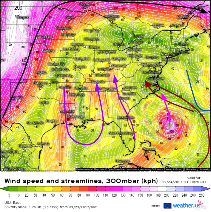
While there’s still considerable disagreement as to how far west Maria makes it, there is good agreement that conditions in eastern NC could get rough, especially if some of the farther west tracks forecast. Let’s take a quick look again at the features in the upper levels that support this westward motion.
The weakness in the ridge left by Jose (blue line) appears to be too weak to guide Maria seamlessly out to sea. A ridge is building to the west of the storm (dark red line) and easterly winds on the west side of that ridge will push Maria closer to the coast. An upper level low over Mississippi will also help with this by strengthening southeast winds (purple arrows). Hurricanes always like to move towards the poles, so Maria’s actual track will be a little bit right of the steering flow (pink line is my forecast for Maria’s track) with a NNW/NW movement towards the Outer Banks rather than a WNW movement towards South Carolina.
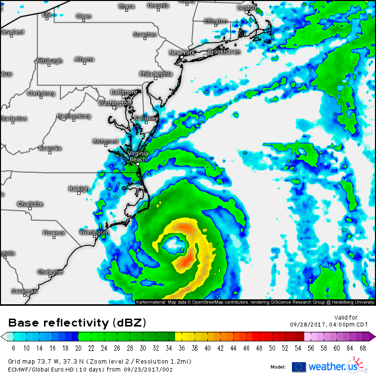
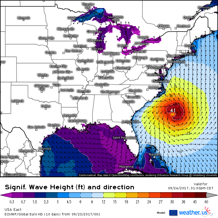
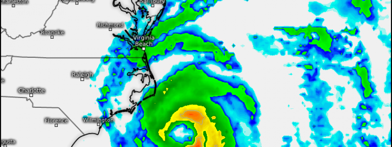
So what are impacts likely to look like across the Outer Banks? That will depend on the exact track. TS force winds (above 40 mph) are fairly likely. I wouldn’t rule out hurricane force winds if one of those tracks farther west ended up panning out, however at the moment, the core of Maria looks to remain offshore. Breezy conditions will extend well inland as Maria’s circulation enhances northwesterly winds behind a cold front.
Steady rains will likely brush the Outer Banks as the core of Maria moves offshore. As with winds, rainfall impacts will depend on how close to the coast the storm makes it. As with the breezy conditions, showers will spread well inland as the outer bands of Maria can stretch hundreds of miles away from the center.
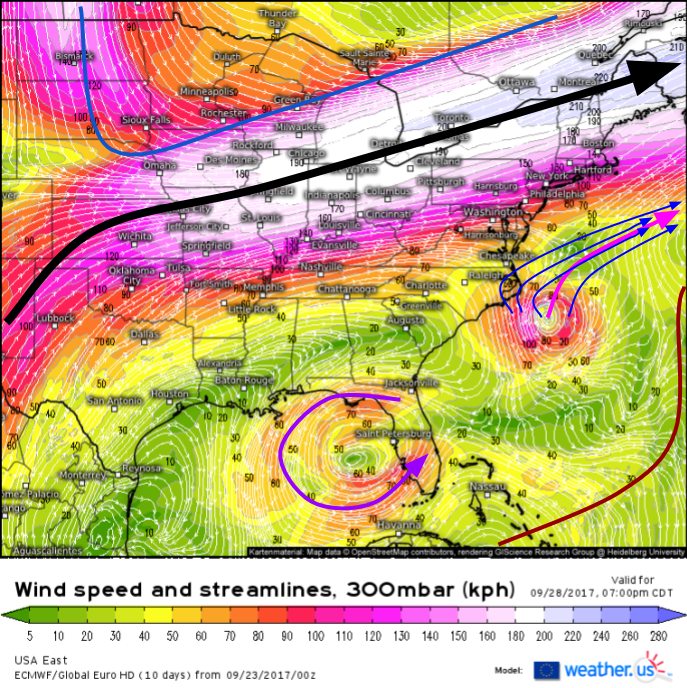
By late this coming week, the blocking high over the northeast will break down and the jet stream that was in Canada will sink into the Northeast (black arrow). The ridge that was steering Maria west will be fading away to the southeast (dark red line), while the ULL that was over Mississippi will weaken and sink south into the SE Gulf of Mexico (purple arrow). This means that Maria will get shot right out to sea (pink arrow). This storm is unlikely to impact New England or the Mid Atlantic north of New Jersey, with the exception of large swells which will impact the entire coast. I drew in the blue arrows to show that despite uncertainties in the storm’s track near the Carolinas, there is extremely high confidence that it will eventually end up out to sea.
Large swells will of course impact the entire East Coast regardless of Maria’s exact track. Beaches already eroded and seawalls already battered by Jose will take another beating from Maria, further compounding existing problems.
Elsewhere across the US today, scattered mountain snow showers will continue in the west but no significant accumulation is expected. Some severe storms are possible in the Plains from Minneapolis down through Nebraska and into the western panhandles of Texas and Oklahoma. Damaging winds and large hail are possible with some of the stronger storms, but no widespread severe weather is expected. Quiet weather will continue in the east as Jose dissipates SE of New England.
More updates in the coming days!
-Jack
