Snow In The West, Tropical Threats In The East, And Severe Weather In Between
Hello everyone!
There’s a lot going on in the weather today across the US as we have an amplified jet stream, caused by Typhoon Talim’s recurve several days ago. Curious how a typhoon in Japan can influence our jet stream? I wrote about Typhoon Talim’s implications for the jet stream last week.
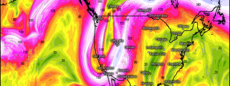
If the words “amplified jet stream” don’t mean a lot to you, this map shows visually what I’m talking about. The pink/white colors indicate strong upper level winds known as the jet stream. The jet stream isn’t a straight line, it moves north and south in waves. The higher the amplitude of these waves (the bigger they are), the more amplified the jet stream is. Because the jet stream is the rough boundary between warm and cold air, an amplified jet brings all sorts of wacky weather with unusually cold conditions under the troughs and unusually warm conditions under the ridges. The boundary between warm and cold air is often a good place to look for severe weather. We’ll check off each one of those boxes; unusually cold, unusually warm, and severe weather today, along with the added bonus of tropical threats to the East Coast.
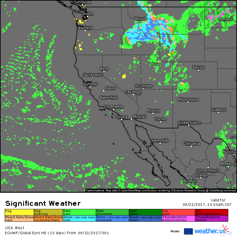
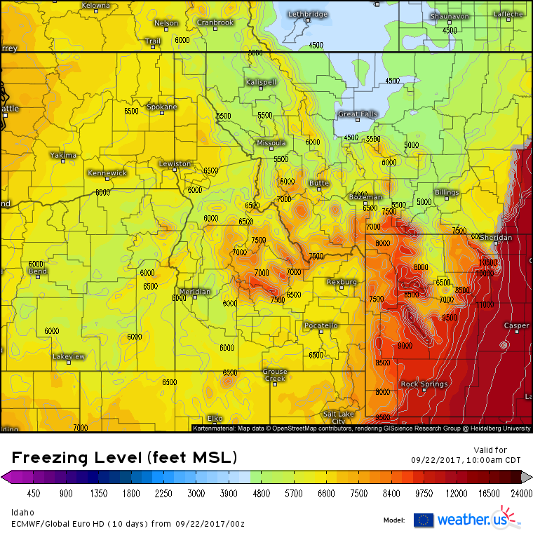
Snow is forecast in the mountains of the west today, and is associated with the cold air under the dip in the jet stream discussed above. Snow will be primarily focused in Montana, Idaho, and Wyoming, but flurries are possible as far south as the Sierra Nevada.
Valley locations will see rain showers as snow levels sit between 5 and 7 thousand feet.
Moving East, the boundary between warm and cold air will indeed be a focal point for severe weather this evening across Minnesota.
Storms will develop this evening and move NE across the state with damaging winds and large hail being the main threats. If you’re interested in a breakdown of the various severe weather ingredients we usually discuss, here are links to shear, instability, and wind forecasts (boundaries where winds converge are often triggers for severe thunderstorms). Storms will weaken and move NE overnight tonight.
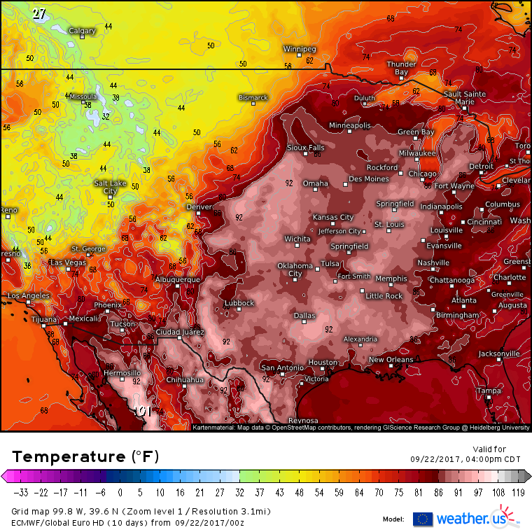
To the south of the severe threat, unusually warm temperatures will dominate the center of the country. Highs in the 90’s are forecast from Dallas to Chicago as strong high pressure sits overhead.
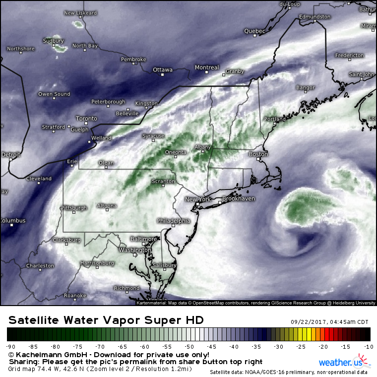
Continuing our journey east, Jose has transitioned into a post-tropical system, but the impacts for New England won’t change. Coastal areas between Portland and Montauk will see the chance for showers continue today, while the entire Northeast continues to enjoy high clouds and beautiful sunrises/sunsets. Breezy winds will continue today, and northeasterly gusts to 40 mph are expected on Cape Cod.
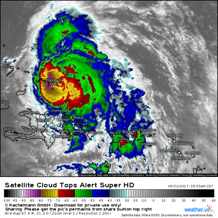
Even farther east, Maria continues to spin down in the tropics. The storm has become slightly less organized overnight with a clearly defined eye no longer visible on satellite imagery. A slow downward trend in intensity is expected as the storm moves towards colder waters and higher wind shear next week.
What do these satellite images show? Learn all about them in this video.
Ensemble tracks for Maria out through day 5 continue to show a wide range of possible solutions. Tracks from Bermuda to North Carolina are all possible. I’ll have a much more detailed update on Maria this evening. Curious about what this map shows? Learn all about ensembles in this video.
For more information on your local forecast, head on over to weather.us.
For more information on the local forecast for Maine and New Hampshire, check out my local blog post from this morning.
-Jack

