Large Hurricane Maria Moving Away From Puerto Rico
Hello everyone!
Generally quiet weather is expected across the US today, as a very large area of high pressure dominates the east while a trough begins to organize in the west. There will be some scattered showers and thunderstorms near the transition between these two systems, mainly in Minnesota. However severe weather is expected to be scattered at best. As a result, this update will again talk mostly about Maria.
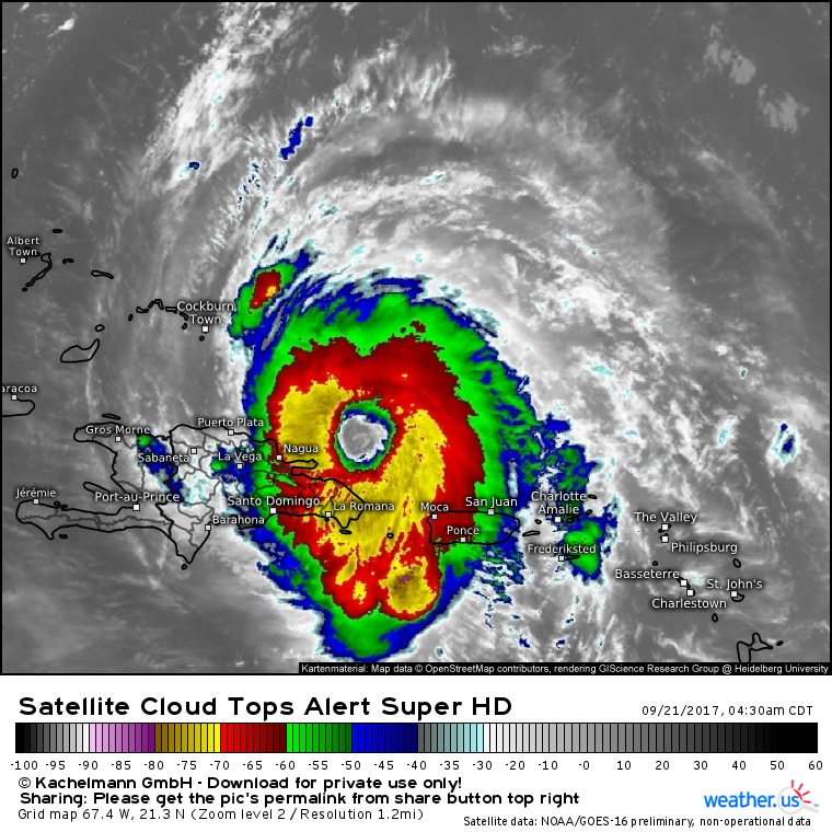
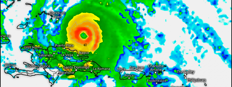
Maria is a healthy hurricane once again this morning. A clear and warm eye is visible at the center of the storm with a ring of very intense thunderstorms surrounding the eye. Excellent outflow continues with cirrus clouds fanning out in all directions away from the cyclone. Maria will move NW today, but any wobbles west would result in the system drifting close enough to the Dominican Republic to potentially disrupt the circulation a bit more. Curious what this map is showing and what warm/cold cloud tops show? Check out my video explaining satellite imagery like this.
Regardless of exact track, heavy rain and gusty winds on the north coast of Hispaniola will cause problems throughout the day today, however impacts there will be nowhere near as bad as what Puerto Rico went through yesterday.
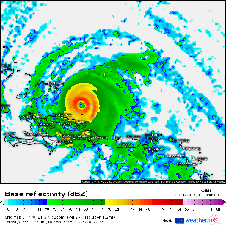
Maria’s next target will be the SE Bahamas along with the Turks and Caicos islands. The eye is forecast to move just NE of these islands, but any wobbles west would result in significantly higher impacts in these islands. Regardless, preparations should be underway to protect life and property before hurricane force winds arrive tomorrow.
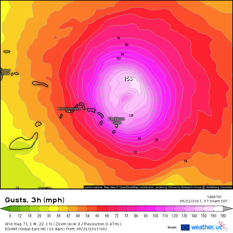
Maria will be strengthening on approach to these islands, and wind gusts over 150 mph are forecast in the eyewall. Currently the ECMWF model forecasts the eyewall to miss the Turks and Caicos to the northeast, but it wouldn’t take much of a westerly wobble to bring some of those ferocious winds into the islands. Even the current forecast calls for hurricane force sustained winds and gusts over 100 mph. Either way, this will be a bad situation for islands that just got a close brush from Irma a couple weeks ago.
What about the longer term forecast?
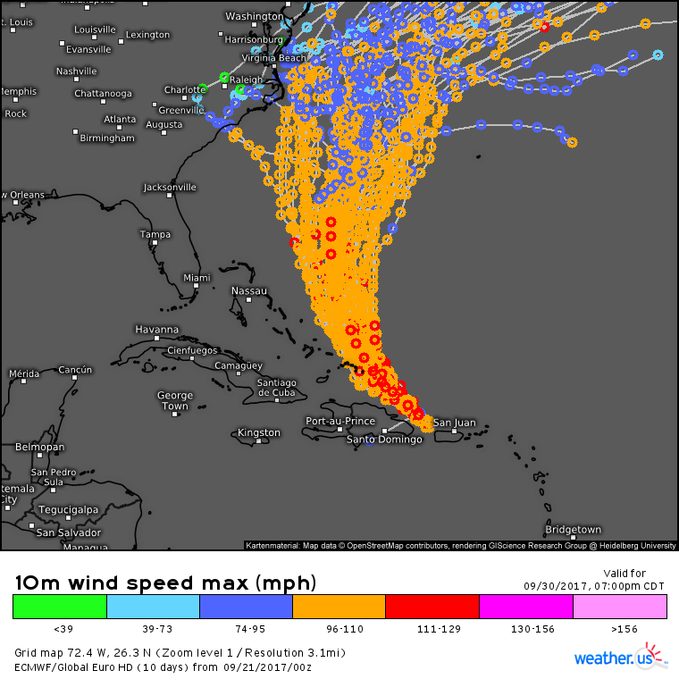
After brushing the Turks and Caicos islands, Maria will turn more to the north. Eventually the storm will pass between North Carolina and Bermuda. However, there is still considerable uncertainty as to how close to the coast this pass will be. A storm 10 miles off the NC coast would bring major impacts, while a storm 210 miles offshore wouldn’t be much of an issue, outside of the typical large swell concerns. Curious about this map and what it shows? This video explains ensembles and the hurricane tracks map.
I went over some of the science behind Maria’s long term track/intensity forecast in last night’s update if you’re interested in which features will play a role in Maria’s future.
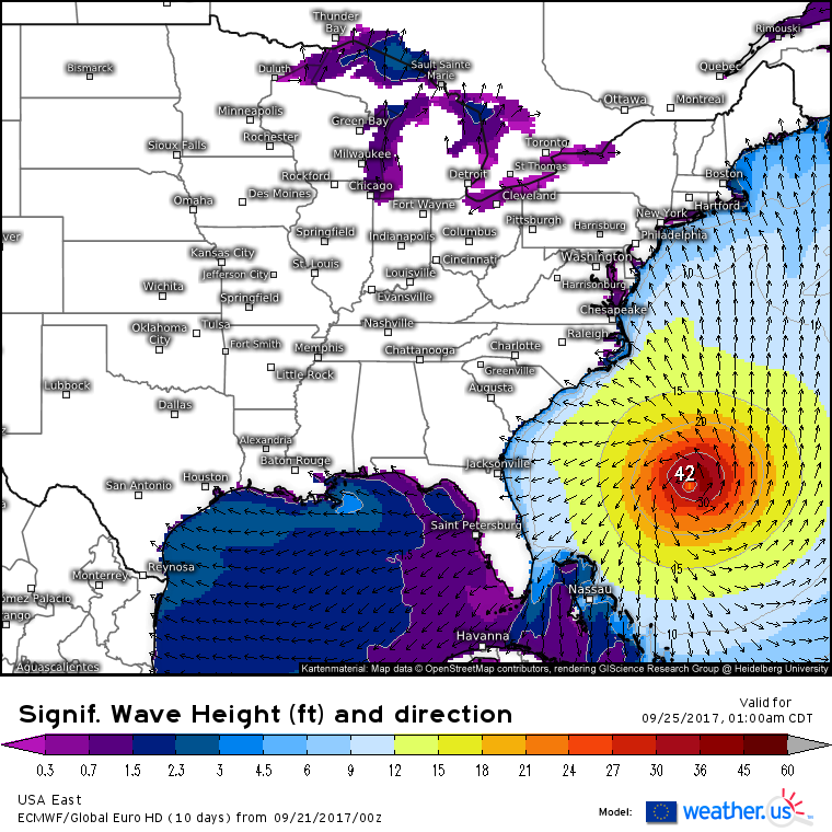
Even if Maria tracks well offshore, large swells will continue to be an issue for beaches that have spent the last 2 weeks dealing with Jose’s waves.
More updates in the coming days as Maria’s forecast becomes much clearer!
For more information on your local forecast, head on over to weather.us.
For more information on the local forecast for Maine and New Hampshire, check out my local blog post from this morning.
-Jack
