Maria Moving Away From Puerto Rico, Long Term Future Remains Uncertain
Hello everyone!
After a devastating landfall in Puerto Rico this morning, Maria is continuing to move NW away from the island. Conditions will slowly improve on Puerto Rico as we head through the day tomorrow, but unfortunately the island faces a long road to recovery.
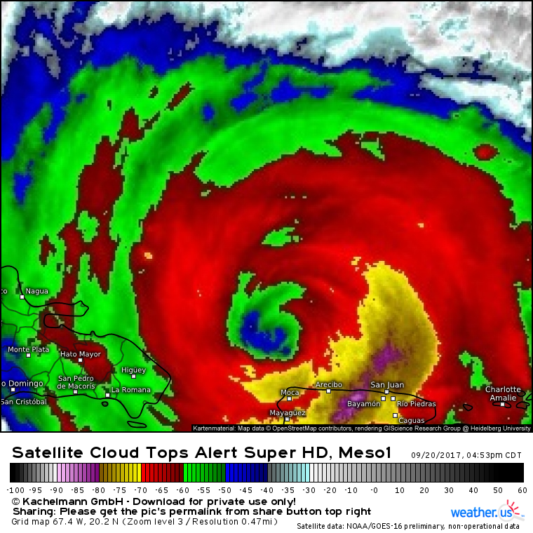
Maria is rebounding this evening following fairly significant weakening over Puerto Rico. The eye has been warming this evening, and the eyewall has been cooling. Both of these trends indicate that the storm is strengthening. If you’re unsure about what this image is showing, or how to use satellite data over at weather.us, this video should help.
While rain and wind will cause problems in the Dominican Republic over the next few days, Maria’s core will remain out over open water for the next several days, and possibly forever. This update will focus on the longer term future of Maria as it is likely to make a close brush of the East Coast next week.
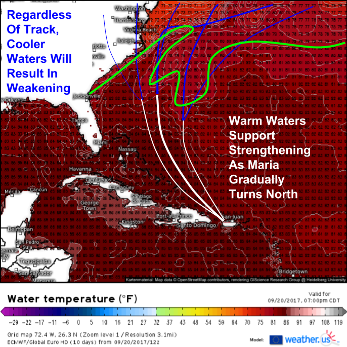
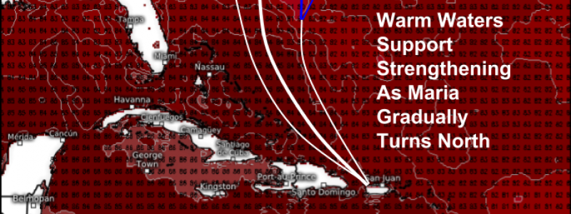
Water temperatures support Maria strengthening and then holding its strength through the next 4-5 days. The green line on the map above, from the ECMWF model, depicts the rough boundary between water temperatures supportive of a hurricane (warmer than 80F) and those that are not (cooler than 80F). The white lines indicate potential tracks over the warmer waters, while I’ve highlighted some possible tracks over the cooler waters in blue. Look complicated? Let’s dig into some of the upper level features that will be pulling on Maria as the storm moves into the Atlantic between Bermuda and the East Coast.
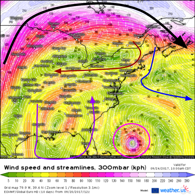
The main jet stream is well north of Maria, all the way up in Canada (black arrow). This means that smaller, more subtle features will play a bigger role in the storm’s steering. If that jet was blasting through the Ohio Valley, this would be a straightforward out to sea (OTS) forecast. On Sunday, a large upper level ridge will be located over the Great Lakes. Easterly winds on the south side of this system will try to push Maria west towards the coast. An upper level low in Mississippi will also be trying to pull the storm towards the coast, similarly to what happened with Irma. Pulling east will be Maria itself, which wants to move north into an opening left by Jose. This opening is the only reason that an out to sea track is viable. Without Jose, the Great Lakes ridge would just link up with the Western Atlantic Ridge, and Maria would be forced into the coast.
So what are some variables that could change Maria’s track forecast? If Jose is stronger, the weakness in the ridge will be stronger, and an OTS solution becomes more likely. If the MS ULL (upper level low) is stronger, a track closer to the coast becomes more likely. If the Great Lakes ridge can become centered closer to Montreal than Milwaukee, that would also open the door for a track closer to the coast. See those southerly winds in the Plains? Those are out in advance of a strong upper level trough over the Rockies. If Maria slows down, or that trough speeds up, the jet stream will shift south, and Maria will head out to sea.
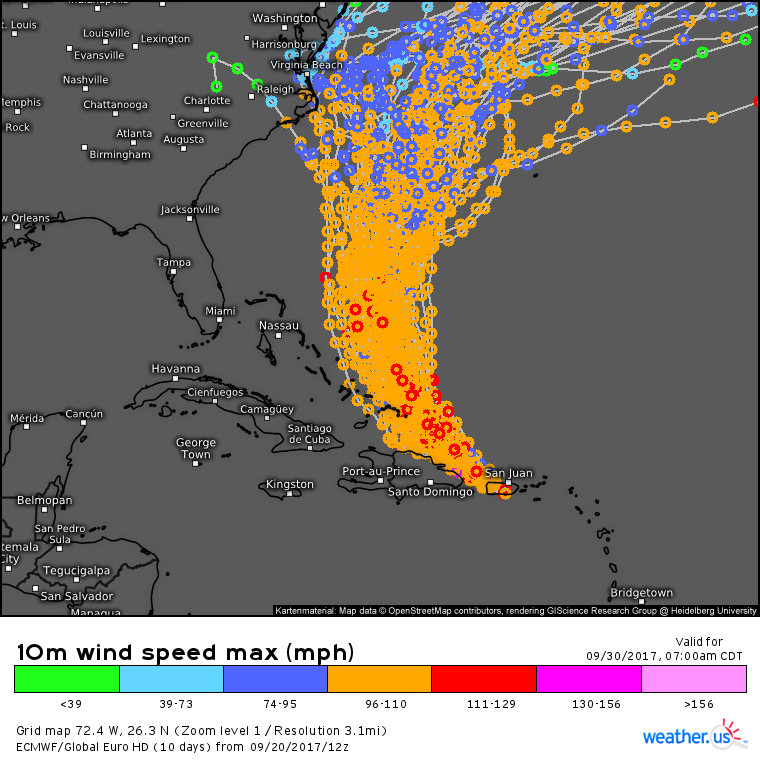
So which solution is more likely at this point? Neither. It’s simply too early to pin down the exact placement/intensity of all those features we just talked about. The details will become much clearer in the coming days as Maria continues to move NW. The EPS ensemble tracks for Maria show this fairly well, but perhaps not well enough. I think there’s some room for some of those tracks to shift west. Curious what ensembles are and how this map works? This video should help.
More updates on Maria tomorrow!
-Jack
