Maria Rapidly Intensifies Into A Strong And Dangerous Category 4 Hurricane
Hello everyone!
While Jose continues to weaken over the NW Atlantic, Maria has put on a stunning show of intensification in the Caribbean. The system now has winds of 130 mph with additional strengthening into a Category 5 system forecast before what is likely to be a devastating landfall in Puerto Rico. I’ve covered Jose’s forecast and impacts at length in the past few days, so this post will focus exclusively on Maria.
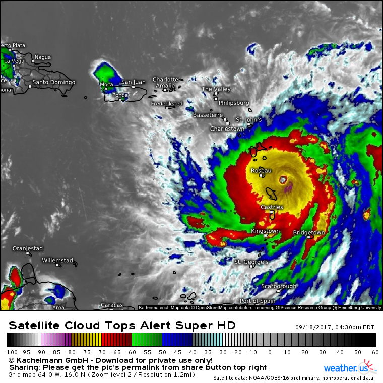
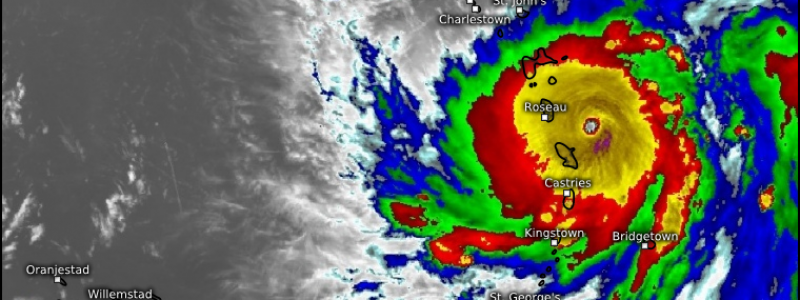
Maria looks excellent on satellite. A small, clear eye has formed at the center of an expansive region of very cold cloud tops signaling intense thunderstorm activity. Outflow in all directions is seamless, and spiral bands are forming out away from the center of the system. Like Jose when it was near the Leeward Islands, Irma when it was plowing through the Caribbean, and Harvey when making landfall in Texas, Maria looks straight out of the textbooks this evening. It’s hard to find a single flaw in the system as a whole.
Curious what this satellite image is showing and how to get other images like it at weather.us? Check out this video for more.
The environment around Maria is favorable for additional strengthening into a Category 5 system.
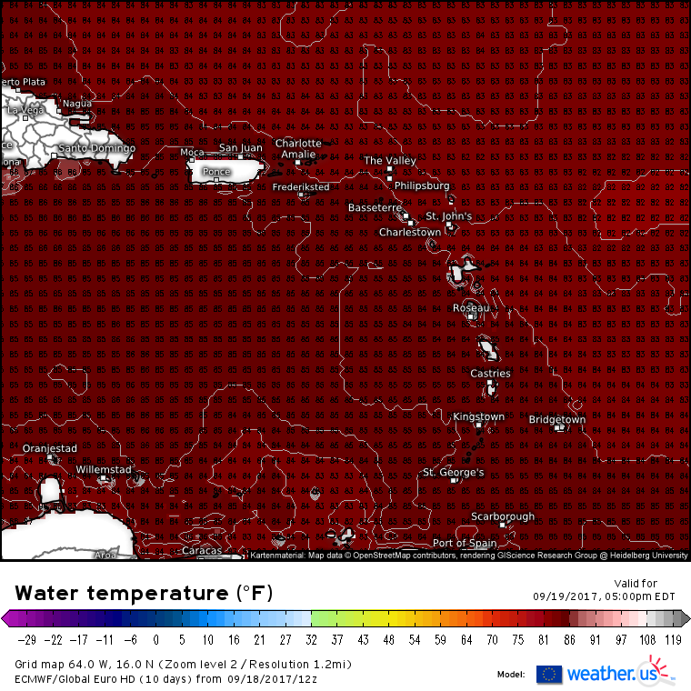
Warm waters, shown above, as well as light upper level winds and reasonably moist air in the mid levels all point to continued intensification as Maria moves WNW.
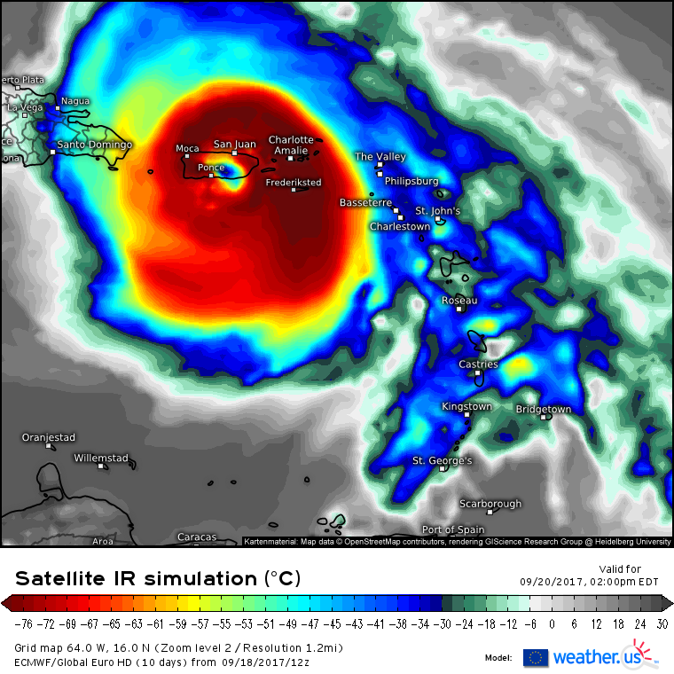
After plowing through the Windward Islands tonight, Maria will set its sights on Puerto Rico where devastating impacts are expected by Wednesday.
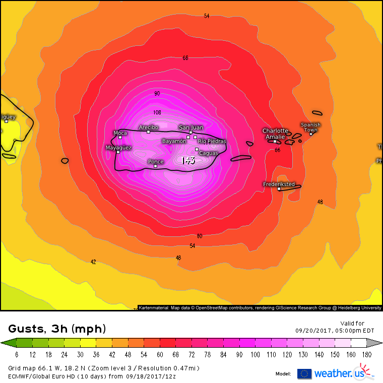
The entire island is likely to see winds gust over 100 mph as the center of the storm moves onshore somewhere on the south shore. Intense hurricanes such as Harvey, Irma, and Maria can spin too fast for their own good, leading to a reshuffling of the inner core where the most intense winds are found. These so-called “Eyewall Replacement Cycles” can temporarily weaken a hurricane’s maximum winds, but they also expand the radius of the strong winds near the hurricane’s core. Given that Maria has already developed a very small eye, and is still a couple of days away from landfall in Puerto Rico, one of these ERC’s is likely to happen between now and then. This means that while the very worst of the winds will still be confined to a small stretch of coastline where the eye makes landfall, the entire island is likely to see extreme wind gusts above hurricane force. Prepare now to protect lives and property!
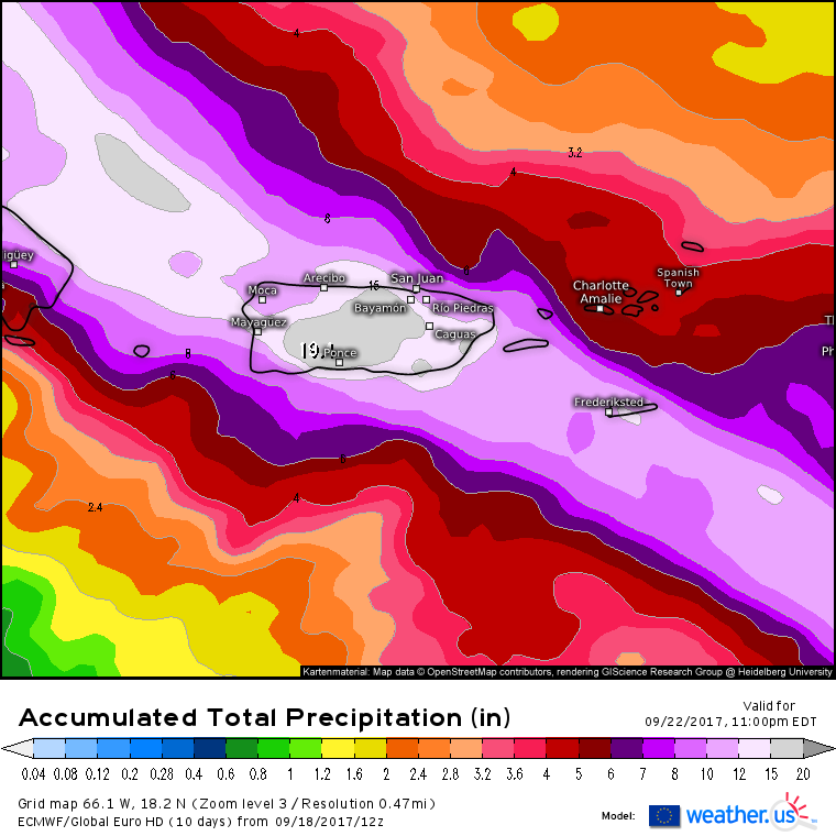
In addition to the extreme wind, flooding from heavy rainfall will be a big concern for Puerto Rico. There’s high confidence that near or over a foot of rain will fall across the island which will cause mudslide and flash flooding issues.
Maria will quickly move away from Puerto Rico on Thursday as it continues WNW.
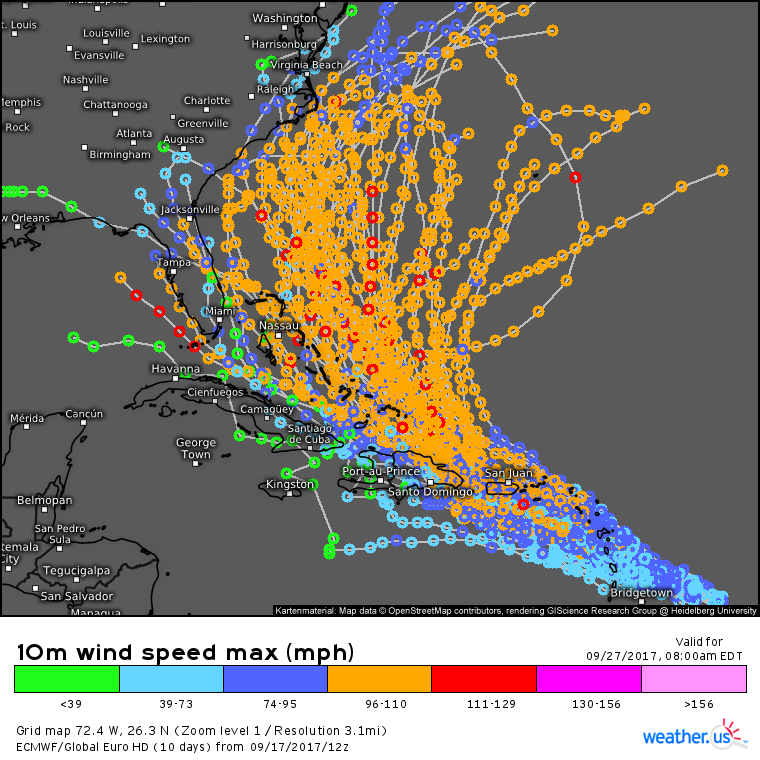
This ECMWF EPS forecast from yesterday shows the wide spread in potential outcomes as Maria approaches the Bahamas and potentially eventually the US. Why use yesterday’s data? The overnight run gave a false sense of confidence that the storm would head out to sea (it could, but it’s too soon to let our guard down) and this afternoon’s data appears to be lost in the void somewhere. Our IT people are working on getting it online!
It’s too early to tell what direct impacts, if any, the US coast will feel from the system, though as always high surf and rip currents will be threats even if the system remains offshore. Much more information to come in the days ahead!
-Jack
