Jose To Bring Nor’easter Impacts To New England, TS Maria Forms In The Deeper Tropics
Hello everyone!
Our onslaught of tropical threats has not slowed down since Harvey and Irma dissipated. Hurricane Jose will bring impacts to the East Coast this coming week before moving east. Meanwhile, TD-15 has formed east of the Lesser Antilles and will be strengthening as it moves WNW in the coming days.
Click on any link for more information about a particular topic. For each link, you can click the map to zoom in, you can click near the edge of the map to pan, and you can use the (-) button to zoom out. You can also explore other parameters/satellite views and time steps via the menus to the left of each image.
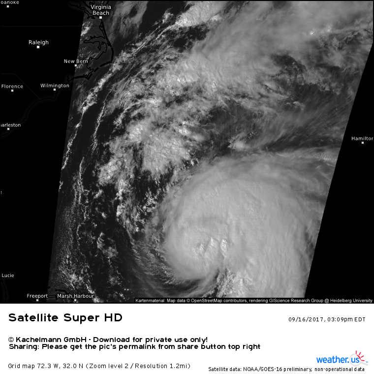
Jose’s satellite appearance has generally improved during the day today, however the system is still lopsided and struggling with dry air and wind shear. The fact that the majority of the heavy rain and high winds are to the east of the center bodes well for the East Coast as the storm will likely continue to track offshore, keeping that band over the open ocean. Nevertheless, some impacts are still expected along the East Coast, especially from Cape Hatteras on north to Cape Cod.
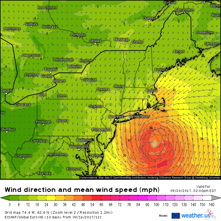
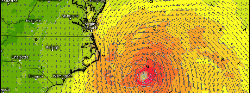
Monday night will mark Jose’s closest approach to Cape Hatteras as the storm moves north. Tropical storm force winds are possible on the Outer Banks along with the potential for some shower activity. Due to the lopsided nature of the storm and dry air on the western side, rainfall is expected to be limited. Winds will depend on the storm’s exact track, but as the system begins to transition towards a subtropical structure, the wind field will dampen and broaden. You can see this in the wind forecast above from the ECMWF which shows a broad area of 30-40 mph winds with only a small inner core of 50+ mph winds. This means that even if the storm’s track shifted 50 miles west, the Outer Banks would still see the same wind speeds. Winds will relax and showers will move away from the Outer Banks on Tuesday as Jose continues north.
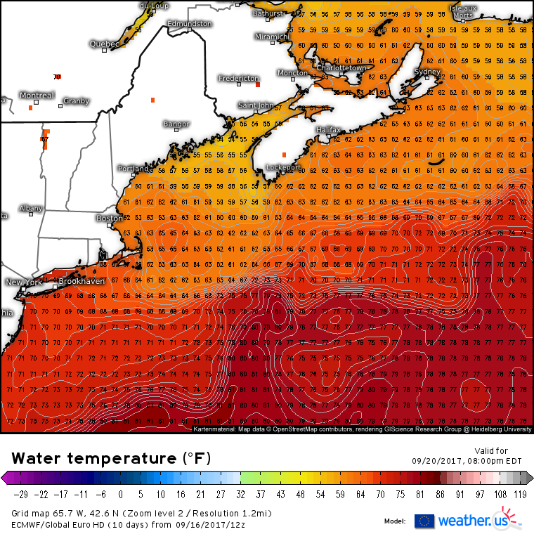
As Jose moves north away from the Carolinas, it will encounter much cooler waters.
Hurricanes generally need water temps above 78 degrees to sustain themselves. Waters off the New England coast range between 60 and 70 degrees. Due to this, as well as due to the influences of dry air and wind shear, will result in Jose weakening as it moves closer to Cape Cod on Wednesday.
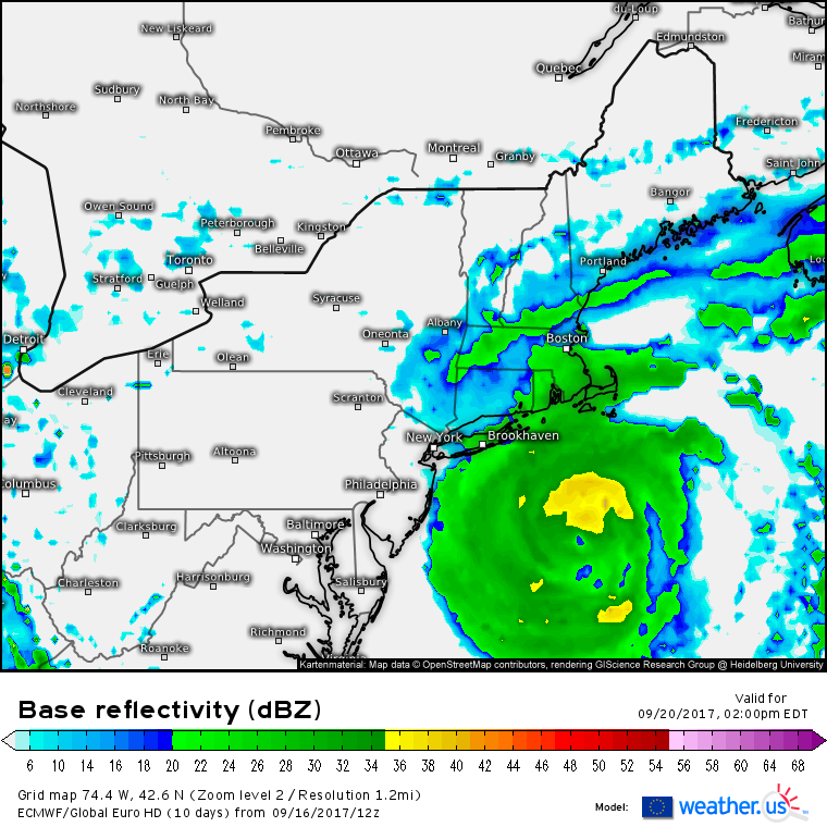
Despite this weakening, Cape Cod will still feel impacts comparable to a potent nor’easter. Moderate rains will fall across the Cape with lighter showers farther northwest towards Central New England and coastal Maine.
Winds will be sustained in the 30-40 mph range across the Cape and islands with gusts to 50 mph possible. Lighter, but still breezy, winds will be noted across the interior northeast and Long Island. Winds and rain won’t be the biggest threat from Jose, however. That title will go to the high surf and dangerous rip currents/beach erosion that come from days of pounding waves.
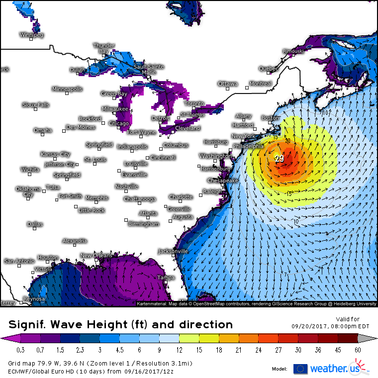
Wave heights will rise in the next few days as Jose moves northeast. While the angriest seas will be found near the center of the system, long period swells will result in large breaking waves as far south as the Atlantic coast of Florida.
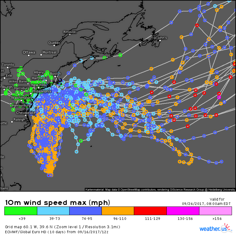
Jose’s long term future is quite uncertain as the system moves east. There are some indications that the storm could loop back south again as upper level high pressure develops over eastern Canada. However it’s also possible that the system shoots ENE out into the open North Atlantic. What Jose’s final track ends up being will have a large impact on our next tropical system, Maria.
Confused about what this image shows? Check out my video explaining ensembles, these ensemble track maps, and how to use them at weather.us.
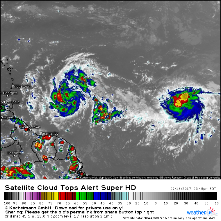
Satellite imagery shows nearly twin systems, TS Maria (left) and TS Lee (right) in the deep tropics this evening. TS Lee is likely to weaken as it drifts west, and is unlikely to threaten land at any point in its life. Unfortunately, the same cannot be said for Maria which is forecast to intensify quickly as it bears down on the Lesser Antilles, the same islands ravaged by Irma just a week and a half ago.
Confused about what this satellite images means? Check out my video explaining satellite imagery and how to use it at weather.us.
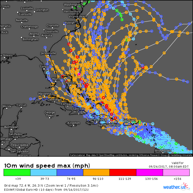
ECMWF ensembles show the wide spread in possible solutions for Maria. While there’s high confidence that the system will strengthen while approaching the Leeward Antilles and eventually Puerto Rico, there’s much lower confidence with regards to potential tracks from there. Anyone in the Greater Antilles, the Bahamas, the US East Coast, and Bermuda should watch this storm very carefully as it continues to develop and move west. As the details of the system’s track become more apparent in the coming days, I’ll have many more updates. In the meantime, watch the system develop with GOES-16 satellite imagery and keep an eye on the latest ensemble data which will provide a much clearer picture of the uncertainty associated with this system than any one individual model run.
Tomorrow morning’s update will have the latest information on Jose with the next update on Maria coming tomorrow evening.
