Jose Likely To Make A Close Pass To The US Next Week
Hello everyone!
There’s plenty to discuss today as we have severe storms in the plains along with Jose spinning offshore. Lingering snow flurries will taper off today across Montana as that system departs to the east. I’ll start with Jose, as that system is the biggest weather story, before briefly going over the severe threat in the Plains.
Click on any link for more information about a particular topic. For each link, you can click the map to zoom in, you can click near the edge of the map to pan, and you can use the (-) button to zoom out. You can also explore other parameters/satellite views and time steps via the menus to the left of each image.
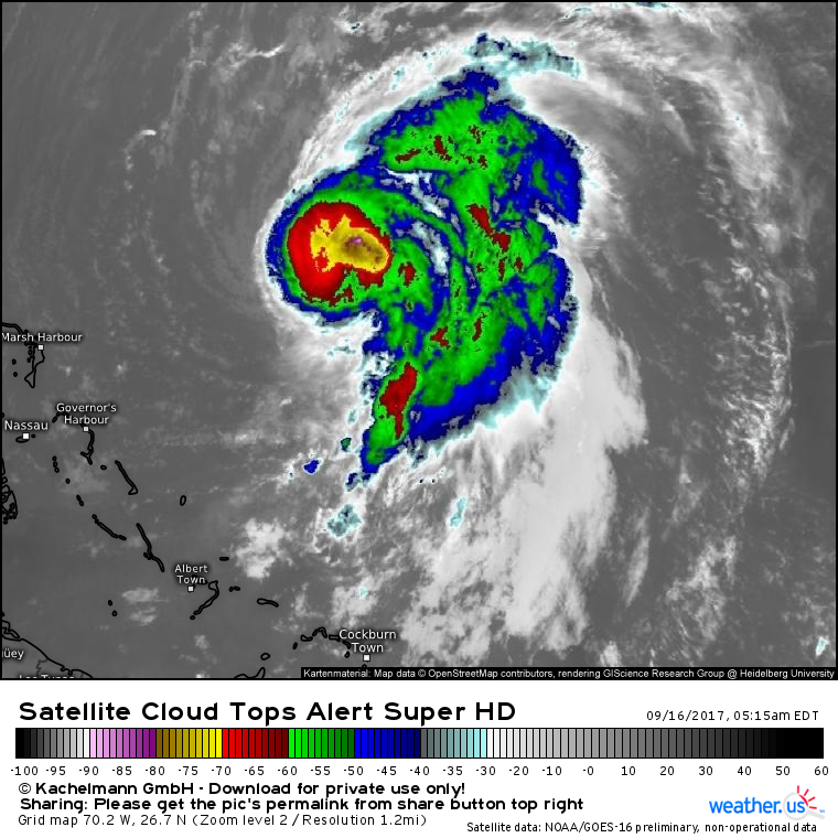
Jose is a low-end hurricane as of the 5 AM EDT hurricane center advisory. Satellite imagery shows that the system is struggling with a little bit of dry air and wind shear, as well as some of the cooler waters it stirred up while moving over this area a few days ago. While outflow to the south, east, and north is textbook, notice the lack of cirrus clouds fanning out to the west of the system. This indicates that a little bit of wind shear is trying to knock Jose’s thunderstorms east of the center. We’ll see if the system can overcome this shear as it turns northward today.
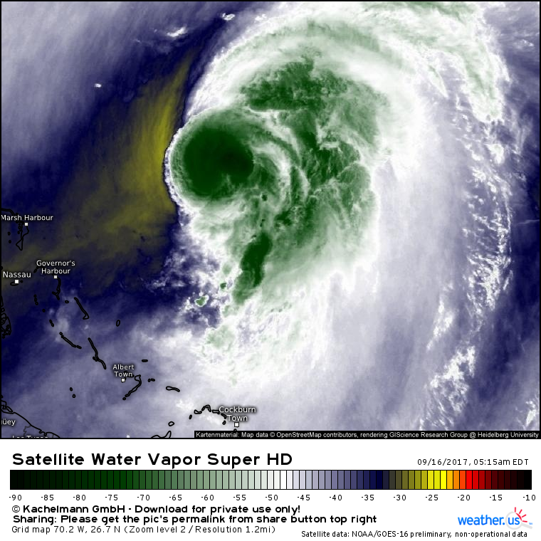
Water vapor imagery shows dry air just to the west of the system’s core. This is also helping to keep Jose fairly weak and disorganized, at least as hurricanes go. So where is Jose headed and how strong is it forecast to get?
Confused about what these satellite images mean? Check out my video explaining satellite imagery and how to use it at weather.us.
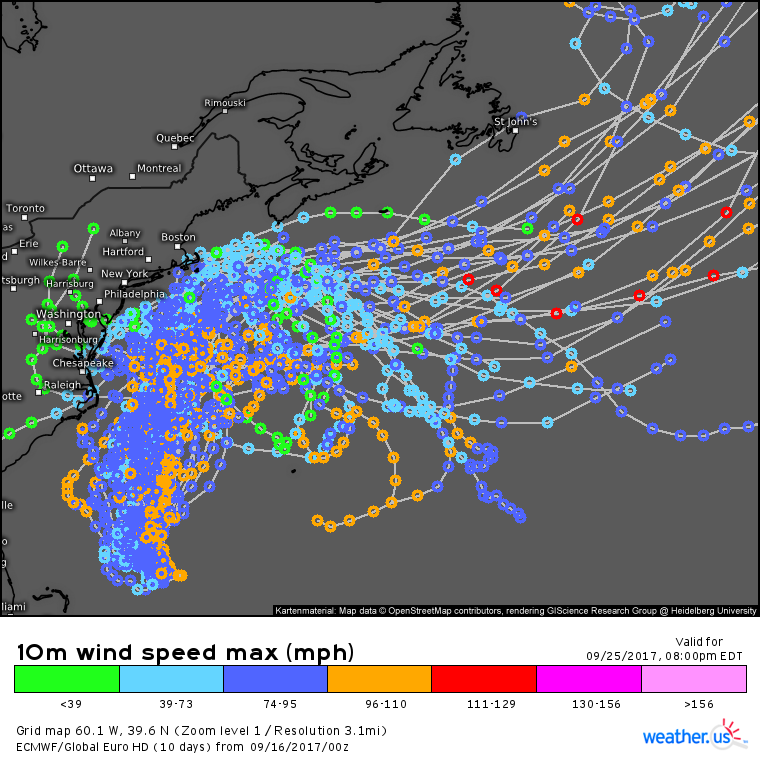
EPS ensemble data show considerable uncertainty with regards to Jose’s track. Some members forecast a landfall somewhere in the New England/Mid Atlantic area as a tropical storm, some recurve the system out to sea past Newfoundland, and some loop the system back down into the tropics after turning away from the US. Basically, we’re not quite sure where Jose is going to go, but we do have some clues about potential impacts for the East Coast.
Confused about what this image shows? Check out my video explaining ensembles, these ensemble track maps, and how to use them at weather.us.
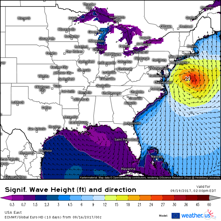
The one impact that’s locked and loaded, regardless of any shifts in track, is the high surf and rip current risk. Wave heights in excess of 10 feet are expected throughout the Mid Atlantic and northeast with powerful long-period swells all the way down to Florida. How about rain and wind impacts? Those are much more dependent on the track/intensity of the system. So let’s look at that.
Jose will be weakening on approach to the Northeast. All parameters that we look at to forecast tropical cyclone intensity, water temperature, shear, and dry air, will be favorable for weakening.
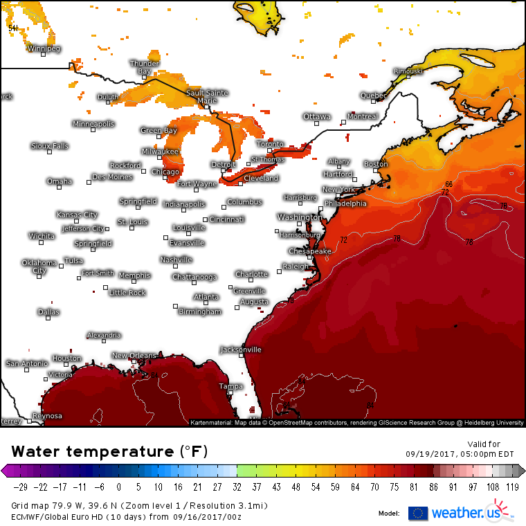
Water temperatures are considerably cooler than normal just to the north of the Gulf Stream. the Gulf Stream is that thin ribbon of very warm water extending from Florida up to the Outer Banks and out into the open ocean. Typically, that ribbon is farther north towards Cape Cod. Tropical cyclones need water temperatures over 78F to hold their strength. Notice that the 78F isotherm is several hundred miles south of Cape Cod. That means as Jose approaches New England, there will be a period of at least a day, maybe two, where the storm will be over waters too cold to support it.
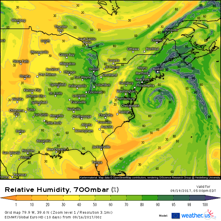
Dry air will also be streaming into Jose’s circulation early next week. Dry air from the Appalachians and from Florida will join forces to help accelerate weakening of the system. That dry air will also put a damper on potential rainfall across coastal parts of the northeast.
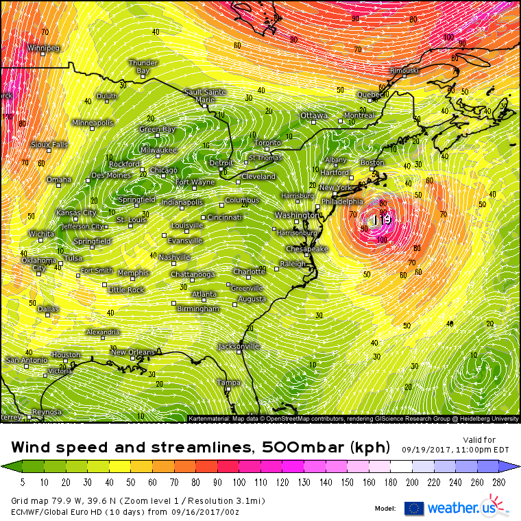
Upper level wind forecasts show westerly wind shear impinging on the system as we head into the beginning of the week. However that’s not the most important feature to note on this map. What’s really important for Jose is that the jet stream is well north of New England, up in Northern Quebec. This means that there won’t be any infusion of jet stream energy into the system as it moves north. In storms like Sandy for example, the weakening effects of shear, dry air, and cool waters were offset by a powerful shot of jet stream energy. This will not happen with Jose, adding further confidence to the forecast for a weakening system.
The structure of the jet stream is also important for the rainfall forecast. Sometimes if the jet stream is in close proximity to a system, it can help funnel moisture northwest, resulting in an expanding rain shield. This won’t happen with Jose given that the jet stream is several hundred miles away from the system.
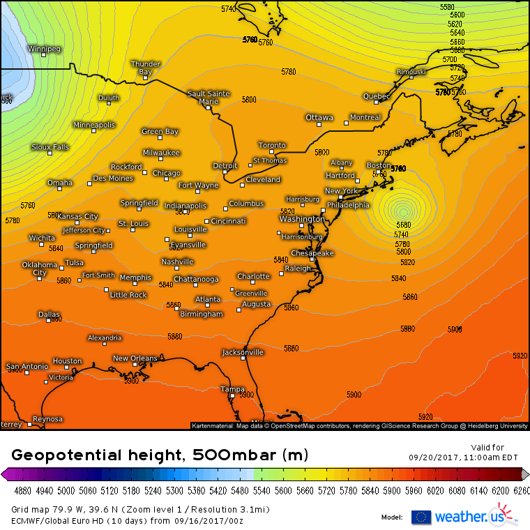
By Wednesday, a large ridge building to the west of Jose combined with a trough over Northern Quebec will turn the system east, away from the US. When this turn east happens will determine the extent of rain and wind across parts of New England. Regardless, there’s an increasing chance for tropical storm impacts in places like Nantucket as the system is forecast to make a pretty close pass to that island.
I’ll have more updates in the coming days as the forecast for Jose becomes a bit clearer.
Now to discuss the severe weather threat across parts of the Plains.
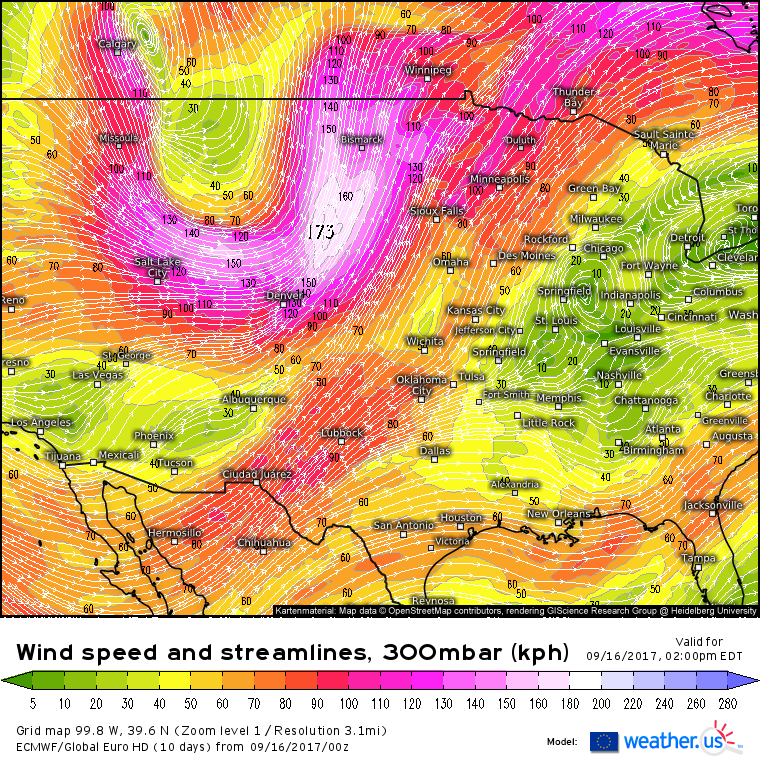
A strong upper level trough is noted across eastern MT in ECMWF forecasts for this afternoon. This is the same trough that brought snowfall to the MT mountains yesterday. Out ahead of this trough, a strong jet streak is forecast between Denver and Bismarck. The right entrance region of this jet streak is an area favorable for rising air and thunderstorm development. Therefore the natural area to look for severe storm potential will be roughly inside a line drawn between Wichita, Sioux Falls, Minneapolis, Des Moines, and back to Wichita. To further hone in that potential, we have to look at the classic three parameters: shear, instability, and a trigger.
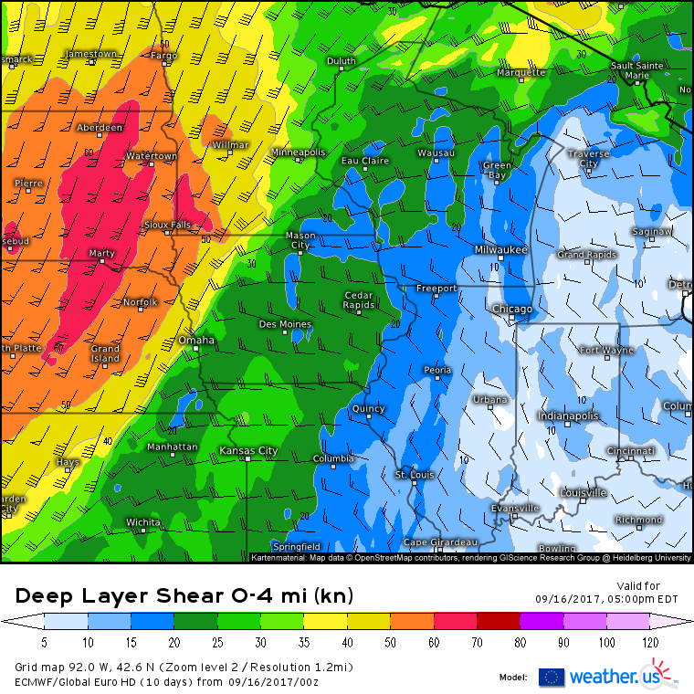
Shear will be strongest in the western part of our area of interest, but even the 25-30 kts of shear from Wichita over towards Kansas City and up to Des Moines will be enough to support some severe thunderstorm activity.
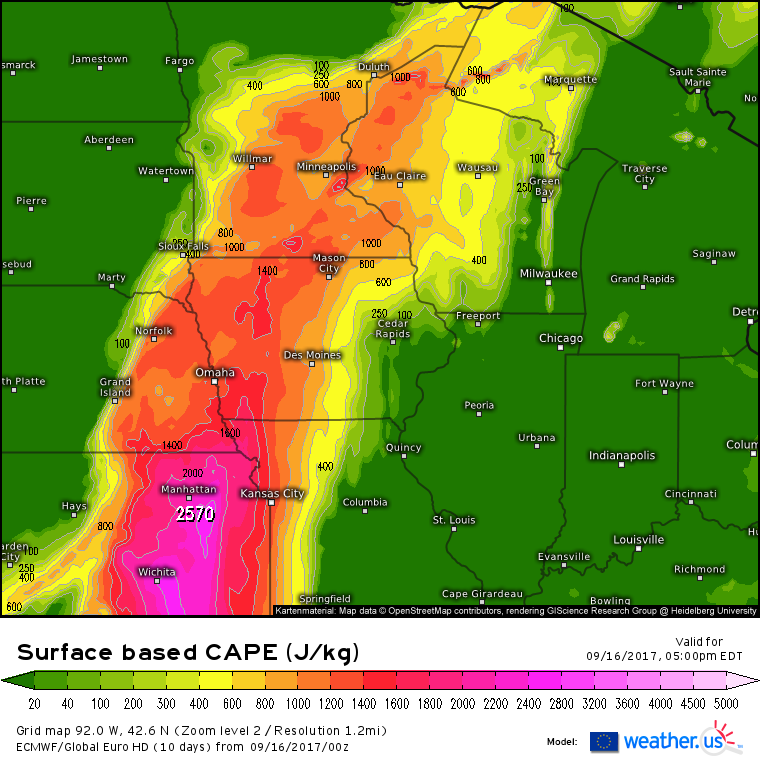
There will be plenty of instability in this area as moisture streams north out of the Gulf of Mexico. CAPE values over 1,000 are generally supportive of severe weather, though of course no one index can completely predict severe weather activity.
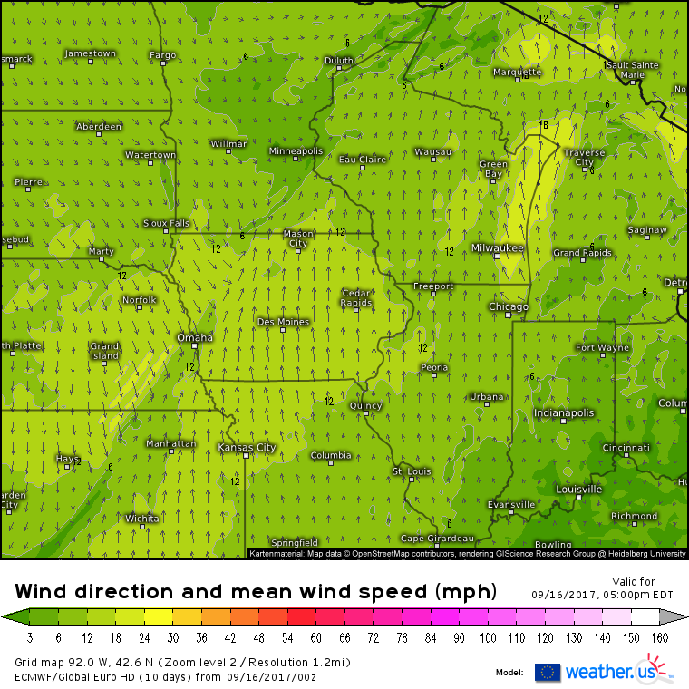
The trigger mechanism for today’s severe storms will be a cold front moving slowly east across KS, NE, IA, and MN. We’ve checked off each item on our list for severe weather ingredients meaning that thunderstorms are likely to develop this afternoon/evening and have a good shot at becoming severe.
High resolution models offer further support for this idea, showing plenty of thunderstorm activity this evening in the area we’ve been talking about. The primary threat from these storms will be damaging winds, with large hail possible in the strongest cells. Tornadoes aren’t expected to be a big issue, but it’s never wise to completely rule them out.
Elsewhere across the country, generally quiet weather is expected.
For more information on your local forecast, head on over to weather.us.
For more information on the local forecast for Maine and New Hampshire, check out my local blog post from this morning.
