Jack Sillin is a weather nerd and forecaster who regularly writes for weather.us and 33andrain.com.

Jose Likely To Remain Out To Sea
Hello everyone!
This update on Jose will be fairly short because, thankfully, the storm appears likely to recurve far enough east to not cause any major problems to the US. I’ll quickly go through a few reasons for that forecast, but given that there doesn’t need to be any discussion of impacts, this will be a much quicker discussion than those from Irma.
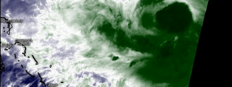
Water Vapor Satellite imagery of Jose (What is Water Vapor Satellite Imagery?)shows the storm struggling with dry air intrusions from the north and west. This shows up as the lighter colors (not the deep green indicating moisture) in the image above. This dry air along with strong wind shear from the north is resulting in Jose continuing to weaken. This weakening trend is important for the track forecast.
The arrows above show the steering flow for Jose at different layers of the atmosphere. The leftmost panel is the highest of the four with the rightmost panel showing winds closer to the ground. The arrows represent the flow near/over Jose subtracting out the winds associated with the storm itself. This gives us important information as to where the storm might track. Notice how the winds in the lower levels (red arrows) are out of the southeast and favor pushing the storm to the north west. A weaker system will respond more to the low level flow. As Jose weakens, the upper level winds pushing the storm to the south and southwest will lose their grip on the system, with that more northerly motion taking over.
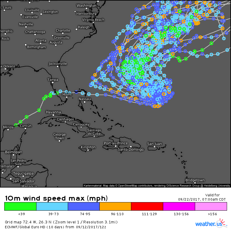
Due to the weaker than forecast system, an adjustment of the track forecast towards the north and east is expected. We see that clearly in the ECMWF ensembles (what are ensembles?).
Remember the graphic I showed a couple days ago that had the potential tracks from Irma scattered all up and down the east coast? Now only one out of 51 EPS members forecasts direct impacts from Jose to the mainland US. While there’s still time for the forecast to change, and it would be unwise to completely rule out a trend towards the west, model data, pattern analysis, and observations all point out to sea, which is great news for areas (and meteorologists) already tired of tropical impacts.
I’ll have another update tomorrow morning talking about tomorrow’s forecast across the US.


Great work on the hurricane front, Jack! Glad to hear that Jose is looking less likely to blow down our cabin of twigs in the Catskills. Cheers, your loyal blog follower, Peter N.
Peter Nulty 09/13/2017
Your comment is awaiting moderation.
Great work on the hurricane front, Jack! Glad to hear that Jose is looking less likely to blow down our cabin of twigs in the Catskills. Cheers, your loyal blog follower, Peter N.