Irma Continues North Through Georgia, Will Dissipate Tomorrow
Hello everyone!
It’s with great happiness that I can say this will be the last update ever solely devoted to Irma. The storm is continuing to cause some fairly major problems in the Southeast, but the storm’s energy is quickly draining and by tomorrow morning it will be no more. Starting with tomorrow morning’s update, I’ll shift out of “storm mode” to cover any and all notable weather stories across the country, not just exclusively Irma.
Click on any link for more information about a particular topic. For each link, you can click the map to zoom in, you can click near the edge of the map to pan, and you can use the (-) button to zoom out. You can also explore other parameters/satellite views and time steps via the menus to the left of each image.
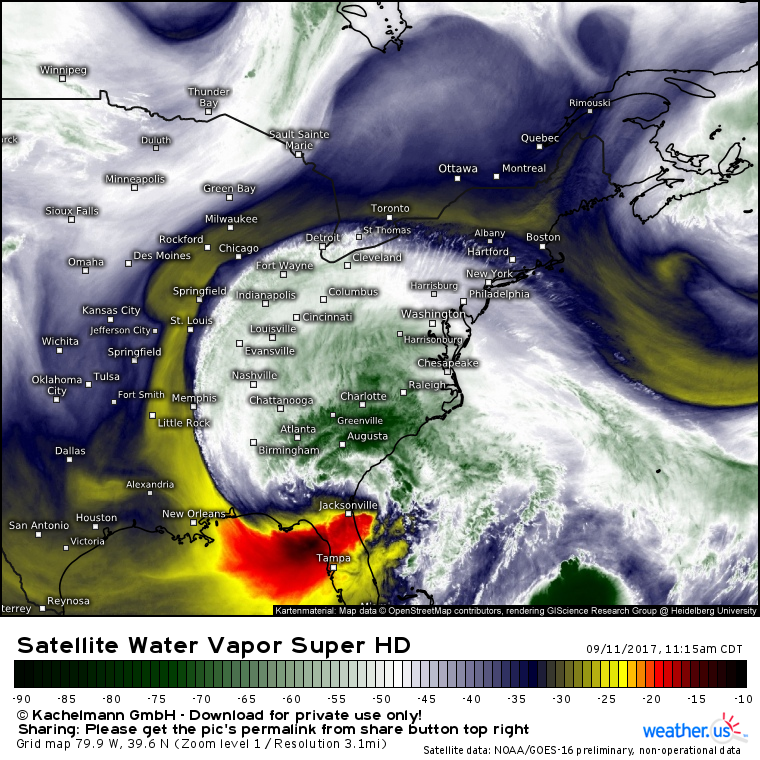
Irma continues to weaken on satellite imagery as the center gradually unwinds over Southern Georgia. Dry air has surrounded the southern flank of the system with sunny skies noted across much of the Florida peninsula now. Farther to the north, heavy rains, severe weather, and storm surge flooding continue to cause problems, but Irma doesn’t even have 24 hours left as a coherent system before degenerating into a harmless remnant low and then evaporating altogether.
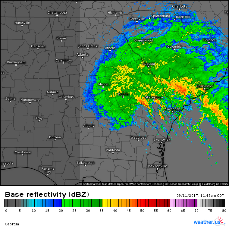
Radar shows heavy rain bands continuing to move onshore over coastal parts of SC and GA with embedded severe thunderstorms.
These bands will weaken as they move slowly northeast this afternoon. You can see the dry air wrapping into far SE GA as little to no rain is noted SW of Savannah.
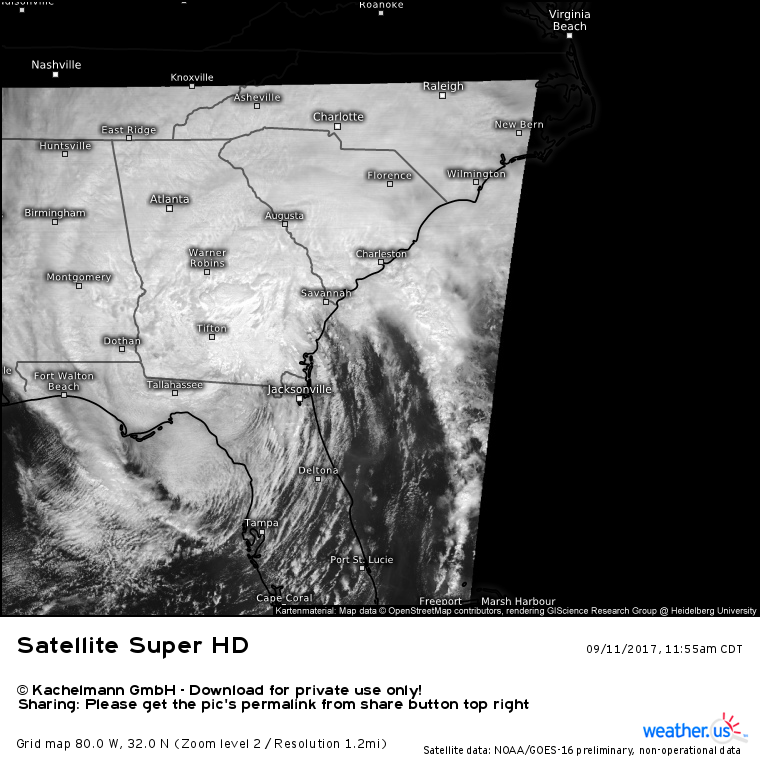
Super-high resolution GOES16 satellite imagery shows Irma’s center unraveling as it moves over Georgia and dry air surges into the system from the south.
Mostly sunny skies are noted across the Florida Peninsula with the remaining heavy thunderstorm activity sweeping north across Georgia. Those sunny skies will sweep into coastal GA/SC this afternoon as bands of severe thunderstorms weaken.
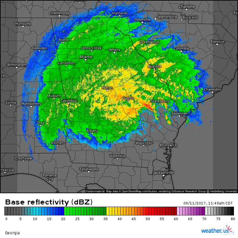
Away from the coastline, radar imagery reveals a much steadier and more uniform rainfall ongoing across Central and Northern Georgia.
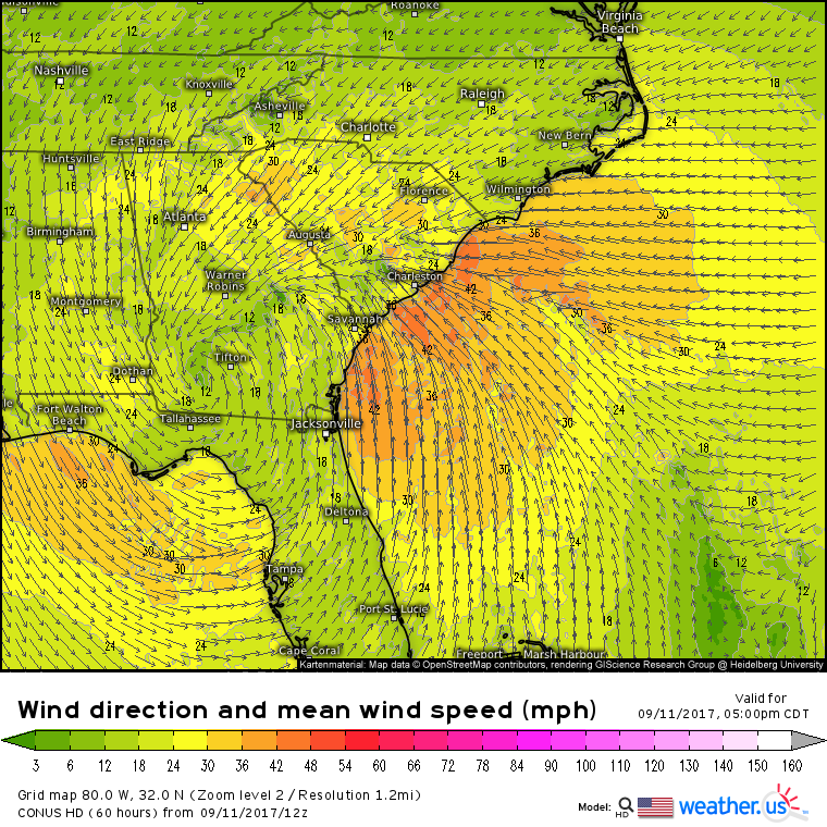
This is a steady, soaking rain that’s being driven by tropical storm force winds. While the winds aren’t even half as strong as the 140 mph wind gusts observed as the core of Irma roared ashore, and the rains are barely 10% of what fell in Houston a couple weeks ago, the combination of heavy rains and gusty winds will result in a power outage threat continuing for the entire state of Georgia through tonight. Gradually, drier air will sweep in from the south tonight and tomorrow morning as the system continues to decay and move north. Total rainfall amounts of 3-6″ could be enough to cause isolated flooding issues, but no major flooding impacts are expected. Wind gusts of 50-60 mph will continue to pose a power outage threat and downed trees could result in some roads becoming impassable.
Gusty winds won’t just be a threat for power outages. Onshore winds will continue through this evening along the coasts of SC and GA which means the storm surge threat will persist into the overnight hours.
Thankfully by tomorrow morning, winds will die down and shift parallel to the shore putting an end to the storm surge threat for waterlogged parts of the coastline.
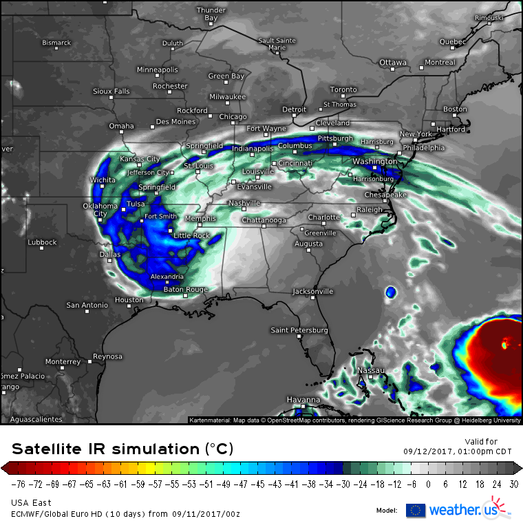
By tomorrow afternoon, the once mighty Category 5 hurricane Irma will be reduced to little more than a swirl of mid level clouds accompanied by some light rain.
Meanwhile in the SW Atlantic, yet another hurricane, Jose, will be strengthening as wind shear from Irma relaxes. I’ll have a full analysis of Jose this evening.
Jack Sillin is a weather nerd and forecaster who regularly writes for weather.us and 33andrain.com.
