Hurricane Irma Remains A Threat As It Moves North Today
Hello everyone!
Irma is weakening, as expected, as the storm moves north this morning. While it is no longer the major hurricane that brought destruction to Southern Florida, it remains a dangerous system.
Click on any link for more information about a particular topic. For each link, you can click the map to zoom in, you can click near the edge of the map to pan, and you can use the (-) button to zoom out. You can also explore other parameters/satellite views and time steps via the menus to the left of each image.
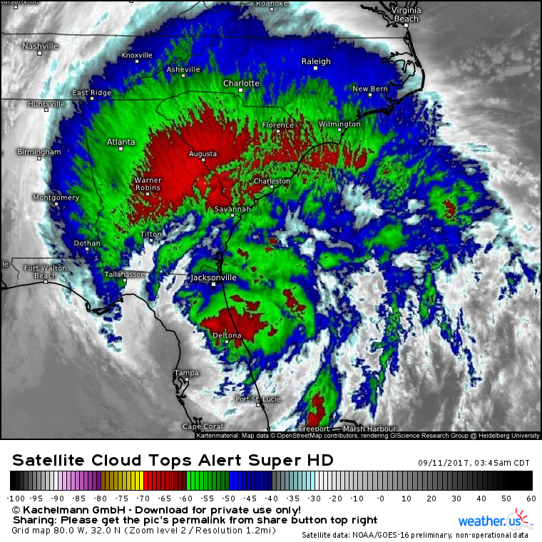
We’re seeing Irma undergo an extratropical transition that is already well underway this morning. Strong rain bands spreading north into the interior Southeast and the thunderstorms near the core weakening and dissipating. Satellite imagery shows the bulk of the energy of the system spreading out away from the core and to a larger area which is a hallmark of these ET events.
This extratropical transition with the energy moving away from the core of the storm means that the maximum winds weaken. We’re seeing that now with the NHC dropping the max winds to 75 mph in its 5 AM advisory. While the storm is certainly weakening and certainly isn’t as powerful as it was in the Florida Keys, it does remain a dangerous storm with wind and rain spreading well away from the center.
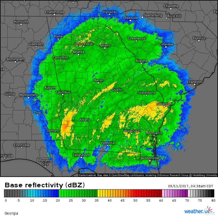
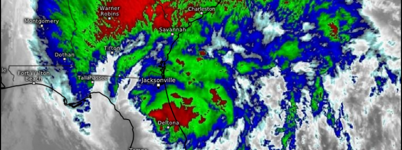
Radar imagery shows this extratropical transition well.
Notice that while the center of the storm is approaching Jacksonville, rain extends all the way up into parts of Tennessee and South Carolina. Also notice that the rain in Atlanta is only slightly lighter than the rain right near the center down by Jacksonville. Also notice how uniform the rain shield is. While there are some banding features, the difference between the bands and non bands are perhaps 5 or maybe 10 dBZ, as opposed to in a fully tropical system where you’ll go from nothing to a 50 dBZ downpour as a band passes through.
As Irma moves north today, the extratropical transition process will continue.
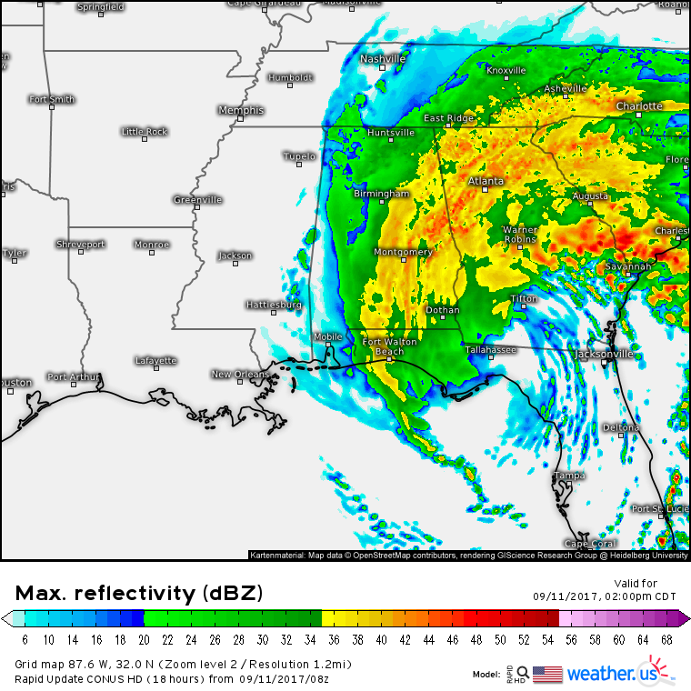
The rain shield will continue to expand across the entire southeastern US from Eastern Mississippi to Tennessee to the Carolinas. Winds will remain quite gusty even as the storm moves inland. We’ve been talking about the inland wind threat from Irma all the way up into the Atlanta region. That’s still definitely a concern as it doesn’t take major hurricane force winds to knock down trees and powerlines. Additionally, the environment very favorable for tornadoes will move north today into the Savannah GA/Charleston SC area. While the firehose of supercells is unlikely to rival what we saw last night off the Florida coast, quick spinup tornadoes will be a threat in NE FL, SE GA, and S SC.
Irma continues to head about 50 miles east of yesterday’s forecast, but in the end that’s going to end up making little difference. The storm will fizzle out tomorrow over Tennessee and will no longer be an issue.
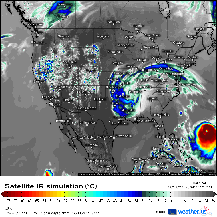
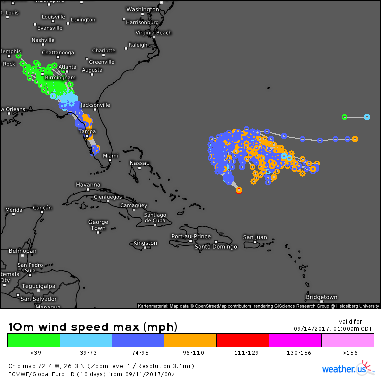
As Irma dies out, Jose will step up to the plate as our next tropical threat. It’s still far too early to say where Jose will go after it does a loop-de-loop in the SW Atlantic.
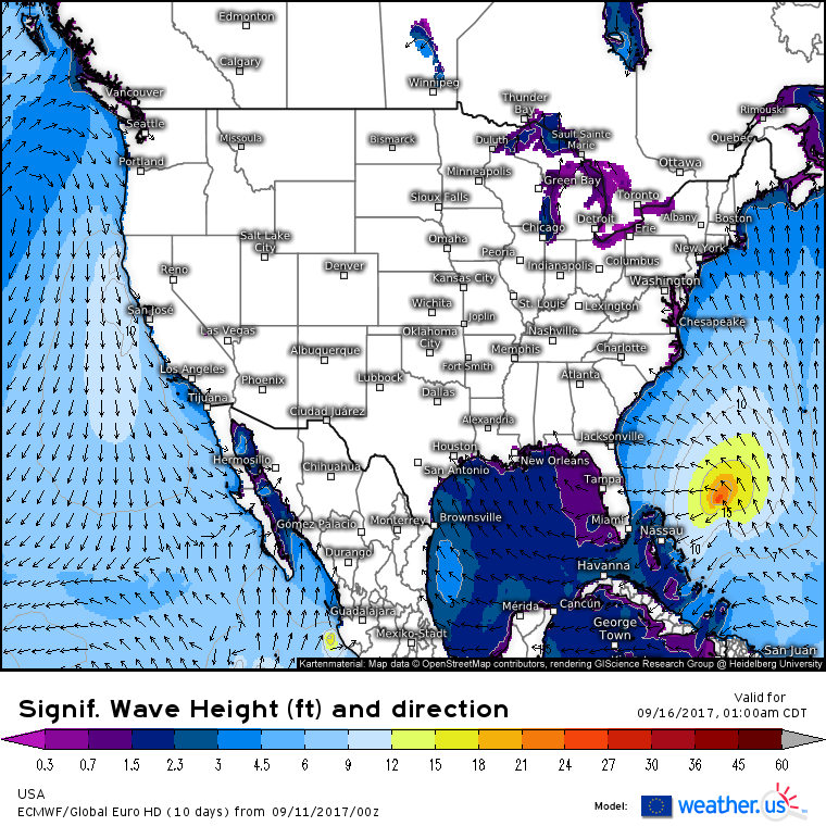
I’ll have more updates on Jose in the coming days as its track becomes a little more certain. One thing that we know already though is that the storm will continue to send plenty of wave energy towards the East Coast as it spins out in the open ocean.
Surf’s up!
Weather outside of Irma in the US today will remain quiet. For more information on your local forecast, head on over to weather.us.
For more information on the local forecast for Maine and New Hampshire, check out my local blog post from this morning.
I’ll have another update on Irma and Jose this afternoon!
Jack Sillin is a weather nerd and forecaster who regularly writes for weather.us and 33andrain.com.
