Scattered Thunderstorms In The Northeast, Irma Gets Closer To Florida
Hello everyone!
Today will feature generally quiet weather across the US as high pressure dominates the middle of the country. We have just a few scattered showers on each coast to mention before talking about Irma.
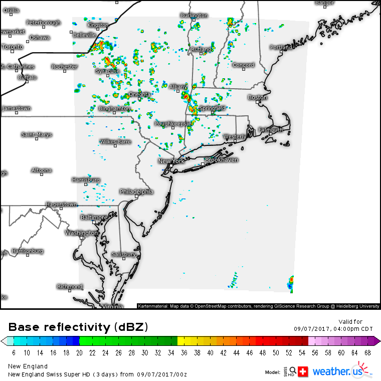
Here’s the Swiss Super HD model showing the first area of scattered showers, in New England.
A cold front will move offshore in the northeast this morning. Sunshine will be quick to break out behind this front allowing for a little instability to develop. This instability will help fuel a few pop up showers, especially across the higher terrain this afternoon. A few could get strong enough to produce a rumble or two, but no severe weather issues are expected. The showers will die down at sunset as their fuel source is removed.
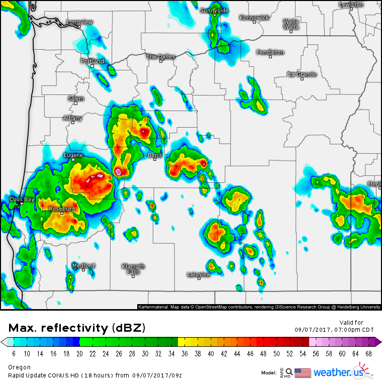
The slightly more significant area of scattered showers and storms will be in Oregon.
This is the HRRR model’s depiction of the radar in Oregon this evening. An upper level low will continue to bring some moisture into the region today, and some of the energy associated with that low will touch off the thunderstorms. A few of the strongest storms will bring some gusty winds and small hail along with heavy rain and lightning.
Otherwise, extremely quiet weather is in store for the rest of the US as a large area of high pressure remains firmly in control.
What about Irma?
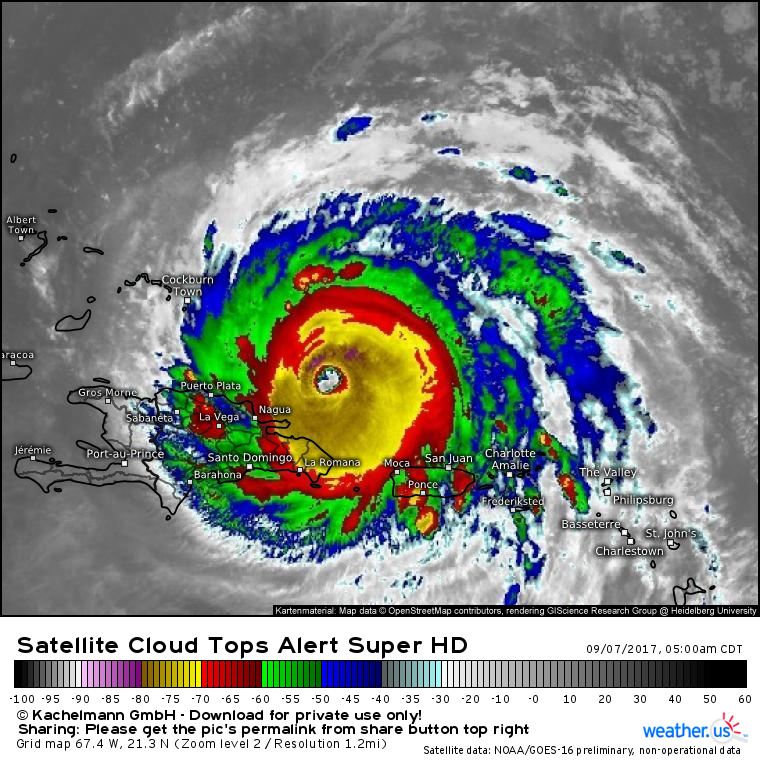
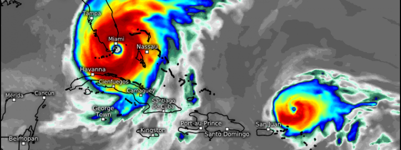
GOES-16 satellite imagery shows a strong and well organized hurricane continuing to plow WNW this morning. The eye has become a little more ragged this morning which indicates that there may be a little bit of dry air getting into the system as southwesterly winds downslope off the mountains of Puerto Rico and Hispaniola. There have also been some signs of an eyewall replacement cycle beginning which is when the hurricane reorganizes its unstable inner core into a more stable configuration. This process can sometimes result in temporary weakening of the hurricane, but usually not more than 5-10 mph.
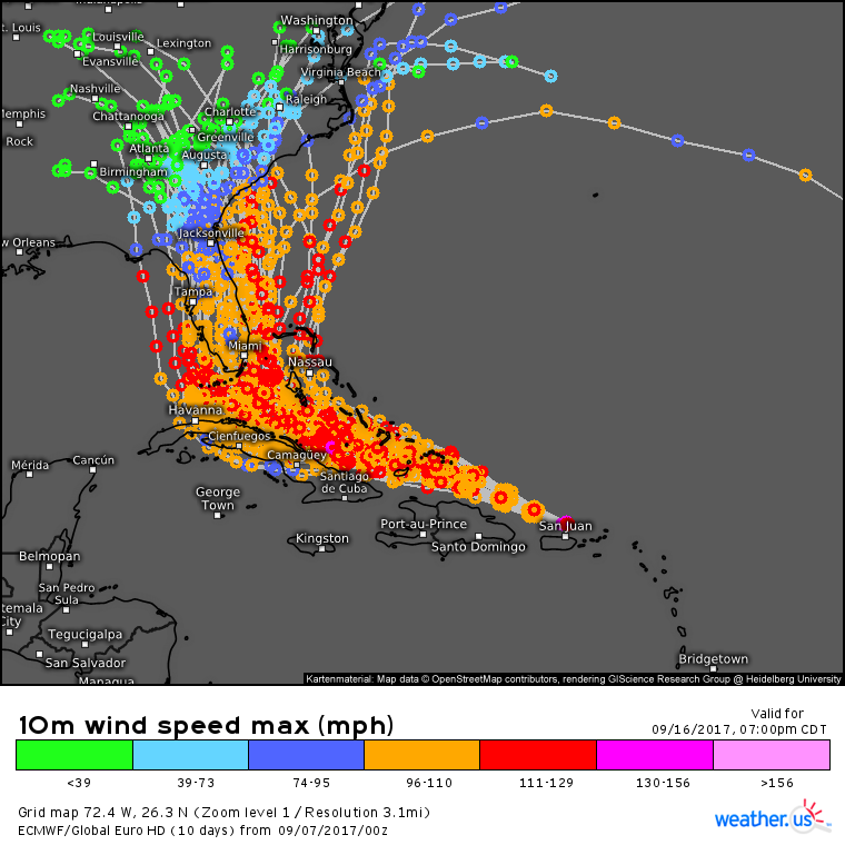
The ECMWF and its ensembles have changed very little in terms of the track forecast. Irma will move WNW into the Southern Bahamas tonight and tomorrow before making a very close brush of the Cuban coast during the day tomorrow. Irma will then turn north, and this is where the uncertainty continues to exist. Where exactly that turn north happens will determine the extent of Florida’s impacts. If the storm turns north a little on the sooner side, the eyewall could miss the Florida peninsula altogether. If the storm turns north at the time currently forecast, the eyewall will move directly over Miami resulting in an absolutely devastating blow to South Florida. If the storm turns north a little on the later side, it could briefly emerge over the Gulf of Mexico before making landfall on the west coast of Florida. Currently, this solution does not seem as likely, but it cannot be ruled out.
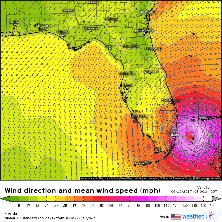
Currently, the ECMWF is forecasting the worst case scenario for Miami with Irma making landfall just to its south. This would put Miami in the “right front quadrant” of the storm which is where the strongest winds and highest surge are found.
The GFS (American) model on the other hand shows one of the better scenarios for the Miami area with Irma tracking just offshore. This would result in a glancing blow as opposed to a direct hit.
Residents of the Miami area should be preparing for the ECMWF solution, and hoping for the GFS solution. Evacuate if you’re told to, and be thankful, not angry, if you return to an undamaged home.
I’ll have more updates and information regarding Irma in the days to come as the storm approaches Florida and its eventual track becomes clearer.
For more information on your local forecast, head on over to weather.us.
For more information on the local forecast for Maine and New Hampshire, check out my local blog post from this morning.
Jack Sillin is a weather nerd and forecaster who regularly writes for weather.us and 33andrain.com.
