Severe Thunderstorms In The Northeast Today As Irma Nears Category 5 Strength
Hello everyone!
High pressure is in firm control of the entire US this morning with the one exception of a cold front in the northeast. This cold front brought strong to severe thunderstorms to parts of the Ohio valley last evening and it will bring strong to severe thunderstorms to areas farther east today.
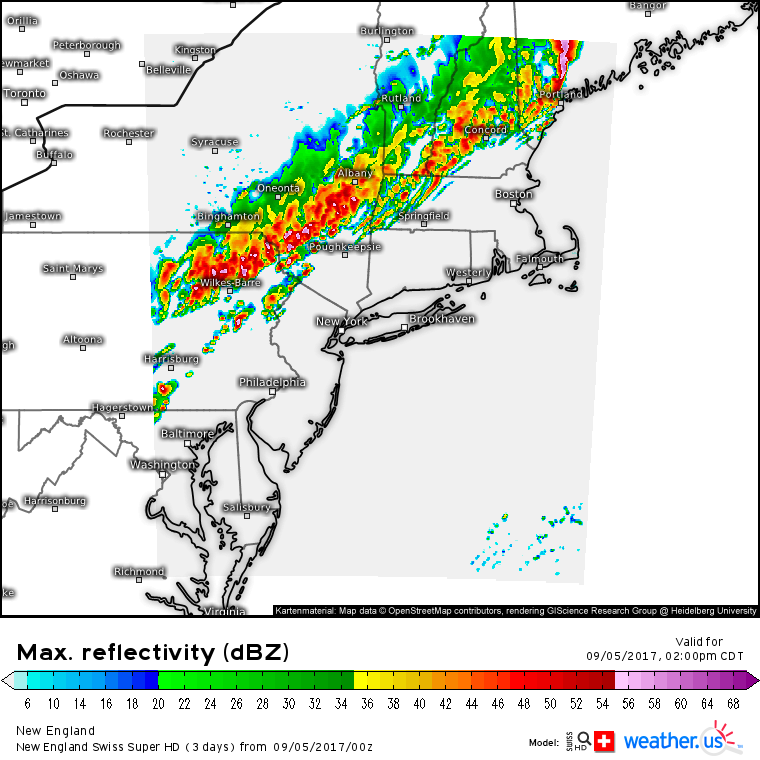
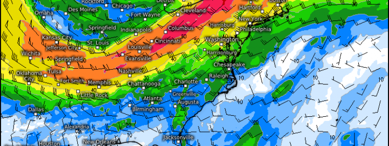
This is the Swiss Super HD model’s forecast for what the radar may look like this afternoon. A strong squall line is forecast to develop, similarly to yesterday. As with any squall line, the biggest threats will be damaging winds, heavy rains, and lightning. Tornadoes and hail are unlikely, but can’t be ruled out, especially with any discrete storms that develop out ahead of the main line.
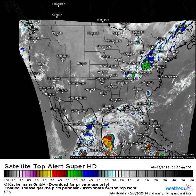
GOES-16 Infrared satellite imagery shows some “convective debris” from last night’s storms moving east. Notice, however, that this cloud layer is thinning and breaking up in some spots. This trend will continue until new storms form this afternoon. As a result, enough sunlight will be able to get through to the surface to allow for warming temperatures and building instability.
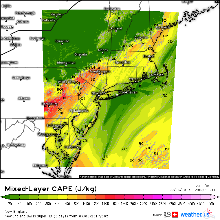
The Swiss Super HD model shows enough instability to power some strong storms, but not so much that things will get out of hand. The really impressive severe weather parameters are the strength of the cold front (trigger), and the strength of the shear.
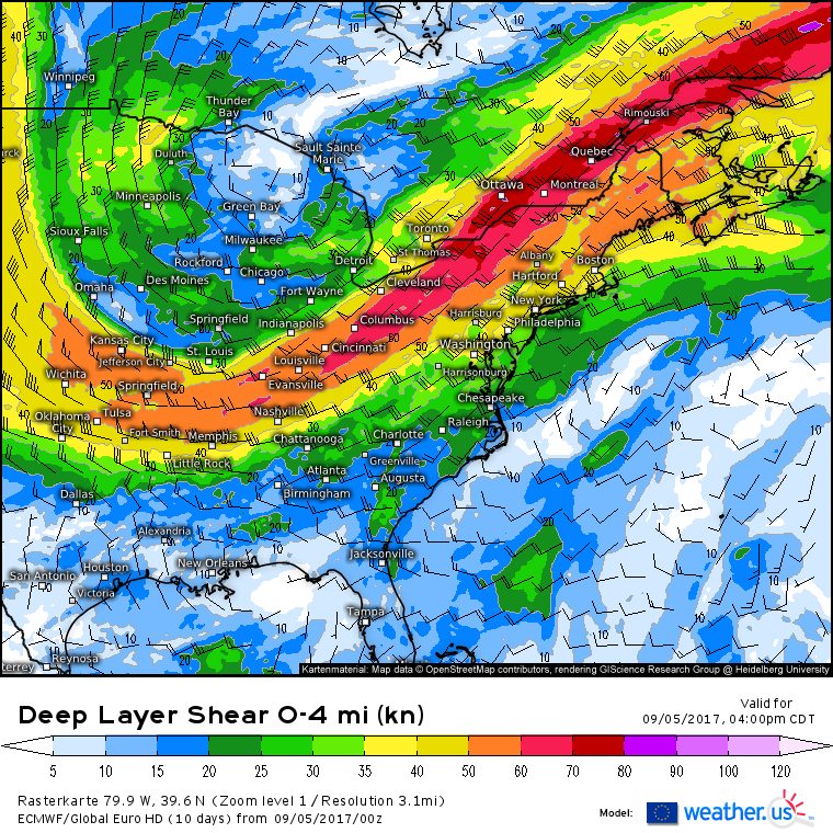
A strong upper level jet streak will provide ample shear for storm development and organization today. Typically shear values over 30kts will support severe storms. In the Northeast today, we have shear values over 50kts. All systems are go for severe storms! The cold front will slow down and stall near the coast tonight and storms will refire along it tomorrow, though they’re not likely to be quite as strong.
Outside of the cold front in the northeast, GOES-16 satellite imagery shows clear skies and quiet weather for nearly the entire US.
For more information on your local forecast, head on over to weather.us.
For more information on the local forecast for Maine and New Hampshire, check out my local blog post from this morning.
Because I won’t have time for an Irma update this afternoon/evening, here’s a quick update on the latest with the storm.
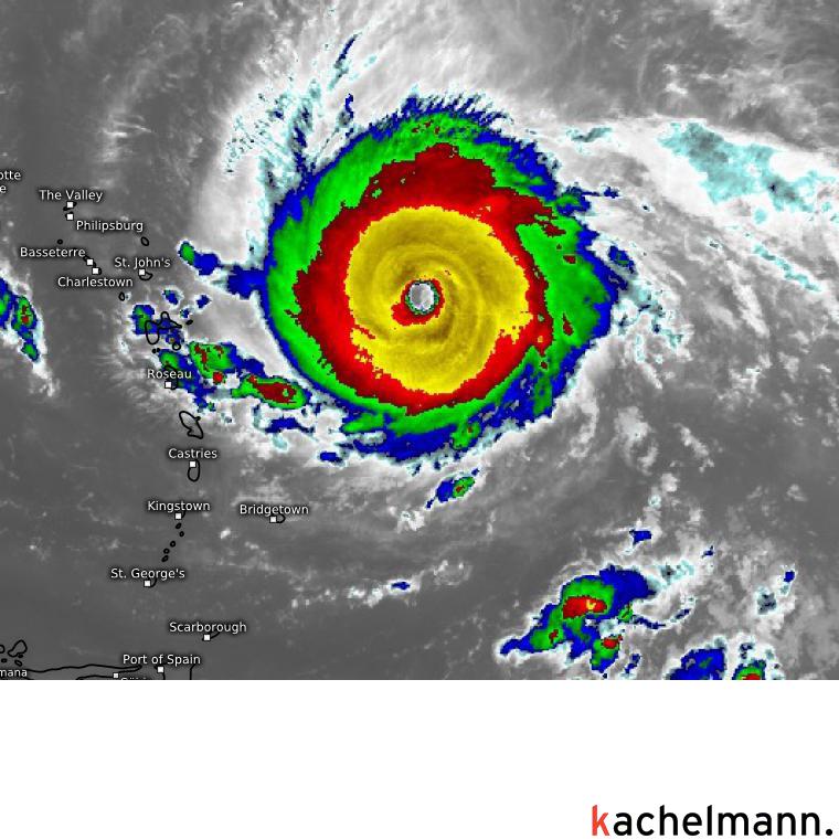
After reorganizing its core, moving over warmer waters, and mixing out some dry air, Irma is now an absolute beast on satellite imagery. A well defined eye, a perfectly symmetric ring of massively intense thunderstorms, and extensive upper level outflow all indicate that Irma is likely not far off from becoming a category 5 hurricane, the highest level of classification. Even if the storm doesn’t get its sustained winds up to 160 mph, I can promise that 150 mph winds aren’t a walk in the park. Any preparations in the Leeward islands that have not been finished need to be rushed to completion today as tropical storm conditions develop this afternoon.
As for its future track, everything I discussed in last night’s analysis remains true. The storm will move WNW near Puerto Rico and north of Hispaniola before brushing the Cuban coast. It will then turn north and move towards Florida but the timing of that turn remains uncertain. I’ll have more updates in the coming days as we nail down exactly where Irma will track and what impacts can be expected in the Florida area.
For now, last evening’s blog has plenty of information regarding Irma, her track, and her potential impacts.
-Jack
