Heat To Build Along The West Coast As Irma Moves Steadily West
Hello everyone!
As Harvey sputters out over the Mississippi valley, we have plenty of weather to watch as we head into the weekend. Here’s a quick rundown, I’ll cover each one in more detail below.
- Harvey’s remnants continue to bring heavy rain and flooding to the Mississippi and Ohio valleys. The system will merge with upper level energy this weekend and bring gusty winds/heavy rains to New England.
- Heat will build over the West Coast as high pressure strengthens.
- Irma will move steadily westward and could bring impacts to the Windward and Leeward Islands as soon as Tuesday. Any potential US impacts remain uncertain.
We’ll start with Harvey and its remnants which continue to bring rain and some severe weather to parts of the southeast. However, the storm is picking up speed, and the rainfall won’t last long enough to cause the type of floods seen in the Houston area.
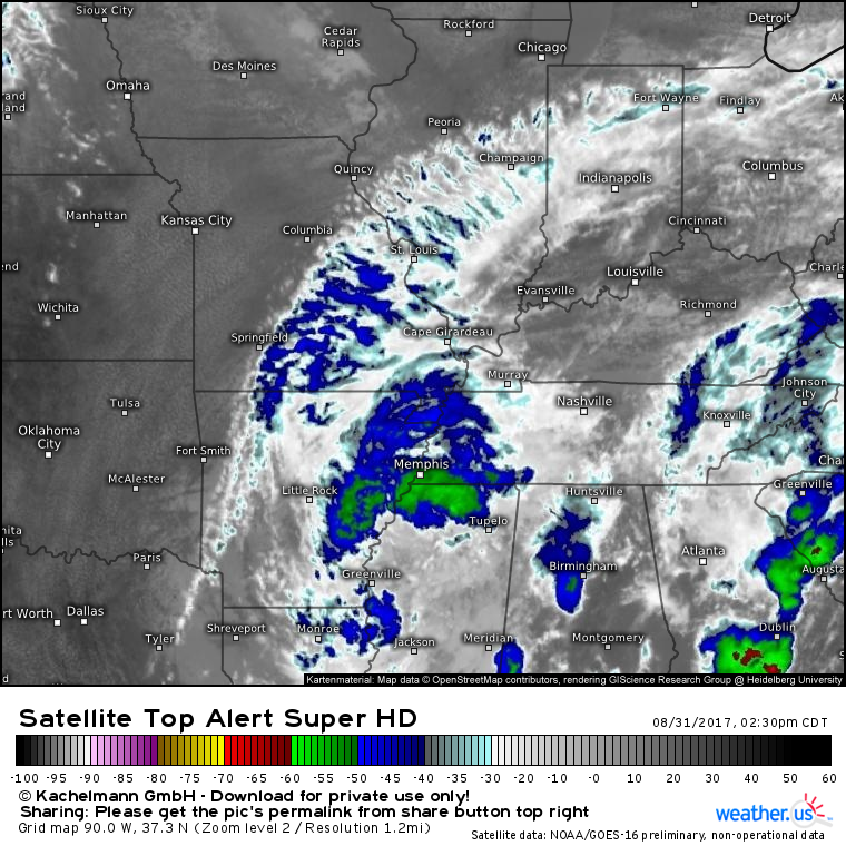
GOES-16 shows a ragged and weak system this afternoon, which is to be expected as Harvey transitions to an extratropical low. That band of green cloud colors indicating cloud tops cooler than -50C indicate areas seeing some moderate to heavy rain at the moment. Satellite loops show that the storm is beginning to gain some momentum, which means that these rains won’t last long enough to cause disaster like Harvey, though they will stick around long enough to cause some nuisance flooding.
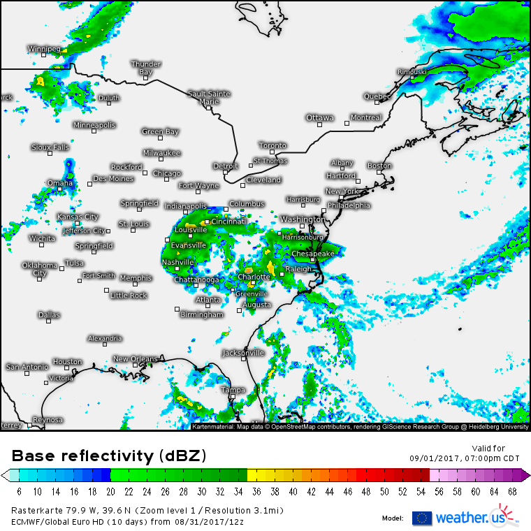
Harvey’s remnants will continue northeastward tonight and tomorrow. The storm will begin to interact with a cold front tomorrow. As a result, ex-Harvey will transition into a coastal extratropical low before it moves northeast. Areas from DC to NYC to Boston will get periods of rain and breezy conditions from this system but no major impacts are expected. The storm will move fully out of the US on Sunday night as it tracks across Atlantic Canada.
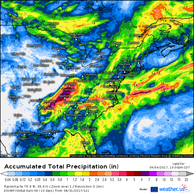
How much rain will Harvey’s remnants bring? The heaviest amounts will be found over the MS/OH valley region with up to 6″ falling there. Otherwise, amounts will generally be below 2″. Some parts of the New England coast likely only see a quarter or half inch of rain.
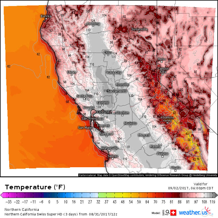
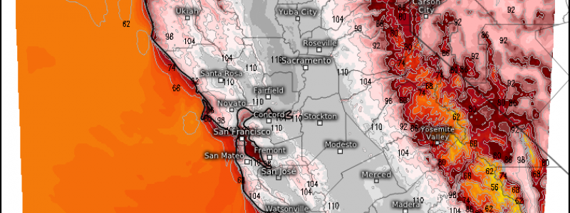
Farther to the west, parts of the West Coast are in for quite the heat wave as high pressure strengthens over the area. Temps in California are expected to soar well into the 90’s and 100’s, even close to the shore where the weather is typically cool.
The Swiss Super HD model shows the potential for high temperatures to exceed 110 degrees across an extremely wide swath of the Central Valley. Temperatures above 100 will be found all the way to within a few miles of the coast. Why is it going to be so hot?
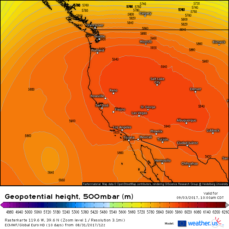
The ECMWF model shows a very large ridge of high pressure located over the Desert Southwest. This high pressure will promote sinking air across this region. Air warms as it sinks, meaning that the temperature rises, and that clouds that might block some of the sun’s energy can’t form. The combination of these two factors means that the furnace is turning on for California. Be sure to take proper precautions for the heat including limiting physical activity during the hottest times of the day and staying hydrated by drinking plenty of water. High pressure is expected to linger into next week meaning that the high temperatures are unlikely to leave in a hurry.
Meanwhile in the tropical Atlantic, Irma has strengthened into a hurricane with 100mph winds.
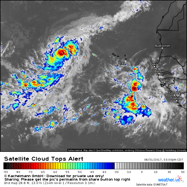
Satellite imagery shows that the storm has developed a small eye and surrounding ring of intense thunderstorms. Cirrus is fanning out from the system in all directions indicating that the storm has strong outflow. Overall, the system looks healthy, and it will likely continue to intensify as it moves WNW then WSW over the coming days.
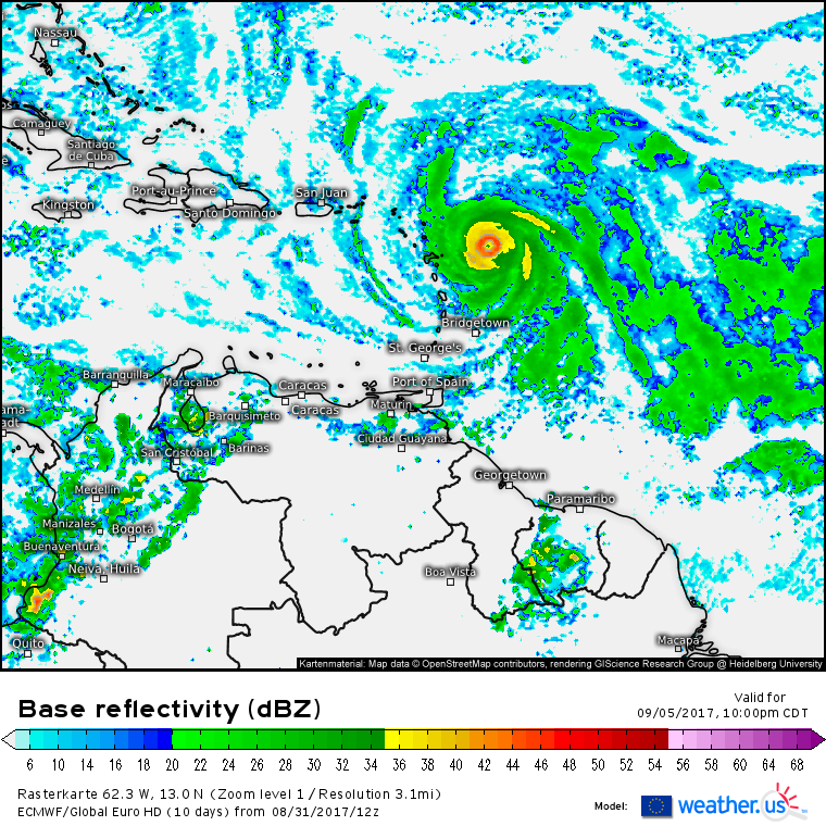
Where’s Irma headed? It will move generally westward over the next few days after taking a quick WNW then WSW jog. There is high confidence that the system will be near the NE Caribbean islands by the middle of next week. Beyond that, there is very low confidence in Irma’s track. The system will move in the general direction of the US but it’s far too soon to say exactly who might be impacted on the US mainland. I’ll have many more updates in the days to come as this storm moves closer!
