Harvey’s Rains Continue, PTC 10 Moves Offshore, And 93L Gains Steam
Hello everyone!
We’re now down to two tropical systems to watch in the Atlantic, though there are indications we could be back up to three by the end of the week. PTC 10 has moved offshore and is now an extratropical cyclone. It will move ENE and intensify, bringing large swells to the East Coast. Given that it’s post-tropical and offshore, it will no longer be a subject of my discussion here. We’ll talk about Harvey and 93L, both of which continue on their respective paths this evening.
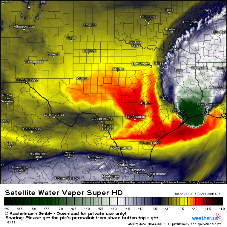
Harvey continues it’s slow drift NE this evening. Drier air is working into the Houston area which will shut off the rains there tonight/tomorrow. Farther east, Louisiana still has several days of heavy rains to go, though their situation will be nowhere near as bad as Houston’s.
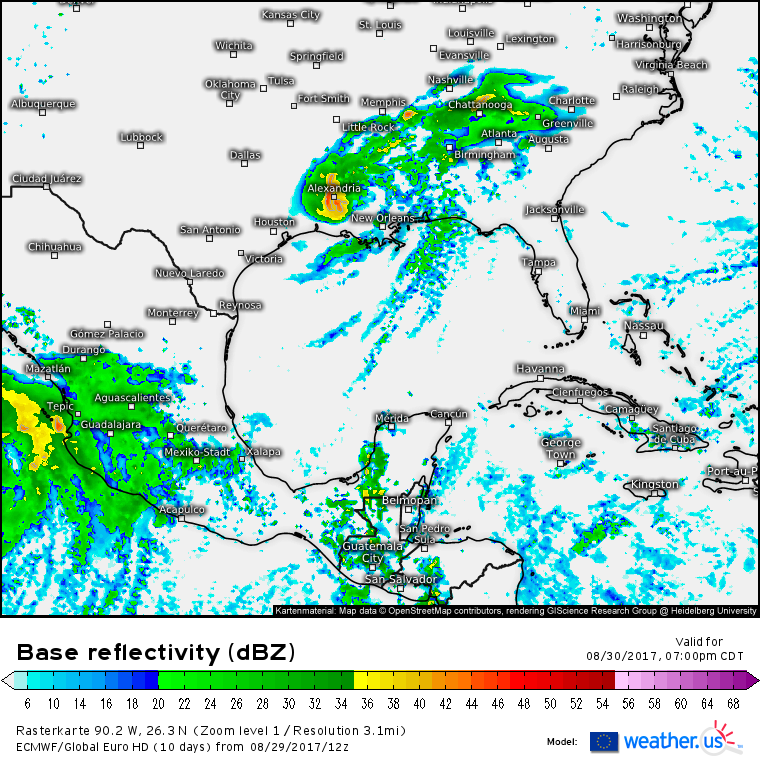
The latest round of ECMWF guidance shows Harvey and its rains moving through Louisiana tomorrow before accelerating through the Ohio Valley this week. Eventually, the storm will leave the US altogether on Monday after it joins up with an incoming cold front to deliver some rains to New England. Rainfall along the rest of Harvey’s path is expected to be only fractions of what fell in Houston. As the storm speeds up and away from its moisture source, it will weaken into a remnant low thus ending the flooding threat.
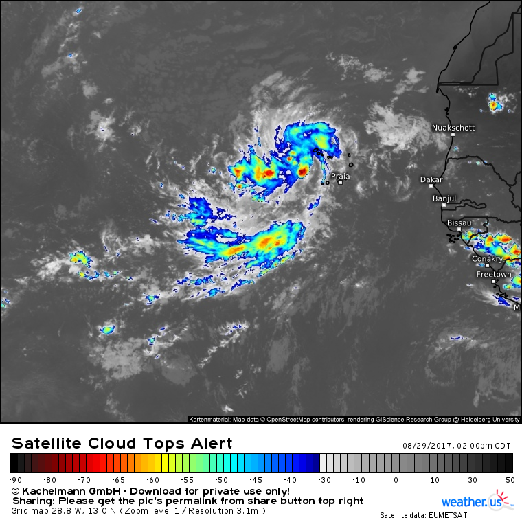
Meanwhile in the far Eastern Atlantic, 93L continues its steady organization and march west.
The storm continues to show signs of organization with developing upper level outflow and a cluster of thunderstorms near the center. Once the system closes off a center of circulation, it will be designated a tropical depression. This should happen in the next day or two. The NHC gives the system a 90% chance of development in the next 5 days. So what’s ahead for this system?
First, it should strengthen in the very favorable environment currently present in its area.
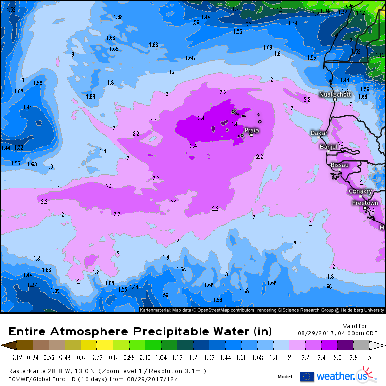
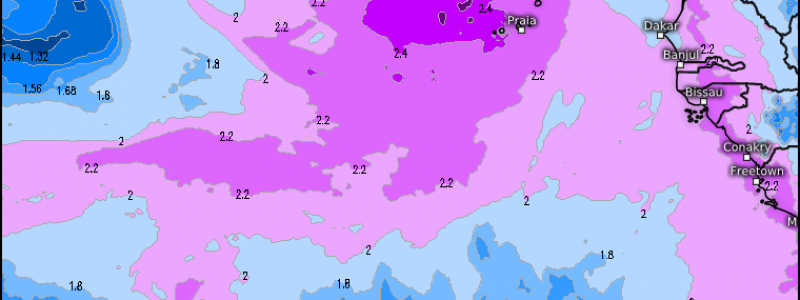
The ECMWF shows an extremely moist atmosphere surrounding 93L. This means that no issues with dry air are expected. Wind shear is low which will be an additional factor in support of a strengthening storm in the coming days. As it strengthens, where will it track?
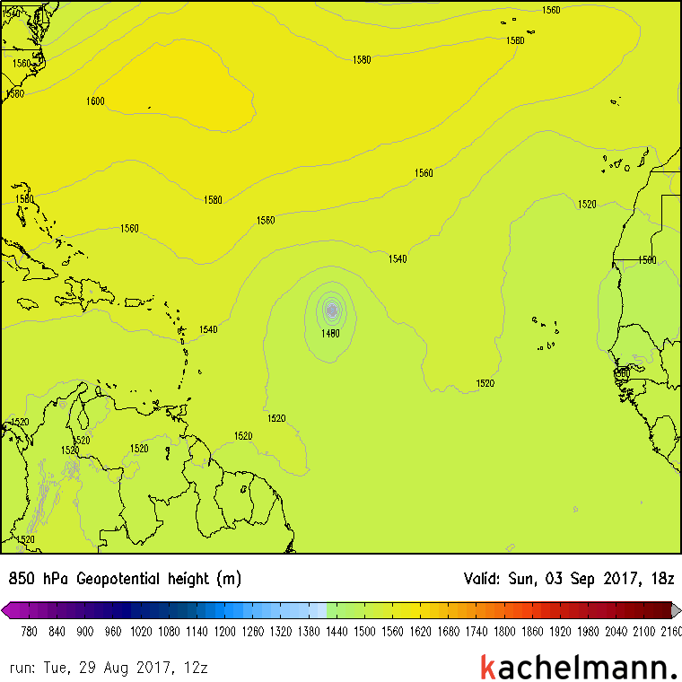
Ensembles are the best tools to answer this question. The closer together the lines are, the more confident we can be about that track. There is high confidence in a general WNW motion over the next few days followed by a WSW motion as the system approaches the Caribbean islands. This WSW turn is the result of high pressure building in the Atlantic.
This map shows the situation in the Atlantic quite clearly. 93L will strengthen and will want to move north. However, a strong, and strengthening, ridge will prevent that. Thus, a general track to the west is expected through the coming week. Beyond that, there’s low confidence in the track of the storm, and even lower confidence with regards to intensity. Intensity forecasts range from an open wave to a major hurricane, and track forecasts range from Florida to Greenland. I’ll have much more in the coming days as we start to figure more out about the storm’s future!
More updates tomorrow on Harvey, 93L, and the potential for another system in the Gulf.
-Jack
