A Series Of Tropical Systems Continue To Cause Trouble In The Atlantic
Hello everyone!
All eyes are once again on the tropics this afternoon as we have one tropical cyclone, one almost-tropical cyclone, and one tropical cyclone-to-be all spinning in the Atlantic. We’ll start by discussing the latest trends associated with Tropical Storm Harvey before moving on to Potential (extra-) Tropical Cyclone 10, and we’ll end by mentioning the latest tropical system to watch which is 93L.
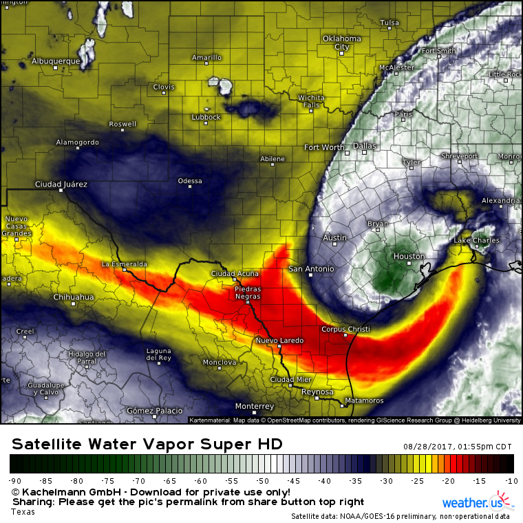
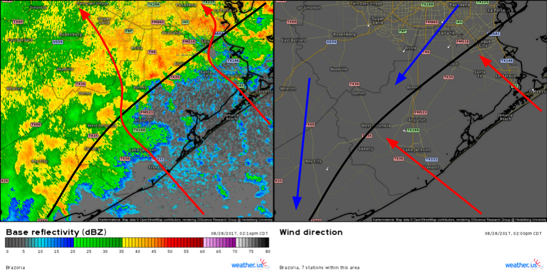
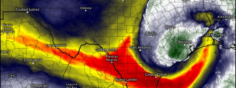
GOES-16 Water Vapor imagery shows a number of recent changes associated with the system. First, the tongue of dry air that shut off the torrential rains in Houston earlier is slowly filling in with new thunderstorm activity. That new activity is located over Harvey’s center as it moves back out over the warm waters of the Gulf of Mexico. Notice how that new thunderstorm activity is located over areas that really don’t need any more rain, including the Houston area. Radar imagery and ground observations show the mechanism behind this band of rain.
A localized boundary that has set up on the NE side of Harvey is helping to focus moderate to heavy rains across the area just S of Houston. So far, this boundary and the associated area of heavy rain hasn’t made any movement towards Houston, but if it does, big problems will ensue. Right now, Houston remains just to the north of the heaviest rain, though it’s important to remember that these more rural areas have experienced flooding that’s just as bad as that in the downtown area.
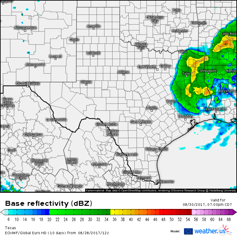
Whatever our mesoscale band of rain does, by Wednesday, it, along with all of Harvey’s rain, will be finally exiting Texas.
The ECMWF model shows this solution well with rain tapering to showers and finally departing as the storm’s center moves through Louisiana. While clouds and a few light showers will likely stick around through Thursday, they won’t amount to much if anything precipitation total wise, which should allow for the smaller rivers and bayous to recede. Some of the larger stem rivers, however, could still take days to crest as all the immense volumes of water slowly meander towards the Gulf. Just how much water has fallen in Texas?
This product was just added today to weather.us and displays the total amount of precipitation that has fallen, as estimated by radar, in the past 3 days. Notice the very wide swatch of rainfall amounts over a foot, with the max of 40″+ located right over downtown Houston. Another 6-10″ of rain is expected over Houston before this storm is all set and done. As bad as that sounds, it won’t fall in nearly the same torrential manner that the first few feet have, meaning that while rivers and bayous are expected to remain well outside their banks, they are unlikely to rise too much more as the next round of rain moves in. The exception will be the larger stem rivers which will take days to crest and recede.
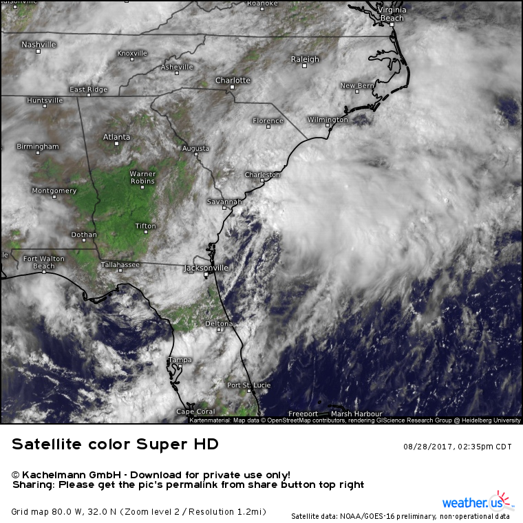
Farther to the east, our not-quite-tropical cyclone near Florida has made only minor strides today in terms of organization. A hurricane hunter plane explored the system this afternoon and found no indications of a closed circulation, meaning that it has not yet developed into a tropical cyclone. Even if it closes off a circulation, I remain doubtful that it will organize into a truly tropical cyclone.
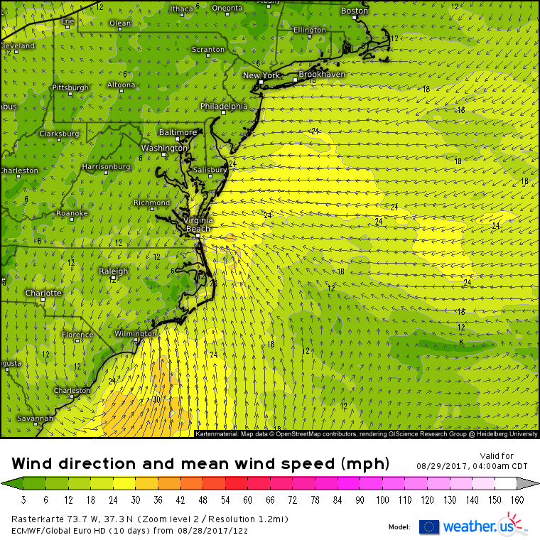
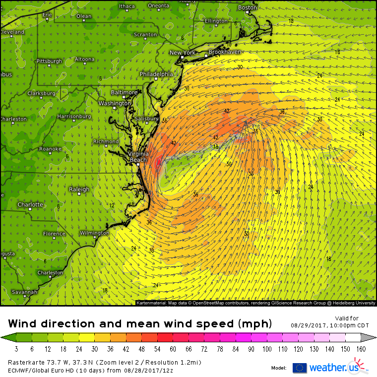
An unseasonably strong cold front is located over the region near PTC 10, and all the models, including the ECMWF shown above, depict PTC 10 (or Irma, if the NHC decides to name it) becoming attached to this front, and then eventually controlling the front and its movement. A frontal system is, by definition, non-tropical. I could go on further about some of the more technical reasons for the system not being “truly” tropical, but whether it’s tropical or not, the impacts will still be the same. Let’s quickly run down those impacts, which will be felt primarily along the East Coast from Jacksonville FL up to Nantucket MA.
Rainfall is already in progress across Coastal South Carolina. This rain will expand and intensify tonight as the system moves NNE.
Swiss HD model guidance shows heavy rain tomorrow morning across the North Carolina-Virginia area. While there could be strong thunderstorms south of the warm front along the NC coast (visible on the simulated radar image above), most areas will just see a steady, soaking rain. The system will begin to accelerate northeastward through the day, meaning that while some minor flooding problems are expected, we’ll avoid the catastrophic flooding situation Houston is experiencing with Harvey.
How much rain will fall in total across parts of the Carolinas? I’m sticking with my forecast from this morning of a wide swath of 1-3″ from Eastern SC up through Raleigh and Richmond VA. Anywhere to the east of that line will see over an inch of rain, with some places close to the NC and SC coastlines (from Charleston to Myrtle Beach to Greenville to Virginia Beach) seeing higher amounts in the 3-6″ range. Some spots that see training thunderstorms in the Outer Banks region may see a few amounts over 6″ but the quick motion of the storm will keep rainfall amounts from getting too out of hand.
Winds will also pick up as the storm moves through. Gusts in the 40-50 mph range will be common along the coast of NC as well as across the Delmarva and the Virginia Beach areas. The winds will be out of the NNE and that could push waters from the Chesapeake Bay into the Norfolk/Virginia Beach area. If you live in that area and are in a location prone to coastal flooding, prepare for tides 1-3 feet above normal. The storm will move swiftly ENE on Wednesday, potentially brushing Nantucket with some showers before racing out to sea.
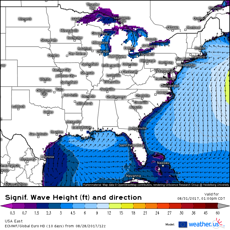
As it races out to sea, it will continue to rapidly develop and that rapid development will kick up some swells that are expected to cause high surf and a risk for rip currents along the East Coast as we head into the latter part of this week.
The swell will peak on Thursday before subsiding as we head into the weekend. Use extra caution if you’re planning on heading into the water this week.
Our third and final tropical disturbance is over the far eastern Atlantic this evening. It is termed 93L and has a high chance of developing into a tropical cyclone this week as it moves WNW across the Atlantic. Currently, satellite imagery shows the system lacking in deep thunderstorm activity, but it has strong outflow channels both to the north and south, meaning that the upper level environment is favorable for its strengthening.
Where is 93L headed and how strong is it expected to get? The latest round of EPS ensemble data pictured above shows the storm slowly organizing into a tropical storm as it heads WNW across the Atlantic. Past this point, about 5 days from now, the forecast becomes much more uncertain. The range of possible outcomes includes the storm recurving out to sea, remaining weak the entire way, or, most worryingly, heading for the East Coast, potentially as a hurricane. Any potential US impacts will be about two weeks from now, meaning the forecast is low confidence. Don’t panic if one model sends a hurricane to your town, and don’t grow complacent if another sends it way out to sea.
There are some developments half way around the world that I think will play a big part in 93L’s future track. I’ll have more on those developments tomorrow!
-Jack
