Potential Tropical Cyclone 9 Likely To Become TS Harvey This Evening
Hello everyone!
I’ve covered some of the marginal severe weather risks on twitter today so the blog will focus on the tropics, where there’s quite a bit of action expected in the next few days. We have a Potential Tropical Cyclone, an Invest, and an undesignated area of interest as Hurricane Gert becomes extratropical and races into the North Atlantic.
We’ll start with the system most likely to develop into a tropical storm: Potential Tropical Cyclone 9.
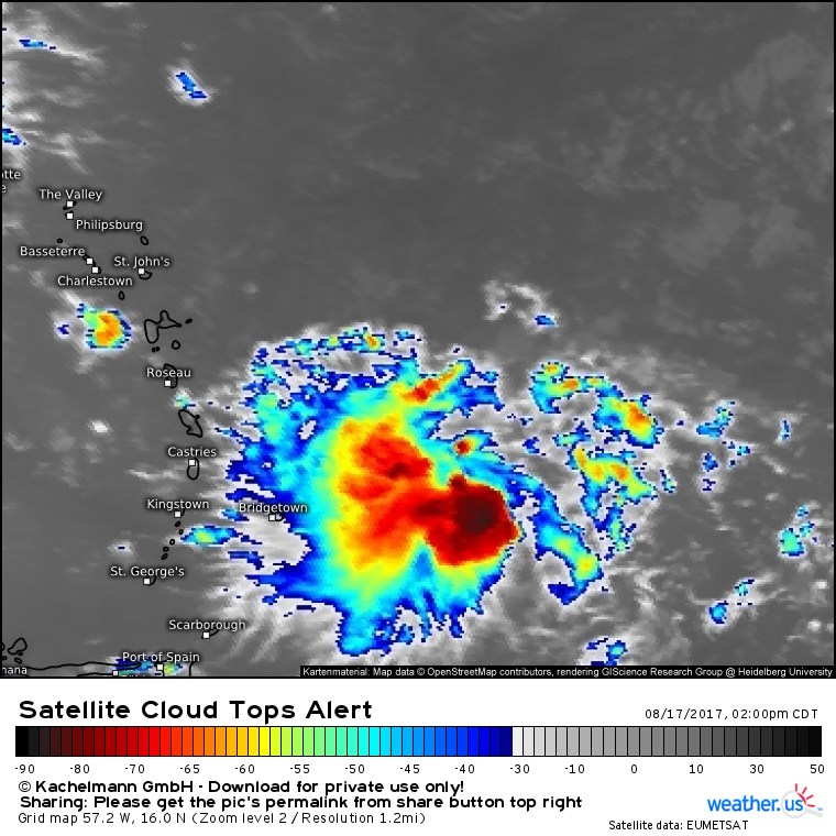
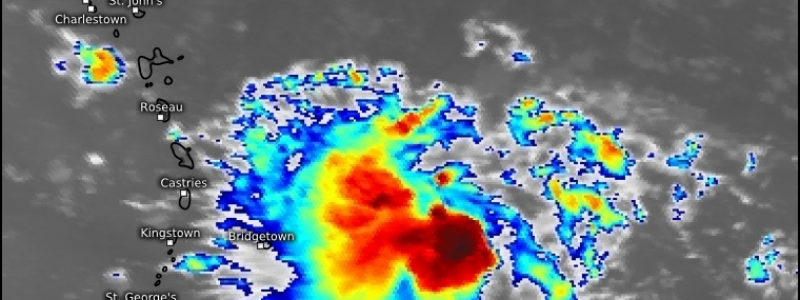
Here’s a look at PTC 9, located just east of Barbados and the rest of the Windward islands. What’s a Potential Tropical Cyclone? It’s a label given to a system by the National Hurricane Center when a system doesn’t meet the technical definition of a tropical storm, but still could bring tropical storm conditions to land. The PTC designation allows the NHC to issue watches and warnings, even if the storm hasn’t technically formed yet. TS warnings are up for Barbados and the Windward Islands north of St George’s and South of Roseau. The storm is expected to move into these areas tonight and tomorrow morning. In addition to the winds, heavy rain is expected and may cause flooding concerns. Want to check out more satellite data for PTC 9? We have lots available!
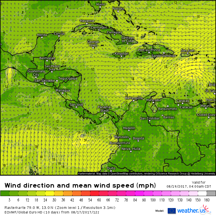
The system will then move into the Eastern Caribbean where it may have a hard time holding together. This region is notoriously harsh for tropical systems and PTC 9 (by then likely TS Harvey) may cease to exist as a coherent tropical entity by Sunday. It will eventually move west into Central America, making landfall in five or six days. Whether that landfall occurs as a tropical wave or as a tropical storm (or even a hurricane) has yet to be determined, but either way, no US impacts are likely.
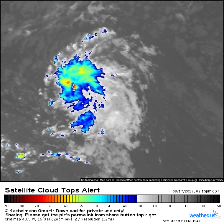
The system that has the best chance for impacting the US in some capacity is located farther to the east and is termed “Invest 92L”. An Invest is an area of active weather in the tropics that the NHC can name as a way to collect more data on a system. Invests get special weather models run for them that can give clues as to the potential future track/intensity of the storm. Invest 92L has a fairly ragged appearance on satellite imagery as you can see in the image below.
Note the lack of strong thunderstorms in this satellite image. Where PTC9 had a fairly large swath of cloud tops in the -60 to -70 C range (very strong thunderstorms extend very high into the atmosphere where it is very cold, hence the lower cloud top temperatures for stronger storms), 92L only has a single small storm with cloud tops that cold. The rest of the system is much weaker. Despite this, there are decent signs of upper level outflow as shown by the feathery clouds on the fringes of the system. The upper level outflow shows up even more clearly in the animated version of the data.
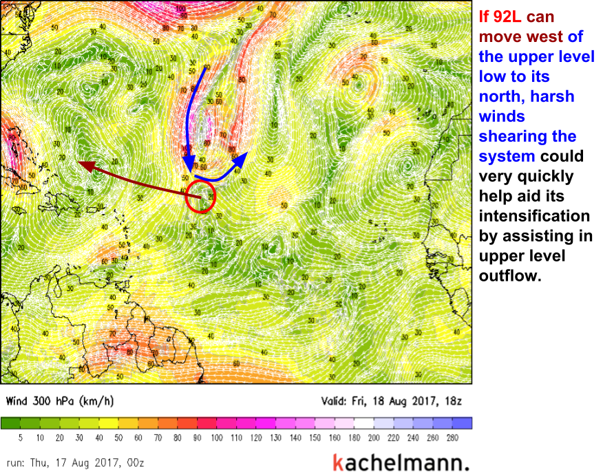
So what does the future hold for 92L? The answer to this question largely depends on the behavior of the system relative to an upper level low that will be developing to its north.
The upper level low has the potential to either really help or really hurt 92L. If the ULL gets out in front of 92L, southwesterly winds aloft will cause the thunderstorms in the system to become disorganized. This would severely inhibit the storm from developing or strengthening. If the ULL lags behind a little bit, and 92L can get out ahead of it, northwesterly winds aloft will help to vent the system, enabling thunderstorms to grow and develop more efficiently. This would help assist the storm in developing/strengthening. It’s not entirely obvious which outcome will occur, but either way 92L, or any tropical storm that develops from it, will enter the Bahamas in about 4 days, where conditions could become more favorable for development.
Potential US impacts range from enhanced rainfall over Southern Florida if the system remains a weak tropical wave, to impacts from a tropical storm or even hurricane if the system can strengthen enough. It’s far too early to tell how strong the storm may be as it makes landfall, or where exactly it might move ashore, so stay tuned for further updates as the forecast becomes a bit clearer.
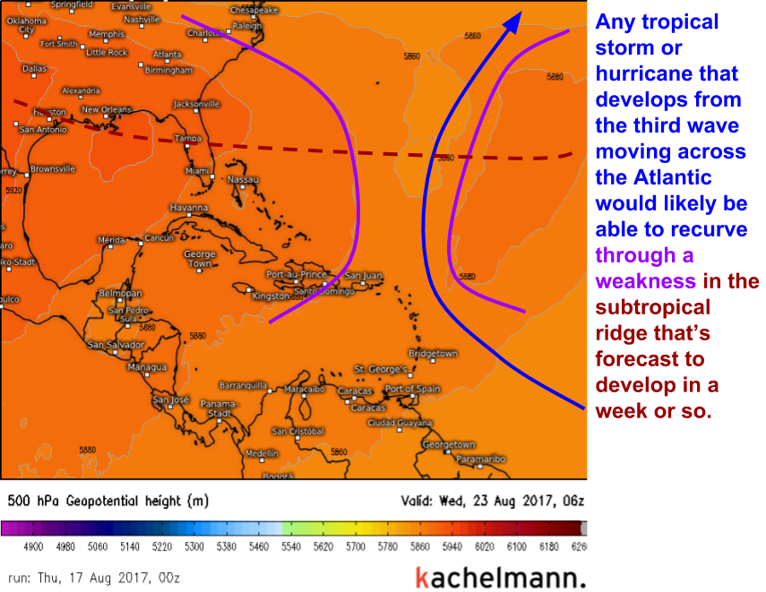
The third area of interest is currently located in the far eastern Atlantic, and likely won’t develop for the next several days. If it does, it will have a clear path out to sea as a weakness is forecast to develop in the subtropical ridge in about a week’s time. At this time, no US impacts are likely from this system aside from potentially a few swells if the storm develops into a strong enough hurricane.
While we continue to monitor PTC 9, 92L, and the third wave in the Eastern Atlantic, remember that the general pattern remains fairly favorable for US tropical cyclone impacts. We’ve had a fairly large Bermuda high pressure system that is guiding tropical waves in the general direction of the US. Some waves/storms (like Franklin and now PTC 9) remain too far south to cause any trouble, other tropical waves make it farther north. Up until now, all of these waves have been too weak to cause any impacts to the US. Whether the incoming train of waves will keep that pattern going remains to be seen, but the steering pattern is unlikely to go anywhere soon.
As a quick programming note, I’ll be away the next couple days until Sunday evening. Unless there are any very significant developments with our tropical systems or the weather across the US, my updates will be limited to twitter until I return. You can follow @WeatherdotUS for my forecasts/analysis over the next few days. I’ll be back on here Sunday or Monday with more on the tropics.
-Jack Sillin
