Dangerous Heat Wave Across The Pacific Northwest
Hello everyone!
A dangerous heat wave is in the forecast for an unusual part of the country- the Pacific northwest. The region’s normally temperate climate is getting put aside this week as a very large and very strong ridge of high pressure moves into the region. Just how hot will it get? Here’s a quick rundown of how high temps will soar as well as what’s behind the heat.
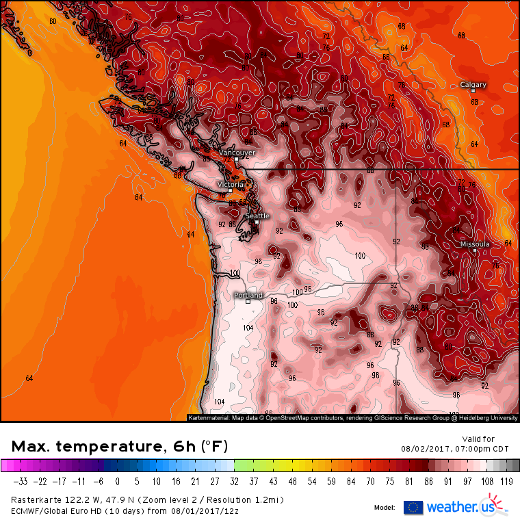
Both the Euro…
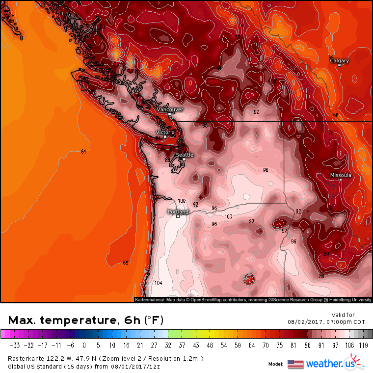
…and the GFS…
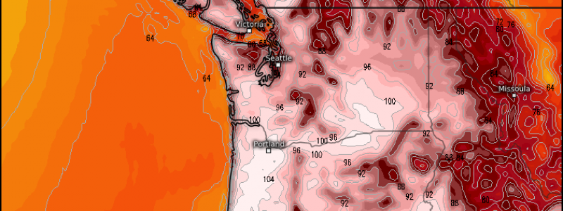
… show extreme heat tomorrow with highs well above 100 in Oregon and Washington. Excessive heat warnings are posted for the region as temps begin to soar. How unusual is it to get heat this extreme in these areas?
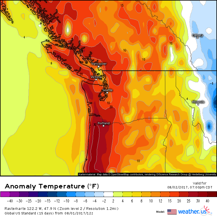
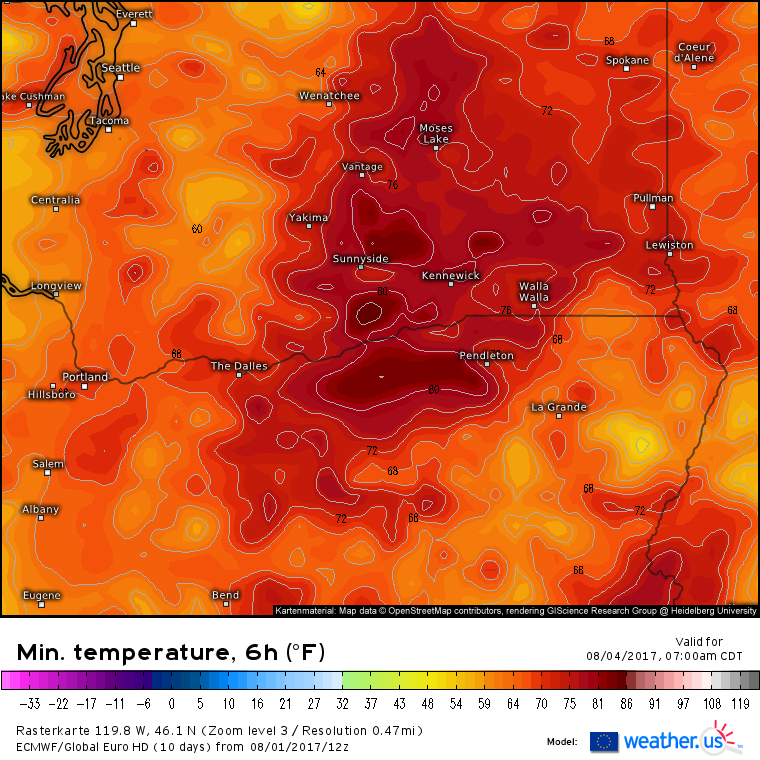
This map from the GFS will give you an idea. High temps along the Oregon coast tomorrow are forecast to be in excess of 30 degrees above normal! Highs in this region are typically in the 70’s or low 80’s this time of year, and in some places temps have never exceeded 100 degrees. Records are likely to be broken, both in terms of daytime highs, and night time lows, which could remain above 80 degrees even in the coolest part of the day over interior Washington and Oregon.
The very high low temps will mean there’s little respite from the heat even at night. This, I’d argue is even more impactful than intense daytime heat. It’s one thing to run an air conditioner for a few hours each afternoon when temps are at their hottest, it’s quite another to run it for three or four days straight. This strain on the system increases the chance for failures which can be dangerous when it gets this hot. It’s also hard to find a time to exercise when the warm temps persist through the morning hours. If you do plan on strenuous physical activity in these areas this week, time it for the coolest part of the day, within an hour on either side of sunrise, and even then, take it easy. Heat exhaustion and heat stroke are quite dangerous.
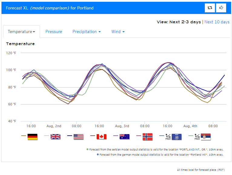
Our forecast XL product shows high confidence in the extreme temperatures with little model to model spread over the next few days.
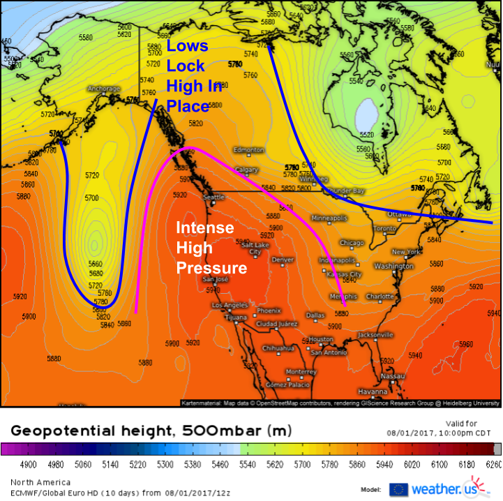
So what’s behind all this heat? It all has to do with a very strong ridge of high pressure that’s building over the West Coast.
The high pressure is being locked in place by areas of low pressure both over the Eastern Pacific, and over Eastern Canada. As a result, the ridge has nowhere to go. So why do ridges result in extreme heat? There are two main reasons for this. First, and most importantly, high pressure favors sinking air which means clouds and precipitation are hard to come by. This allows for the sun to bake the ground with nothing to intercept its energy before it can arrive at the surface. Clouds are really good at reflecting solar radiation back into space, thus preventing some of it from reaching the surface. This is why temperatures are typically cooler under cloud cover than in the sun. The sinking air also helps generate heat. As air sinks, it warms up due to a process known as adiabatic warming. Adiabatic warming occurs when an air parcel sinks through the atmosphere. As it sinks, it goes from an area of low pressure (higher in the atmosphere) to an area of higher pressure (lower in the atmosphere). As it does so, it is compressed so it can “fit” with all the other air parcels in the lower levels. The energy used to compress the air also helps to warm it. Under high pressure, there’s plenty of sinking air, and thus plenty of adiabatic warming.
The heat is expected to break by the weekend as the high pressure area weakens.
If you’re in the Pacific Northwest this week, be sure to drink plenty of water and stay inside as much as possible!
-Jack Sillin
