Mid Atlantic Nor’easter Still Very Much On Track, NYC To Escape The Worst
Hello everyone!
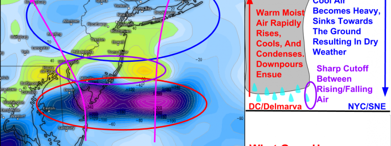
Our Mid Atlantic Nor’easter/flooding event is locked and loaded this morning. The “Jackpot” area we discussed yesterday is still on track for some amazing (and very dangerous) rainfall totals. A sharp cutoff is forecast to develop just north and west of this area, and that sharp cutoff will mean that one location could see over a half foot of rain while another location, but 100 miles away, could stay almost completely dry. So where exactly will this cutoff set up? Who’s dry and who’s not? That’s always a tough question to answer but it appears as though guidance has figured it out as our storm begins to take shape.
I’ve covered many other aspects of the storm in yesterday’s blog post. Everything there is still relevant, except for the placement of the heaviest rain. There’s no need to repeat what’s already been discussed, so this post will focus on the shift in placement of the heaviest rain and why that’s occurring.
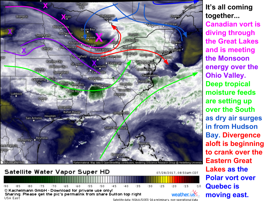
Everything is set up for a prolific heavy rain event over parts of the Mid Atlantic. Deep tropical moisture is in place to the south of the system, ready to be pulled north this evening. Our strong disturbance has traveled all the way from Northwest Canada and is now driving SE through the Great Lakes. Meanwhile, our surge of dry air is beginning to flood south into Northern New England and into the Great Lakes as well. So what’s changed from yesterday’s forecast and why?
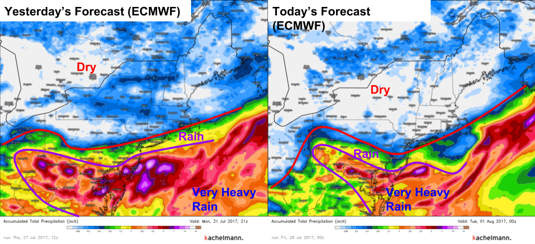
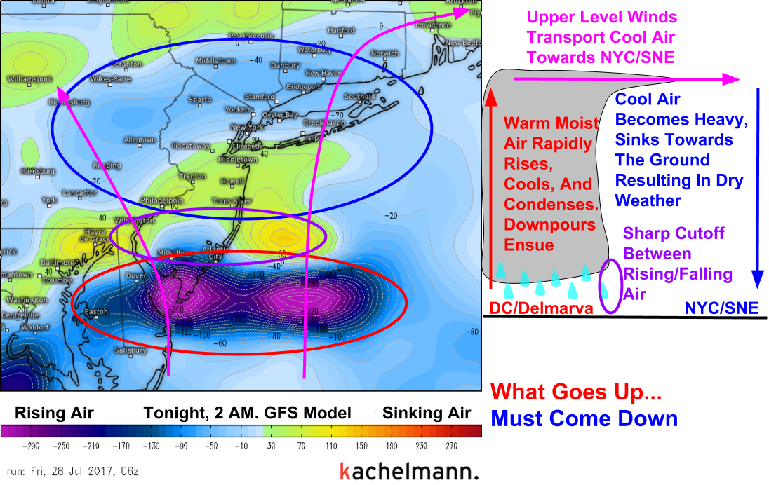
Here’s what changed. Guidance is now suggesting that NYC and the Southern New England coast could escape mostly dry. Yesterday, it seemed as though at least a moderate rainfall was in store for those areas. At the moment, I see data to back up both scenarios. The ‘room to grow’ that our disturbance has was discussed yesterday in detail. This would argue for more moisture heading NW, and thus the chance for rainfall in these areas. However, guidance may be picking up on another feature I mentioned yesterday- a surge of dry air moving south from Canada. Also, some basic physics may help to explain why NYC may struggle to see a single drop while DC racks up the rainfall totals.
So why will there be this sharp cutoff? For that we turn to basic physics. What goes up, must come down. Where exactly this gradient sets up will determine exactly who gets rain and who doesn’t. Right now, the area I highlighted yesterday, from Southern New Jersey back through Maryland, Delaware, Northern Virginia, and now back into parts of Northern West Virginia, is still on track for a dangerous flooding event. Some areas have already reported over 3″ of rain in this area with a small shower that popped up well out ahead of the main system.
I suspect a few locales will make a run at double digit rainfall totals when this is all said and done. Most, however, in this area will see between 3 and 6″ of rain. Rainfall totals will drop off rapidly to the north, and areas such as NYC could see up to as much as an inch of rain, should things drift a little bit north of the current forecast. However, I suspect that NYC has a good chance of seeing exactly zero rain from this system as strong sinking air sets up overhead. For more details about how much rain could fall at your house, check out our Forecast XL product which will show you the full range of potential outcomes in terms of rainfall at your house.
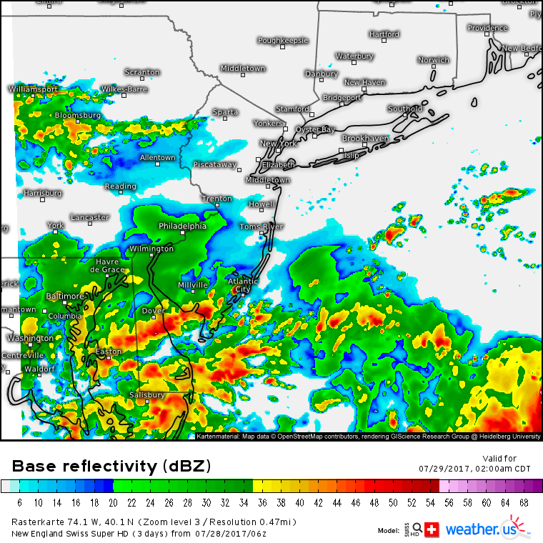
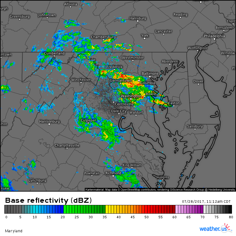
Storms are already developing and the rainfall totals are already piling up across the DC area. Remember that our storm has not even formed yet. These area just showers and storms popping up in the tropical airmass and along a front stalled near the area. This is a precursor to the main event which isn’t slated to kick off until the sun goes down tonight. Watch the whole event unfold with our HD radar and satellite products.
As always, for more info about the weather at your house, head on over to weather.us.
-Jack Sillin
