9-27-18: Weak Storm In The Southeast, Next Shot Of Cold Air Arrives In The Northern Plains
Hello everyone!
Here’s a quick roundup of what to look for in terms of weather across the lower 48 today. The two main features to watch will be a weak storm system in the southeast that will carry rain and some severe storms up into the Mid Atlantic tonight. The other feature will be a cold front dropping south over the Northern Plains, which will lack enough moisture/instability to produce thunderstorms, but will bring a nice reinforcing shot of cool air.
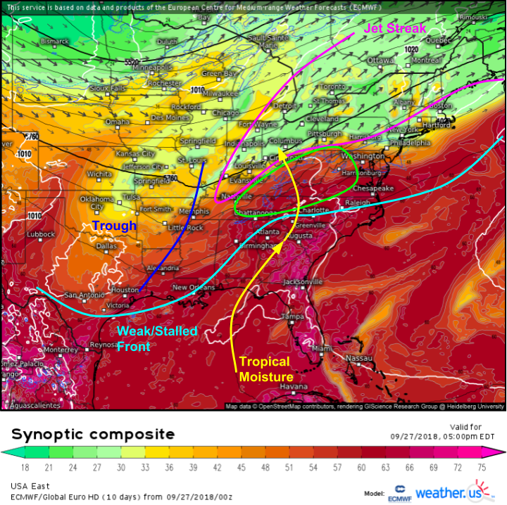
Here’s a look at the setup in the southeast this evening, forecast by the ECMWF’s synoptic composite product. Check out my video tutorial on the synoptic composite product if you’re unsure what you’re seeing here and want to learn more. A stalled/weak frontal boundary is draped across the region, with a bend in the front located near Atlanta. A strong upper level jet streak extends from Nashville through Louisville, continuing up into New England. The right entrance region of this jet is located just north of the front, and ahead of a 500mb trough. This is the perfect setup for a weak wave of low pressure to develop along the front and ride northeast.
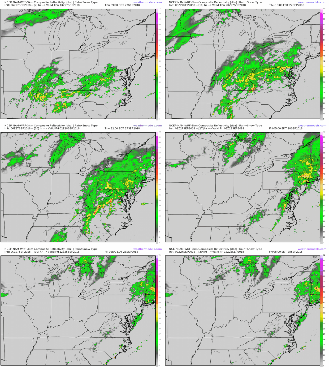
Here’s a look at what this will look like (approximately!) in terms of simulated radar. Note the broad area of steady rain that tracks from Kentucky through WV/PA/NY today/tonight. This is associated with the jet dynamics mentioned above. basically, in the entrance region of a jet streak, air parcels (theoretically imagined basketball sized chunks of air) accelerate away from themselves (i.e. some get pulled into the very fast jet and some don’t). This leaves an area of lower pressure, which air from below must rise to fill. This then leaves low pressure at the surface, which air from somewhere else (i.e. the Gulf of Mexico) then rushes in to fill. The net effect is moisture being transported into the jet entrance region, where it then gets lifted, cooled, and condensed into precip. What does this mean? Rain!
Precip along and south of the front will be more of the thunderstorm variety, with some marginally severe weather possible in SC and Eastern NC. Gusty winds will be the primary threat from these storms. Radar GIF via weathermodels.com.
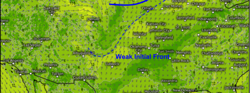
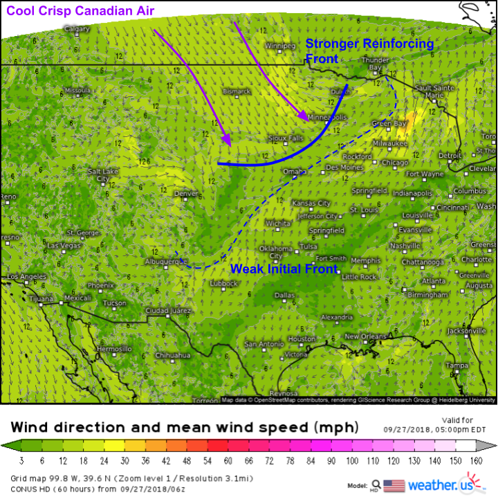
Here’s a look at that Northern Plains front, which will bring a nice reinforcing shot of Canadian air as it moves southeast today, picking up where a previous front (now stalled out) left off. Due to a lack of moisture, there won’t be much in the way of activity along this front, but the airmass refresher will be nice nonetheless!
Find forecast info specific to your town at weather.us in case you want more info than I presented here, or if I didn’t mention your area.
-Jack


