5/16 Severe Weather Discussion
Hello everyone!
There are several areas to watch for severe weather this afternoon and evening as a multi-day severe weather event gets underway. For details on the large scale setup, please check out this post. Here, I will outline some of the more specific areas to watch today and how to watch for observational clues during the midday hours that will assist in anticipating severe weather later in the day.
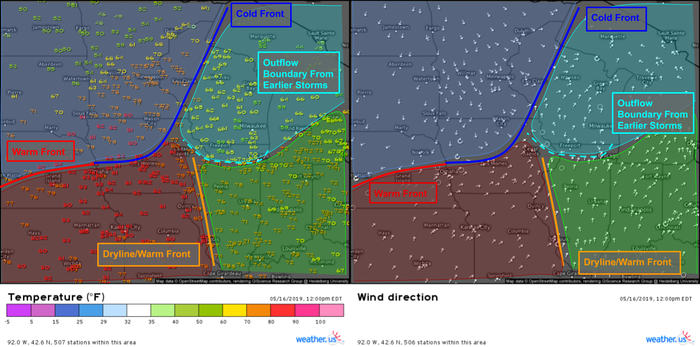
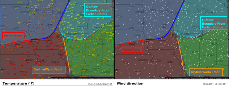
While radar and satellite data provide invaluable tools to analyze severe thunderstorms, it’s often most valuable to start with good old fashioned weather station observations which paint an excellent picture of what airmasses are present over which areas. Here I’ve used temperature and wind direction data (while consulting dew point data on the side) to categorize the airmasses over the Midwest into four categories: warm/moist (green), cool/moist (light blue), cool/dry (dark blue), and warm/dry (dark red). Thunderstorms like warm air and moisture, and also like boundaries. Instantly this helps narrow our focus for severe weather to parts of Iowa, Illinois, Indiana, Michigan, and Ohio. Because the warm/dry airmass isn’t really all that dry (dew points in the 50’s as opposed to 20’s west of the Texas dryline), additional storms are possible along the warm front in parts of Nebraska.
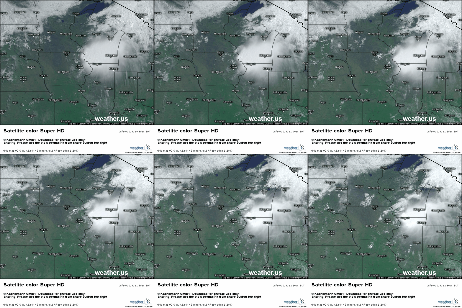
Satellite imagery shows the ongoing storm activity over northern Illinois well, and offers some additional clues about the potential for severe weather later on. Low level clouds can be seen moving south near Cedar Rapids Iowa as the thunderstorms’ rain cooled outflow hits the ground and spreads out. This will be a boundary to watch later in the day. Farther south, mostly sunny skies will allow for destabilization of the atmosphere, which will provide fuel for thunderstorms developing later on. Finally, a lone thunderstorm can be seen popping up west of Urbana Illinois, indicating that the environment along/east of the weak dryline/warm front boundary is ripe for further development. If that storm can persist, it may even be a direct severe weather threat over the next few hours.
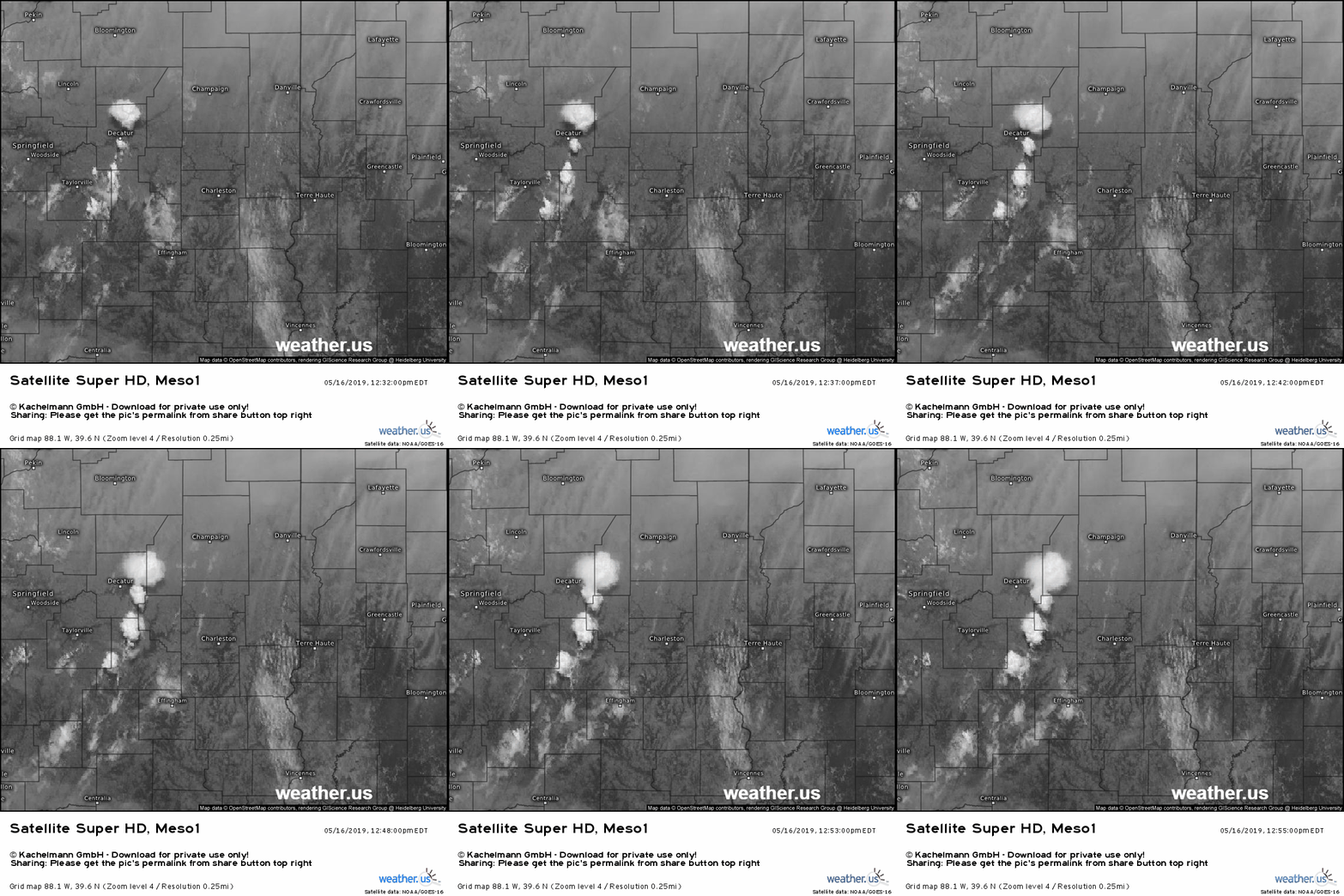
Here’s a closer look at those developing Illinois storms using GOES-East 1-minute visible satellite imagery. In addition to the developing cells, you can also see wind shear (change in wind speed/direction with height) in this loop. Note the low level clouds near Terre Haute moving to the north while the upper level cirrus clouds are moving towards the SE. This suggests veering winds with height, another important ingredient for severe storms. Use HD radar imagery to track these storms as they continue to develop over the next few hours.
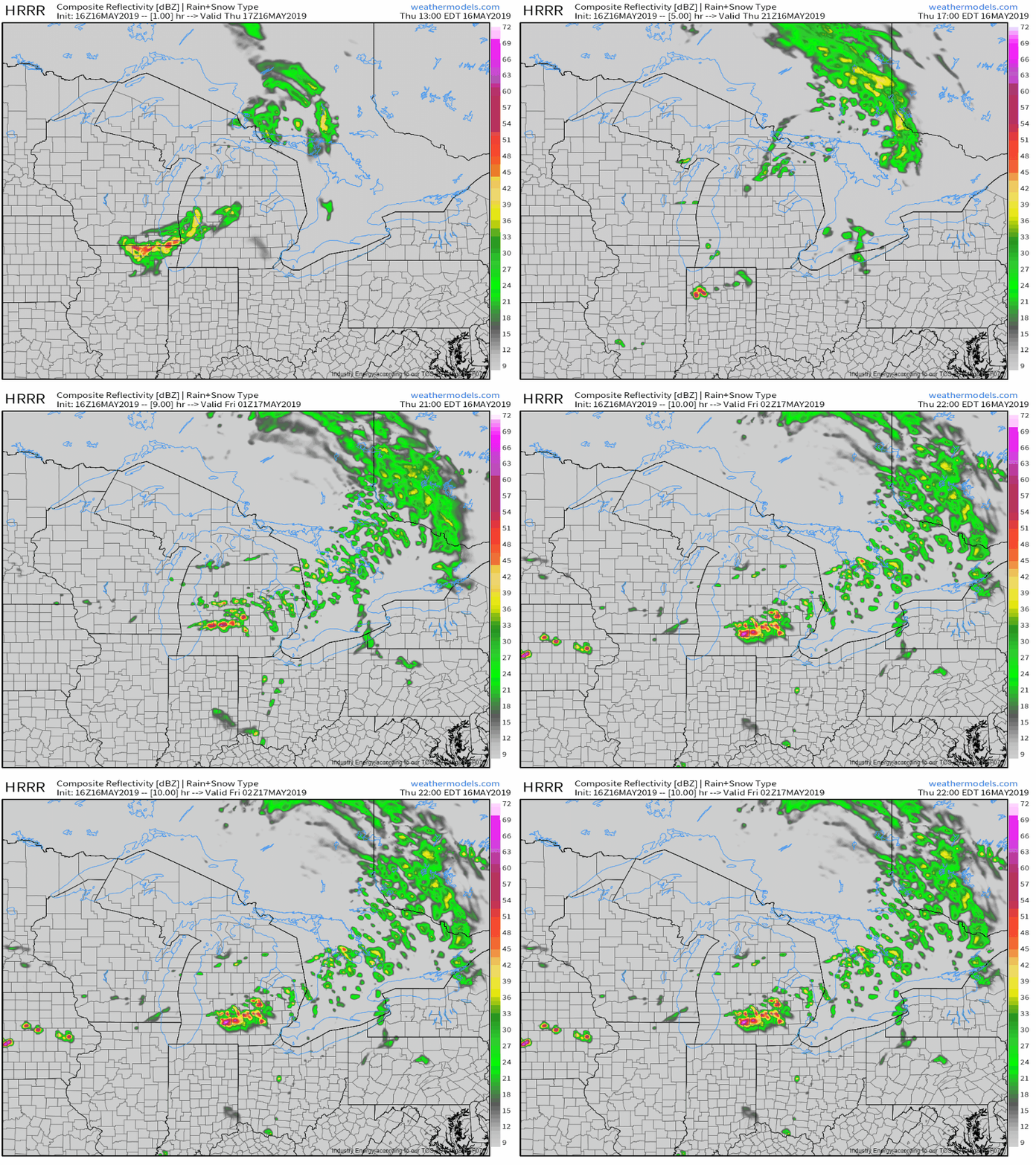
As the afternoon wears on, we’ll be watching for a few things to happen. The simulated radar imagery above from the HRRR provides a rough outline of what to expect, but most of the processes can be inferred from the observations. First, the current thunderstorms near Chicago may weaken as they move south. Given the environment in front of these storms, they may persist for a while in spite of what the model suggests. Second, though the model misses them entirely, the storms developing in Illinois will continue to move east through a warm moist airmass, and will likely continue to strengthen given the favorable environment. These storms will pose a damaging wind threat, a hail threat, and could even produce a tornado. Third, more storms could develop farther west in IA along the warm front. These storms will be primarily damaging wind and large hail threats given the slightly drier environment. Finally, a line of storms is likely to form later on tonight across parts of Michigan. Damaging winds will be the main threat with those storms as they sag south during the overnight hours.
The focus will shift towards the Plains tomorrow, where supercells are likely to form along the warm front in Nebraska and along the dryline in Texas. I will have more info on that setup later on.
-Jack
