4/13/19 Severe Weather Live Blog
Hello everyone!
Today will be an extremely active day for severe weather across parts of the South from Texas through Louisiana into parts of Mississippi. Instead of the traditional overview blog, I wanted to switch things up a little bit today by working off a ‘live blog’ where I’ll post updates through the day. Neither this blog nor our twitter feed @WeatherdotUS is meant to serve as a replacement for official warning information from your local NWS office and other local emergency management officials. Make sure you have a way of getting that information before storms arrive in your area!
12:00 PM CDT
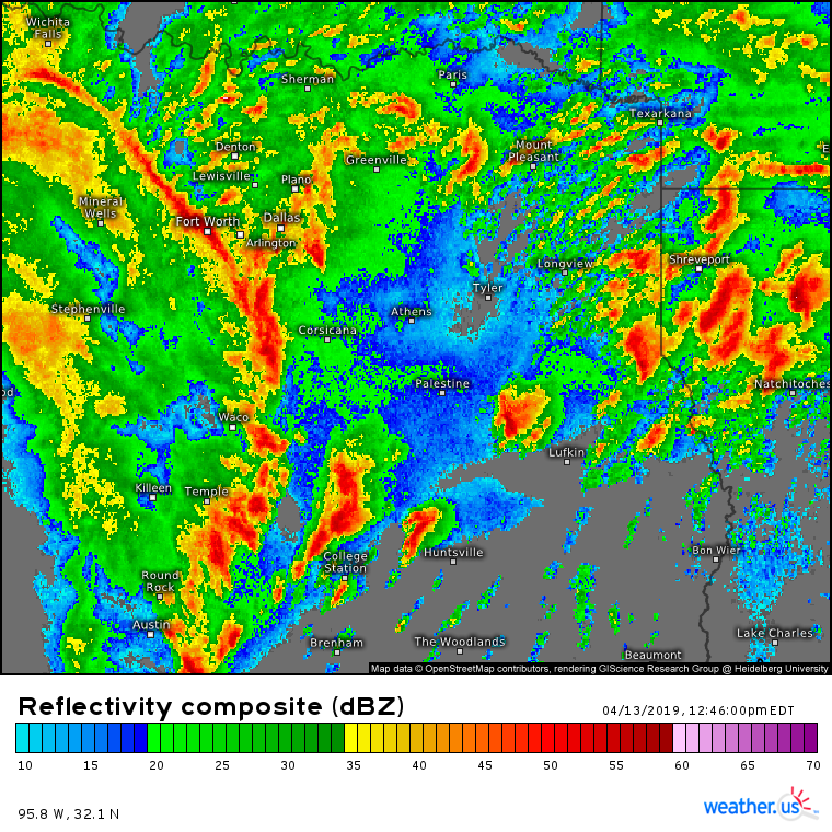
Over the past hour, the storm along the warm front in Texas that was highlighted for tornado potential in my last update did indeed produce a long-track strong tornado. That tornado continues to move NE just north of College Station. Several other cells are also developing in this area, as the composite radar image above highlights. So what’s going on here and are these storms likely to continue producing dangerous tornadoes?
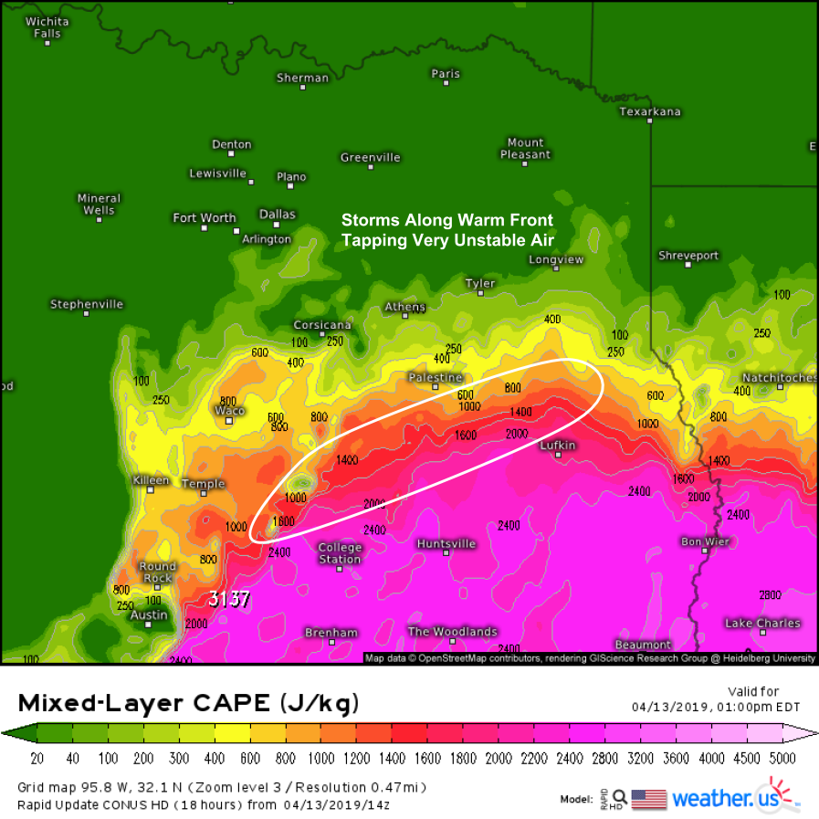
Here’s the HRRR’s analysis of the area as of 12:00 PM CDT. You can actually see the College Station storm show up as an area of locally small CAPE near the west end of the white ellipse I’ve drawn. The environment this storm is in will continue to be exceedingly favorable for tornadoes over the coming few hours as the storm moves NE. The storm is moving along the warm front, which gives it two distinct advantages. First, it can tap into the deep instability just south of the front. Any air parcels the storm is ingesting come from the south, and they are very unstable.
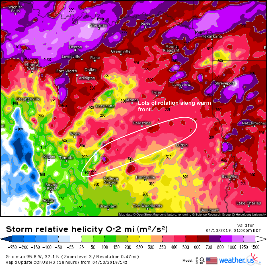
Second, there’s a lot of rotational energy along the front, which is what this map shows. The storms will be able to continue harnessing that rotational energy, and using it to power their rotating updrafts, and their tornadoes. Any storms that develop in this area over the next few hours will pose a significant tornado threat!
10:30 AM CDT
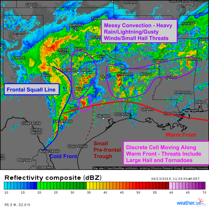
Here’s a look at the big picture on radar as of 10:20 AM CDT. Lots of storms have gone up ahead of the warm front in an environment characterized by abundant elevated instability. These storms are producing gusty winds, small hail generally less than 1″ in diameter, and very heavy rains. In fact, a flash flood warning has been issued for parts of far E TX near Shreveport LA. Due to the elevated nature of these storms, they don’t pose as much of a tornado threat. Farther south, the most dangerous storm is likely located NE of Austin. It is a discrete cell, riding along the warm front, and has access to lots of instability given that it isn’t competing with lots of other storms nearby. Thankfully, the cell hasn’t been able to consolidate enough yet to pose an imminent tornado threat. Farther west, the squall line located along the cold front continues to march eastward with gusty sub-severe winds and small hail.
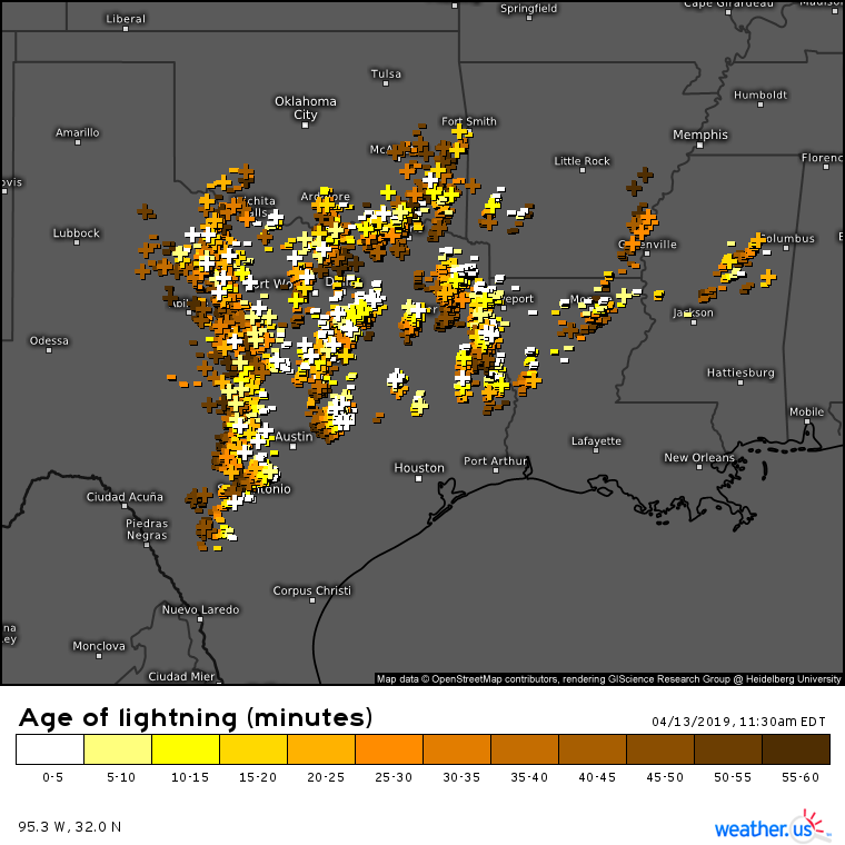
Keep in mind that tornadoes, strong winds, and hail aren’t the only threats associated with these storms. Our lightning analysis product shows lots of strikes associated with non-severe storms. If you’re interested in any particular strike, head on over to weather.us, click the map to zoom into county level (or level 3 on custom zoom) then click an individual strike icon for info on that specific strike.
The latest high resolution model analysis (0 hour forecast via HRRR) shows a deep reservoir of unstable air to the south of the surface warm front. That front will be lifting farther north over the next few hours which will set the stage for the major tornado risk over northern LA.
9:30 AM CDT
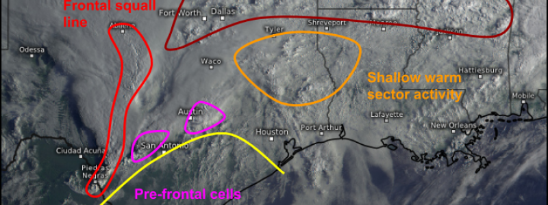
Here’s a regional look at GOES-East satellite imagery as of 8:30 AM CDT. Storms are already well underway in several areas, and are being fueled by several different mechanisms. So far, the mid level warm front has produced some severe hail and wind activity, while the cells ahead of the front in Texas have been tornado warned at times. Shallow shower and thunderstorm activity in the warm sector is so far not posing a severe threat, but it will impact the environment for severe storms later in the day. The best chance for severe weather this morning will be in Texas as developing sunshine works to improve instability ahead of the cold front.
Click here for the latest visible satellite imagery over Texas.
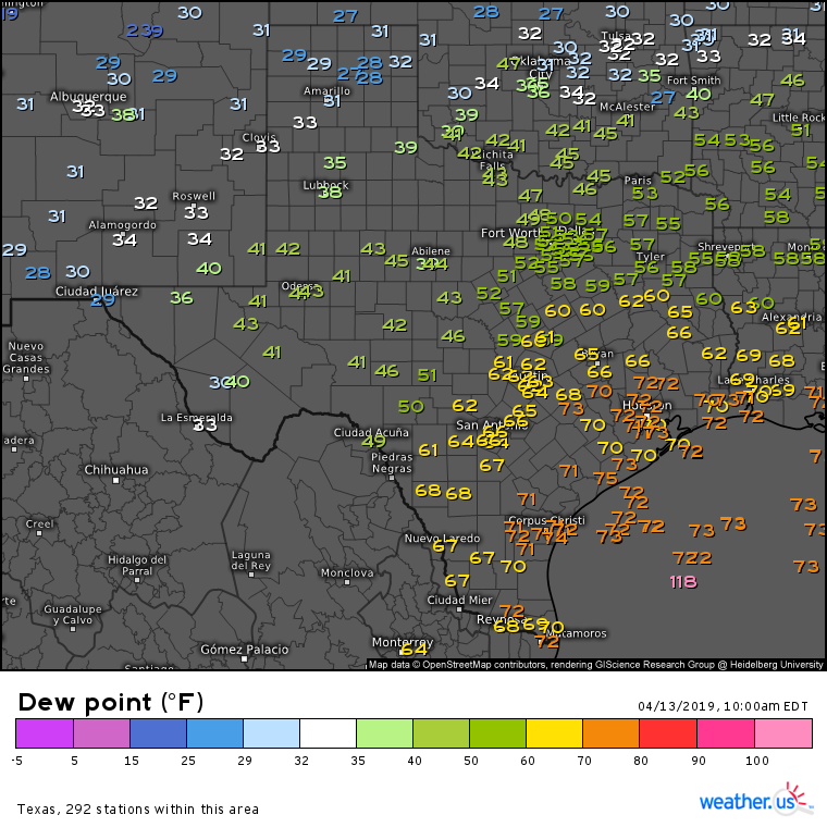
Storms in Texas are working in a very favorable environment this morning with dew points surging into the upper 60’s and low 70’s. This will give developing storms plenty of moisture to work with, and help drop cloud bases close enough to the ground that we have to worry about tornadoes.
Click here for the latest dew point observations in Texas.
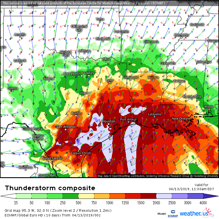
The ECMWF’s thunderstorm composite plot is another great way to visualize the storm environment, including winds through all levels of the atmosphere. Note the strongly veering winds (becoming more westerly with height) across all of SE TX and LA. These wind profiles are already supporting strongly rotating storms! For more on how to use the thunderstorm composite map, check out this tutorial video.
More updates will be posted here through the day.
-Jack
