10-2-18 Morning Roundup- A Busy Day Of Fall Weather Today Part One: Northeast
Hello everyone!
There’s plenty of weather to discuss today as an active fall pattern gets underway. I’ll briefly go over each of the expected areas of active weather, and will provide plenty of links to the tools we have at weather.us and weathermodels.com to get more information specific to the system that might be affecting you. This post will focus on severe storms and flash flooding in the Northeast, while my next post will briefly discuss heavy rains and mountain snow in the West.
Heavy Rain And Severe Weather In The Northeast
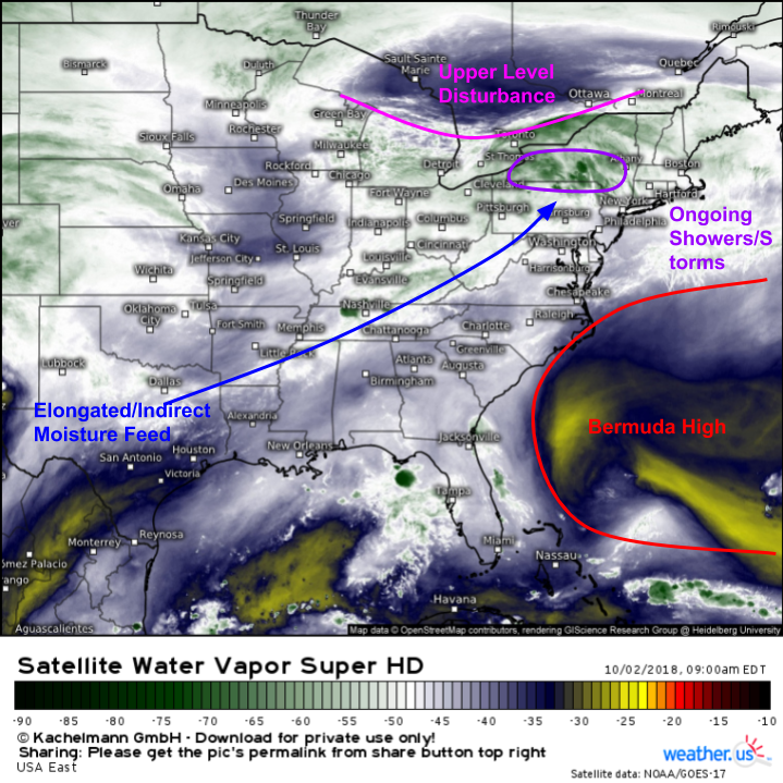
Here’s a look at the overall pattern this morning in the east. A strong Bermuda/Subtropical high extends from the Western Atlantic through the Southeast (I marked the western edge of the upper level high visible on WV imagery, but analysis of mid level maps shows this high extending much farther west). This is leading to an elongated/indirect moisture feed from Texas, as opposed to a direct tap to the Gulf of Mexico. However, TD Rosa is located in the Desert Southwest, so what would usually be a dry tap now has tropical moisture. While it’s not as good for heavy rain as a direct line to the GOM, it will certainly suffice for today. Meanwhile closer to home, the upper level disturbance responsible for today’s storms is clearly visible over Ontario.
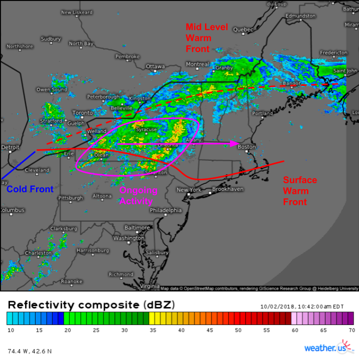
Current radar imagery shows shower and thunderstorm activity ongoing near a surface warm front (which you can see clearly on surface observation data, both winds and temps). Lighter/steadier shower activity is noted along a mid level warm front from Lake Ontario up through Northern New England. Keep an eye on the SD radar composite throughout the day to get a general sense of how storms are evolving on the regional scale, then click on an individual radar site (yellow circles on the SD map) to take a closer look at individual cells on a more local level. Click any of our maps to zoom in for a closer look, and use the refresh button at the top left of the map to get the latest data.
GOES visible satellite imagery paints a similar picture as WV/radar with regards to the ongoing activity across Central NY, but adds a helpful tidbit of information regarding conditions farther south. Note the breaks in the cloud cover across OH-PA and points south. These clear skies will help destabilize the atmosphere for thunderstorms later on today. The more sunshine you see, the stronger your storms could be!
The ECMWF’s thunderstorm composite map ties this nicely together, showing the area of best instability from Northern PA west to OH, and south into the Northern Mid Atlantic. Decent mid level winds (green/red arrows) will provide some dynamical support for strong storms ahead of the cold front this afternoon. Note the greater turning of winds with heigh (S/SE surface, SW mid level, W upper level) in the SE NY/CT region, right on the boundary between strong and weak instability. This could provide just enough of a boost for storms to rotate, with a small but nonzero tornado threat. For the rest of the severe weather area of interest, strong winds will be the primary concern.
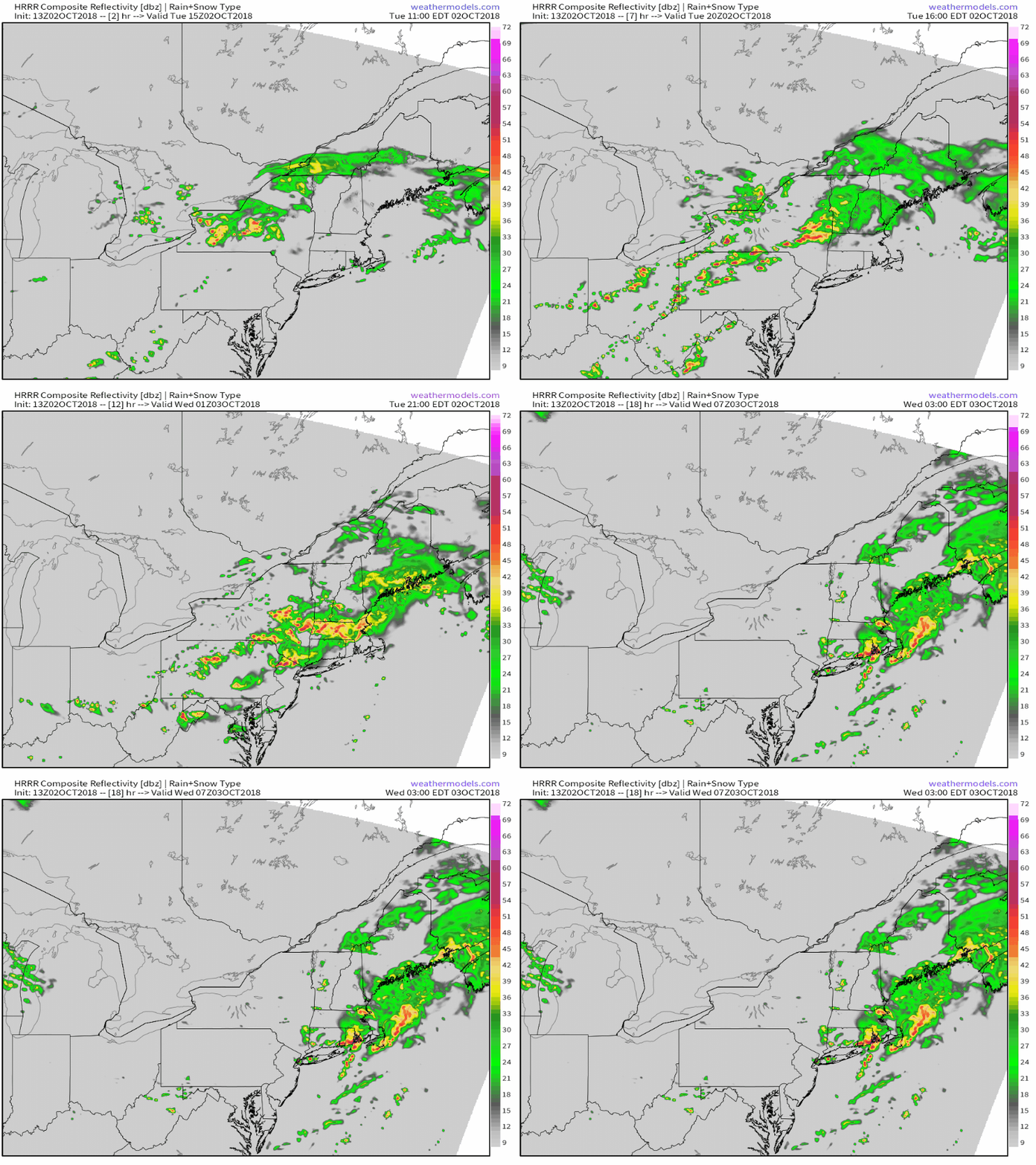
The HRRR’s simulated radar animation via weathermodels.com gives a good general sense of how storms might evolve today. Note the uptick in activity along the cold front in OH/PA early this afternoon, with activity sweeping towards the coast and weakening tonight.
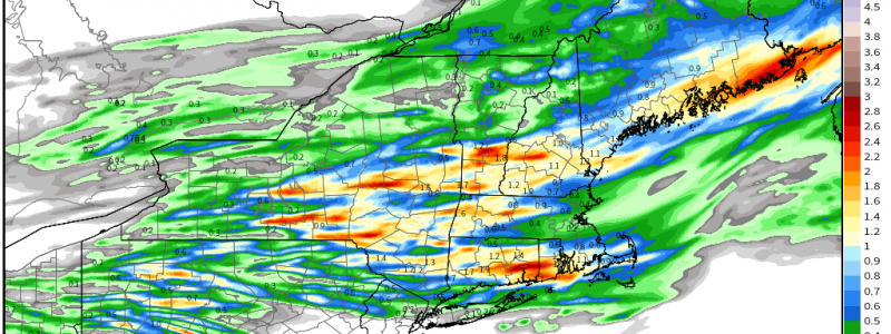
Here’s a look at the HRRR’s forecast for total precip via weathermodels.com. In addition to the severe weather threat across OH/PA/Southern NY, there will be a flash flooding threat with this system. That threat will be located farther north, just north of the surface warm front where “training” of storms is most likely. Note the wide swaths of >1″ of rain forecast today, with localized pockets up to 3″. Wherever these pockets set up, watch for rapid rises in small streams and ponding on roads. Thankfully this system will be fast moving so widespread/major flooding is not anticipated.
-Jack


