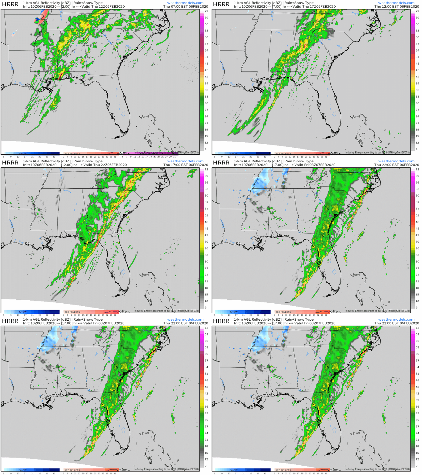
Intense Squall Line Expected To Move Through The Southeast Today
Hello everyone!
Today will feature the development of an intense squall line in the Southeast as the storm we’ve been following all week begins its final departure. Storms are already ongoing this morning across parts of Mississippi, Alabama, and Georgia. As the surface low deepens and moves northeast, the cold front producing these storms will resume its eastward journey through a warm/moist airmass located over SE AL, GA, SC, and FL. The front’s movement through this unstable airmass will continue to produce severe thunderstorms today.
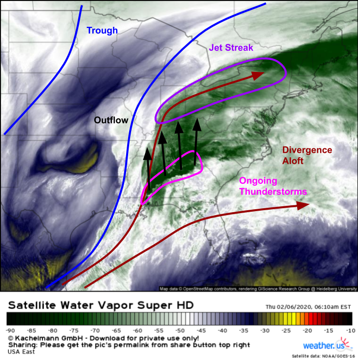
After a quick look at GOES-East WV imagery, it’s pretty evident why we’re expecting such intense storms today. A strong trough is moving east through the Plains, which means there will be plenty of large-scale upward motion east of the Mississippi. One source of upward motion comes from strong divergence aloft, which must produce upward motion as air from lower in the atmosphere rises to fill the “gap” left in the upper levels by divergent flow. That divergence also helps vent “exhaust” from thunderstorms (in the form of warm upper level outflow) away from the storms so they’re able to persist. That outflow is racing northward into a strong jet streak located over the upper Ohio Valley. Because that jet’s strength is determined by the temperature gradient in its surrounding area, the jet will strengthen as the warm air from thunderstorms races north. In response to the strengthening of the upper level jet streak, the low level jet will strengthen over the Southeast over the course of the day today.
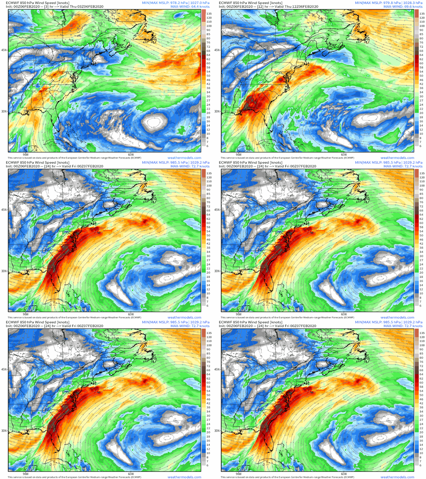
This animation shows strengthening winds at 850mb (~5,000ft) over the course of the day today in response to the dynamical process described above (thunderstorm outflow -> stronger thermal gradient -> stronger jet streak -> LLJ response). With such strong winds (>75mph) located just above the surface, it won’t take much vertical motion associated with the thunderstorm circulations for damaging winds to make it to the surface.
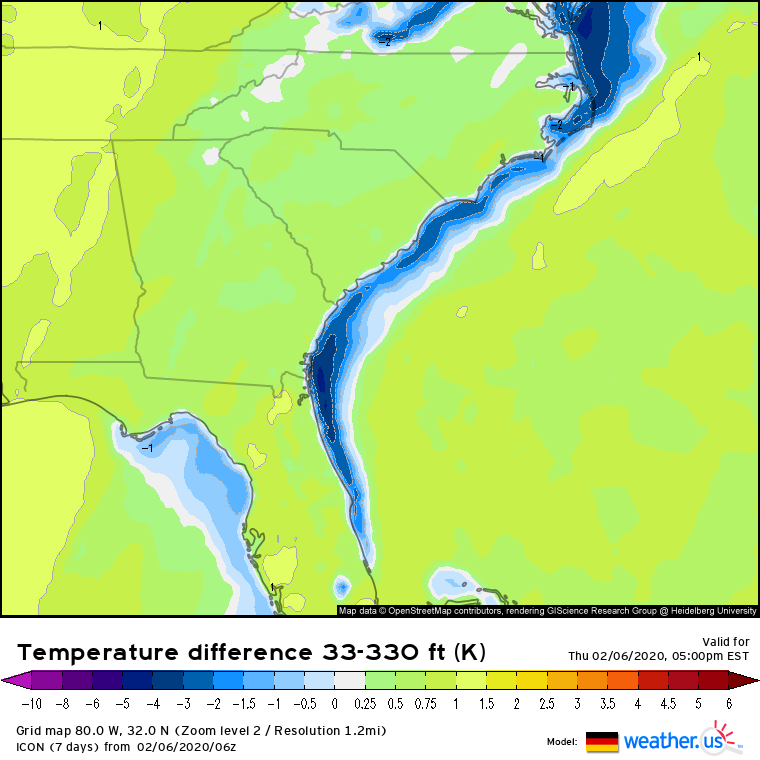
One key factor that determines the extent to which strong winds aloft can mix down to the surface is the strength of the vertical temperature gradient in the lowest few hundred feet of the atmosphere. If temperatures increase with height (i.e. the temperature at 330ft is greater than the temperature at 33ft, and thus the difference between them is negative), that layer of the atmosphere is considered stable. It’s relatively hard to mix strong wind gusts through a stable layer, so areas in the blue on the map above are generally at a lower risk of severe wind gusts. This analysis is helpful for putting a northern limit on the extent of today’s severe threat, which will likely remain fairly minimal north of the NC/VA border (with the exception of far SE VA).
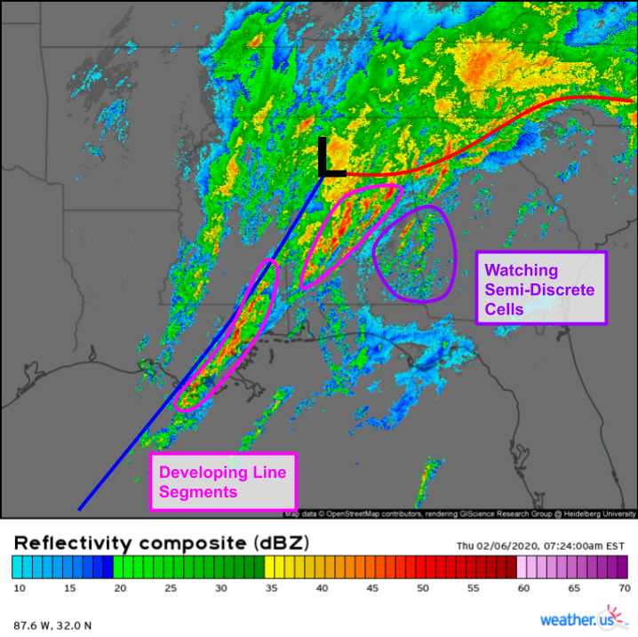
A quick look at composite radar imagery this morning shows plenty of storms ongoing across the Southeast as our surface low develops in northern Alabama. The storms are mostly organized in line segments along or just ahead of the cold front, though some semi-discrete cells have popped up near the southern AL/GA border. These discrete cells, should they continue to intensify, will pose a tornado threat while the line will primarily produce damaging straight-line winds (embedded tornadoes are also possible).
By this evening, here’s what the environment for severe thunderstorms will look like, as forecast by the ECMWF. Our strong jet-level divergence will be even stronger as the jet over southeastern Canada develops in response to the thunderstorm outflow. The cold front will continue moving east/southeast and will be oriented roughly NE/SW especially later in the day. This is roughly parallel to strong winds throughout the entire atmosphere from the low level jet we discussed above to the upper level jet. Because the shear is unidirectional and winds at all levels are oriented parallel to the cold front, I’d expect a mostly linear storm mode to emerge by this evening.
Even though discrete cells usually produce the strongest and longest-lived tornadoes, circulations embedded within the line itself can also produce damaging tornadoes. These embedded circulations are perhaps even more dangerous than their discrete counterparts because they develop extremely quickly (sometimes between radar scans) so you might not have much warning before they arrive. Make sure you have several ways of receiving warnings if you’re in the Southeast today.
Here’s a quick look at the HRRR’s forecast for thunderstorm activity today. Of course we shouldn’t take it too literally, but I think it does a decent job highlighting the gradual transition from disorganized line segments/semi discrete cells this morning to a more organized squall line this evening.
Keep up with the storms using our HD radar and lightning analysis tools at weather.us, and of course always stay up-to-date with watches/warnings issued for your area.
-Jack
