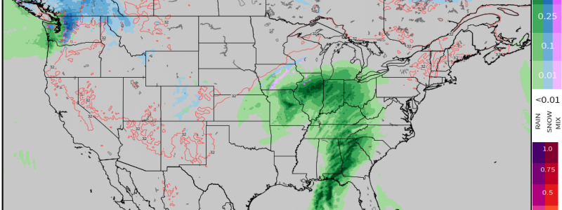
Your Post-Thanksgiving Travel Outlook
Ah, the start of the holiday season. Arguably the best time of the year, isn’t it?
While the weather doesn’t necessarily impact the Thanksgiving meal too much (as this is generally an indoor event for most), it has the potential to impact travel to and from those holiday meet-ups.
Armando covered the forecast through Thanksgiving Day in his blog yesterday, so today we’ll look at what the journey home may hold for those traveling around the country.
There are two main “weathermakers” we’ll need to be aware of as we enter the weekend.
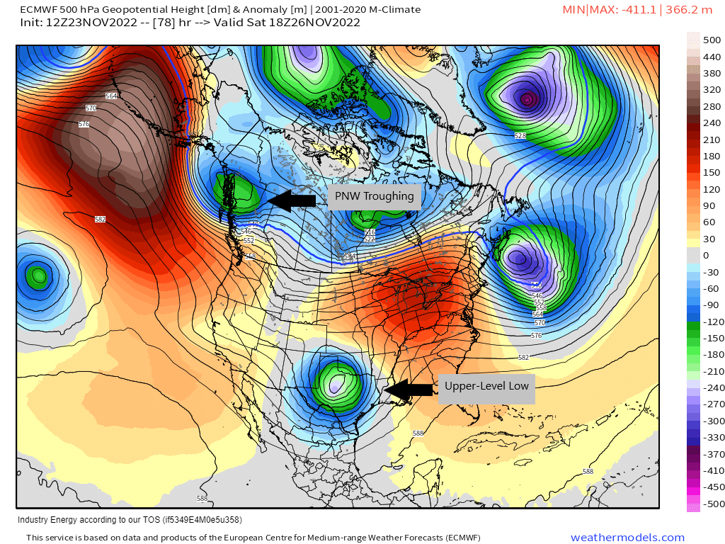
These are: incoming Pacific Northwest troughing and an upper-level low over the southern US.
Let’s take a look at the weekend weather by region.
Northwest
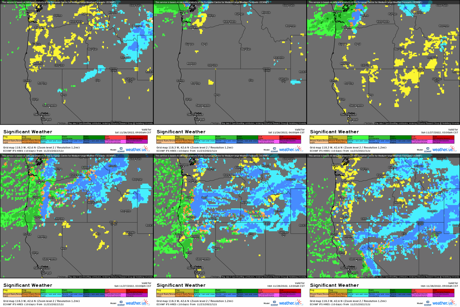
The trough I indicated on the first graphic will be dropping into place over the Northwest by Saturday afternoon. However, a shortwave will precede it, bring a shot of rain and elevation snow to the area Friday afternoon as well.
Rain and (some heavy) mountain snow will no doubt cause travel headaches, so build in a little extra time into your journey home.
This trough will shift rain and snow southward toward parts of the Southwest as the weekend wears on, so be aware of that as well if you choose to return home on Sunday instead.
If you’re traveling, be sure keep up to date with the latest conditions so you can plan your drive in the safest way.
Southwest

Outside of the upper-level low, which we’ll get to in a minute, ridging in place early in the weekend will keep this region relatively sunny and warmer than average.
A shift will occur later in the weekend, however, as the trough we talked about earlier begins to drop south. Travel conditions may become increasingly tricky heading into Sunday evening – but mostly over the northern part of this region. Conditions will then continue to go downhill as the work week begins.
Eastern Half of the US
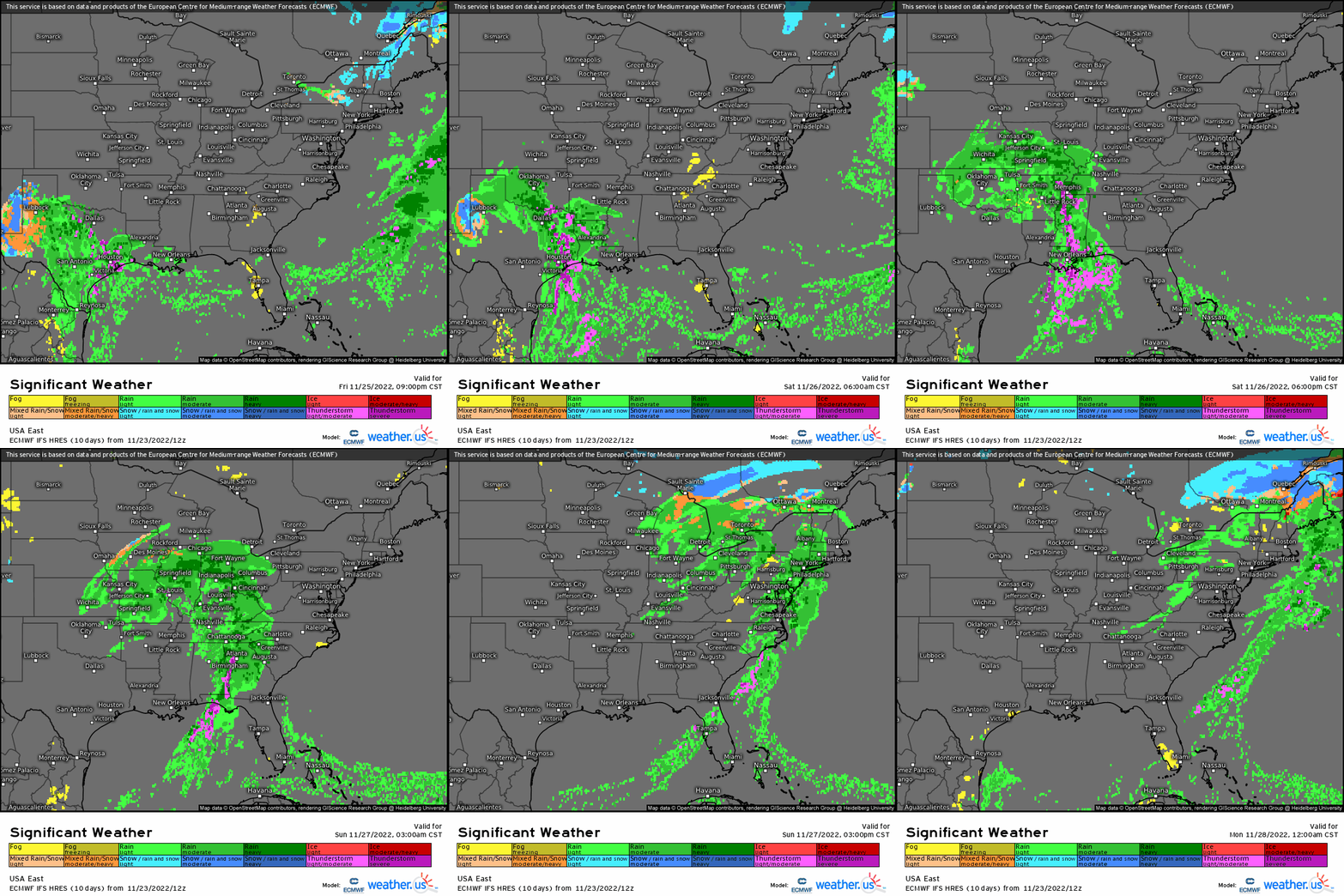
Normally I wouldn’t lump the entire Eastern US together in a forecast since conditions can vary quite significantly from state to state – or even within the borders of a single state. However, we have a large upper-level low that will be impacting conditions for just about everyone in this part of the country through the weekend.
On the back side of this feature late Thursday through early Saturday, cold air will seep into the higher elevations of the Southern High Plains. Rain will turn to some snow.
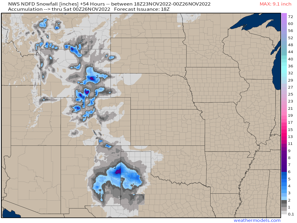
While this doesn’t appear to be a crippling snow storm, it will likely cause travel issues in Northwestern Texas and eastern New Mexico. Plan accordingly if you’re driving through here.
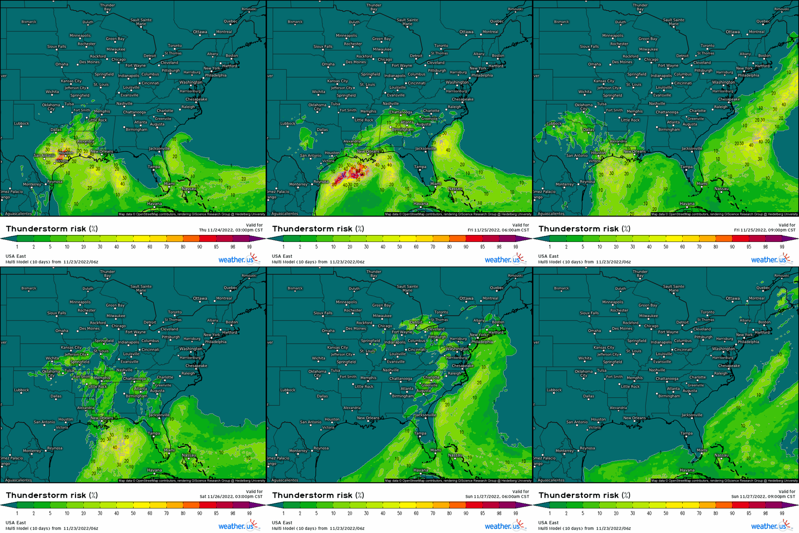
Aside from a localized marginal risk for severe weather for Southeastern Texas on Thursday evening, more widespread severe weather does not seem likely from this system as moisture quality and instability won’t be the best.
There is a small chance of very localized severe weather in far south Louisiana and Mississippi Friday evening, but it seems conditional at the moment.
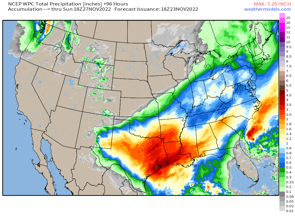
The biggest impact from our upper-level low will be the overall rainfall. Convective storms with access to better moisture could bring decent downpours. Flash flooding is a possibility – specifically in the Mid-South.
If you’re traveling here, be aware of current conditions and have alternate routes in mind if any roadways flood. Also, use caution driving in downpours and pull over if visibility becomes limited.
Our upper-level low will escape northeastward as the weekend progresses. Due to the lack of an influx of cold air, snow will not be an issue. This forecast is for all rain through Sunday evening.
By Monday morning, a changeover to snow could be seen in the far northern reaches of the Northeast, but that’ll be more of a problem for the start of the work week than for holiday travel.
All of us here at weather.us/weathermodels.com will be taking time off Thursday through Monday to spend with our families for the holiday. Expect your regular weather info to start flowing again bright and early Monday morning.
From our families to yours – have a wonderful Thanksgiving!


