Your New Year’s Holiday Weekend Outlook
Hello everyone, and happy New Year! Hopefully everyone had a very merry and wonderful Christmas!
I do want to first by stating that between this holiday weekend, and last weekend, it’s going to be literally a huge difference in terms of sensible impacts all around!
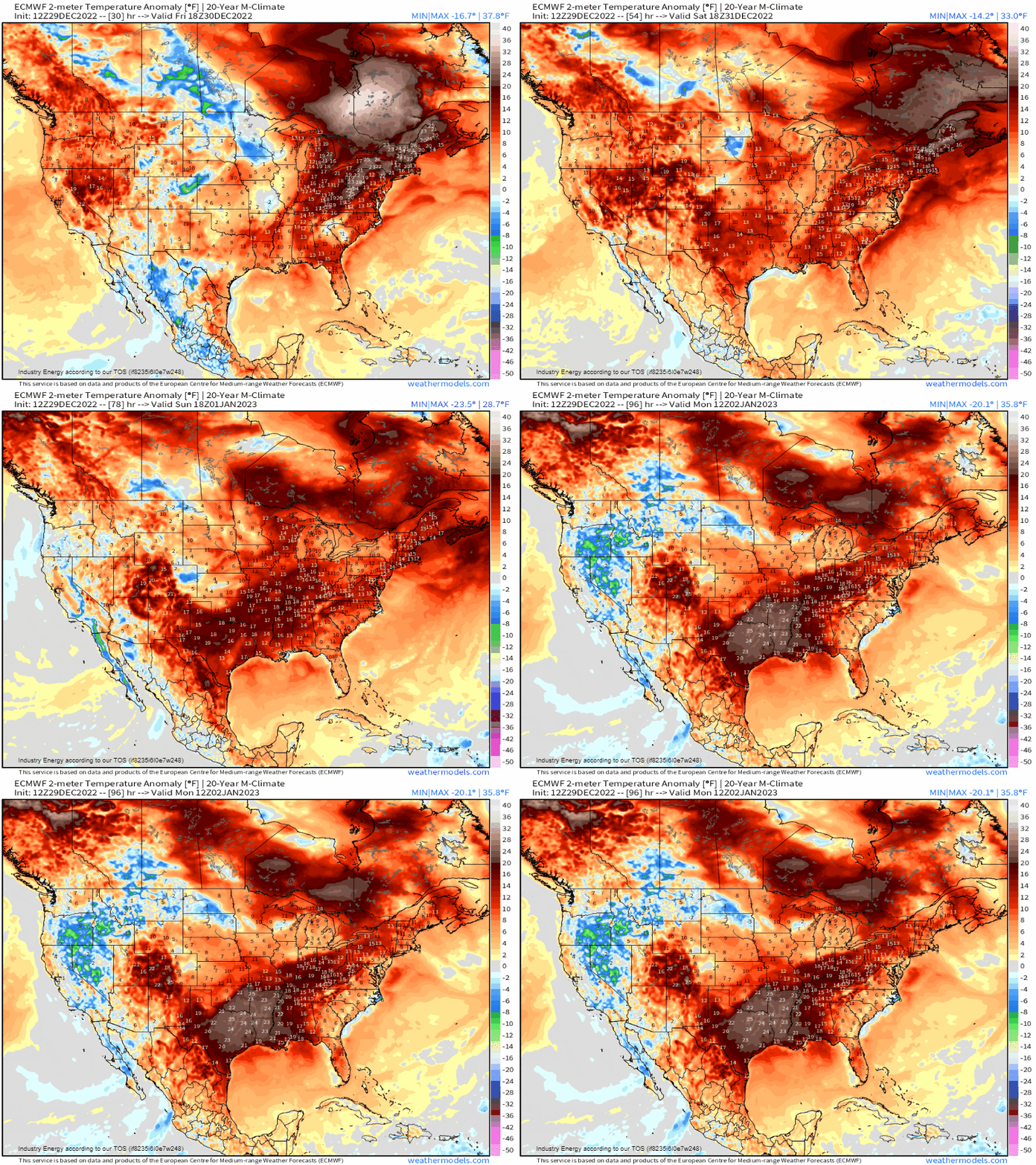
First, lets start by showing the complete flip in temperatures, from where we saw wind chills 30 to as much as 50 degrees below zero, subzero temperatures along with single digits and into the teens for highs, and all around over 20-30 degrees below average on a widespread basis for consecutive days! A ridiculous amount transpired with a powerful arctic front, but do I have wonderful news for you! Instead of widespread below average, how about a flip to widespread above average. We’re going to see from coast-to-coast, anywhere from 5 to near 30 degrees above average through Sunday!
The reason why we’re seeing such a turn-around, is because the polar jet stream lifts northward, and the pacific jet stream “crashes” into the West Coast yielding an active weather pattern while scouring out the cold as it “floods” the nation with maritime-induced air. Notice at 250mb how we see the entire jet stream lift northward, indicative of mid-upper level ridging expanding across the eastern 2/3rds, while there is a large dip out West. The latter is indicative of a trough, with a persistence to it.

In a nutshell, we’re going to be primarily concerned with two main weather events across the U.S.;
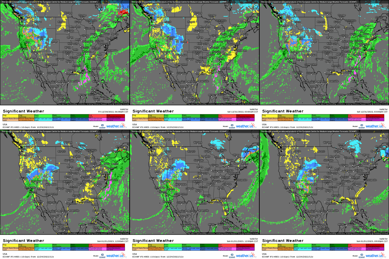
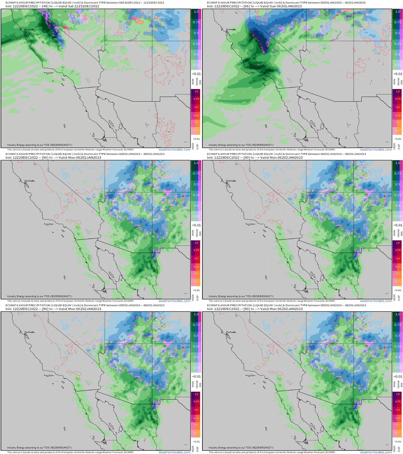
- The active weather pattern across the West Coast as the Pacific jet stream extends, thereby causing continuous amount of moisture to fall across the Sierra’s, Cascades, Intermountain West, Front range, and the Great Basin.
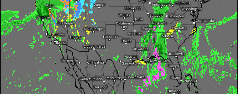
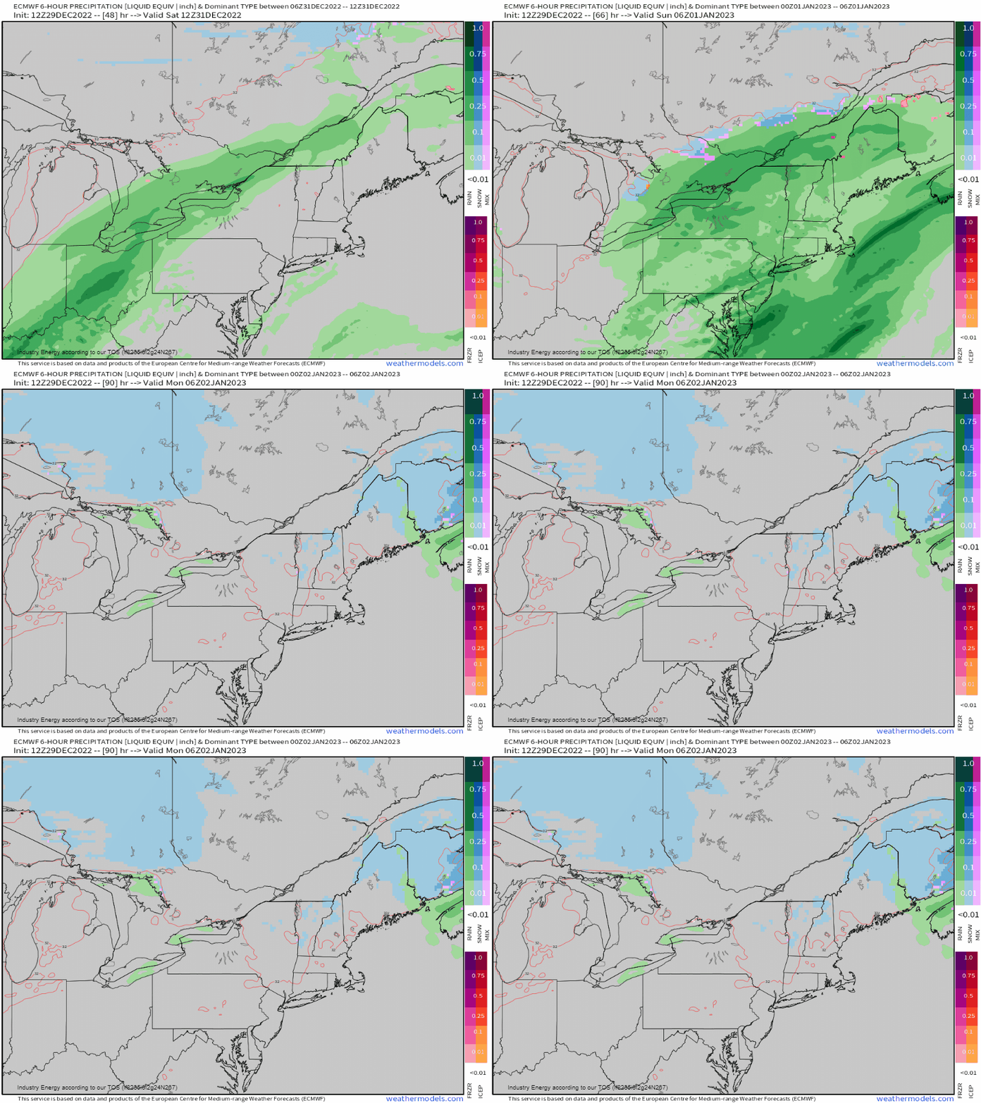
- A developing frontal system that forms from the Gulf and rides up the boundary causing heavy rain along the Southeast, Mid-Atlantic, and into the Northeast.
Northwest Region:
The Pacific NW will see a break in the heavy precipitation by Saturday, as high pressure shifts into the region. Heavy mountain snow remains confined further south in Nevada, Utah, and the Sierra’s. Temperatures will remain above average to near average with high’s in the 30’s and 40’s closer to the coast.

West Coast:
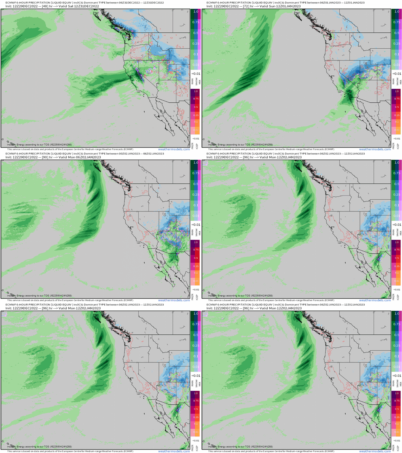
As an atmospheric river establishes bringing an onslaught of heavy precipitation out West, over a foot of snow is likely in mountainous regions with heavy rainfall in lower elevations. In terms of liquid equivalent (i.e. so it’s all in liquid form), this amounts to 1-2” of rainfall. This again extends across California across the higher terrain, along with Utah, Nevada, and into the Flagstaff, Arizona along with the Front Range of Colorado.

Southwest:
High pressure will serve to keep dry conditions along with a fair amount of sunshine. By the holiday, a disturbance will look to approach from the west, bringing with it heavy rainfall to Arizona and western New Mexico, and into Baja, CA. This will amount to anywhere from 0.5 to 1.00″ of rain through Monday with widespread temperatures in the 40’s, 50’s, and even 60’s further south.
Midwest:
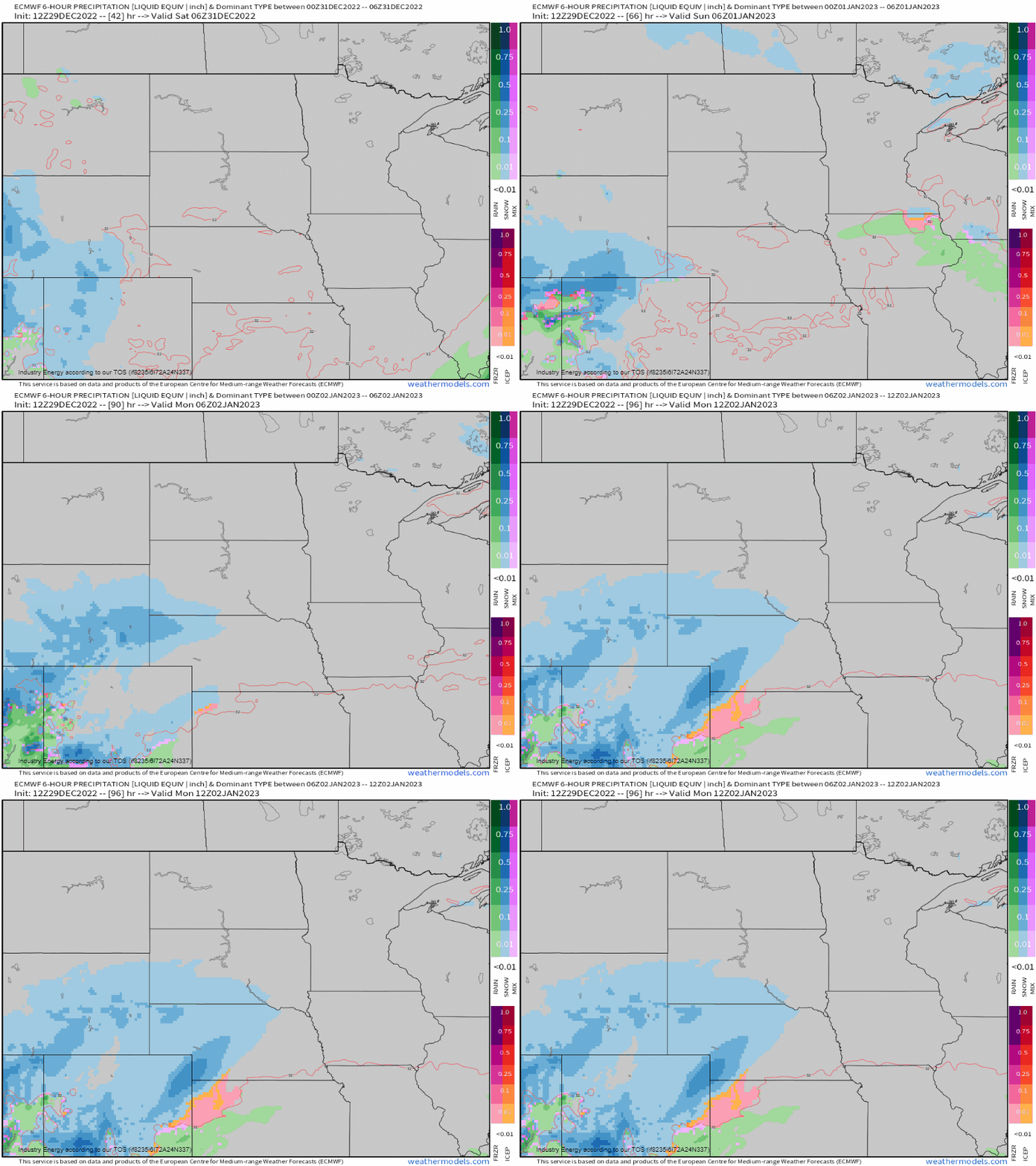
This region will stay relatively quiet outside of a weak wave of low pressure with light snow that gets brought into Minnesota Saturday. Elsewhere, pleasant conditions prevail with sunshine and clouds, along with average to even slightly above average temperatures by Sunday! The next big system to watch will be from the Intermountain West, but won’t be a concern until next week.
Deep South:
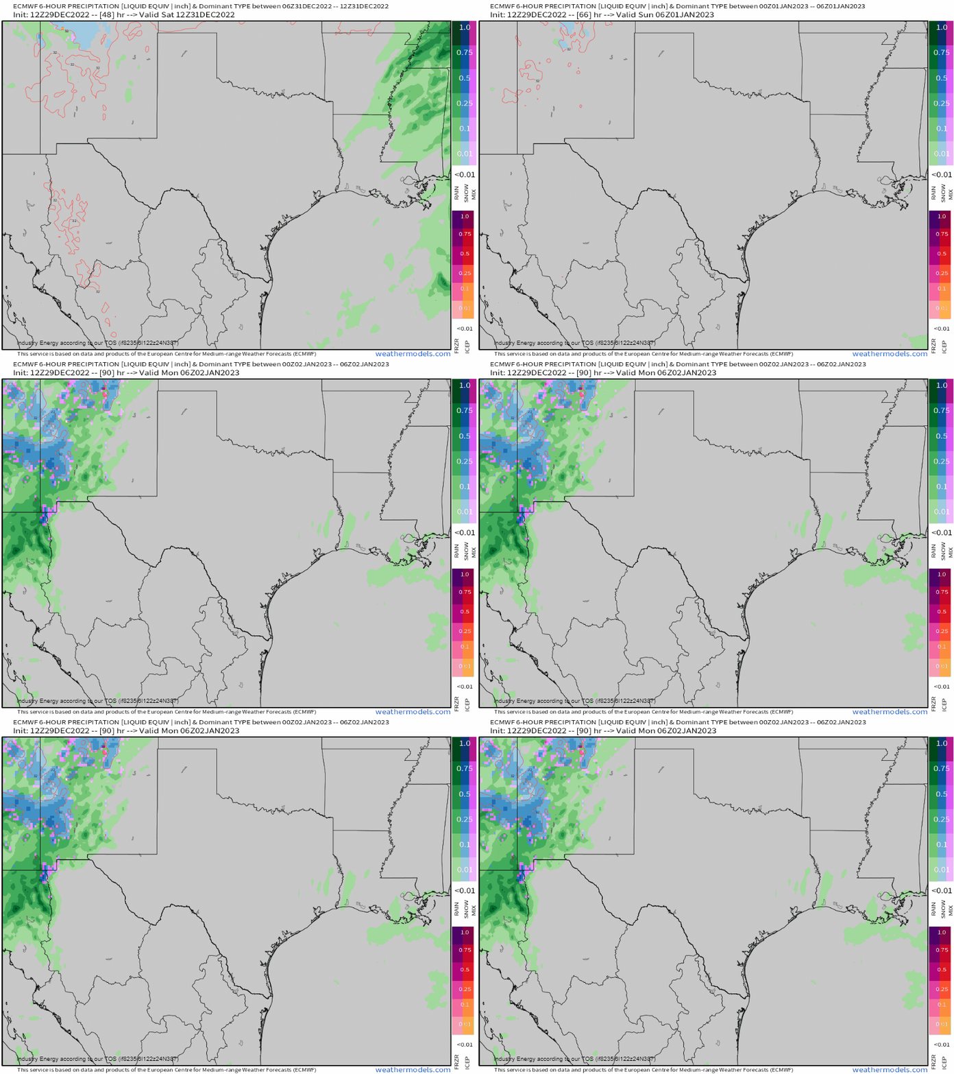
The South will win out this weekend with plenty of sunshine, mild temperatures, and precipitation-free concerns through the entire holiday weekend. Temperatures will range in the 60’s and 70’s, which will extend on into the Southeast.
Southeast:
A frontal boundary will shift in from the Gulf beginning late tonight and into early tomorrow. This will keep the Southeast relatively damp through the first part of the holiday weekend where we can see anywhere from a few tenths up to 2” with heaviest of rain remaining confined toward ArkLaTex region up into the Tennessee river valley. Across Florida and regions nearby, rain will sweep through quickly tomorrow before high pressure filters in dry air by Sunday. Also it’ll be turning milder and more humid.

Northeast:
A system and a front will be charging into the region tomorrow and into Sunday across New England. Along the cold front, a wave pushes through bringing with it widespread rainfall with amounts anywhere from a few tenths to as much as an inch (more as you go closer to the coast). The good news is that this is a quick moving system, so by Sunday sunshine returns for the Mid-Atlantic, Ohio River Valley, and parts of the Northeast. Further into New England, rainfall holds up until later Saturday and does shift out by Sunday afternoon with some lingering snow or rain further inland and across the interior Northeast. With the rainfall and milder temperatures, flooding may become a concern especially where there resides a deep snowpack. Temperatures shoot up into the 40’s and 50’s, making here and everywhere else much warmer than what it is at the surface relative to what we’ve experienced last week!
Overall, relative to last week, this pattern is more manageable with more wet than white happening, and temperatures well above average for this time of year. So if you’re looking to travel either back from vacation, visiting family or friends, or returning home, expect much less in the way of travel disruptions! To everyone who reads and is a supporter of both Meghan and I in terms of our blogs, we appreciate the support and wish you a very Happy New Year!!


