Yet Another Trough, This One Bringing Fire Threat to SoCal
Now that the wave train has started, it seems intent on continuing ad infinitum.
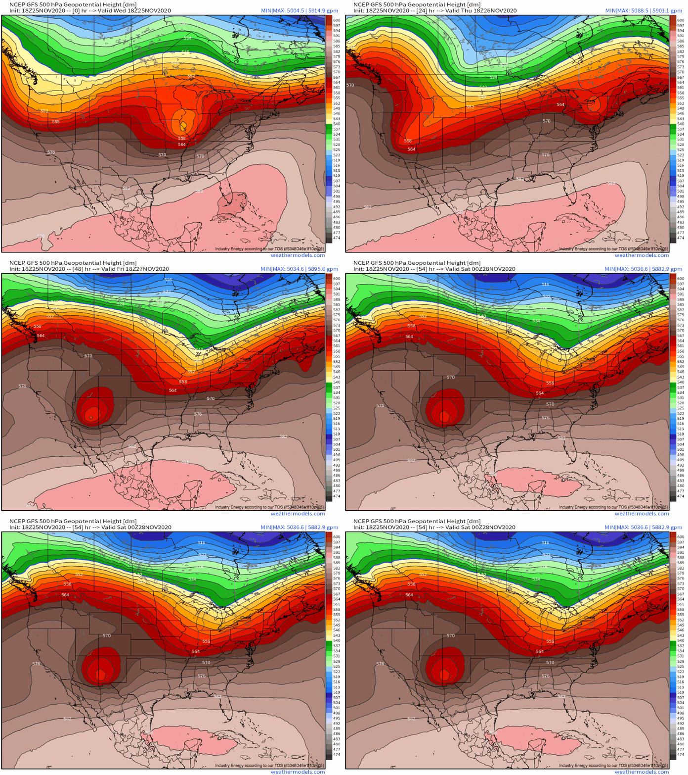
This next wave will become bottom-heavy early, taking on an extreme positive tilt before closing off altogether as the southern parts of the trough axis slow well below the speed of the northern part.
This type of pattern will surely cause problems once it moves east of the mountains, but this blog isn’t about that. Rather, it is about what will happen while the trough skirts the Sierra Nevadas, a pattern many West Coast readers are well aware can lead to weather supportive of fire.
There are a few different ways the atmosphere can work with the surface to produce impactful weather with a relatively minimal, simple meteorological input. Lake effect snow, for example, really only requires a ball of cold air moving southeast over the Great Lakes; the orientation and thermal properties of the water, and the topography of the nearby land, turns this basic atmospheric input into an output of significant sensible weather in the form of multi-day snow accumulations that can exceed 5′. Similarly, all it takes is an expansive low-level high pressure system spilling south, to the east of the Sierra Nevadas, and the topography of Southern California allows intense pressure gradients to develop across the mountains, pointed towards the Pacific. This, in turn, promotes rapid offshore flow, which dramatically dries via adiabatic warming as it slides down the steep mountain slopes. The resulting fast moving, very low-humidity air is perfect at promoting rapid fire spread, especially when it overlaps with non-atmospheric parameters like dry, warm fuel.
Anyway, this type of strong, southward moving high pressure system can develop in a couple ways, but the most common is through this type of pinched off, aggressively positive tilting, intense midlevel trough. As this type of system skirts the Sierra Nevadas, dramatic convergence and cold air aloft moving just east of the airmass-stalling mountains creates the “perfect storm” for the type of offshore pressure gradient in question. This set-up seems likely over the next couple days.
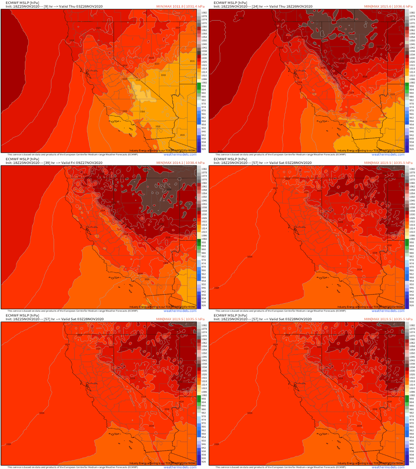
We’ve just discussed the conceptual model for what appears likely to lead to fire weather over SoCal through Friday. Now, let’s see how it is modeled to actually play out, starting with the development of our much-discussed pressure gradient.
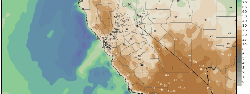
As the anticipated high pressure system pushes southwest into the Sierra Nevadas, the mountains will prevent surface pressure falls from spreading into southern California itself. This will result in the expected powerful pressure gradient, pointed offshore. Predictably, the result will be strong offshore flow, which kicks the rest of the fire equation into motion.
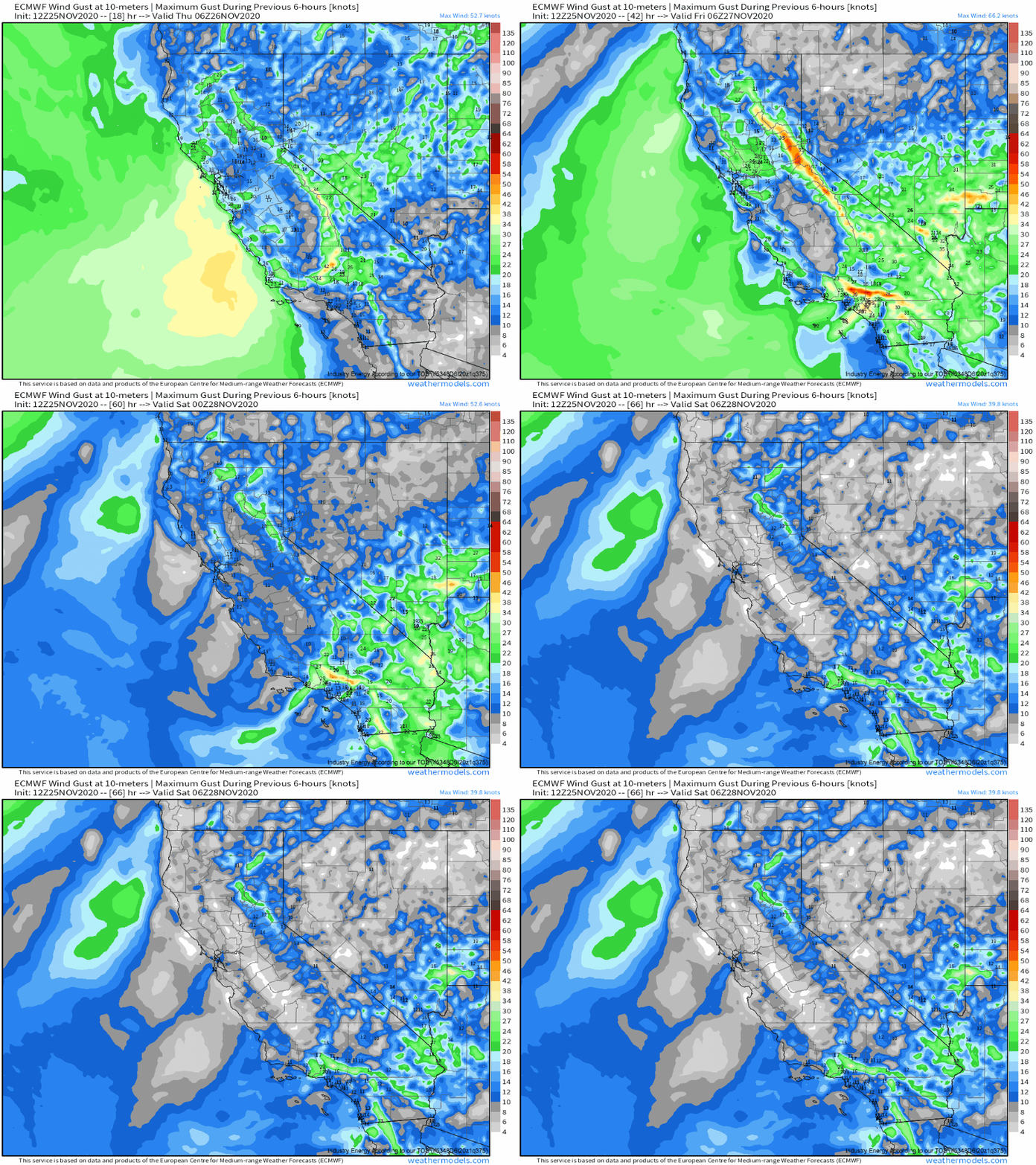
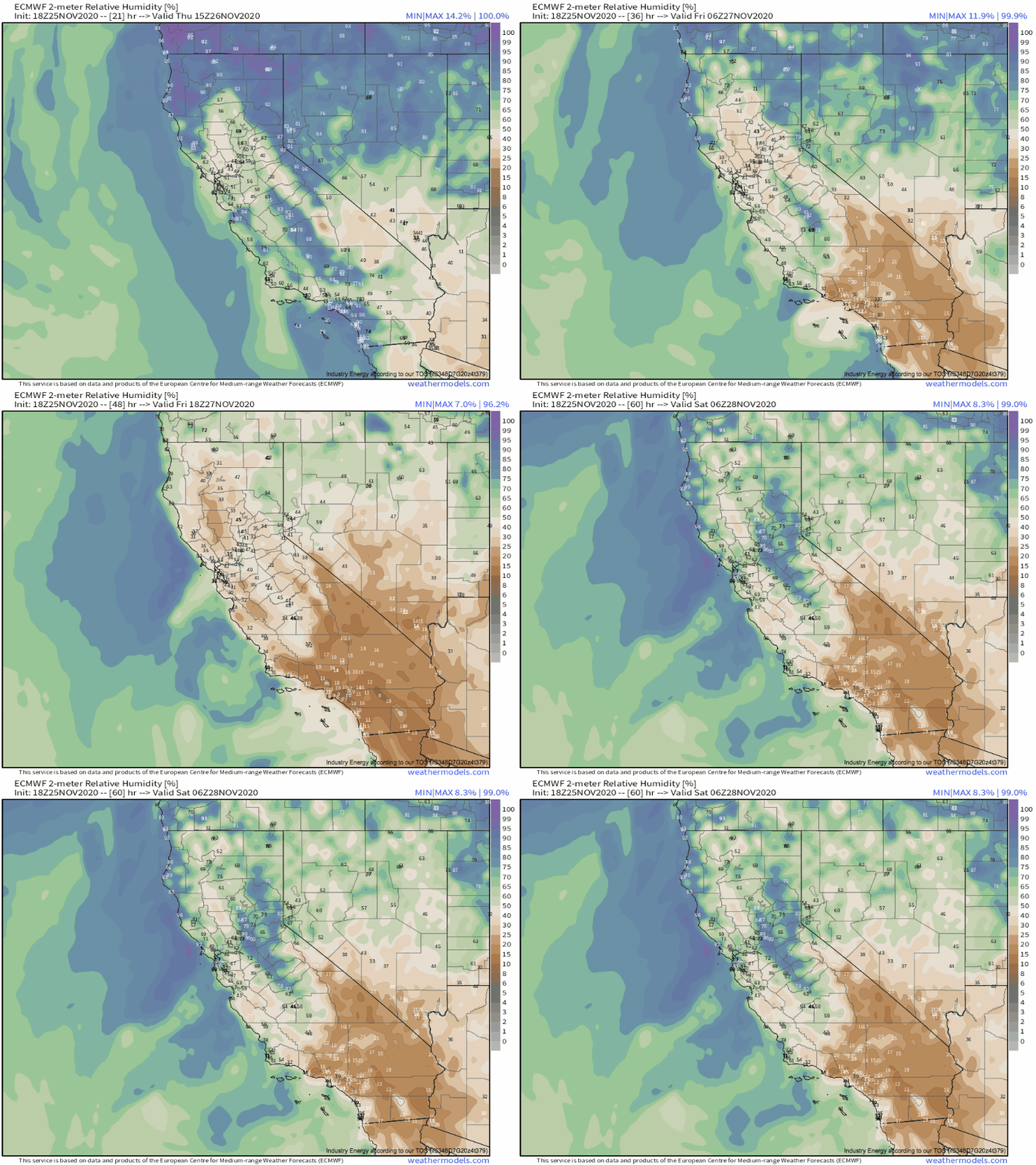
These strong wind gusts are capable of fanning flames and allowing existing fires to move dramatically and unpredictably, which served to increase the threat of dangerous fire weather. And, as we’ve talked about, the powerful offshore wind also interacts with the mountains through a process called downsloping. In this process, air heats adiabatically as it moves down the mountainous terrain, with the relative humidity significantly decreasing as moisture content stays constant in the warming air. As wind intensifies tomorrow, the downsloping will correspondingly intensify, and the relative humidity will drop to single digits!
So, there we have it. A trough will kick a series of inter-related atmospheric phenomena into motion, many of which will create an environment very favorable for fire spread over Southern California, particularly tomorrow and Friday. Strong winds and low humidity will ensure that any fires able to start will develop and spread, at times rapidly, and could even exhibit extreme behavior where the best atmospheric conditions interact with the most favorable topography and the driest fuels.
Eventually, likely on Saturday or Sunday, the pressure gradient that drives this whole machine will slacken, and the fire threat will lessen. But until then, the input of a positively tilted, Sierra-skirting trough will produce a consistent output of conditions very favorable for fire weather. We’ll keep you posted on twitter!
