Wintry Weather Returns For the Northern Plains, Great Lakes, N. Midwest Regions This Week
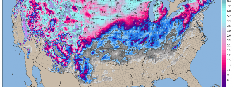
It’s been an active season for parts of the northern Midwest, Plains, and especially the Intermountain West & Pacific NW in terms of snowfall. Many of these places within the last 60 days are already in excess of 75 – 100% of accumulated precipitation thus far, and we’re still in the “heart” of winter! Many of these places have seen near record, or in some cases, record-breaking snowy starts (i.e. Minneapolis). More this will will yet again add to their seasonal totals.
- Starting with the “top-down” approach, we start with 300mb. Notice how downstream of a jet streak (darker purple colors), we see the streamlines spreading out resembling an obtuse angle. This is indicative of a diffluent pattern, and in this case, a divergent one! In this situation, we’re going to see the left-exit region of the jet streak shift first into the upper Midwest, before it allocates into the Ohio Valley. We know that through mass conservation and the kinematics at work, air rises in the left-exit region, which further augments the surface low pressure to increase.

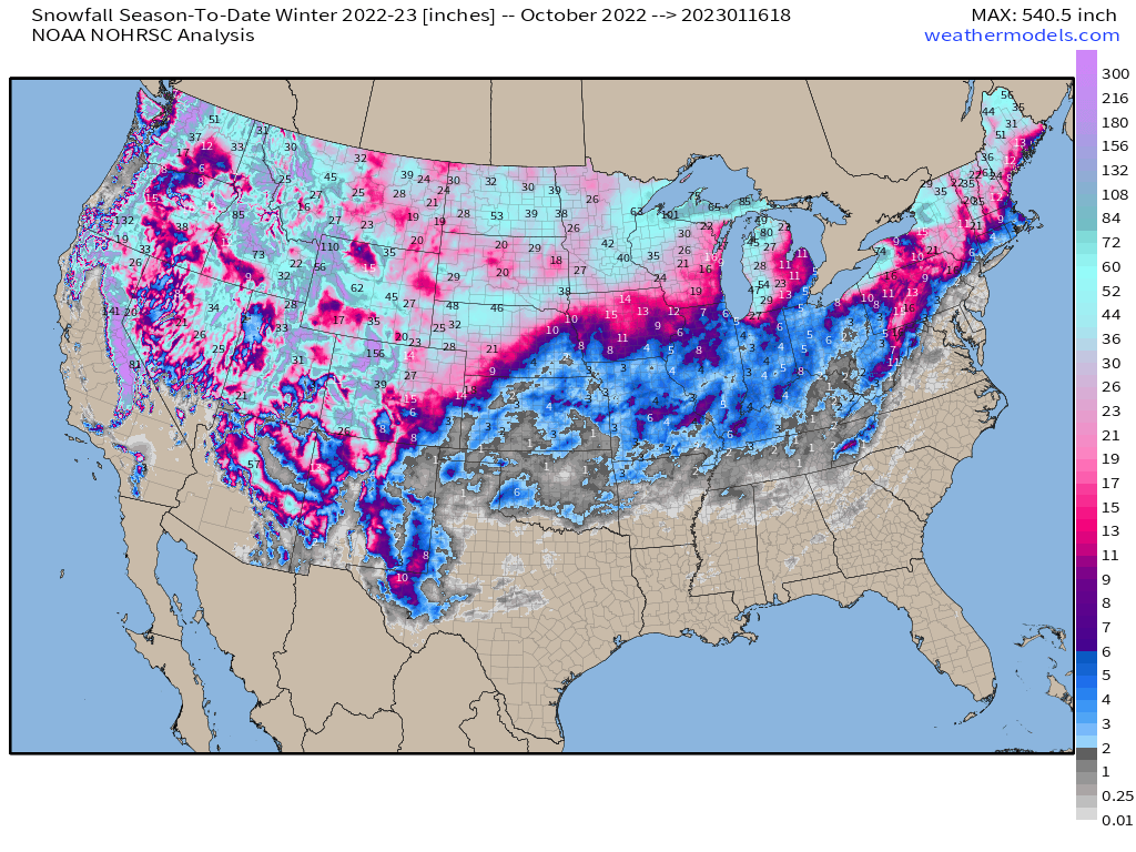
2. Looking at the mid level z500mb relative vorticity via ECMWF, we see a potent large trough, with a trough that is goes from a positive to neutral tilt, though a bit progressive within a relative fast flow. We see that there is net positive vorticity advection that springs into the upper Midwest & northern Plains, before then shifting into the Great Lakes and interior Northeast. We now have forcing for ascent, and this is where you’d fully expect a surface cyclone at the surface. The general timing for this will take place Wednesday night into early Friday.
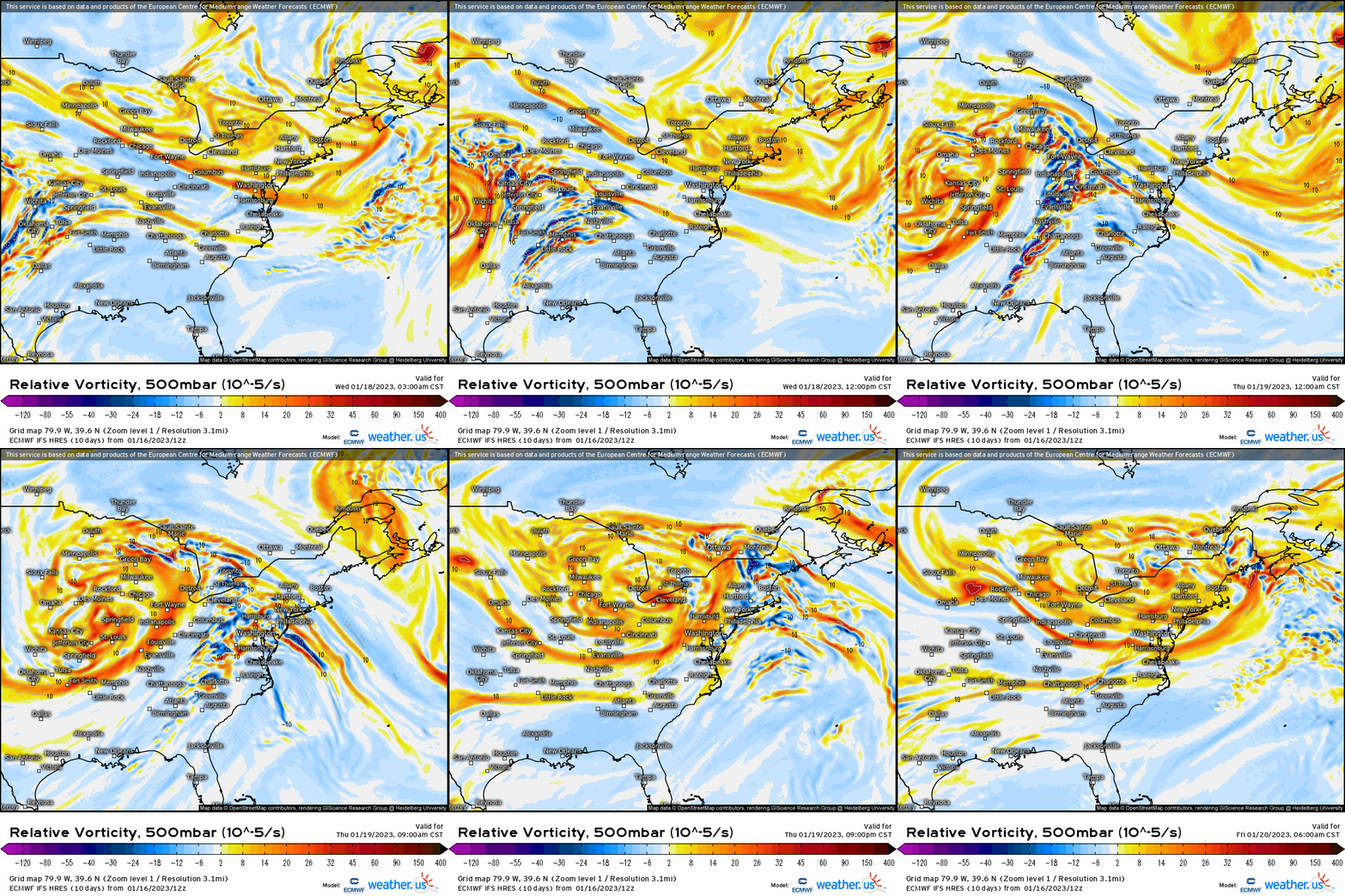
3. At the surface, we do in fact see a surface cyclone develop thanks to the dynamics at work! A storm will form along the front-range (lee cyclogenesis), and will gradually strengthen and organize into a sub 1000 mb low. This low will track from CO into IA and then into MI before shifting into the Northeast. A storm track verbatim puts the heaviest snow on the NW side of the surface low, which lends support to snowfall accumulating from NE, IA, MN, WI, and into the UP of MI and northern peninsula, with snow showers developing on the backside. This track puts places like Chicago metro, Indy, and Dayton in the warm sector and therefore rain, though on the backside we could see lingering snow showers.
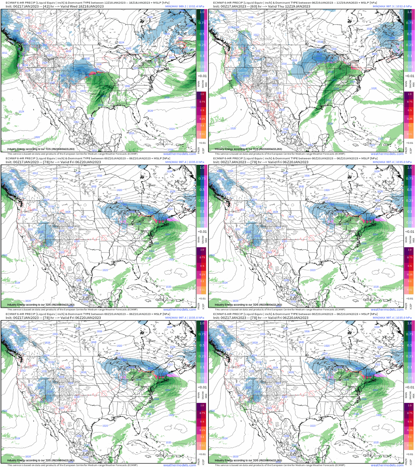
In terms of snowfall, expect anywhere from an inch up to as much as 10”, with the higher end likely for places across the Great Lakes since there’s more cold air to work with and better in the way of dynamics.

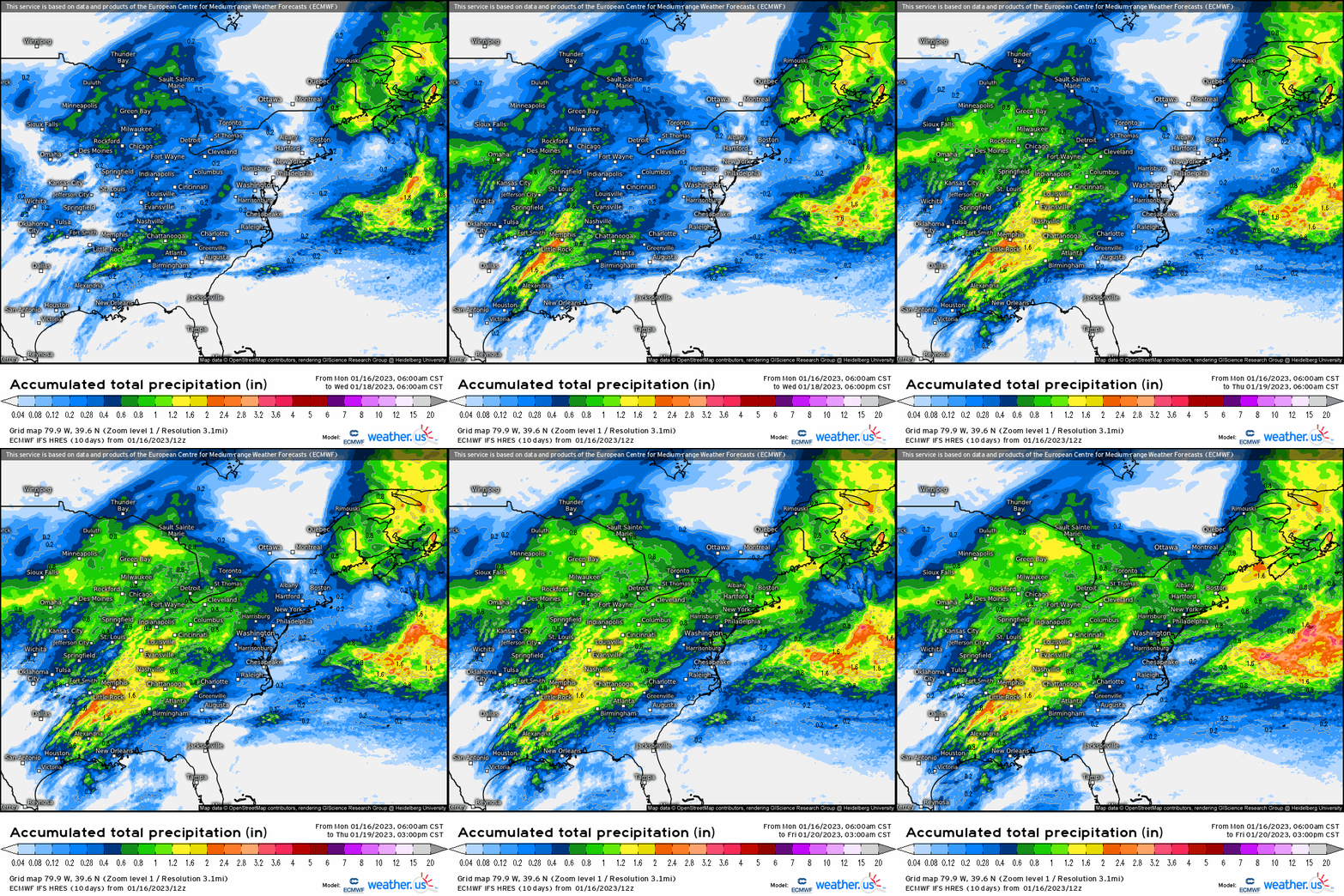
In terms of rainfall, anywhere from a few tenths to just over an inch can be expected along the cold front that is associated with this cyclone for places like the Southeast, up into the TN river valley, Ohio river, and into the Mid-Atlantic. We may even be looking at snow for New England by Thursday as we see this same trough and system end up influencing what happens there. That’ll be covered in the next blog.
