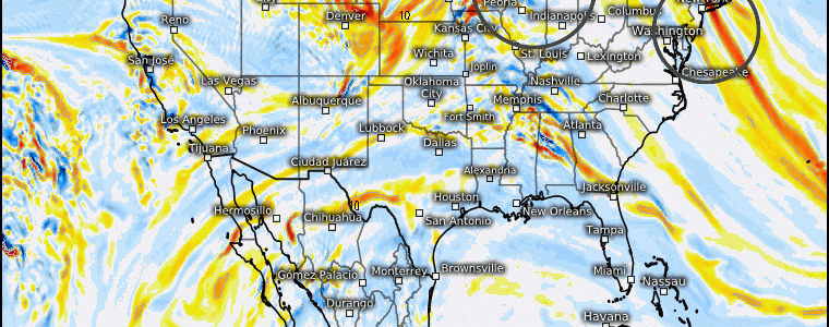
Wintry Implications For Two Regions From One Trough
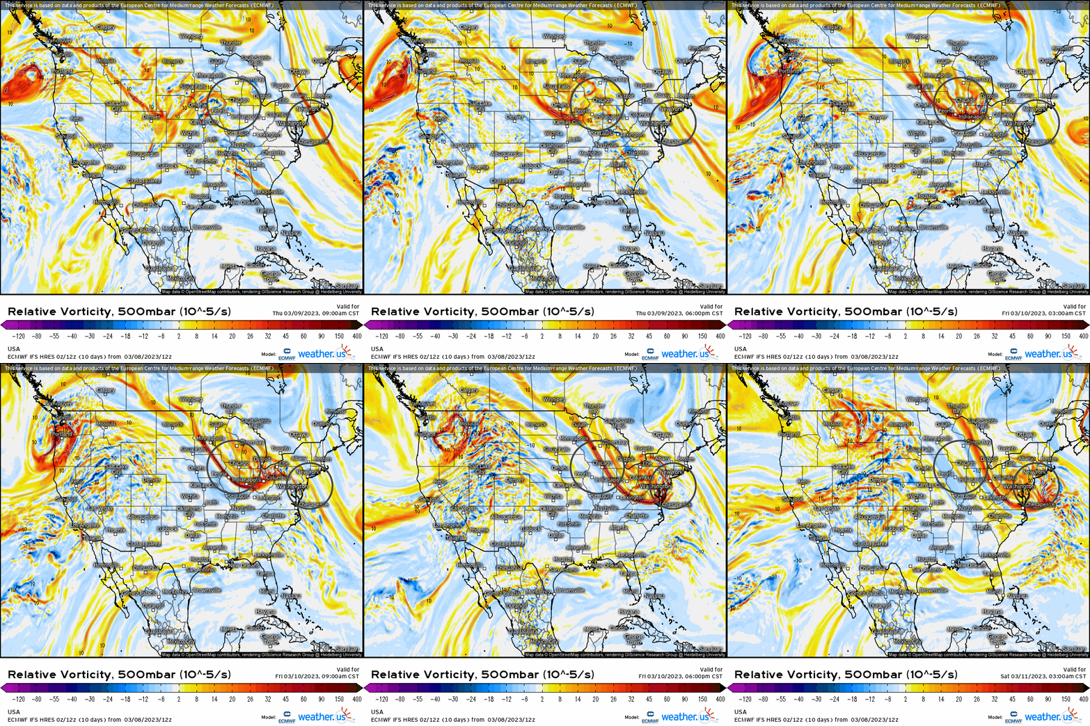
A potent shortwave trough will first eject into the upper Midwest before sliding toward the Mid-Atlantic delivering a 1-2 “punch” regarding wintry weather today and into tomorrow. Below, I’ve highlighted the areas where this shortwave trough will provide sufficient lift in the atmosphere that’ll allow a response at the surface as it’s shown here verbatim the 500mb level (relative vorticity).
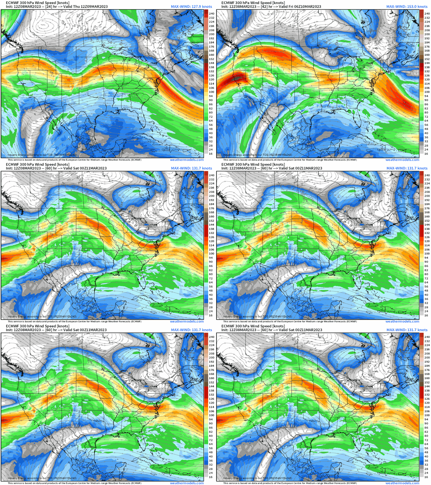
Looking at it from an even broader view, we can analyze where the trough itself will propagate along with areas of divergence that we may be interested in.
- Judging by the flow from coast-to-coast, we can see we have a relatively progressive flow as we don’t all that much of meridional flow with no such large ridges or deep troughs.
- We do see that we have a jet streak that approaches the upper Midwest (i.e. IA, IL, WI), and then shifts into the southern Mid-Atlantic. We have a divergence downstream of this jet streak as the left-exit region will juxtapose itself first across the upper Midwest / Great Lakes before shifting into the Mid-Atlantic.
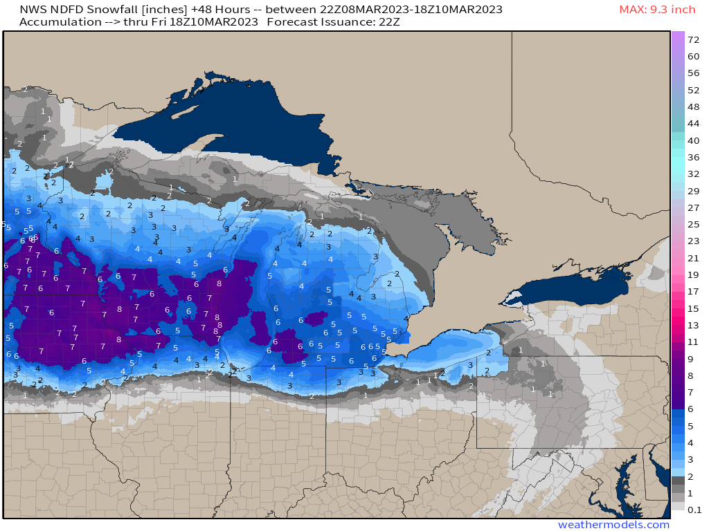
The result is that at the surface, a weak low pressure will eject from the Front Range and slide south of IL, IN, and into southern OH. With enough divergence aloft and cold air, we’re going to see a wintry mix to all snow from places along and north of central IL to Columbus, OH. This will be a quick-moving system, but will bring a swath of snow across IA, south/central MN, WI, northern IL, MI, and northern locations of IN and OH tonight into tomorrow afternoon from west to east.
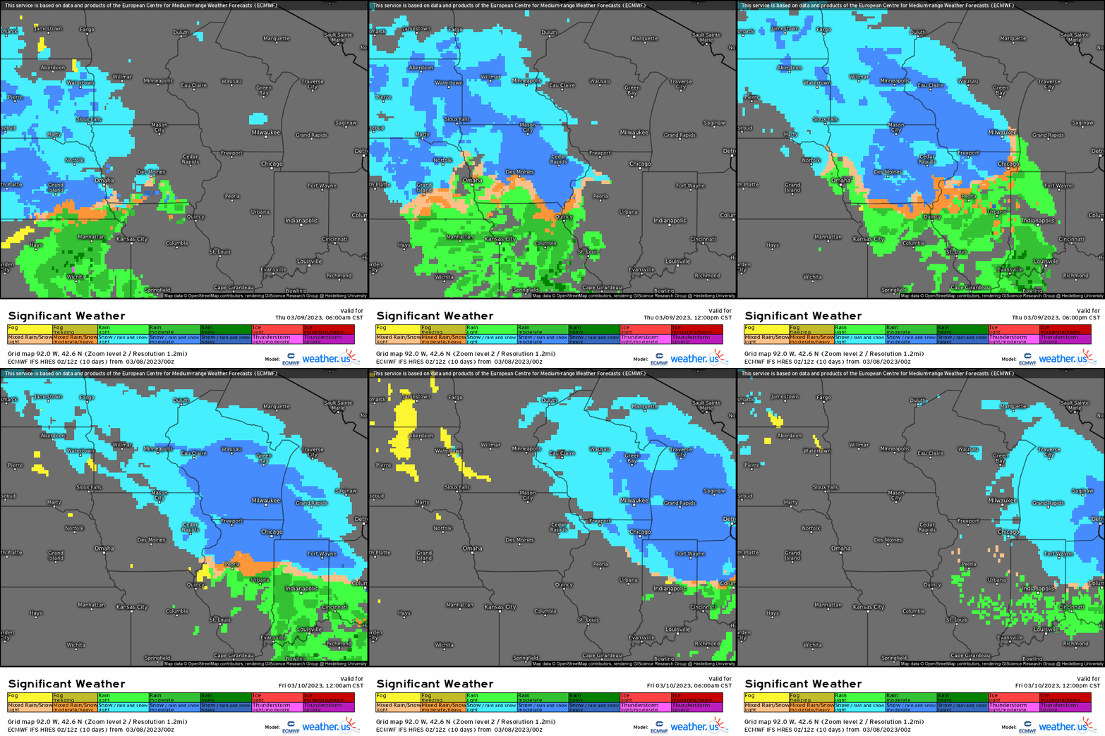
Despite a progressive system, this according to the NWS output, will put down a wide swath of 3-6”/4-8” north of the low’s track where the greatest ascent, moisture advection, and cold air will be.
Now, if you take a close look at the 500mb relative vorticity as the trough axis shifts southeastward, you’ll notice that the greatest differential cyclonic/positive vorticity advection (coined “DCVA” or “DPVA) shifts offshore of the Mid-Atlantic coast. Where this transpires results in the lowest height falls, and therefore the surface low pressure responds accordingly. We see a track where the main low actually heads to western PA, but a secondary forms quickly offshore as a result of a blocking high to the north as well.
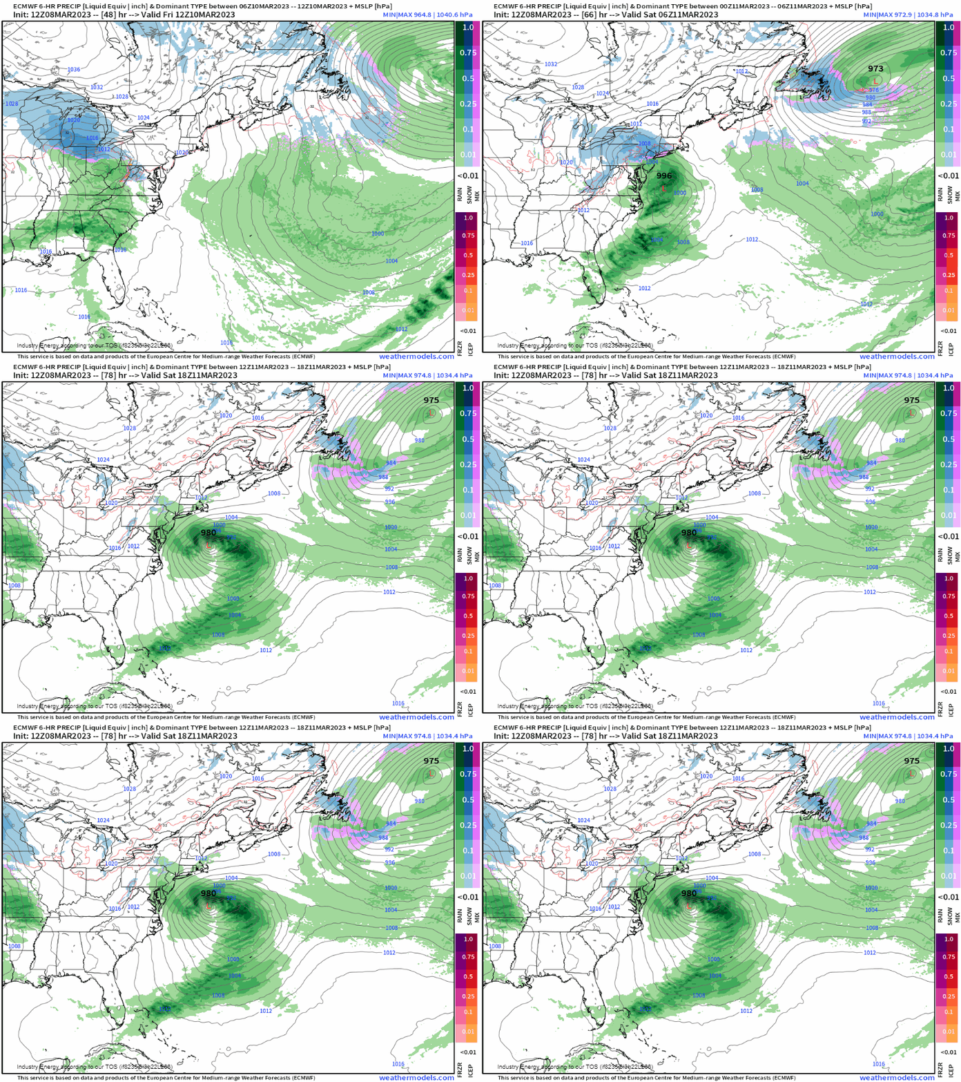
This results in a rain/snow mix for areas along and north of I-78 / I-80 in PA to NJ and up into the lower Hudson Valley. The only issue with this is that temperatures will be on the marginal side to begin; however, accumulating snow is likely for places like central/northern PA, northern NJ, and southern NY with more wet than white further south toward PHL, DC, and BALT. NYC will be on the verge, though can see initially it begin as rain/snow with a brief period of snow. This will move into the region by midday Friday and into Friday night before churning out to sea by Saturday rather than try to make it up the coast due to the entire progressive nature of the pattern pushing everything eastward.
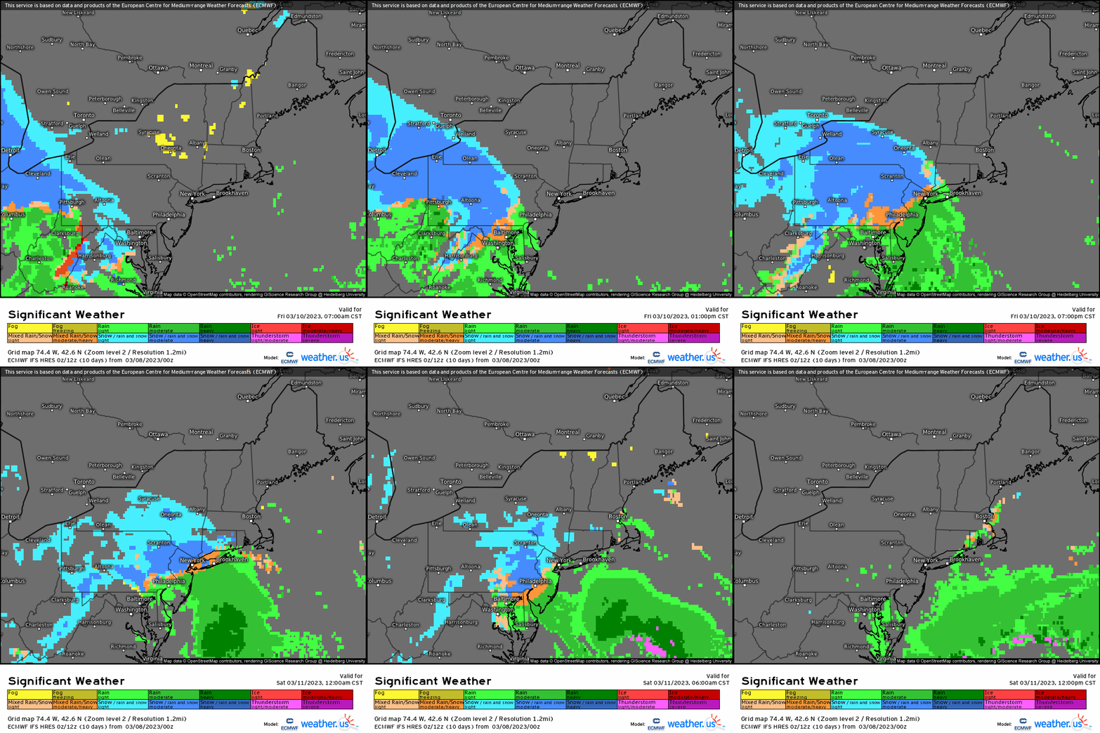
Here we see a general idea of where we may see a light snow event via NWS showing that the usual regions that exploit a setup as such and is colder are confined mainly central/northern PA, upstate NY, and into NNJ along with the Hudson Valley as it quickly tapers off further south and east.

This is just one event in the “pipeline” with a few more storms not too far behind that could bring more snow to these same places, and could be one event early next week that could result in a more widespread risk for snow in the East as we’ll be closely monitoring!


