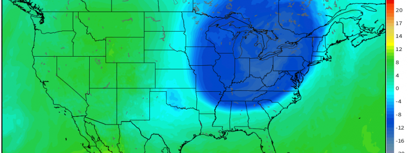
Wintry Blast Inbound
Those wanting sweater weather are about to get more than they bargained for as the coldest air yet this season will be settling in today and tonight. In fact, you’ll need to skip the sweaters and go straight for the winter coats.
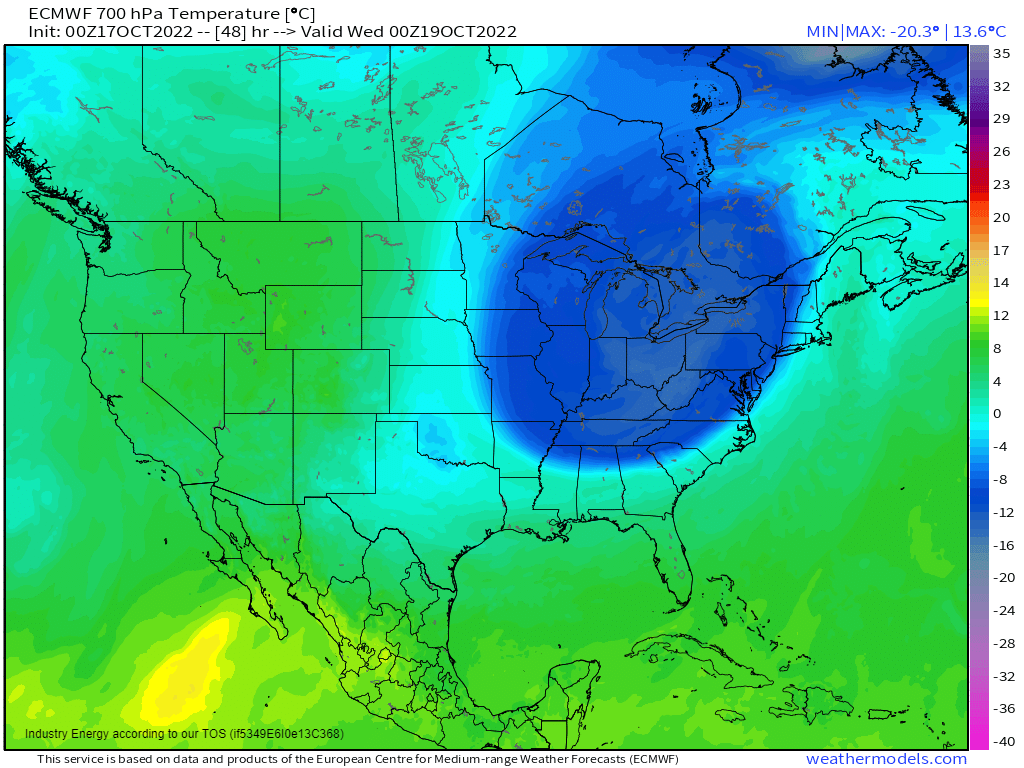
A lobe of very cold air with origins in Northern Canada will be sinking into place today. In fact, some are already experiencing the effects.
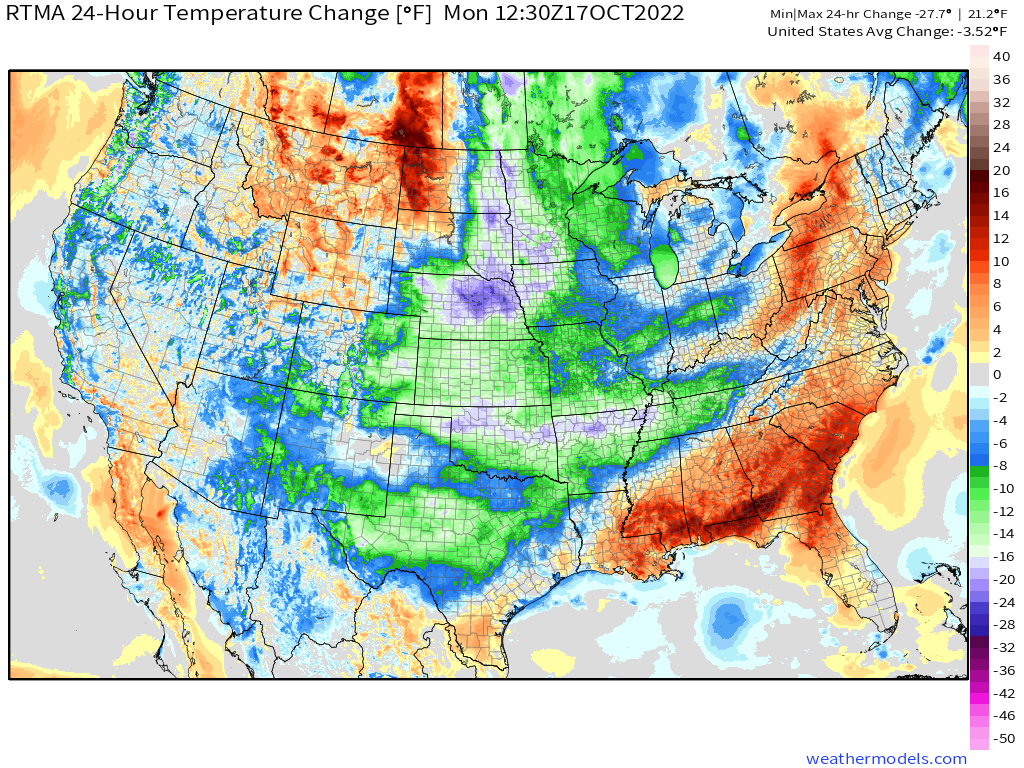
Parts of the Central US are currently 10 to nearly 30 degrees colder than this time yesterday. That places most of the upper Midwest solidly below the freezing mark. Additionally, brisk winds out of the northwest are making it feel even colder with wind chills in the teens. A bit more like Winter than Fall, isn’t it?
This early season cold blast will be a potent one. In fact, morning lows from Tuesday to Thursday will likely challenge records over a large area.
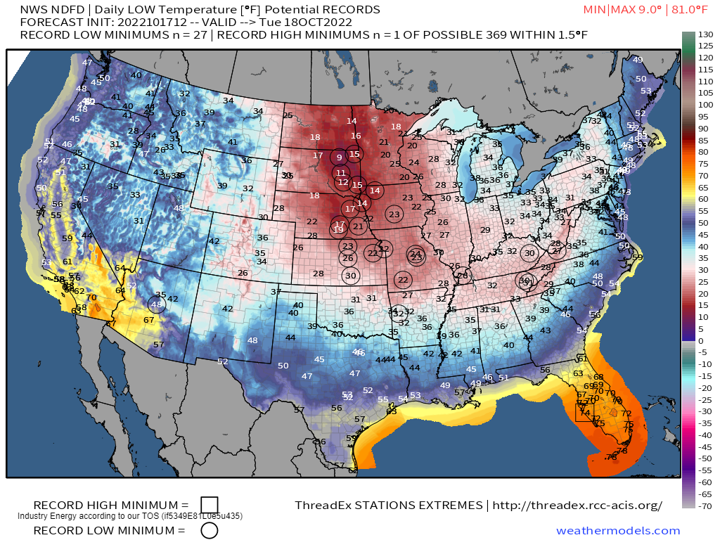
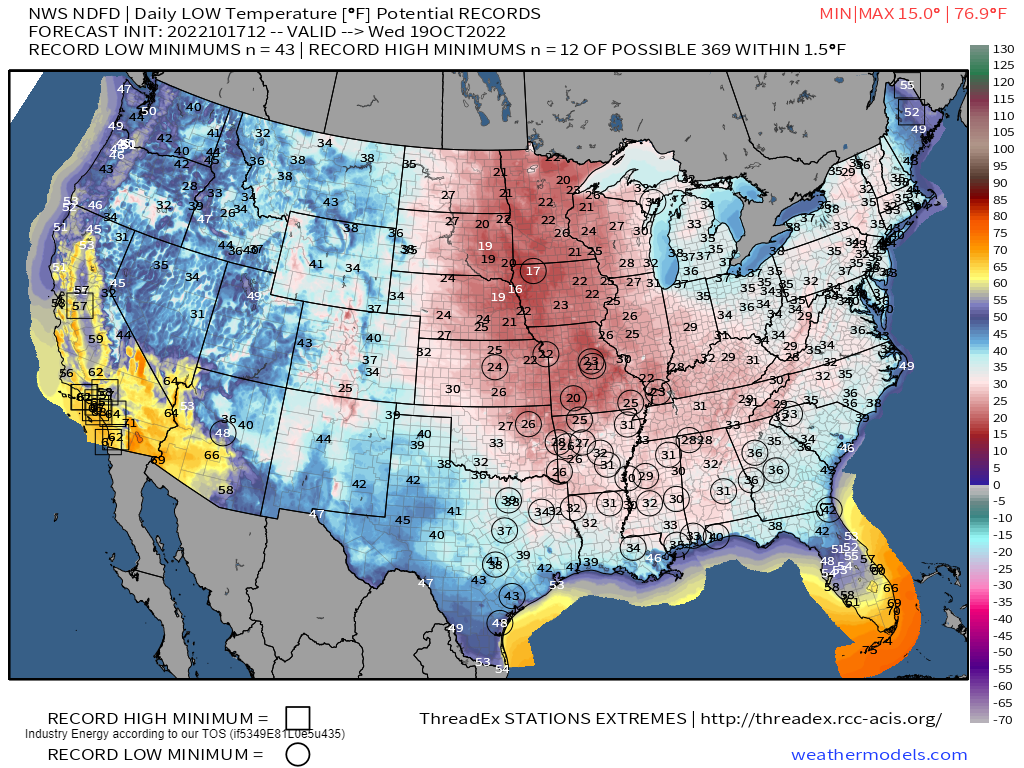
We’ll start with the Plains states tomorrow morning. Lows in the single digits are possible in some locations!
Let’s look at one of the colder locations: Sioux Falls, South Dakota.
Per NWS data, Sioux Falls’ average low temperature for this time of year is 37 degrees. It’s record low for October 18 is 15 degrees, set in 1972. So, if Sioux Falls does indeed fall to 12 degrees tomorrow morning, not only will it be ~25 degrees below average, but it will smash the record low by 3 degrees. Pretty significant, wouldn’t you say?
By Wednesday morning, the potential record lows become more widespread as much of the South flirts with the freezing mark.
Let’s look at another location: Montgomery, AL.
Per NWS data, Montgomery’s average low temperature for this time of year is 53 degrees. It’s record low for October 19 is 34 degrees, set in 1948. Assuming they reach the forecasted 31 degrees on Wednesday morning, that’s 22 degrees below average and breaking the record by 3 degrees. Again, fairly significant!
All talk of records aside, it’s important to note that this will be a killing freeze for many locations that have not yet seen temperatures near freezing. If you’re a farmer and you still have crops out, get them in today. If you have sensitive plants, take measures to protect them today as well.
And as for personal preparation…
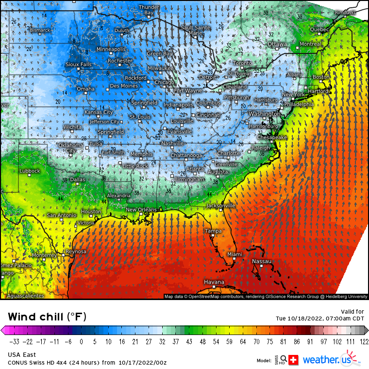
…Let’s not forget that winds could be gusty out of the north/northwest. This will lead to wind chills somewhat to significantly lower than the actual air temperature. Of course, it depends on your region. But, if you must be out and about on these cold mornings, be sure to take precautions to protect your skin against frostbite, especially if you’ll be outside for a prolonged amount of time.
One final thing to discuss: snow!
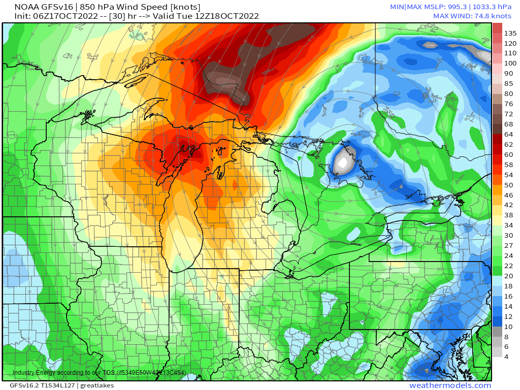
The lake effect snow machine will be roaring to life this week as a strong, persistent, favorable flow sweeps over the Great Lakes.
The Upper Peninsula of Michigan, Northern Michigan, and perhaps even a small part of Northwestern Indiana and Northwest Pennsylvania/Southwest New York are in line for some accumulation this week.
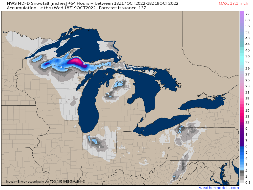
The largest totals will be found in the Upper Peninsula and far northern Wisconsin where the air will be consistently colder and the flow stronger/more favorably oriented. Totals exceeding 20 inches are possible here, especially in the UP. But some accumulation is also possible in Indiana, Pennsylvania, and New York, as mentioned.
One thing to note is that any snow/accumulation will be seen inland, away from the lakefront. Why is that? Well, the water temperature is still “warm.”
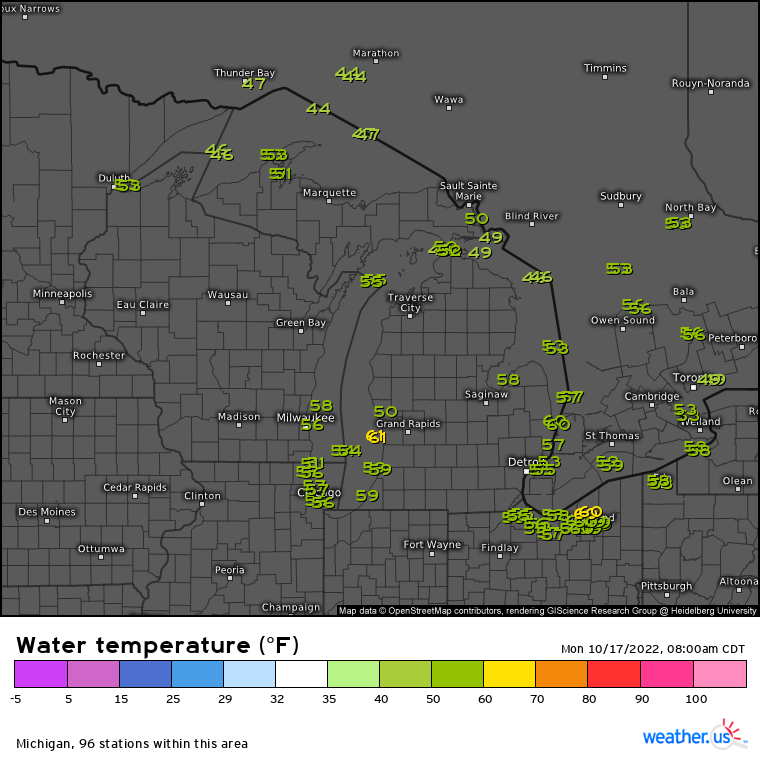
Though I’m sure no one would technically call water in the 45 to 55 degree range warm, it is still much warmer than the air will be. Water cools much slower than air due to its specific heat. In other words, it takes much more energy to cool water than it does air, and land as well for that matter. So, the warmer water moderates the temperature of the land/air around it, keeping it above freezing. Inland, where the warm water has no effect, temperatures will be cold enough to support accumulating snow.
Anyway, if you’re a winter lover, the early part of this week is for you. Warmer temperatures will make a return toward the end of the week as ridging builds in.


