Winter Storm Update
Yesterday, I wrote a pretty fleshed out blog on what will end up very significant northeast winter storm.
I encourage you to read it- this will simply be an update of that.
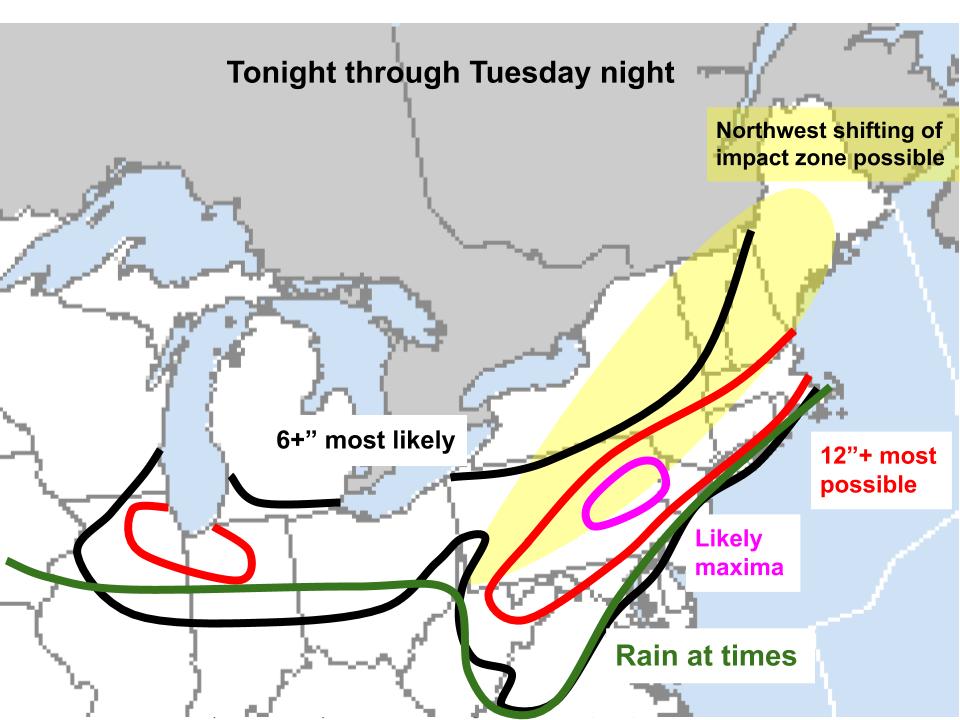
I created the following summary graphic yesterday:
As of this morning, models have trended northwest with the secondary cyclone, like I expected they might. This does a couple things to the forecast!
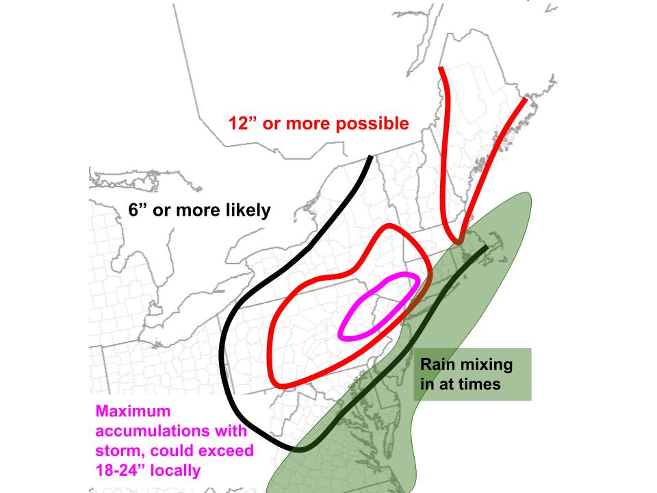
First of all, it means the 700mb speed convergence, which will serve as our main lifting mechanism, will end up extending northwest of original anticipation when it pivots. This will cast heavy snow further NW, into central and west NY, than originally anticipated. It will also move the absolute maximum snowfall location slightly NW, but not much. Finally, it will allow for an orientation more conducive to high-end moisture transport into the pivot point, increasing the areal expanse of the potential 18″+ zone. In here, given this increasingly favorable moisture regime, impressive dynamics, and longevity via a pivot point, totals could locally exceed 2′.
It will also spread the rain/snow line further inland, as well as introduce a mid/low level dry slot capable of reducing precipitation intensity further inland than expected. This will reduce snow in parts of Maryland, Long Island, Connecticut, Rhode Island, and Massachusetts.
Finally, increased confidence on Tuesday impacts will spread significant snow north through Maine.
Overall, this will be a very high-end storm. The areal extent of 6+” snow is unusually high, and overlaps with several of the most populous counties in the country, especially considering yesterday’s Chicago area snow. Higher end totals exceeding a foot are likely in a very populous urban corridor from Philadelphia through New York City, Hartford, Boston, and towards Portland.
For some, this will likely be a top-10 event. The swath of maximum snow accumulations will probably extend from NE PA through parts of SE NY and potentially parts of N NJ and SW CT. Here, 18-24+” could fall, likely ranking this among historical storms.
With that all out of the way, an updated summary graphic:
Enjoy this one!!


