Winter Precipitation: A Review
Good evening, all!
With the lower 48 getting ready to enter an active pattern that will likely include all modes of precipitation in one way or another, I thought that for tonight’s blog I would do a little review of the precipitation types and what conditions are needed for each to happen.
Probably stating the obvious here, but those types would be: Rain, Freezing Rain, Sleet, and Snow.
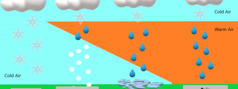
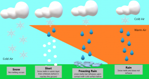
I’ve created a little graphic for you to refer to above, and will go into further detail below.
Rain
In order for rain to occur, the temperature profile must be consistently above 32 degrees F in the lower layers of the troposphere. A sounding done in an area expecting rain would look like the image above. The temperature remains above freezing in a decent portion of the lower troposphere. Precipitation starts frozen aloft, but melts once it hits the warm layer and, since the temperatures remain above freezing, it does not refreeze.
Freezing Rain
Freezing rain starts out aloft as frozen precipitation. On it’s way to the surface, it passes through a warm layer and melts. Though it remains liquid, there is a shallow layer of air below freezing at the surface. Once it makes contact with the surface, it will refreeze. This is where “ice storms” come from. The rain hits surfaces that are already below freezing, refreezes, and accumulates as ice. It may accumulate on trees and powerlines first since they cool faster, but can start piling up on roads, cars, etc if temperatures have been below freezing long enough. Freezing rain is not sleet, and sleet is not freezing rain. This is a common misconception.
Sleet
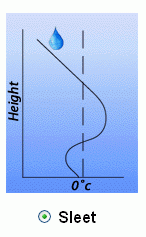
Sleet starts aloft as frozen precipitation. It then falls through a relatively shallow warm layer and melts. Closer to the surface, it encounters a layer with temperatures below freezing and re-freezes into an ice pellet. These pellets then accumulate on the surface and resemble an almost pebble-like layer of snow. Sleet is commonly confused with hail, but they are not even remotely the same thing. Hail is created by and exists solely in (severe) thunderstorms.
Snow
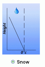
Snow begins aloft as frozen precipitation and stays that way. It does not melt on its journey to the surface, but arrives in the form in which it began. The sounding in an area expecting snow would resemble the image above with the temperature below freezing throughout the troposphere.
One final term you may hear, though less common, is Graupel.
Snow crystals sometimes encounter supercooled (liquid cooled below freezing without becoming solid) water droplets. These droplets then freeze themselves to the crystals producing a fragile pellet that is similar to sleet, but will often crumble if touched. It generally exhibits an oblong shape and falls together with ice pellets (sleet) in a wintry mix situation.
You may have been familiar with all the above information before this blog, but if you weren’t, hopefully you learned something new tonight. You’ll get to put your new knowledge to the test starting this weekend as the first system in a forthcoming active pattern moves through the US.
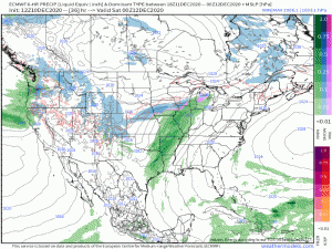
With a large temperature profile across the nation, the system is bound to bring all modes of precipitation with it: snow on the cold side, rain on the warm side, and a mix somewhere in between. We’ll look into this system in tomorrow’s blog post. For now though, have a great evening!
(sounding examples taken from weather.gov)




Thanks Meghan. Looks like there could be a nore’easter in the next week or so..at least the GFS is hinting at it.