Wind, Fire Weather, Severe Threat, Oh My!
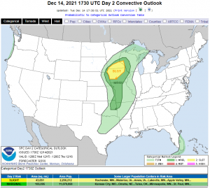
Remember that potential severe weather threat I mentioned at the end of yesterday’s blog? Well, I obviously need to start trusting my skills and intuition a little more because it was indeed added to the Day 2 Outlook this morning.
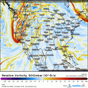
A potent shortwave trough will lift north out of California and into the Rockies. On it’s decent, it will undergo surface cyclogenesis and form a rather deep low. This system will enable a variety of potentially nasty weather tomorrow, not just a severe threat. Let’s take a look at what we’re expecting.
Wind
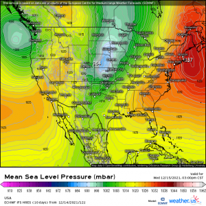
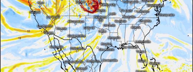
The forming surface low will deepen rather quickly as it moves off of the Rockies. At the same time, a strong area of high pressure will be hanging out just off of New England. The pressure gradient between these two will produce some very windy conditions – even without any thunderstorms.
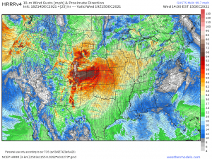
Now, the HRRR has a bit of a tendency to over do its forecast wind gusts. That said, a high-impact, wide-spread wind event is expected. As mentioned, these forecast gusts are not expected to be solely convective, so rain or no rain, it’ll be windy.
The official forecast is for gusts potentially up to 70/80 mph. That’s more than enough to bring down some trees and cause power outages. Consider securing your Christmas decorations as well, before your friends in the next town over are the brand new owners of decorations they didn’t buy.
Fire Weather
These aforementioned winds will, unfortunately, be blowing over areas that are very dry right now.
Coming down the mountains, not only will those winds speed up, they will dry out as well. Dewpoints in the teens are likely, with dewpoints in the single digits not entirely out of the question.
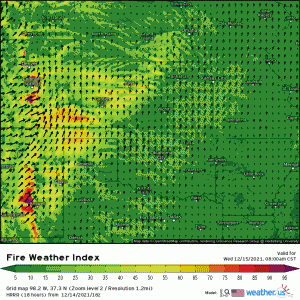
This leads to a not-often-seen Extreme Fire Weather Risk for parts of Northern Texas, Oklahoma, and Kansas.
Any new or currently burning fires will spread very, very quickly tomorrow. Avoid any and all activities that may spark a fire.
Severe Weather
Does anything look particularly strange about these risk areas to you? Yes, its December, but severe weather does happen at this time of year. However, it usually happens much further south.
This is the type of outlook that might be expected, or even common, in summer when the jet stream is still way up north. Severe weather this far north at this time of year is, well, almost unheard of. In fact, there are currently no tornadoes on record in Minnesota for the month of December. I don’t know about you, but I’m hoping it stays that way. We’ve had enough historic weather for one week.
Nevertheless, there is actually a tornado risk attached to this set-up for tomorrow afternoon.
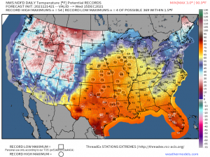
Anomalous ridging, as discussed yesterday, will be in place. This enables significantly above average warmth to stream northward.
Speaking of historic weather, many records are likely to not only be broken, but shattered tomorrow by the magnitude of the heat streaming in. Ever feel like you’d like to live in precedented times again? No such luck.
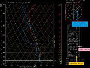
So lets pull a forecasted sounding and take a look at what we’re dealing with.
Though instability is still forecast to be rather limited, the proximity to the low, and therefore the strongest lifting, and the shear more than make up for whatever is lacking.
Notice the storm motion as well. Due to the speedy wind field, these storms will be MOVING. The wind speed at 500 mb is nearly 100 kts!
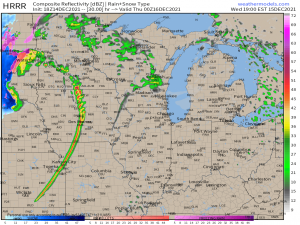
By late afternoon, the short-term high-res models all develop a skinny, but rather nasty-looking line of storms.
All of these models try to develop supercells on the northern end of the line, closer to the low. Should these be able to form, tornadoes are absolutely possible, especially considering the amount of shear forecast.
Is this going to be like Friday/Saturday? Well, no. The thermodynamic environment is much more marginal. Lower dewpoints, lower temperatures, and lower instability make for much less to work with than the environment that produced the “Quad-State Supercell” had.
However, this is a threat in an odd part of the country for the time of year. People may not be fully prepared for the possibility of tornadoes in December.
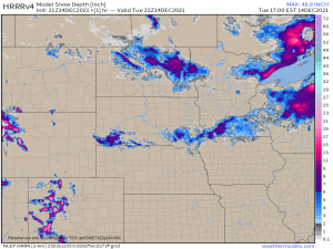
In fact, in some of the area inside the Slight risk, there is currently snow on the ground.
Of course, this will melt quickly as temperatures rise tomorrow. But it’s still rather strange to be forecasting tornadoes while snow from the last storm remains.
In addition to severe weather and tornado threats, remember that the winds will be roaring whether or not it’s storming. Wind damage remains a possibility regardless.
As far as safety goes:
If you live in the risk area, be prepared for the possibility of a tornado ahead of time. Know your plan, have a safe space, have ways to receive warnings.
If you know people that live in the risk area, warn them. As I said, they may not be expecting a severe threat tomorrow, all things considered.
Should anything change dramatically in the forecast between now and tomorrow morning, I’ll publish an update. For now, be safe!
