Wild Winter Weather Impacts Huge Swath of US Amidst Arctic Air
As we’ve been writing about quite a bit over the last week, an incredibly active winter weather pattern will kick into high gear this weekend, threatening much of the central and eastern US with significant winter weather.
If you’re curious about the synoptic-scale features driving the activity, be sure to check out my blog from Thursday. If you’re curious about today’s winter and severe weather threats, check out Meghan’s blog from yesterday. This blog will take up where the two left off, and will outline the expansive, major winter storm from sunrise Sunday through sunrise Tuesday.
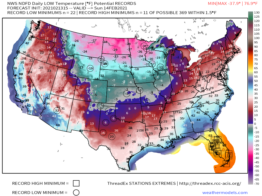
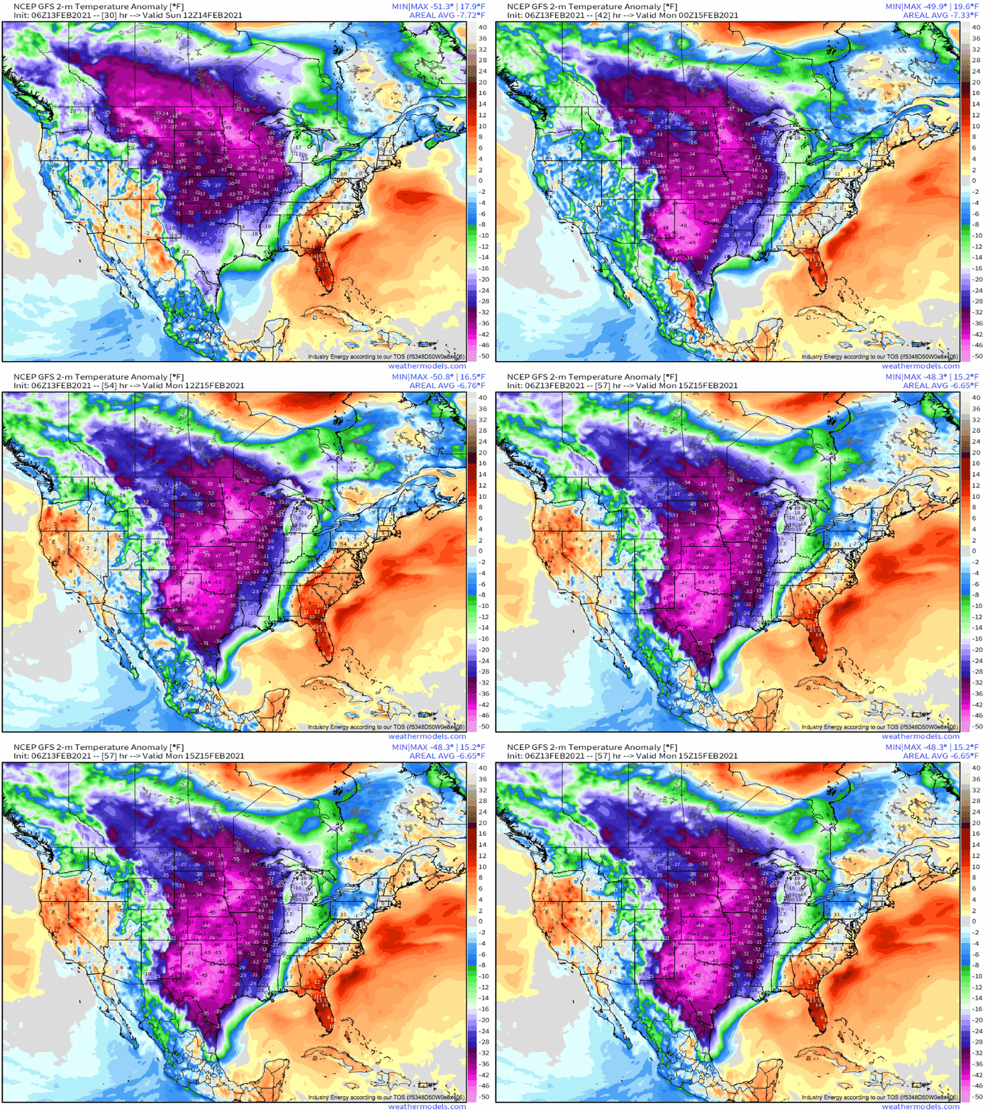
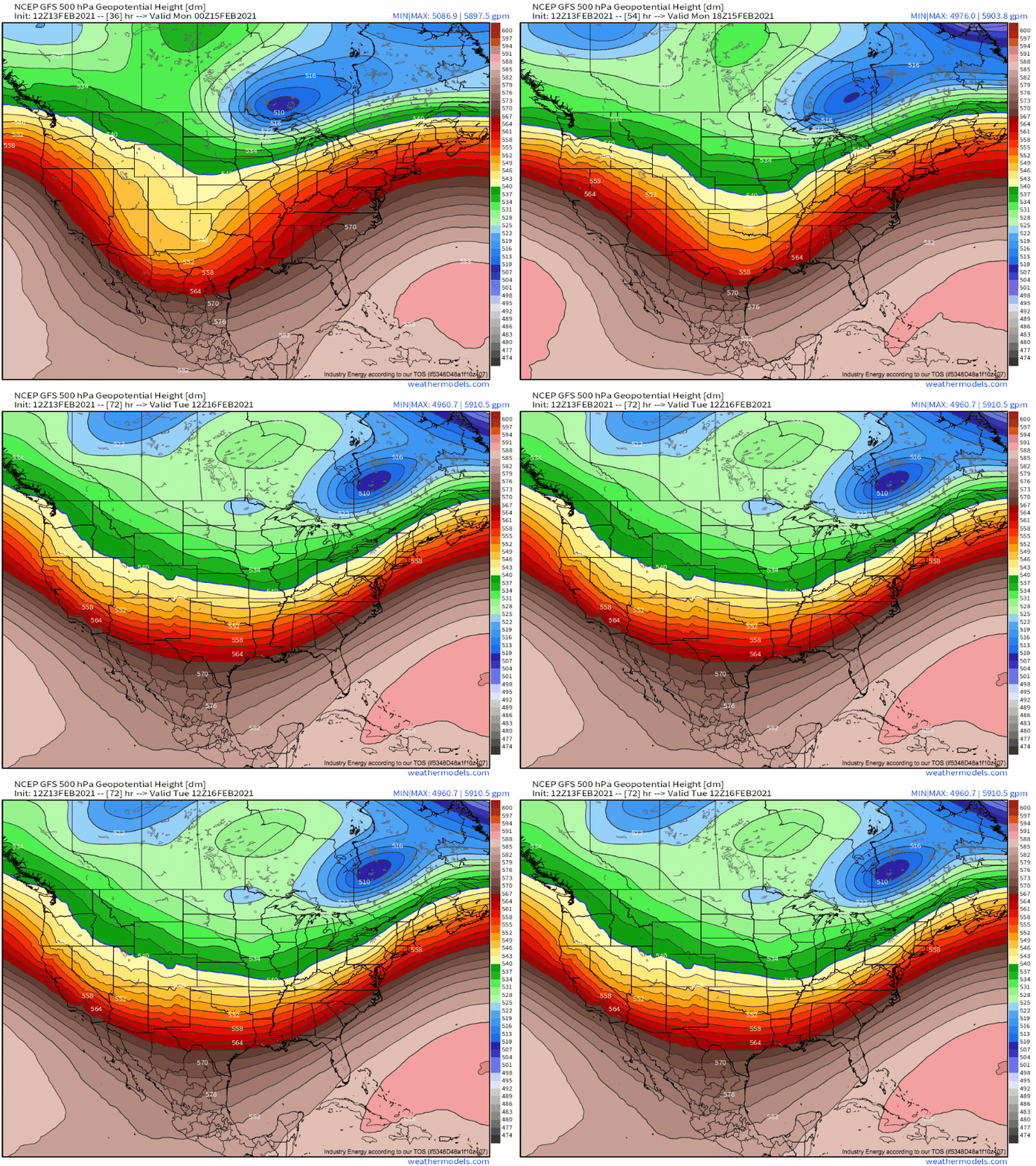
Sunday will begin with a deepening trough crossing the four-corners region. As the trough progresses eastward through the first half of Sunday, a re-orientation of the Canadian cyclone will allow arctic air to spill south with a renewed vengeance. As of Sunday morning, temperature anomalies will exceed -30°F for much of the central US, with genuinely dangerous wind chills as far south as central Texas.
Ahead of the trough, a strong, unconsolidated surface low will allow Pacific moisture to overspread the central Plains. As discussed, antecedent temperatures will be daily-record frigid, and so even though the forcing will likely remain diffuse and precipitation light to moderate, incredibly efficient snow will be falling from Nebraska to central Texas. Brisk northerly winds will easily blow the powdery snow around, creating whiteout conditions and exacerbating dangerous windchills. If you live in the south-central US, tomorrow will not be a good day to be outside.
As the day progresses, the surface low will jump around along the topography near the Texas/Mexico border. As it attempts to re-consolidate south of the border by mid-afternoon, northerly advection will intensify just as the coldest of the midlevel air swings in from the east. The result will be a dramatic jump in negative temperature anomalies Sunday afternoon for Oklahoma and Texas.
As this surface low hop-scotch occurs, a large plume of powdery, blowing moderate snow will continue to fall from Kansas to central Texas.
By Sunday evening, around 6-8″ of snow will have fallen for parts of Oklahoma and Texas. Waning solar heating will allow temperatures to fall back towards 0 for many, and wind chills will remain dangerously cold.
Meanwhile, as the strongest divergence ahead of the trough reaches the far northwest Gulf, it’ll suddenly overlay an intense thermal boundary for the first time since landfalling in Oregon. The result will be a quick consolidation of a surface low amidst a synoptic set-up quite favorable for Gulf moisture to over-run frigid polar air.
As these changes occur Sunday evening into Sunday night, the zone of heaviest precipitation will quickly shift towards a band stretching from south Texas through the Great Lakes. For many, frigid temperatures throughout the atmosphere will mean snow. For others, a low-level warm nose above a frozen airmass will mean moderate to heavy freezing rain. As the surface low and accompanying Gulf moisture swing northeast, so too will the ingredients for heavy precipitation.
At this stage, the duration and, therefore, impacts from the system will be tied largely to the extent to which the precipitation regime can parallel the midlevel flow. With immature, overrunning systems like this, that will determine who sees the longest-lasting infusion of Gulf air over frigid temperatures, and with it, wintry precipitation. It looks like this is most likely in a swath from SE Texas to the northeast as trough de-amplifies and rides NE, paralleling its own zone of divergence through Tuesday morning.
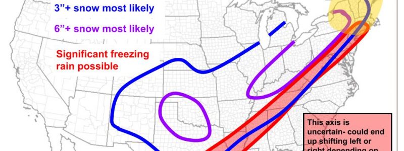
This process will create a somewhat narrow but very long zone of significant snowfall, and another to the immediate south of significant icing.
By Tuesday morning, this is what will probably have happened across the United States, precip-wise: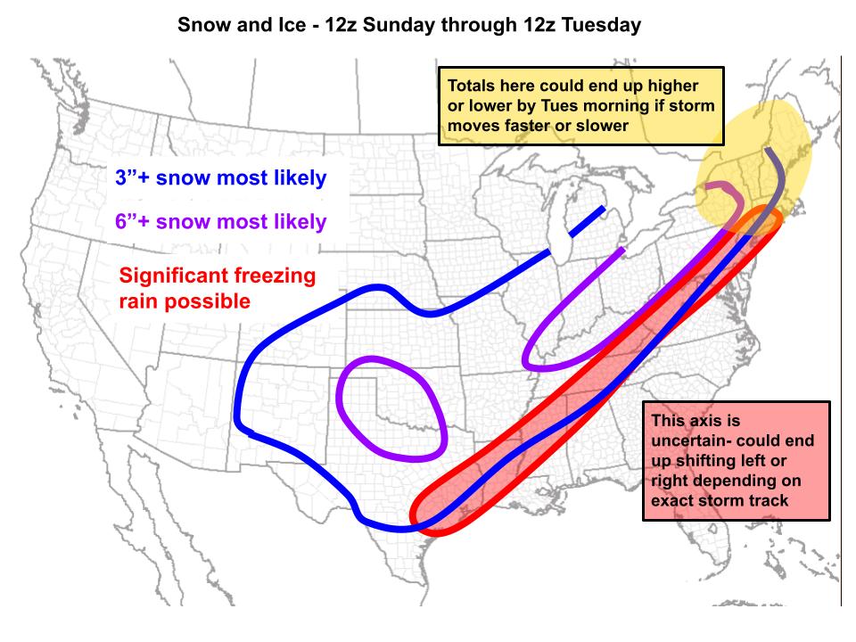
To restate, this is one of the most active winter weather patterns in many, many years, especially for the central US.
Frigid temperatures and brisk wind will prove dangerous to those caught outside.
In the Plains, near-whiteout conditions amidst heavy, powdery snow will make driving nearly impossible.
For a swath from SE TX to the Mid-Atlantic, freezing rain will make road conditions treacherous, and could lead to scattered damage to power infrastructure.
Stay safe, and expect frequent updates here and on Twitter.
