Widespread Severe Weather Expected Today
If you reside pretty much anywhere from Upstate New York to Central Alabama, you’re going to want to pay attention to the weather today.
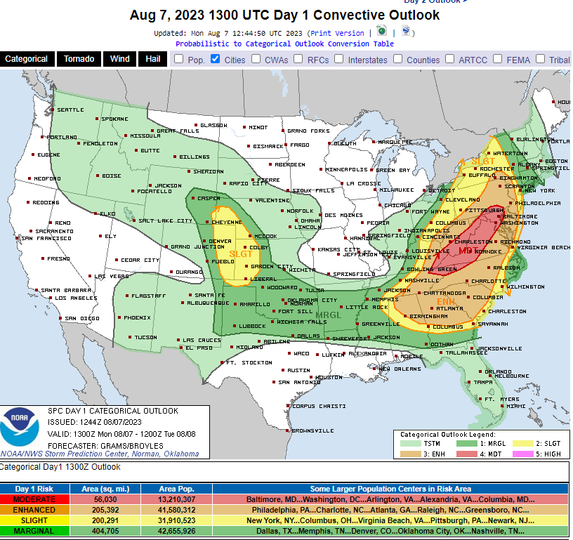
Per the SPC, a severe weather outbreak is possible for much of the Eastern fourth of the US today.
As this is far too large of an area for me to be overly specific about all the mesoscale details in play, let’s take a fast look at the overall set up before we move into impacts:
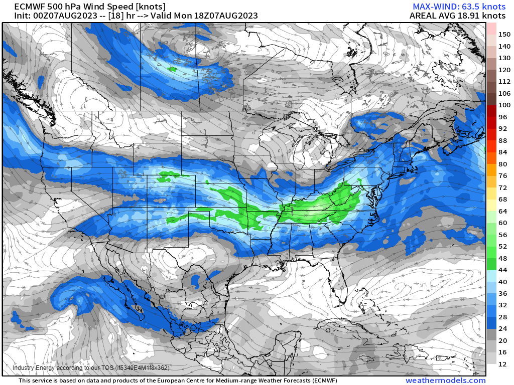
In the mid-levels, we can clearly identify a trough over the Great Lakes region. At the base of the trough, we have the associated mid-level flow featuring a jet streak from the Tennessee Valley region through the Mid-Atlantic. Diverging winds aloft (evident in the streak where the streamlines pull apart from each other) will help to incite rising air at the surface.
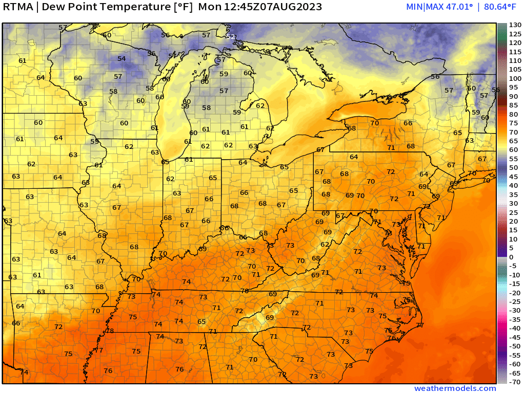
At 9 AM, we already have very moist air in place. Additionally, broken cloud cover – especially over the TN Valley and Mid-Atlantic – is allowing for additional heating that will lead to further destabilization.
With a set-up like this, it won’t take much for storms to begin forming in the next couple of hours.
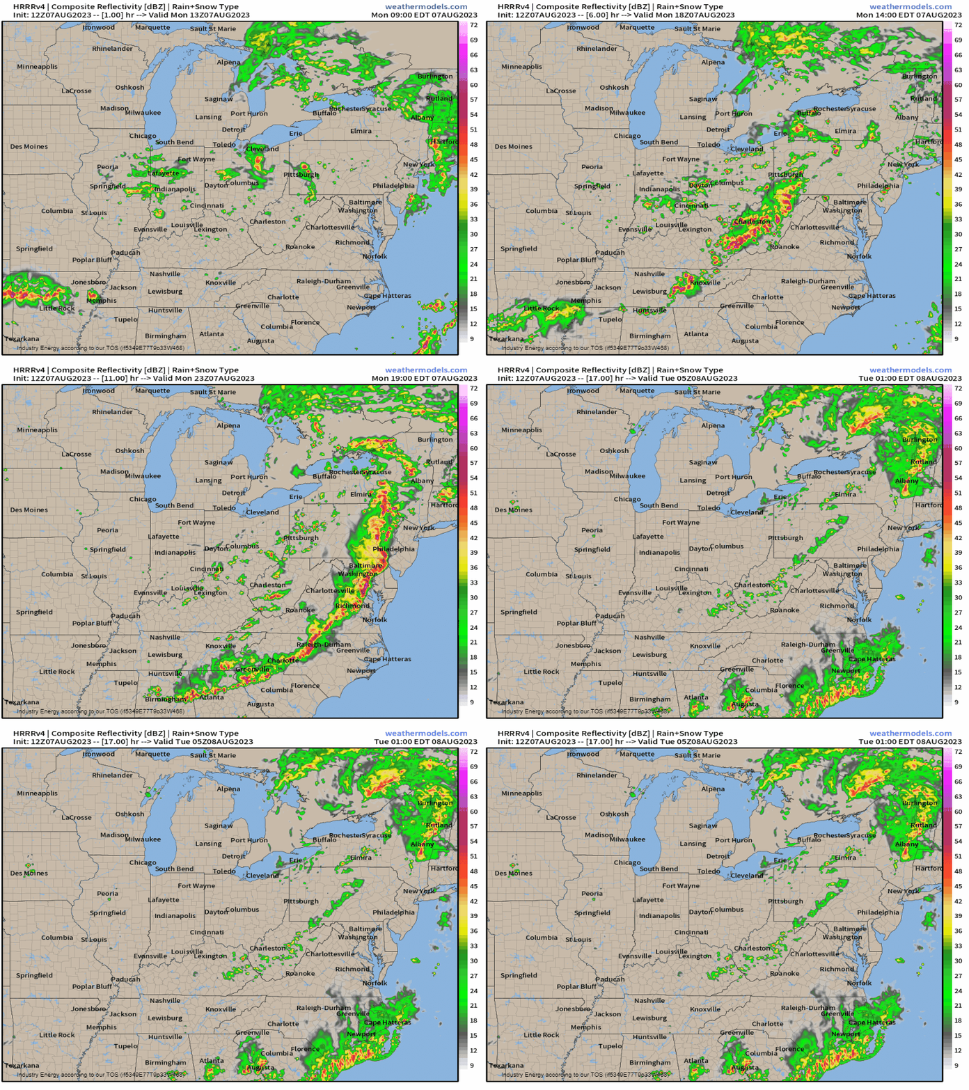
Beginning as early as late morning, we will see convective initiation. Supercells/multicellular clusters will erupt first and then grow upscale into a more broken linear mode as the afternoon transitions into evening.
As far as expected hazards go, damaging winds will be the primary threat as a large convective line will form after initial multicellular/supercellular clusters.
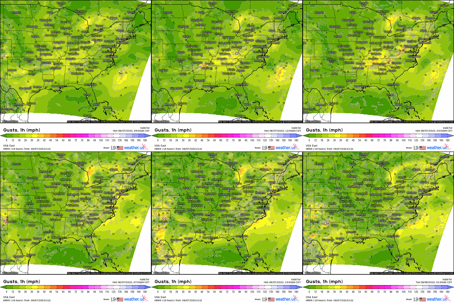
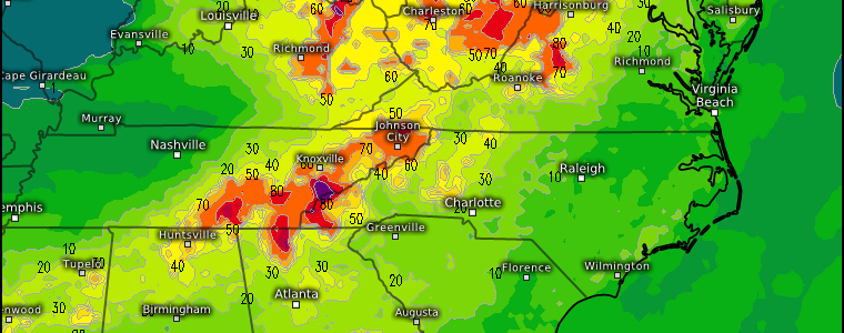
Using the 1 hour gusts map, we can clearly see the convective line and the gusts associated with it. Severe wind gusts (60+ mph) are possible with any of these storms.
Additionally, with favorable shear in place and the right ingredients for supercells also in place, a few tornadoes are possible.
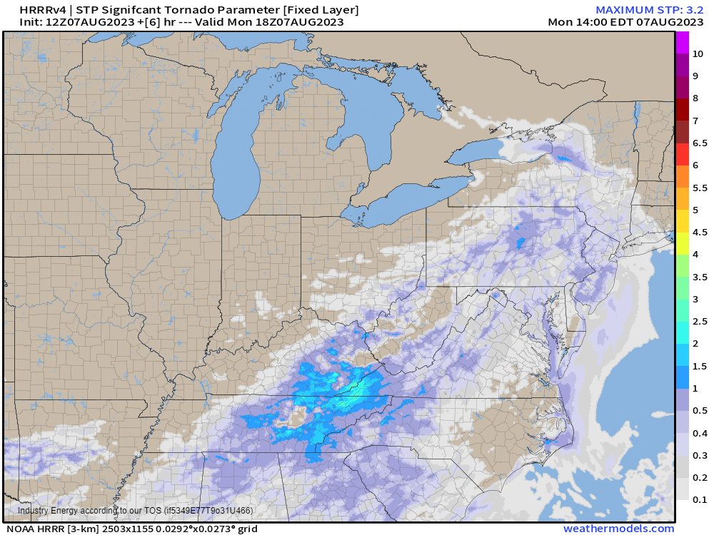
Tornado chances will be maximized along Central Appalachia and into the Mid-Atlantic as terrain combines with the most favorable ingredients to produce this risk.
Remember: the idea that tornadoes can not form in the mountains is incorrect. They can, have done so before, and will continue to do so – possibly today. Don’t drop your guard if you reside in a mountainous region.
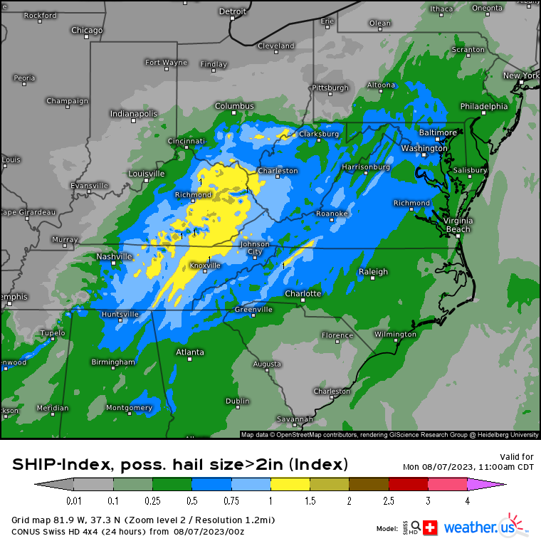
Hail reaching/exceeding severe thresholds (1 or more inches in diameter) is also possible, especially from any supercells that form early in the event.
To sum up:
- Anyone from Upstate New York through Central Alabama needs to be weather aware today.
- A severe weather outbreak is possible beginning as early as late morning.
- All hazards are possible. Damaging winds are the main threat, but tornadoes and large hail are also on the table.
- Have multiple ways to receive warnings. A NOAA weather radio should be your primary source with secondary sources like Wireless Emergency Alerts, TV, or one of your local news stations’ weather apps.
- Warn friends, warn family. Increase awareness so that no one is caught off guard today.
- Know your plan to shelter. If you must be out and about during severe weather, know where you can go to shelter if you are driving or at work/school if it becomes necessary.
For a more detailed forecast for your specific area, check out your local NWS office’s site or tune in to your local broadcast meteorologists on your favorite news station. They’ve got your back today!
Be safe!


