What’s Up, 97L?
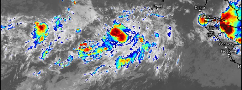
As of this morning, our month-long+ period without an official area of interest in the Atlantic basin is at an end. The tropical wave not terribly far off of the African coast has been designated Invest 97L.
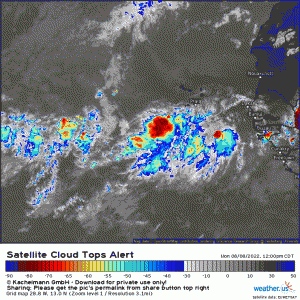
97L is looking fairly healthy.
Though it is an open wave embedded in the Intertropical Convergence Zone (ITCZ), it seems to be on the right track with a good amount of convection firing in a concentrated area.
Obviously this area of interest has a long way to go before we can determine if it will pose a threat to the US mainland. But what can we expect over the next few days as far as forecast and potential track go? Let’s take a look.
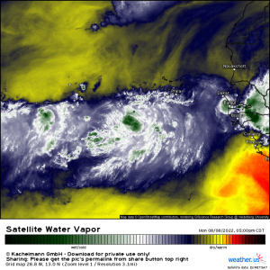
As mentioned above, 97L is currently embedded in the moist environment of the ITCZ. The atmosphere around it, however, is very dry.
This dry air seems to back off just a very little bit by mid/late week, perhaps giving our budding storm a shot at some sort of development. The NHC notes that slow development is possible (40%) in the next 5 days, indicating that conditions will become more conducive as the week wears on.
Something that may complicate development, at least initially, is a fast forward speed.
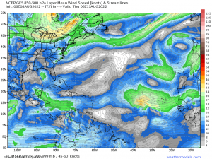
As this is still developing and therefore weak, 97L will “feel” the flow from the lower to mid-levels much more than the upper levels. The easterly trade winds will be moving at a fairly brisk pace, sweeping our Invest along with them.
The problem with that is this: a quickly-moving disturbance can create its own shear. Shear is not great for tropical cyclones as they require a stacked circulation. Shear will sustain a supercell but it will weaken or destroy a tropical cyclone. It makes sense then that 97 will struggle to organize initially as the flow remains fairly quick. But, as it relaxes some later in the week, perhaps our Invest will seize the opportunity.
Where will 97L go?
Well, as you may know from reading my previous tropical blogs, nothing is really certain (or as certain as we can be with current technology, at any rate) with track until a center forms. However, we can still look at the overall pattern and come up with a general idea.
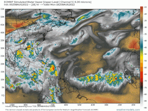
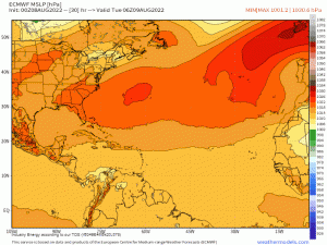
Currently, there is consensus between the models that a strong, blocking high near the US East Coast will weaken and retreat east by the latter half of the week. The disturbance, in whatever form it is in at that time, will feel this weakness and turn.
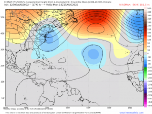
Additionally, models agree on persistent troughing over the US East Coast developing by the weekend and lasting into at least late next week.
Troughing would not only provide shear to our disturbance, but would prevent it from moving ashore and instead force it out to sea.
Of course, this is dependent on timing. A faster forward speed may see the storm trapped under the ridge (unlikely) while a significantly slower speed may allow the trough to clear before the disturbance approaches (also unlikely due to the forecast length of the troughing). The most likely course at this time is that if the disturbance does develop, it will curve out to sea.
So lets sum that up:
97L doesn’t look too terrible at the moment and is sustaining convection. However, dry air and a fairly fast forward speed could cause some issues with development. Conditions seem slightly more conducive in a few days time, however, an extended period of troughing over the East Coast could add shear and more dry air for the system to contend with as it approaches the US.
Given what we discussed about the high’s movement, it seems likely that, if this were to develop (IF being the key word), it would remain on the weak side and curve out to sea.
97L still has a long journey across the Atlantic during which change can occur. At this time though, it poses no threat to land.
We’ll monitor the forecast and keep you up to date with any changes as the week wears on!
