What To Expect When You’re Expecting Nicole
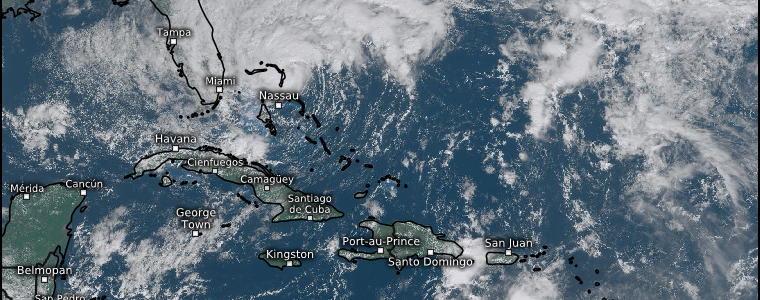
Yesterday, Nicole was able to transition from a subtropical storm to a fully tropical cyclone.
What exactly does that mean? Well, it was able to develop a well-defined core and surround it with convection. So now it looks much more like the tropical cyclones we’re used to seeing.
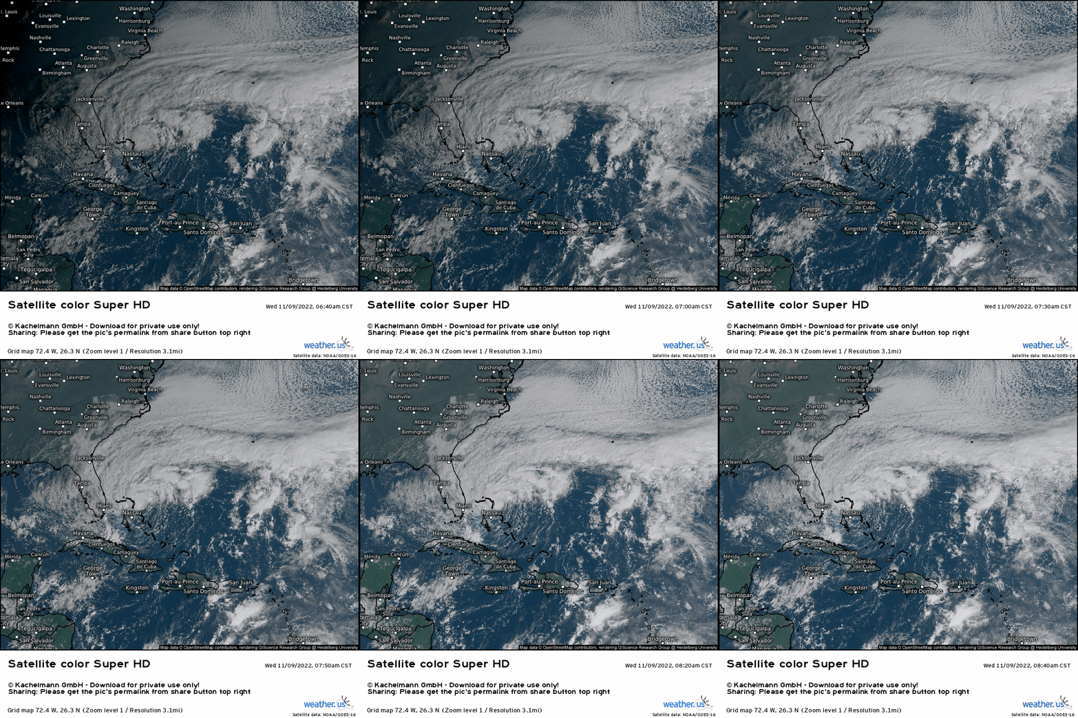
We can now clearly see the defined center, though strong shear north of Nicole and dry air to the south are working to keep intensification in check.
Regardless, Nicole has steadily strengthened and, as of the 10 am advisory, has sustained winds of 70 mph – just below hurricane status. Nicole is still expected to attain hurricane strength later today before landfall along Florida’s southeastern coast. However, the shear and dry air mentioned above will keep intensification in check. Anything beyond a category 1 hurricane is not expected at this time.
Talk of intensity aside, Nicole is still a rather large storm. Effects will be felt far from the center and not kept confined to the core.
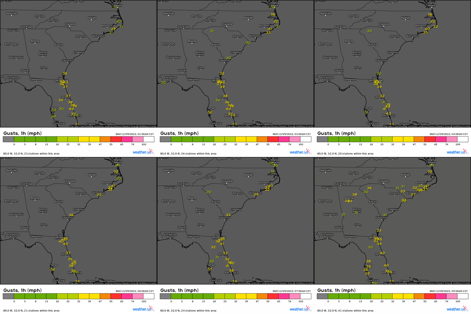
In fact, many along the southeastern coast are feeling some of the effects now while Nicole is just entering the Bahamas. Gusty winds have steadily ramped up overnight, spreading from the Florida peninsula to the Carolinas.
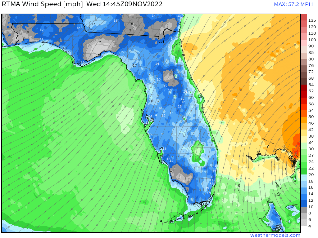
The counterclockwise flow around Nicole is also allowing the winds to flow onshore. This results in a push of water onshore as well.
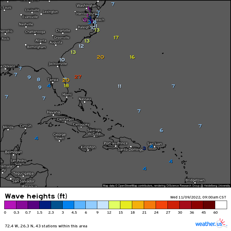
Large swells combined with the relentless onshore flow is already causing coastal flooding issues for many along the eastern side of the Florida peninsula – and these issues will continue as Nicole approaches landfall later tonight.
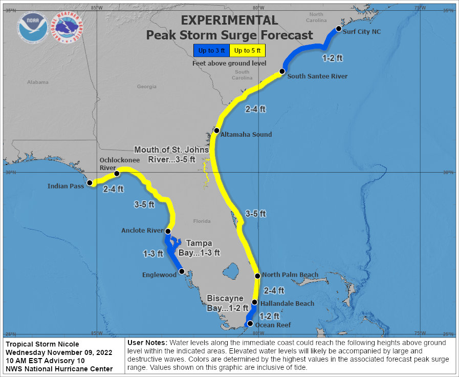
Those near and north of the center will see the greatest surge heights. As we discussed in Monday’s blog, the onshore push of water will be exacerbated by King Tides, resulting in higher water levels than we would otherwise see.
If your location is under evacuation orders and you haven’t left yet, there’s still a little time. You can’t fight rising surge and the water component of a hurricane is the most dangerous, especially considering how prolonged this onshore push is already/will continue to be. Better to be safe than wishing you had evacuated later on.
Additionally, the western coast of the Florida peninsula stands to see a surge risk as well. Nicole is forecast to cross the peninsula and either emerge briefly into the Gulf before recurving northeastward or come close to the Gulf before recurving.

As it does so, there will be a (less prolonged) onshore push of water for some of the Panhandle, Big Bend region, and down into the Tampa Bay area. Low lying roads, communities, and barrier islands could flood. Beach erosion will also be an issue.
As Nicole recurves northeast, surge will become a problem for the Carolinas/Georgia coast as well. As I’ve mentioned before, know your zone. Know how much water it takes to flood your location if you’re near the coast – and then plan accordingly.
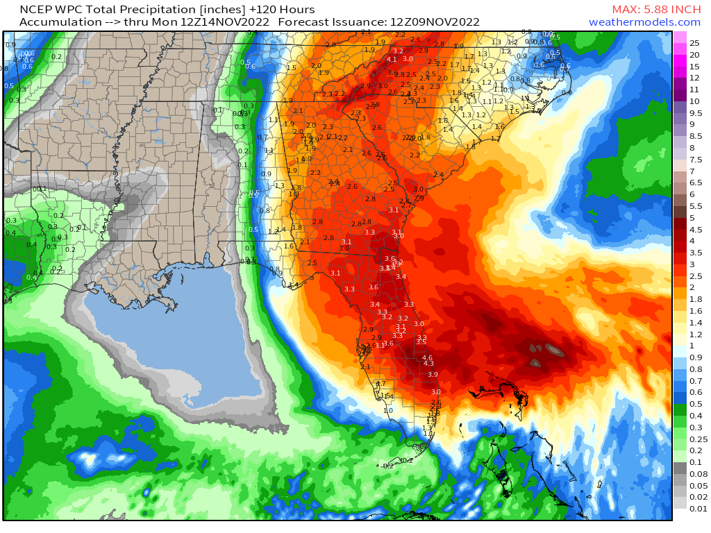
As discussed on Monday, heavy rain remains an issue. Rivers/creeks still at or near flood stage from Hurricane Ian will likely flood again. Flash flooding in urban areas and low-lying areas is also possible.
The heavy rain will go on to potentially cause problems through the Southeast, Mid-Atlantic, and Northeast through an event called a Predecessor Rain Event (PRE). Armando will have a blog out tomorrow explaining the expected effects.
One last hazard to mention.

The right front quadrant of a TC features a wind profile favorable for tornadoes. As Nicole makes landfall and friction increases at the surface, spin-up tornadoes become possible. Many of these remain weak, but that is not always the case.
Therefore, if you’re located north of where the center is expected to make landfall, know that, in addition to other risks, you need to be prepared for potential tornadoes. Have a plan to shelter ready to go ahead of time. Tornadoes from tropical systems tend to spin up quickly. Sometimes there won’t be a lot of time between the warning and the tornado rolling through.
Don’t panic, just be prepared.
What you need to know:
- Landfall is expected later tonight along the southeastern coast of Florida. Nicole is expected to strengthen into a hurricane before landfall.
- Do NOT focus on the cone. Due to the size of this TC, impacts will extend far from the center.
- The water component of Nicole will be the biggest concern. Extended onshore winds and higher than average tide levels (all already occurring) will produce a long-duration flooding and erosion event. Additionally, heavy rain is likely to cause freshwater flooding of rivers/streams and, potentially, flash flooding.
- A few tornadoes are possible as Nicole makes landfall, mainly in the right front quadrant of the storm (north of the center).
- As Nicole recurves, storm surge will impact the Florida panhandle/western side of the peninsula and the Georgia/Carolinas coast.
- Heavy rain may cause flooding issues into the Northeast as moisture is pulled northward ahead of a front.
Nicole has the potential to be a high impact event for a large area of the Eastern US. Prepare to the best of your ability for the impacts expected in your area. If you’re under evacuation orders and can leave, please do so. Better safe than stuck when water is rising.
Stay up to date via your local NWS and TV meteorologists. And, stay safe!


