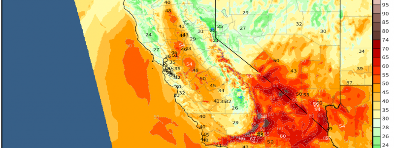
Western Trough Brings Heavy Snow, Damaging Wind, Fire Weather
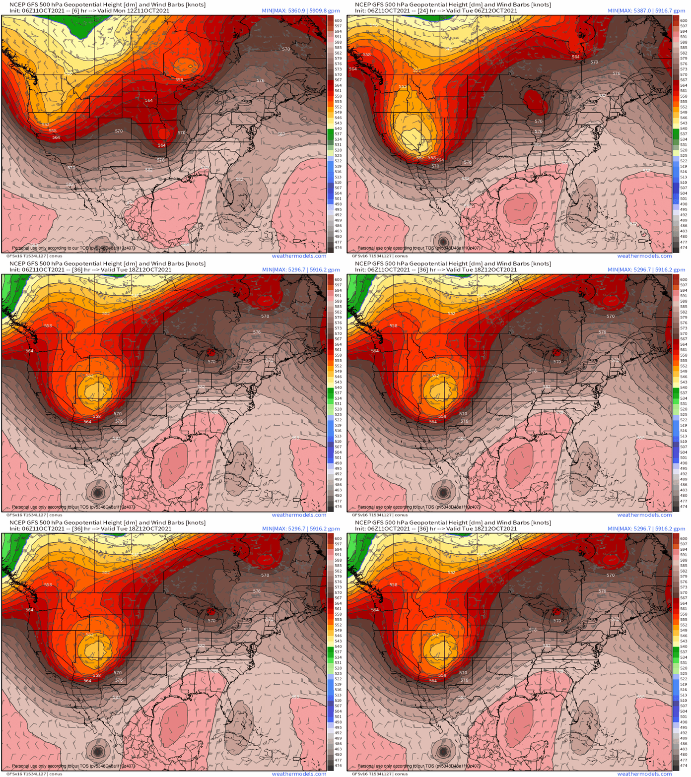
An active pattern continues today, as the longwave responsible for widespread severe weather yesterday moves into the Midwest while another, even more intense midlevel system plunges into the Great Basin.
As an impulse sliding towards the base of the trough intensifies and closes off over the next 24 hours, it will retrace a classic pattern for dangerously high offshore winds in California capable of supporting wildfire risk.
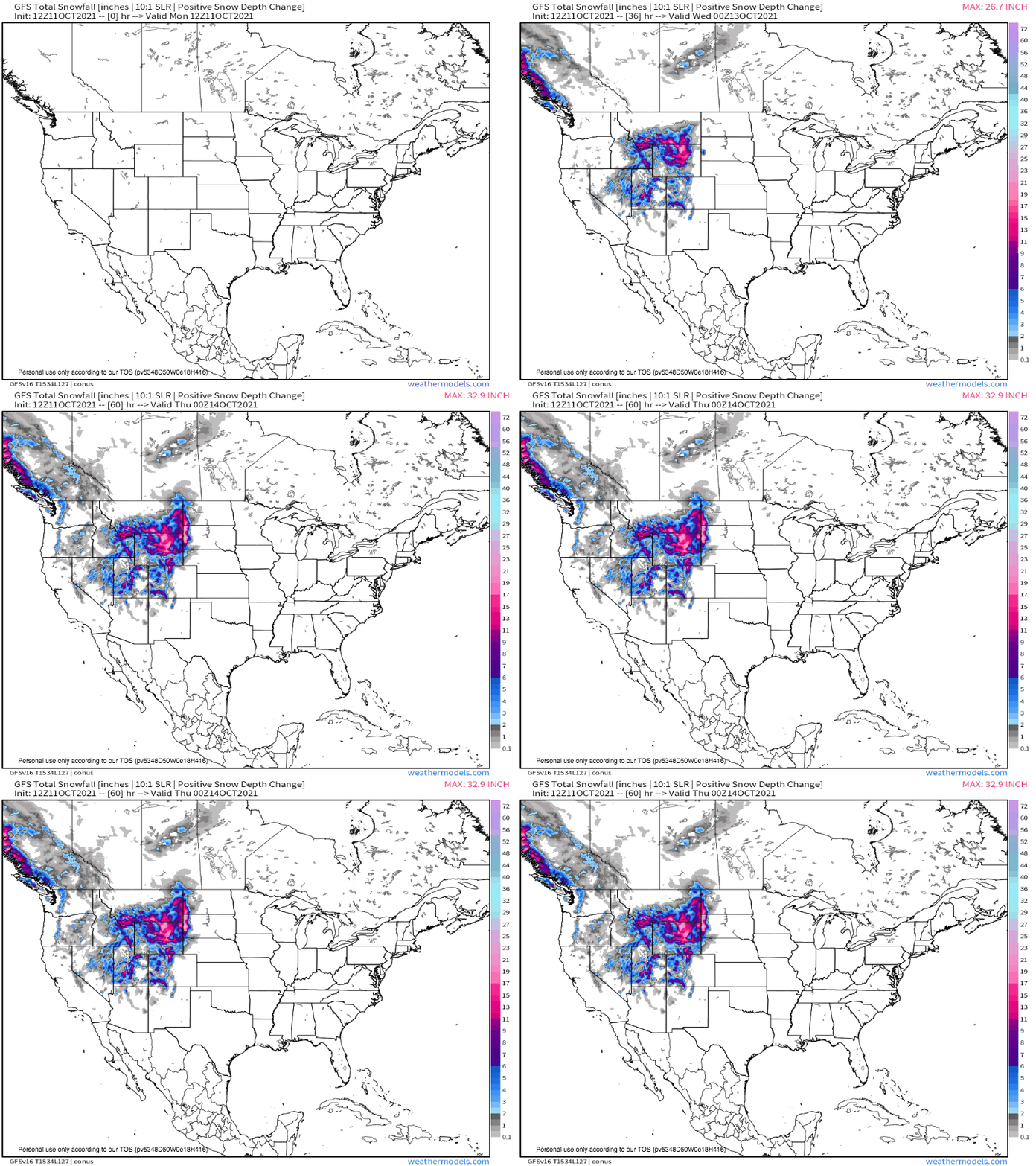
The midlevel cyclone cranking south will support a zone of broad, intense diffluence east, with associated mass removal likely to incite intense southerly flow from the Gulf. As this moisture smashes into atmospheric and topographical convergence amidst the frigid mountainous air, widespread snow will be likely. This is especially true over the Northern Rockies, which could see the most substantial snow of the season thus far.
Meanwhile, the convergent zone west of the midlevel trough will similarly pack a range of weather hazards.
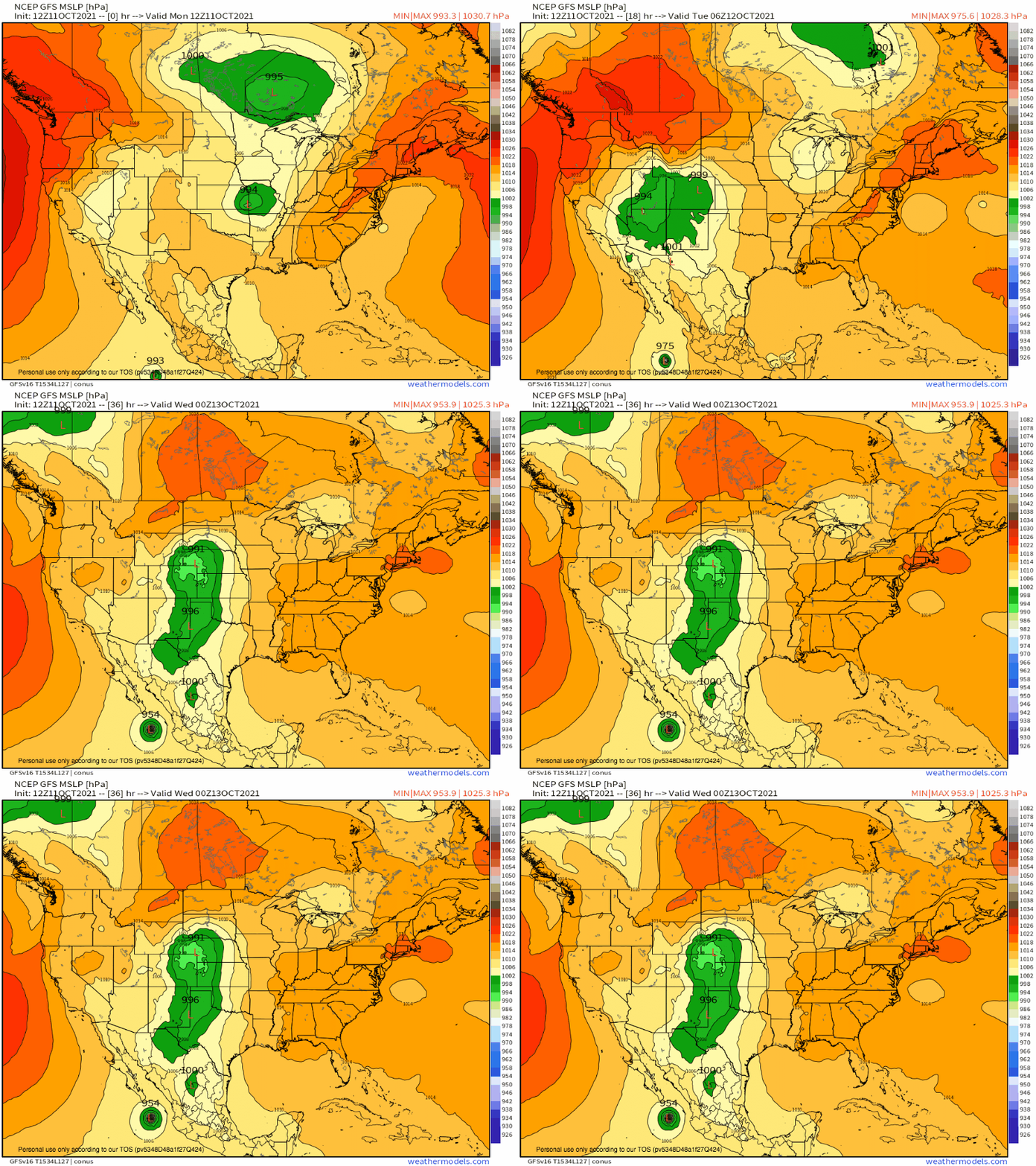
Sinking air aloft will promote an expansive, intense high pressure system just off the Pacific coast, arcing North into Washington and Oregon. The intense blockade forged by the towering Sierra Nevada range will prevent the high to low pressure zone from smoothly evening out, which will keep a very high gradient in place over much of California.
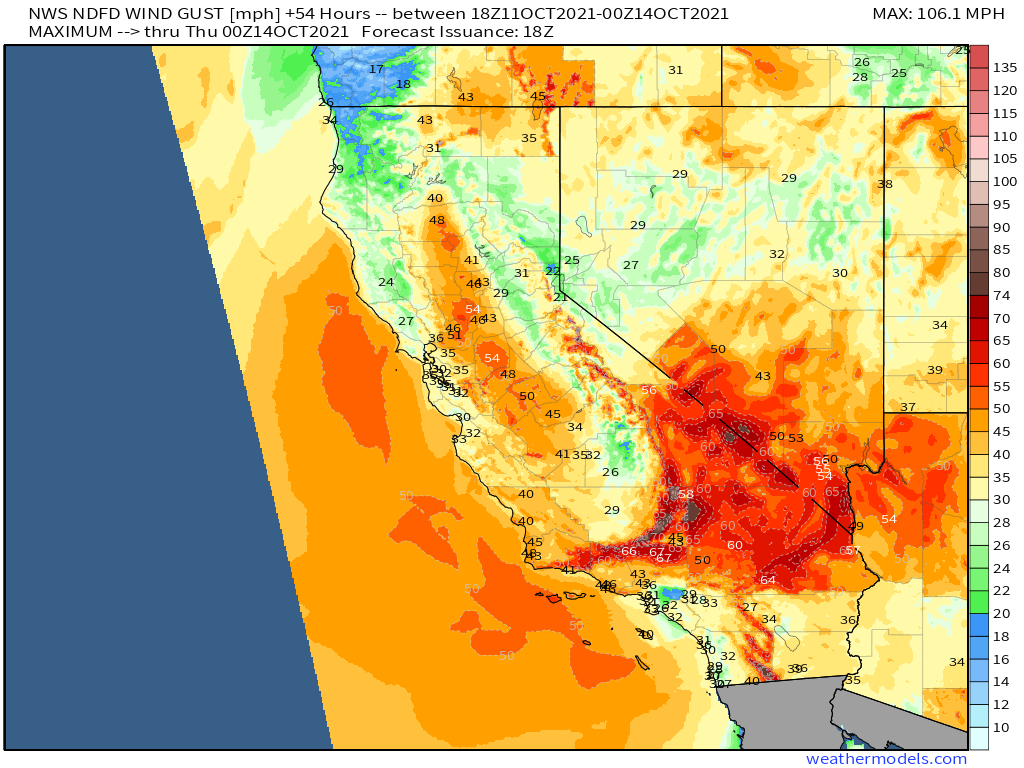
As this gradient intensifies today into tomorrow, it will force high winds to gust from the Great Basin towards the Pacific coast. These winds will gust well beyond the 70 mph range in places, with some peaks likely to exceed 100mph wind gust! The result will be a particularly dangerous wind storm from the valley to the high peaks to the coastal plains and mountain ranges, which could lead to locally widespread power outages and scattered property damage.
An additional threat posed by the air racing offshore will come as tremendous volumes of it are forced down the slopes of the state. The process will force parcels to warm adiabatically via contraction, with resultant decreasing relative humidity. As this warm, dry wind speedily rushes through the forests and hills of California, the result will be an environment quite favorable for wildfire development, growth, and spread across a wide swath of the state.
The result is a particularly challenging situation for power providers, who must face a threat not only that lines may fail, but that any which do may spark wildfires amidst the dry, flammable organic matter that litters the state. These fires, also due to the hot and dry wind streaming offshore, could spread readily.
Residents of California who live in areas vulnerable to either wind or wildfire should stay aware of developments from the National Weather Service, and should attempt to limit outdoor burning for the duration of the threat.
