Weekend Blog: Seiche Edition
Have you ever seen storm surge that wasn’t connected to a hurricane? Can that even happen? Yes, actually it can.
The phenomenon is known as a seiche (say-sh) and storm surge, so to speak, is only one part of it.
A seiche is event caused by strong winds or rapid changes in atmospheric pressure. It generally happens in enclosed lakes that are relatively shallow.
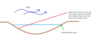
When a particularly strong wind blows across a lake, it can push the water to the opposite side. The water level then rises as the excess piles up. Eventually, if the water level is high enough for the lake to come out of its banks, it spills over as a flooding storm surge. As long as the wind stays strong from the same direction, water is blown continuously to the opposite bank and continues to pile up.
But winds don’t last forever. At some point the winds end, and when they do, all of the water that has piled up comes sloshing back. Picture, if you will, water sloshing around in a bathtub or swimming pool. It’s like that. The water continues to oscillate back and forth until equilibrium is once again achieved. This can take hours or even days if it is a large body of water.
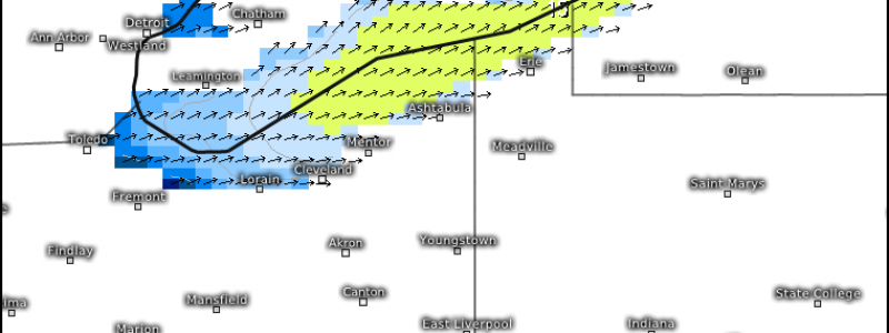
But why exactly am I writing about this tonight? Well, the Great Lakes are prone to seiches, especially Lake Erie. When a particularly strong wind blows from southwest to northeast, Lake Erie will often experience varying degrees of seiches. As the wind blows lengthwise across the lake, it is able to avoid the influence of friction it would feel over land and maintain high rates of speed. In short: gusts over water are higher than gusts over land due to the lack of friction the water presents. Unfortunately, conditions are ripe for this to occur tomorrow.
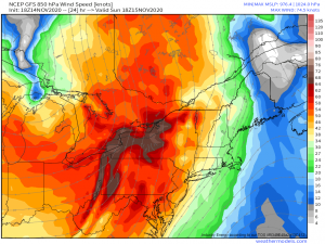
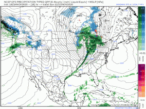
A powerful low level jet in front of a deepening surface cyclone will sweep out of the Great Lakes region throughout the day tomorrow. As it does, it sets up the perfect (or maybe not so perfect, depending on how you’re looking at it) southwest flow across the length of Lake Erie.
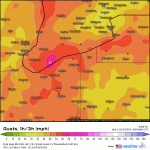
(link: https://weather.us/model-charts/standard/808-w-421-n/gusts-1h-3h-mph/20201115-2300z.html)
As the surface cyclone perpetuates east, gusts of up to, or possibly over, 70 mph may occur over Lake Erie. This presents a two-fold problem. One: the seiche effect I mentioned earlier. Two: wind creates waves. And gusts of 70+ mph can create some large waves.
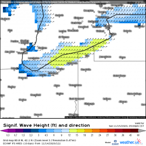
(link: https://weather.us/model-charts/euro/808-w-421-n/sign-wave-height-direction-ft/20201115-2300z.html)
This map suggests waves heights in the 15 ft vicinity are possible. The National Weather Service is suggesting that at the peak of the event, wave heights of up to 23 ft will be possible, especially at the eastern end of the lake, where all the water will pile up.
As I mentioned before, Lake Erie is no stranger to this phenomenon. Around this time last year, a similar event occurred. Gusts of up to 60 mph were observed as part of an approaching cold front. Water levels near Buffalo, NY rose 10 ft above normal, causing flooding and damage throughout the lakefront area. The total displacement between Toledo, OH (west end) and Buffalo, NY (east end) was over 13 ft!
The National Weather Service in Buffalo, NY has issued a Lakeshore Flood Warning ahead of this event in anticipation of the initial pile-up of water. You can read the warning here if you’re in the effected area or if you’re just curious.
If you’re in the area of concern, please take the necessary precautions now and in the morning before the winds really begin to pick up. Stay away from the lake shore and absolutely stay off the water. This has the potential to be a very dangerous situation that will evolve throughout the day tomorrow.
Have a great evening, y’all!


An educative post indeed! I will watch out for the Lake Erie storm on my climacell app. Thank you for all the information.